Category:De Poelen, Dronryp
Jump to navigation
Jump to search
| Object location | | View all coordinates using: OpenStreetMap |
|---|
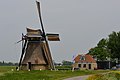
windmill in Dronryp, Netherlands  | |||||
| Upload media | |||||
| Instance of |
| ||||
|---|---|---|---|---|---|
| Location | Dronryp, Waadhoeke, Friesland, Netherlands | ||||
| Street address |
| ||||
| Located on street |
| ||||
| Has use |
| ||||
| Heritage designation |
| ||||
| Source of energy | |||||
 | |||||
|
This is a category about rijksmonument number 28612
|
| Address |
|
Media in category "De Poelen, Dronryp"
The following 28 files are in this category, out of 28 total.
-

-

-

-
 De Poelen, Dronrijp.JPG 4,032 × 3,024; 2.22 MB
-
 De Puollen, Dronryp.jpg 1,908 × 1,191; 835 KB
-
 Dronrijp - molen De Poelen.jpg 1,500 × 1,000; 867 KB
-
 Interieur achtkante grondzeiler - AMR Molenfoto - 20538676 - RCE.jpg 1,200 × 900; 190 KB
-
 Interieur achtkante grondzeiler - AMR Molenfoto - 20538677 - RCE.jpg 1,200 × 900; 178 KB
-
 Interieur achtkante grondzeiler - AMR Molenfoto - 20538678 - RCE.jpg 1,200 × 900; 188 KB
-
 Interieur achtkante grondzeiler - AMR Molenfoto - 20538679 - RCE.jpg 1,200 × 900; 204 KB
-
 Monnikmolen "De Poelen" van de Oosterpolder. - Dronrijp - 20064736 - RCE.jpg 1,200 × 1,200; 269 KB
-

-

-
 Monnikmolen "De Poelen", van de Oosterpolder. - Dronrijp - 20064738 - RCE.jpg 1,200 × 1,193; 300 KB
-
 Monnikmolen "De Poelen", van de Oosterpolder. - Dronrijp - 20064739 - RCE.jpg 1,200 × 1,186; 303 KB
-
 Monnikmolen "De Poelen", van de Oosterpolder. - Dronrijp - 20064740 - RCE.jpg 1,200 × 1,200; 228 KB
-
 Monnikmolen "De Poelen", van de Oosterpolder. - Dronrijp - 20064741 - RCE.jpg 1,200 × 1,191; 370 KB
-

-
 Mûne De Puollen, Dronryp.jpg 2,000 × 1,334; 1.09 MB
-
 Poldermolen de Poelen in Dronryp (2023).jpg 4,500 × 3,375; 9.02 MB
-
 Uitzicht van achtkante grondzeiler - AMR Molenfoto - 20538680 - RCE.jpg 1,200 × 900; 222 KB
-
 Watermolen "De Poelen", romp in restauratie - Dronrijp - 20064746 - RCE.jpg 1,200 × 1,200; 345 KB
-
 Watermolen "De Poelen", van de Oosterpolder, detail kap. - Dronrijp - 20064747 - RCE.jpg 1,193 × 1,200; 340 KB
-

-

-
 Watermolen van de Oosterpolder - Dronrijp - 20064717 - RCE.jpg 788 × 1,200; 169 KB
-
 Watermolen van de Oosterpolder - Dronrijp - 20064718 - RCE.jpg 1,200 × 788; 176 KB
-
 Woonhuis bij achtkante grondzeiler - AMR Molenfoto - 20538674 - RCE.jpg 1,200 × 900; 294 KB


.jpg)


