Category:Devil's Point, Cairngorms
Jump to navigation
Jump to search

1004m high mountain in Aberdeenshire, Scotland, UK  | |||||
| Upload media | |||||
| Instance of | |||||
|---|---|---|---|---|---|
| Location | Aberdeenshire, Scotland | ||||
| Mountain range | |||||
| Topographic prominence |
| ||||
| Elevation above sea level |
| ||||
| Parent peak | |||||
 | |||||
Media in category "Devil's Point, Cairngorms"
The following 31 files are in this category, out of 31 total.
-

-
 Bod an Deamhain - geograph.org.uk - 3739140.jpg 640 × 480; 268 KB
-
 Bod an Deamhain. - geograph.org.uk - 3737401.jpg 640 × 480; 230 KB
-
 Cairngorms 3D test.png 794 × 622; 204 KB
-
 Coire Odhar, Devil's Point - geograph.org.uk - 229151.jpg 640 × 480; 79 KB
-
 Corrour Bothy by Bruce McAdam.jpg 2,304 × 3,072; 3.29 MB
-
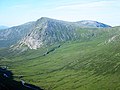
 Devil's Point from Carn a' Mhaim - geograph.org.uk - 230936.jpg 640 × 480; 80 KB
-
 Devil's Point with Cairn Toul beyond - geograph.org.uk - 229117.jpg 640 × 480; 59 KB
-
 Devils Point Summit - geograph.org.uk - 1397694.jpg 640 × 480; 74 KB
-
 Devils point.jpg 377 × 256; 29 KB
-
 Downhill view from the Devil's Point - geograph.org.uk - 595096.jpg 800 × 600; 256 KB
-
 Glen Dee and Devil's Point - geograph.org.uk - 2928518.jpg 2,520 × 1,680; 426 KB
-
 Glen Dee from Ben MacDhui - geograph.org.uk - 683618.jpg 640 × 422; 52 KB
-
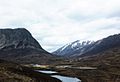
 Glen Geusachan - geograph.org.uk - 683688.jpg 640 × 422; 61 KB
-
-
 Glen Geusachan and the Devils Point - geograph.org.uk - 10134.jpg 640 × 427; 64 KB
-
 Lairig Ghru - geograph.org.uk - 203115.jpg 640 × 437; 43 KB
-
 Path into Glen Dee - geograph.org.uk - 778409.jpg 1,024 × 689; 917 KB
-

-
 Pools of Dee looking South - geograph.org.uk - 404610.jpg 640 × 460; 144 KB
-
 Retrospect of the Devil’s Point - geograph.org.uk - 3067594.jpg 3,968 × 2,976; 3.13 MB
-

-
 Summit cairn of the Devil's Point - geograph.org.uk - 595116.jpg 800 × 600; 173 KB
-
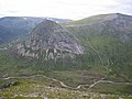
 The Devil's Point , Munro No 130 - geograph.org.uk - 239563.jpg 640 × 480; 152 KB
-
 The devil's point 01.jpg 2,288 × 1,712; 901 KB
-
 The Devil's Point and Cairn Toul - geograph.org.uk - 133742.jpg 640 × 433; 63 KB
-
 The Lairig Ghru - geograph.org.uk - 24077.jpg 640 × 480; 219 KB
-
 View from the Devil's Point - Flickr - Graham Grinner Lewis.jpg 3,648 × 2,736; 2.58 MB
-
 View south west from the Devil's Point - geograph.org.uk - 595111.jpg 800 × 600; 173 KB
-
 View west from Carn a' Mhaim - geograph.org.uk - 641776.jpg 800 × 544; 135 KB
-
 Path from Cairn Toul to The Devil's Point - geograph.org.uk - 237955.jpg 640 × 480; 150 KB
_-_geograph.org.uk_-_3748722.jpg)


.jpg)


