Category:Dry stone walls in Northern Ireland
Jump to navigation
Jump to search
Subcategories
This category has the following 2 subcategories, out of 2 total.
A
D
Media in category "Dry stone walls in Northern Ireland"
The following 19 files are in this category, out of 19 total.
-
 A Mourne gate near Kilkeel - geograph.org.uk - 842281.jpg 640 × 386; 93 KB
-
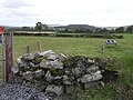
 Creevy Lower - geograph.org.uk - 406946.jpg 640 × 479; 76 KB
-
 Dry stone wall near Slievenaglogh - geograph.org.uk - 1205513.jpg 640 × 480; 390 KB
-
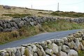
 Drystone wall - geograph.org.uk - 1095486.jpg 640 × 426; 109 KB
-
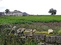 Farm Buildings, Milltown - geograph.org.uk - 1478644.jpg 640 × 479; 74 KB
-
 Lislafferty Townland - geograph.org.uk - 1450186.jpg 640 × 479; 54 KB
-
 Lislafferty Townland - geograph.org.uk - 1450190.jpg 640 × 479; 68 KB
-
 Milltown Townland - geograph.org.uk - 1478642.jpg 640 × 479; 65 KB
-
 Mourne country near Bryansford - geograph.org.uk - 823444.jpg 640 × 417; 93 KB
-
 Shelter, Slievenaglogh - geograph.org.uk - 1205527.jpg 640 × 480; 370 KB
-
 Shelter, Slievenagore - geograph.org.uk - 1205499.jpg 640 × 480; 395 KB
-
 Stone wall at Creevy Lower - geograph.org.uk - 406948.jpg 640 × 479; 100 KB
-
 Stone wall, Grenaghnagee - geograph.org.uk - 782608.jpg 640 × 479; 100 KB
-
 Yet another lichen encrusted wall (50398879396).jpg 6,016 × 4,016; 11.1 MB
-
 Drystone wall at Burrenbeg - geograph.org.uk - 301332.jpg 640 × 426; 170 KB
-
 Drystone wall near Castlewellan - geograph.org.uk - 527473.jpg 640 × 426; 116 KB
-
 Drystone wall near Hilltown - geograph.org.uk - 457789.jpg 640 × 427; 120 KB
-
 Drystone wall near Raholp - geograph.org.uk - 502886.jpg 640 × 426; 90 KB
-
 Drystone walls near Annalong - geograph.org.uk - 583322.jpg 636 × 423; 183 KB


.jpg)


