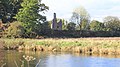
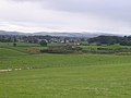
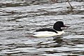
Category:Dumfries
Перейти до навігації
Перейти до пошуку
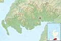
town in Dumfries and Galloway, Scotland, UK .jpg) | |||||
| Завантажити медіафайл | |||||
| Є одним із |
| ||||
|---|---|---|---|---|---|
| Місце розташування |
| ||||
| Розташовується на водоймі | |||||
| Кількість населення |
| ||||
 | |||||
Azərbaycanca: Damfris — Böyük Britaniyada, Şotlandiya (Şotlandiya Boyük Britaniya dövlətinin vilayətidir) vilayətində şəhər. (→Damfris)
Беларуская: Дамфрыс — горад на поўдні Шатландыі, адміністрацыйны цэнтр вобласці Дамфрыс і Галаўэй. Месца смерці шатландскага паэта Роберта Бёрнса. (→Горад Дамфрыс)
Cymraeg: Tref yn Dumfries a Galloway yn yr Alban yw Dumfries (Gaeleg: Dùn Phris). Mae'n dref farchnad fawr a fu'n dref sirol hen sir Dumfries. Saif yn ne-orllewin yr Alban ar lan Afon Nith ger ei haber ym Moryd Solway. Poblogaeth: 31,146 (2001). Mae Caerdydd 400.5 km i ffwrdd o Dumfries ac mae Llundain yn 459.1 km. Y ddinas agosaf ydy Caerliwelydd sy'n 46.9 km i ffwrdd. (→Dumfries)
Dansk: Dumfries er en by i det sydlige Skotland, med et indbyggertal (pr. 2001) på cirka 31.000. Byen ligger i countyet Dumfries and Galloway, tæt ved havområdet Solway Firth og grænsen til nabolandet England. (→Dumfries)
Deutsch: Dumfries ( gälisch Dùn Phris) ist die größte Stadt und Verwaltungssitz des im Süden Schottlands gelegenen Council Area von Dumfries and Galloway. Bis 1889 war sie Verwaltungssitz der traditionellen Grafschaft Dumfriesshire. Die Stadt hatte 2001 37.846 Einwohner. (→Dumfries)
English: Dumfries is a market town and former royal burgh within the Dumfries and Galloway council area of Scotland. It is near the mouth of the River Nith into the Solway Firth. Dumfries was a civil parish and became the county town of the former county of Dumfriesshire. Dumfries is nicknamed Queen of the South. People from Dumfries are known colloquially as Doonhamers. (→Dumfries)
Esperanto: Dumfries estas merkaturbo kaj iama reĝa urbo ene de la municipara areo Dumfries kaj Galloway de Skotlando. Ĝi estas ĉe la enfluo de la Rivero Nith en la Solway Firth. Dumfries estis la kantonurbo de la iama kantono de Dumfriesshire. Dumfries ricevas la kromnomon de Queen of the South (Reĝino de la Sudo). La loĝantaro de Dumfries estas konata popole kiel Doonhamers. (→Dumfries)
Español: Dumfries es una ciudad y un burgo real ubicado en el consejo unitario de Dumfries and Galloway en Escocia, Reino Unido. Está situada cerca del Fiordo de Solway, cerca de la desembocadura del Río Nith. Dumfries era la ciudad condado del condado histórico de Dumfriesshire. (→Dumfries)
Euskara: Dumfries ( Eskoziako gaeleraz: Dùn Phris), Eskozia hegoaldeko udalerria da, Dumfries eta Galloway eskualdean kokatuta. (→Dumfries)
فارسی: دامفریس (به انگلیسی: Dumfries) یک شهرک در بریتانیا است که در Dumfriesshire واقع شدهاست. (→دامفریس)
Suomi: Dumfries on kauppala Skotlannissa, Yhdistyneessä kuningaskunnassa. Se sijaitsee Nith-joen kohdalla Dumfries ja Gallowayn paikallishallintoalueella. Dumfries on entinen royal burgh ja entisen Dumfriesshiren kreivikunnan kreivikuntakaupunki. Asukkaita kaupungissa on 43 009. (→Dumfries)
Français : Dumfries est une ville (et ancien burgh royal) d'Écosse, capitale administrative du council area (après avoir été celle de la région) de Dumfries and Galloway et appartenant à la région de lieutenance du Dumfriesshire, au sud-ouest de l'Écosse. De 1975 à 1996, elle était la capitale administrative du district de Nithsdale, au sein de la région du Dumfries and Galloway. Sa population s'élève à 38 000 habitants, y compris les villages de Locharbriggs et Cargenbridge. (→Dumfries)
Frysk: Dumfries (Dùn Phris of Druim Phris) is in eardere burgh en plak (town) yn it bestjoerlike gebiet Dumfries en Galloway. Dumfries hat sa'n 38.000 inwoners (→Dumfries)
Gàidhlig: ‘S e baile meadhanach agus faisg air Cille Chuithbeirt, air an àirde an iar-dheas na h-Alba a th' ann an Dùn Phrìs. Tha e suidhichte aig 17m os cionn ìre na mara, ann an cridhe Dhùin Phris is Gall-Ghaidhealaibh (Siorrachd Dhùn Phrìs ro 1975), eadar Dail Bheithe agus Inbhir Anainn, ri taobh na h-aibhne Nid. Tha e 250km air falbh bho Obar Dheathain, 97km bho Ghlaschu, 15km bho Ruadhail agus 102km bho Dhùn Èideann, prìomh-bhaile na dùthcha. 'S e Beurla a th' ann a’ chiad chànan aig a’ mhòr-chuid dhe na daoine ann an Dùn Phrìs, ach tha Pòlais làidir cuideachd. Tha Eaconomaidh a' bhaile gu math crochte air àiteachas, coilltearachd agus gnìomhachas. A bharrachd air sin, tha an t-àite làn seirbheisean dhen a h-uile sheòrsa. Taobh fhoghlaim, tha deich bun sgoil agus ceithir àrd sgoil ann an Dùn Phrìs. A thuilleadh air sin, 's e a' phrìomh-bhaile dhen Comhairle Dhùn Phris is Gall-Ghaidhealaibh a th' ann. Ann an 2001 bha 31,146 duine a' fuireach an seo. (→Dùn Phrìs)
Italiano: Dumfries (in gaelico scozzese Dùn Phris) è una città della Dumfries e Galloway, una regione della Scozia sud-occidentale. Situata approssimativamente a 125 km a sud-ovest di Glasgow e a 35 km dal confine con l'Inghilterra. Secondo il censimento del Regno Unito effettuato nel 2001 a Dumfries vivevano 47.568 persone. (→Dumfries)
日本語: ダンフリーズ (Dumfries) は、 スコットランド・ダンフリーズ・アンド・ガロウェイのマーケット・タウン。かつては王室バラでもあった。ソルウェー湾に流れ込むニス川の河口に程近い。以前、ダンフリーズは、かつて存在したダンフリーズシャーのカウンティ・タウンで行政教区であった。 (→ダンフリーズ)
한국어: 덤프리스(Dumfries)는 스코틀랜드 덤프리스 갤러웨이 주의 도시로, 인구는 43,009명이다. 니스 강(江: River Nith)이 솔웨이 만(灣: Solway Firth)으로 들어가는 강구 근처에 있다. 남방의 여왕이라는 별칭이 있다. (→덤프리스)
Lietuvių: Damfrisas (poetiškai vadinamas Queen of the South – „Pietų karalienė“) – miestas pietvakarių Škotijoje, prie Nito žiočių. Geležinkelio stotis. Yra muziejus, karališkasis teatras, akademija, 3 parkai. (→Damfrisas)
Nederlands: Dumfries (Dùn Phris or Druim Phris) is een voormalige burgh en plaats (town) in het bestuurlijke gebied Dumfries and Galloway. Dumfries telt ongeveer 38.000 inwoners (→Dumfries)
Norsk nynorsk: Dumfries er ein by og det administrative senteret i regionen Dumfries and Galloway i det sørlege Skottland. Han har kring 40 000 innbyggjarar og ligg ved elva Nith. (→Dumfries)
Norsk bokmål: Dumfries er administrasjonsbyen i Dumfries and Galloway i det sørlige Skottland. Den ligger ved elven Nith, og har omkring 30 000 innbyggere (2004). (→Dumfries)
Polski: Dumfries ( gael. Dùn Phris lub Druim Phris) - miasto w Szkocji, ośrodek administracyjny hrabstwa Dumfries and Galloway. Miejscowość położona jest nad rzeką Nith, nieopodal zatoki Solway Firth. (→Dumfries)
Português: Dumfries (em Gaélico escocês Dùn Phris) é uma cidade do Reino Unido, na Escócia, capital da região de Dumfries and Galloway, com 45 000 h. Fica situada no sul da Escócia, nas margens do rio Nith. A cidade é centro comercial de uma próspera região agrícola e com indústrias têxteis (fibras artificiais e lã).É o berço do DJ Calvin Harris. (→Dumfries)
Русский: Дамфри́с — город на юге Шотландии, административный центр области Дамфрис и Галлоуэй. (→Дамфрис)
Srpskohrvatski / српскохрватски: Dumfries ( škotsko-gelski: Dùn Phris) je najveći grad jugozapade Škotske od (→Dumfries)
Simple English: Dumfries, meaning either fort or ridge of the thicket, is a former royal burgh and town within the Dumfries and Galloway council area of Scotland and is close to the Solway Firth, near the mouth of the River Nith. Dumfries was the county town of the former county of Dumfriesshire. Its nickname is Queen of the South, which is also the name of its local football team Queen of the South F.C.. (→Dumfries)
Svenska: Dumfries är en tidigare kunglig burgh och stad i Dumfries and Galloway i Skottland. Folkmängden uppgår till cirka 33 000 invånare. Staden ligger nära Solway Firth och Niths mynning. Den var huvudort i det tidigare grevskapet Dumfriesshire, och smeknamnet är Queen of the South. (→Dumfries)
Українська: Дамфрі́с — місто на півдні Шотландії, адміністративний центр області Дамфріс-і-Галловей. (→Дамфріс)
Підкатегорії
Показано 39 підкатегорій із 39.
*
- Quality images of Dumfries (1 F)
B
C
- Castledykes Park (1 F)
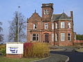
- County Buildings, Dumfries (3 F)
- Crichton Gardens (1 F)
D
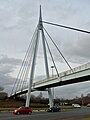
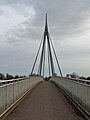
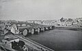
- Devorgilla Bridge (65 F)
- Dumfries Suspension Bridge (32 F)
F
- Fountain, Dumfries High Street (14 F)
G
- Glencaple Quay (15 F)
H
K
- Kelton, Dumfries (28 F)
- Kingholm Quay (38 F)
L
M
- Maxwelltown war memorial (3 F)
- Midsteeple, Dumfries (25 F)
- Moat Brae, Dumfries (18 F)
P
Q
- Queensberry Hotel, Dumfries (19 F)
- Queensberry Monument, Dumfries (16 F)
R
- Racks railway station (9 F)
- Robert Burns Centre, Dumfries (11 F)
- Robert Burns House in Dumfries (12 F)
S
- St Michael's Bridge, Dumfries (20 F)
- Statue of Robert Burns, Dumfries (27 F)
T
- The Minerva Building (19 F)
- Theatre Royal, Dumfries (5 F)
W
- Weir on the River Nith, Dumfries (24 F)
- Whitesands, Dumfries (1 F)
Файли в категорії «Dumfries»
Показано 200 файлів цієї категорії (із 414).
(попередня сторінка) (наступна сторінка)-
 06 Terregles Road hump back bridge.JPG 640 × 480; 132 КБ
-
 07 Terregles Road.JPG 640 × 480; 122 КБ
-

-
 1990dumfrieswhitesands.jpg 1000 × 654; 124 КБ
-
 393 Stone carving 2.jpg 2480 × 1984; 794 КБ
-
 393 Stone carving 3.jpg 2807 × 3508; 1,11 МБ
-
 393 Stone carving 4.jpg 2806 × 3508; 1,16 МБ
-
 393 Stone carving 5.jpg 2480 × 1654; 661 КБ
-
 393 Stone carving.jpg 2480 × 2480; 900 КБ
-
-
 A75 crosses the River Nith - geograph.org.uk - 1768172.jpg 1024 × 768; 561 КБ
-
 Across The Nith - geograph.org.uk - 3721988.jpg 640 × 480; 68 КБ
-
 Across The River Nith - geograph.org.uk - 3722006.jpg 640 × 407; 53 КБ
-
 Ae Fond Kiss - Globe Inn, Dumfries.JPG 1712 × 2288; 1,27 МБ
-
 Allied Forces in the United Kingdom 1939-45 H11118.jpg 800 × 593; 80 КБ
-
 Allied Forces in the United Kingdom 1939-45 H11120 (cropped).jpg 800 × 475; 47 КБ
-
 Allied Forces in the United Kingdom 1939-45 H11120.jpg 800 × 571; 53 КБ
-
 Allied Forces in the United Kingdom 1939-45 H11122.jpg 800 × 592; 85 КБ
-
 Balmoral Fish and Chicken Bar - geograph.org.uk - 528889.jpg 640 × 480; 72 КБ
-
 Bankend Road - geograph.org.uk - 455909.jpg 640 × 480; 74 КБ
-
 Barnkin of Craigs - geograph.org.uk - 279689.jpg 640 × 441; 81 КБ
-
 Barnkin of Craigs - geograph.org.uk - 949930.jpg 640 × 395; 42 КБ
-
 Berries on a bush 02.jpg 3024 × 4032; 3,99 МБ
-
 Berries on a bush.jpg 3024 × 4032; 3,89 МБ
-
 Birchwood Road - geograph.org.uk - 1081815.jpg 640 × 365; 45 КБ
-
 Boats at Kingholm Quay - geograph.org.uk - 455719.jpg 640 × 480; 79 КБ
-
 Boats at the Quay - geograph.org.uk - 949921.jpg 640 × 480; 55 КБ
-
 Bottom of the hill, Friars Vennel - geograph.org.uk - 933004.jpg 640 × 480; 287 КБ
-
 BPI Polythene - geograph.org.uk - 1768408.jpg 1024 × 768; 603 КБ
-
 BPI Polythene, Dumfries - geograph.org.uk - 1768414.jpg 1024 × 768; 608 КБ
-
 Bridge across the River Nith, Dumfries - geograph.org.uk - 2098167.jpg 2000 × 1507; 611 КБ
-
 Bridge over the Nith - geograph.org.uk - 672453.jpg 640 × 480; 105 КБ
-
 Brigend Theatre - geograph.org.uk - 984416.jpg 640 × 480; 74 КБ
-
 Brownrigg Loaning, 6 AM - geograph.org.uk - 481731.jpg 640 × 480; 47 КБ
-
 Buccleuch Street Sunset - geograph.org.uk - 401578.jpg 640 × 480; 116 КБ
-
 Burn's Mausoleum, Dumfries, Scotland LOC 3449529765.jpg 771 × 1024; 221 КБ
-
 Caledonian Cycleway, Dumfries - geograph.org.uk - 380939.jpg 428 × 640; 101 КБ
-
 Camera Obscura, Dumfries.JPG 2564 × 3848; 2,77 МБ
-
 Car Park for Pet Supply Store - geograph.org.uk - 498831.jpg 640 × 480; 78 КБ
-
 Castledykes Park - geograph.org.uk - 1396362.jpg 427 × 640; 298 КБ
-
 Castledykes Park and the River Nith, Dumfries.jpg 4896 × 2752; 3,61 МБ
-
 Catch Of The Day - Flickr - TrotterFechan.jpg 7360 × 4912; 33,79 МБ
-
 Catherinefield Ind Est - geograph.org.uk - 876017.jpg 640 × 303; 51 КБ
-
 Catherinefield Industrial Estate - geograph.org.uk - 672392.jpg 640 × 480; 88 КБ
-
 Cholera Pit, Dumfries (2).JPG 2288 × 1712; 1,33 МБ
-
 Cholera Pit, Dumfries.JPG 2288 × 1712; 1,2 МБ
-
 Cluden Water from the New Bridge, Dumfries. View downstream.jpg 4896 × 2752; 5,8 МБ
-
 Cluden Water from the New Bridge, Dumfries. View upstream.jpg 4896 × 2752; 3,33 МБ
-
 Covenanters Memorials, Saint Michael's Cemetery, Dumfries.jpg 4602 × 3448; 5,85 МБ
-
 Crichton Grounds, Dumfries - geograph.org.uk - 769582.jpg 640 × 480; 156 КБ
-
 Crichton Royal Hospital Grotto ponds, Dumfries, Scotland.jpg 4608 × 3456; 3,62 МБ
-
 Crichton Royal Hospital rockery and grotto, Dumfries, Scotland.jpg 4590 × 3432; 5,28 МБ
-
 Crichton University Campus, Dumfries - geograph.org.uk - 769517.jpg 480 × 640; 116 КБ
-
 Cricket Pavilion, Crichton Royal Hospital, Dumfries.jpg 4526 × 2257; 4,42 МБ
-
 Curling at the Ice Bowl, Dumfries - geograph.org.uk - 3801294.jpg 2592 × 1936; 1,13 МБ
-
 Cygnets on the River Nith - geograph.org.uk - 2436270.jpg 585 × 640; 132 КБ
-
 Dalscone Water Treatment Plant - geograph.org.uk - 672447.jpg 640 × 480; 103 КБ
-
 Dandelions at Park Farm.jpg 4032 × 3024; 2,59 МБ
-
 Dawn over Dumfries.jpg 2848 × 2136; 1,59 МБ
-
 Death of Comyn.jpg 929 × 685; 184 КБ
-
 Dervorguilla sculpture in the River Nith, Dumfries.jpg 3056 × 4592; 6,37 МБ
-
 Devorgilla Bridge in Dumfries - geograph.org.uk - 2206348.jpg 640 × 480; 101 КБ
-
 Devorgilla Bridge, Dumfries - geograph.org.uk - 4699131.jpg 1920 × 1280; 1,44 МБ
-
 Devorgilla Bridge, Dumfries - geograph.org.uk - 4699132.jpg 1920 × 1280; 1,47 МБ
-
 DG One, Dumfries, 2007-07-26.jpg 2288 × 1712; 818 КБ
-
 DG One, Leafield Road-Hoods Loaning - geograph.org.uk - 827731.jpg 640 × 480; 64 КБ
-
 DG One, Main Entrance - geograph.org.uk - 827730.jpg 640 × 480; 57 КБ
-
 Dgri.jpg 432 × 720; 117 КБ
-
 Digging a trench - geograph.org.uk - 715902.jpg 640 × 480; 54 КБ
-
 DIY Statue at Dumfries, Dumfries and Galloway, Scotland.jpg 4608 × 3456; 4,9 МБ
-
 Dock Park at night.jpg 3024 × 4032; 4,01 МБ
-
 Dumfries (49263146631).jpg 6176 × 4883; 19,72 МБ
-
 Dumfries - geograph.org.uk - 380920.jpg 640 × 428; 107 КБ
-
 Dumfries - geograph.org.uk - 447572.jpg 409 × 640; 115 КБ
-
 Dumfries - panoramio (1).jpg 3872 × 2592; 5,76 МБ
-
 Dumfries - panoramio (3).jpg 3872 × 2592; 6,97 МБ
-
 Dumfries - panoramio (4).jpg 3872 × 2592; 5,16 МБ
-
 Dumfries and County Golf Club course - geograph.org.uk - 709327.jpg 640 × 480; 59 КБ
-
 Dumfries and Galloway College - geograph.org.uk - 1246409.jpg 640 × 480; 47 КБ
-
 Dumfries and Galloway College - geograph.org.uk - 456523.jpg 640 × 480; 105 КБ
-

-

-
-

-
-

-
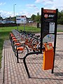 Dumfries Bike Sharing Station.jpg 461 × 615; 267 КБ
-
 Dumfries Bypass, Glasgow Road footbridge - geograph.org.uk - 1761149.jpg 1024 × 1365; 788 КБ
-
 Dumfries Bypass, Glasgow Road footbridge - geograph.org.uk - 1761157.jpg 1024 × 1365; 832 КБ
-

-
 Dumfries Cemetery - geograph.org.uk - 697982.jpg 640 × 480; 97 КБ
-
 Dumfries downtown 3.jpg 4128 × 3096; 2,68 МБ
-
 Dumfries downtown 4.jpg 4128 × 3096; 4,23 МБ
-
 Dumfries Downtown early Morning.jpg 4128 × 3096; 4,2 МБ
-
 Dumfries engraving by William Miller after C Stanfield.jpg 2230 × 1480; 1,19 МБ
-

-
 Dumfries looking east.jpg 1074 × 900; 208 КБ
-
 Dumfries Police Station - geograph.org.uk - 118254.jpg 640 × 480; 116 КБ
-
 Dumfries salvation army.jpg 834 × 527; 403 КБ
-
 Dumfries Sheriff Court - geograph.org.uk - 1769926.jpg 1024 × 768; 706 КБ
-
 Dumfries Sheriff Court - geograph.org.uk - 873296.jpg 640 × 480; 68 КБ
-
 Dumfries Town and Bridge, Dumfries and Galloway.jpg 3072 × 1719; 1,02 МБ
-
 Dumfries, 1898.jpg 2557 × 1590; 1,04 МБ
-

-
 Dumfries, River Nith - geograph.org.uk - 3333744.jpg 640 × 481; 556 КБ
-
 Dumfries, Scotland - geograph.org.uk - 557354.jpg 640 × 258; 43 КБ
-
 Dumfries, View to St Michael's Church - geograph.org.uk - 151733.jpg 640 × 480; 314 КБ
-
 Dumfries-Scotland (Location).png 553 × 933; 177 КБ
-
Dumfries.ogg 1,9с; 35 КБ
-
 Dumfrieshighschool.jpg 845 × 634; 55 КБ
-
 Dundas Chemical Works - geograph.org.uk - 279665.jpg 640 × 480; 84 КБ
-
 East Riverview - geograph.org.uk - 3797338.jpg 640 × 424; 108 КБ
-
 Electricity sub station - geograph.org.uk - 279439.jpg 640 × 480; 82 КБ
-
 Ellisland Farm, Dumfries, c 1900.jpg 3264 × 1792; 1,64 МБ
-
 Entering Dumfries - geograph.org.uk - 3944217.jpg 628 × 640; 100 КБ
-
 Entrance to Craigend Cottage - geograph.org.uk - 279676.jpg 640 × 480; 76 КБ
-
 Every little helps - geograph.org.uk - 2128461.jpg 640 × 425; 48 КБ
-
 Ewart Library, Catherine Street, Dumfries - geograph.org.uk - 930720.jpg 640 × 480; 300 КБ
-
 Ewart Library, main entrance - geograph.org.uk - 930737.jpg 483 × 640; 317 КБ
-
 Excise Return by Robert Burns. 1791. Dumfries District.jpg 3152 × 2623; 1,17 МБ
-
 Farm at Barnkin of Craigs - geograph.org.uk - 1273197.jpg 640 × 480; 64 КБ
-
 Farmland, Locharbriggs - geograph.org.uk - 546368.jpg 640 × 480; 60 КБ
-
-
 Field near Dalscone - geograph.org.uk - 672427.jpg 640 × 480; 38 КБ
-
 Field on Craigs Road - geograph.org.uk - 455797.jpg 640 × 480; 95 КБ
-
-
 Fishing the Nith - geograph.org.uk - 560329.jpg 428 × 640; 91 КБ
-
 Flooding at Friars Vaults - geograph.org.uk - 1595111.jpg 436 × 640; 114 КБ
-
 Footbridge over the Nith, Dumfries - geograph.org.uk - 5036467.jpg 1024 × 678; 231 КБ
-
 Footbridge Over the River Nith - geograph.org.uk - 3335745.jpg 640 × 481; 436 КБ
-
 Forestry Road, Heathhall - geograph.org.uk - 673567.jpg 640 × 480; 103 КБ
-
 Friars Vennel - geograph.org.uk - 3835078.jpg 640 × 432; 120 КБ
-
 Friars Vennel - geograph.org.uk - 672538.jpg 640 × 480; 73 КБ
-
 Friars Vennel, Dumfries - geograph.org.uk - 967317.jpg 640 × 480; 66 КБ
-

-
 Galloway Tourist Route - geograph.org.uk - 546268.jpg 640 × 480; 58 КБ
-
 Garden of Cosmic Speculation - V Rail.JPG 2288 × 1712; 1,31 МБ
-
 Gates and fences, Racks - geograph.org.uk - 691450.jpg 640 × 480; 75 КБ
-
 Georgestown Community Centre, Dumfries - geograph.org.uk - 279663.jpg 640 × 480; 113 КБ
-
 GeorgeStreetSchoolofArt DumfriesStonecarvingProject GrantMcintosh (1 of 7).jpg 2480 × 1654; 796 КБ
-
 GeorgeStreetSchoolofArt DumfriesStonecarvingProject GrantMcintosh (2 of 7).jpg 2480 × 1654; 913 КБ
-
 GeorgeStreetSchoolofArt DumfriesStonecarvingProject GrantMcintosh (3 of 7).jpg 2480 × 1654; 851 КБ
-
 GeorgeStreetSchoolofArt DumfriesStonecarvingProject GrantMcintosh (4 of 7).jpg 4511 × 3007; 2,1 МБ
-
 GeorgeStreetSchoolofArt DumfriesStonecarvingProject GrantMcintosh (5 of 7).jpg 2480 × 1654; 739 КБ
-
 GeorgeStreetSchoolofArt DumfriesStonecarvingProject GrantMcintosh (6 of 7).jpg 2480 × 1653; 897 КБ
-
 GeorgeStreetSchoolofArt DumfriesStonecarvingProject GrantMcintosh (7 of 7).jpg 2480 × 3101; 715 КБ
-
 Georgetown library Dumfries - geograph.org.uk - 279441.jpg 640 × 480; 84 КБ
-
 Globe Inn - geograph.org.uk - 401545.jpg 480 × 640; 95 КБ
-
 Goosander chase - geograph.org.uk - 4357567.jpg 1600 × 1200; 507 КБ
-
 Gracefield Arts Centre, Dumfries - geograph.org.uk - 1769905.jpg 1024 × 768; 872 КБ
-

-
 Hawthorn Bank - geograph.org.uk - 406360.jpg 640 × 480; 101 КБ
-
 Heathall Uniroyal, Dumfries (48814813082).jpg 5345 × 3605; 11,33 МБ
-
 Heathhall, Dumfries - geograph.org.uk - 546351.jpg 640 × 480; 63 КБ
-
 Heron on the Nith - geograph.org.uk - 2925501.jpg 492 × 640; 156 КБ
-
 Hightown of Craigs - geograph.org.uk - 455889.jpg 640 × 480; 74 КБ
-
 Hole in the Wa'.jpg 480 × 640; 101 КБ
-
 Hopeful Mallards on The Nith - geograph.org.uk - 4018446.jpg 640 × 424; 128 КБ
-
 I Mak Siccar - geograph.org.uk - 1770203.jpg 600 × 800; 199 КБ
-
 In Racks Moss near Dumfries - geograph.org.uk - 691428.jpg 640 × 480; 59 КБ
-
 Isle of Whithorn, Wigtownshire (7381460744) (2).jpg 9892 × 2686; 12,63 МБ
-
 Ivy (Hedera helix) flowers and fruit, Dumfries.jpg 2908 × 2715; 2,38 МБ
-
 James Hill grave St Michael's Churchyard Dumfries.jpg 2302 × 1737; 1,37 МБ
-
 James Kirko, Covenanter memorial, Dumfries.jpg 3456 × 4608; 7,04 МБ
-
 Jessie Lewars - 1840.jpg 1565 × 1814; 1,03 МБ
-
 Keeping the tatties warm^ - geograph.org.uk - 1273187.jpg 640 × 480; 98 КБ
-
 Lady Park Farm, Dumfries - geograph.org.uk - 546282.jpg 640 × 480; 68 КБ
-
 Lady Park Farm, Dumfries - geograph.org.uk - 546290.jpg 640 × 480; 72 КБ
-
 Lane leading to Cairn of Craigs - geograph.org.uk - 279683.jpg 640 × 467; 106 КБ
-

-
 Lane to High Kelton - geograph.org.uk - 406286.jpg 640 × 480; 90 КБ
-
 Leaving Dumfries - geograph.org.uk - 782528.jpg 640 × 480; 50 КБ
-

-
 Life on the Nith - geograph.org.uk - 2779806.jpg 640 × 480; 64 КБ
-
 Lincluden Abbey Dumfries Scotland.jpg 1059 × 832; 157 КБ
-
 Lincluden Collegiate Church and castle motte, View from Nunholm, Dumfries.jpg 4896 × 2752; 3,17 МБ
-
 Looking west from Locharbriggs - geograph.org.uk - 546371.jpg 640 × 480; 55 КБ
-
 Loreburn Shopping Centre - geograph.org.uk - 415380.jpg 640 × 480; 92 КБ
-
-

-
 Mapa dg dùn phrìs 01.jpg 2004 × 1363; 599 КБ
-
-
 Maxwelltown Railway Path, Dumfries (looking towards Hardthorn Road bridge).jpg 3008 × 2000; 2,91 МБ
-
 Mid Craig on Craigs Road - geograph.org.uk - 455817.jpg 640 × 398; 69 КБ
-
 Mid Dargavel Farm - geograph.org.uk - 546047.jpg 640 × 480; 75 КБ
-
 Mid Dargavel Farm - geograph.org.uk - 546050.jpg 640 × 480; 67 КБ
-
 Millennium milepost, Caledonian Cycleway - geograph.org.uk - 932827.jpg 640 × 480; 368 КБ
-
 NCN Millennium Milepost MP347 Dumfries.jpeg 1728 × 2592; 2,63 МБ
-
 NCN Millennium Milepost MP351 Dumfries.jpeg 768 × 1024; 390 КБ
-
 NCN Millennium Milepost MP352 Kingholm.jpeg 1069 × 1600; 1,52 МБ
-
 NCN Millennium Milepost MP942 Dumfries.jpeg 768 × 1024; 526 КБ
-
 Nether Dargavel Farm - geograph.org.uk - 546306.jpg 640 × 480; 89 КБ
-
 Nether Dargavel Farm - geograph.org.uk - 546313.jpg 640 × 480; 66 КБ
-
 Nether Dargavel Farm - geograph.org.uk - 546319.jpg 640 × 480; 65 КБ
-
 New houses - geograph.org.uk - 672437.jpg 640 × 480; 64 КБ
-
 New year in Dumfries.jpg 3024 × 4032; 1,59 МБ
-
 Newspaper offices - geograph.org.uk - 6163611.jpg 1024 × 768; 285 КБ
-
 Nith in spate - geograph.org.uk - 2779815.jpg 640 × 512; 67 КБ
-
 Nith Place, Dumfries - geograph.org.uk - 4699564.jpg 1920 × 1280; 1,23 МБ
-
 Nith River - geograph.org.uk - 557311.jpg 640 × 480; 53 КБ


.jpg)


.JPG)


.jpg)


.jpg)
.jpg)


.png)


_on_the_Nith_at_Dumfries_-_geograph.org.uk_-_3928757.jpg)


.jpg)
.jpg)
.jpg)
.jpg)
.jpg)
.jpg)
.jpg)


.jpg)


_flowers_and_fruit,_Dumfries.jpg)


_on_the_Nith_at_Dumfries_-_geograph.org.uk_-_3928767.jpg)


_on_the_Nith_at_Dumfries_-_geograph.org.uk_-_3928754.jpg)
_on_the_Nith_at_Dumfries_-_geograph.org.uk_-_3928762.jpg)


.jpg)


_(2).jpg)