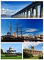
Category:Dundee
Hopp til navigering
Hopp til søk
- This category is for Dundee, Scotland. For other places of this name, see Category:Dundee (disambiguation).
Council areas (municipalities) of Scotland: Aberdeen · Aberdeenshire · Angus · Argyll and Bute · Clackmannanshire · Dumfries and Galloway · Dundee · East Ayrshire · East Dunbartonshire · East Lothian · East Renfrewshire · Edinburgh · Falkirk · Fife · Glasgow · Highland · Inverclyde · Midlothian · Moray · North Ayrshire · North Lanarkshire · Outer Hebrides · Orkney Islands · Perth and Kinross · Renfrewshire · Scottish Borders · Shetland Islands · South Ayrshire · South Lanarkshire · Stirling · West Dunbartonshire · West Lothian
city in Scotland, UK .jpg)    | |||||
| Last opp mediefiler | |||||
| Forekomst av | |||||
|---|---|---|---|---|---|
| Plassering |
| ||||
| Lovgivende forsamling |
| ||||
| Offisielt språk | |||||
| Folketall |
| ||||
| Areal |
| ||||
| Høyde over havet |
| ||||
| Forskjellig fra | |||||
| offisielt nettsted | |||||
 | |||||

Underkategorier
Denne kategorien har følgende 36 underkategorier, av totalt 36.
*
- Quality images of Dundee (1 fil)
A
- Aerial photographs of Dundee (3 filer)
- Artifacts of Dundee (8 filer)
B
C
D
E
G
H
I
J
- Joe Dorward:Dundee (4 filer)
L
- Linlathen (1 fil)
N
P
- Playgrounds in Dundee (3 filer)
S
- RNAS Stannergate (2 filer)
- Symbols of Dundee (6 filer)
T
U
- Unidentified locations in Dundee (1 fil)
V
Filer i kategorien «Dundee»
Følgende 200 filer er i denne kategorien, av totalt 257.
(forrige side) (neste side)-
 287 Dundee Science Centre AR.jpg 7 090 × 4 732; 3,92 MB
-
 442 dundee header.jpg 442 × 600; 79 KB
-
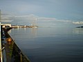
 A chilly River Tay - geograph.org.uk - 4866906.jpg 640 × 480; 24 KB
-
-
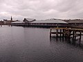 A decrepit small jetty in Victoria Dock - geograph.org.uk - 4545289.jpg 4 608 × 3 456; 3,33 MB
-
 A snowbound RRS Discovery - geograph.org.uk - 2960263.jpg 417 × 640; 70 KB
-
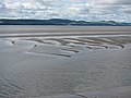
 A stony Grassy Beach - geograph.org.uk - 3349457.jpg 640 × 480; 288 KB
-
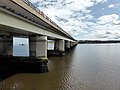
 A view towards the Tay Road Bridge - geograph.org.uk - 4511884.jpg 640 × 480; 158 KB
-
-
 Access to a 'dry' dock from Victoria Dock - geograph.org.uk - 4545263.jpg 4 608 × 3 456; 2,89 MB
-
-
 Anchor by the leisure centre - geograph.org.uk - 2050577.jpg 600 × 800; 115 KB
-
 Approach to City Quay cafeteria - geograph.org.uk - 4545337.jpg 4 608 × 3 456; 3,02 MB
-

-
 Approaching the Tay Road Bridge by ferry - geograph.org.uk - 3889648.jpg 1 799 × 1 111; 200 KB
-
 Approximate location of Lochee West station as it looked in 2022.jpg 4 032 × 1 816; 1,85 MB
-
 Beach at Broughty Ferry - geograph.org.uk - 1897365.jpg 640 × 480; 51 KB
-
 Beach, Barnhill - geograph.org.uk - 3351363.jpg 640 × 360; 203 KB
-
 Boat in the Tay - geograph.org.uk - 2050767.jpg 1 024 × 768; 116 KB
-
 Bollard by the dock - geograph.org.uk - 2050718.jpg 600 × 800; 128 KB
-
 Bow of a former Fife Ness lightship - geograph.org.uk - 4545114.jpg 3 456 × 4 608; 2,76 MB
-
 Bridge by the board - geograph.org.uk - 2050633.jpg 1 024 × 768; 135 KB
-
 BridgeFMDundee.png 416 × 399; 104 KB
-
 Bringing in the haggis.jpg 6 000 × 4 000; 7,19 MB
-
 Caird Hall, Dundee (30830236138).jpg 4 608 × 3 072; 3,87 MB
-
 Caledon West Wharf, Port of Dundee - geograph.org.uk - 5078332.jpg 640 × 427; 280 KB
-
 Cancale (35) Église Saint-Méen - Intérieur - 11.jpg 1 379 × 1 650; 554 KB
-
 City of Discovery - geograph.org.uk - 2676942.jpg 2 592 × 1 287; 1,37 MB
-
 City Quay, Dundee - geograph.org.uk - 4763444.jpg 2 048 × 1 536; 1,11 MB
-
 City Quay, Victoria Dock - geograph.org.uk - 5581460.jpg 2 560 × 1 920; 648 KB
-
 Close up of the Tay Road Bridge - geograph.org.uk - 5445345.jpg 800 × 686; 126 KB
-
 Coastal Path at Grassy Beach - geograph.org.uk - 3103767.jpg 640 × 480; 69 KB
-
 Coastal path at Grassy Beach - geograph.org.uk - 5912743.jpg 640 × 480; 251 KB
-
 Coastal path at Grassy Beach - geograph.org.uk - 5912762.jpg 640 × 480; 274 KB
-
-
 Crossing the River Tay by train - geograph.org.uk - 2679156.jpg 2 437 × 1 828; 1,55 MB
-
 Crossing the Tay Road Bridge - geograph.org.uk - 2822198.jpg 2 186 × 1 708; 887 KB
-
 Das Boot - geograph.org.uk - 1970855.jpg 640 × 427; 23 KB
-
 Discovery Point - geograph.org.uk - 6123739.jpg 1 024 × 678; 113 KB
-
 Dock by the flats - geograph.org.uk - 2050695.jpg 1 024 × 768; 163 KB
-
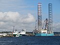
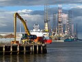
 Drilling rig at Stannergate - geograph.org.uk - 4128712.jpg 640 × 480; 56 KB
-
 Drilling rigs at the Dundee Docks - geograph.org.uk - 5444068.jpg 800 × 573; 111 KB
-
 Drizzly Dundee Day - geograph.org.uk - 1974051.jpg 640 × 428; 33 KB
-
 Dundee (94883437).jpeg 1 500 × 1 000; 374 KB
-
 Dundee 01.jpg 4 080 × 3 072; 4,43 MB
-
-
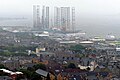
 Dundee City IMG 6712.jpg 600 × 399; 117 KB
-
 Dundee dam.jpg 1 040 × 780; 106 KB
-
 Dundee Docks - geograph.org.uk - 5078440.jpg 640 × 481; 323 KB
-

-
 Dundee Harbour, from Fife - geograph.org.uk - 5488647.jpg 2 831 × 1 820; 3,97 MB
-

-
 Dundee Picture Collage (new).jpg 870 × 1 395; 653 KB
-
 Dundee Railway Station (29762924647).jpg 4 608 × 3 072; 4,86 MB
-
 Dundee Submarine Memorial - geograph.org.uk - 1839169.jpg 600 × 800; 67 KB
-
 Dundee Waterfront - geograph.org.uk - 4188186.jpg 800 × 600; 395 KB
-
 Dundee, 1-7 Union Street, Royal Hotel.jpg 3 024 × 2 689; 5,56 MB
-
 Dundee, 114 Nethergate, St Paul's Church.jpg 3 024 × 2 521; 5,71 MB
-
 Dundee, 20-24 (even Nos) Castle Street.jpg 2 709 × 3 612; 5,37 MB
-
 Dundee, 36-42 Union Street.jpg 2 837 × 2 424; 4,09 MB
-
 Dundee, 38 Castle Street.jpg 2 789 × 3 719; 6,94 MB
-
 Dundee, 94-6 High Street, Clydesdale Bank.jpg 2 788 × 2 788; 5,03 MB
-
 Dundee, Riverside Drive, Discovery Quay, Alexandra Fountain.jpg 3 024 × 4 032; 7,23 MB
-
 Dundee, Scotland (42888431680).jpg 4 608 × 3 456; 4,9 MB
-
 Dundee-presbytery-unknown-man-standing-rev-james-e.jpg 1 920 × 1 377; 593 KB
-
Dundee.ogg 1,3 s; 32 KB
-
 Dundee Directory (IA dundeedirectory187475prin).pdf 681×1 193, 634 sider; 40,12 MB
-
 DundeeRepRecreatedLogo.png 3 455 × 3 513; 672 KB
-
 DundeeSkyline2017.jpg 5 152 × 2 821; 6 MB
-
 Edge of Dundee Airport - geograph.org.uk - 3714674.jpg 640 × 480; 63 KB
-
 Fence by the leisure centre - geograph.org.uk - 2049161.jpg 1 024 × 768; 164 KB
-

-
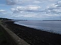
 Firth of Tay shoreline at West Ferry - geograph.org.uk - 5998572.jpg 640 × 400; 61 KB
-
 Fishing the Tay at Dundee - geograph.org.uk - 5444594.jpg 800 × 578; 122 KB
-
 Flag of Dundee.png 4 125 × 2 475; 1,14 MB
-
 Flybe Dash 8.jpg 960 × 539; 26 KB
-
 Footbridge over Victoria Dock - geograph.org.uk - 4545205.jpg 4 608 × 3 456; 3,09 MB
-

-
 Footpath on edge of Dundee Airport - geograph.org.uk - 4386902.jpg 640 × 480; 56 KB
-
 Former dry dock in Victoria Dock, Dundee - geograph.org.uk - 4763436.jpg 2 048 × 1 536; 1,07 MB
-
 Fowler and Beacon Rocks - geograph.org.uk - 2505709.jpg 1 500 × 1 003; 120 KB
-
 Fowler and Beacon Rocks - geograph.org.uk - 2825775.jpg 640 × 360; 210 KB
-
 Fowler Rock - geograph.org.uk - 6123806.jpg 1 024 × 678; 119 KB
-
 Frigate Unicorn in Victoria Dock, Dundee - geograph.org.uk - 4763458.jpg 2 048 × 1 536; 954 KB
-
 From The Tay Bridge - geograph.org.uk - 5984259.jpg 640 × 377; 62 KB
-
 Grassy Beach - geograph.org.uk - 1970913.jpg 640 × 428; 120 KB
-
 Grieve Exhibition.jpg 1 171 × 1 491; 876 KB
-
 Grissel Jaffray fire mosaic.jpg 3 456 × 3 456; 4,73 MB
-
 Grissel Jaffray plaque Dundee.jpg 2 770 × 2 685; 2,06 MB
-
 Grissel Jaffray water mosaic.jpg 3 456 × 3 456; 5,1 MB
-

-

-
 HMS Unicorn Figurehead - geograph.org.uk - 2488981.jpg 640 × 561; 385 KB
-
 Inside HMS Unicorn - geograph.org.uk - 6123823.jpg 1 024 × 678; 149 KB
-
 Invergowrie Bay - geograph.org.uk - 3634598.jpg 640 × 469; 49 KB
-
 Invergowrie Bay - geograph.org.uk - 4649033.jpg 640 × 480; 72 KB
-
-
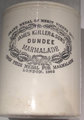 Keillers marmalade cropped.png 1 508 × 2 148; 5,68 MB
-
 King George V Wharf - geograph.org.uk - 6123797.jpg 1 024 × 678; 95 KB
-

-
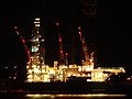 Lit up Rig - geograph.org.uk - 2679607.jpg 2 106 × 1 580; 1,16 MB
-
-
 Looking on to Dundee Airport.jpg 750 × 1 334; 98 KB
-
 Looking south across the Tay Bridge - geograph.org.uk - 3284984.jpg 640 × 480; 74 KB
-
 Looking towards the V&A Dundee (44651351052).jpg 4 608 × 3 072; 4,64 MB
-
 Main-mast of the RRS Discovery, Dundee - geograph.org.uk - 2161627.jpg 800 × 530; 140 KB
-
-
 Marigot training vessel, Victoria Dock, Dundee - geograph.org.uk - 4545095.jpg 4 608 × 3 456; 3,13 MB
-
 McGonagall's Walk - geograph.org.uk - 4513301.jpg 640 × 480; 189 KB
-
 Mid Lin Day Centre, Dundee, After (4389792578).jpg 2 832 × 2 128; 3,14 MB
-
 Mid Lin Day Centre, Dundee, Before (4389792580).jpg 1 842 × 1 228; 1,2 MB
-
 MillofMainsAug2022Dundee.jpg 3 177 × 2 184; 2,4 MB
-
 Mud flats in Invergowrie Bay - geograph.org.uk - 3634591.jpg 640 × 464; 60 KB
-
-

-
 North Carr Lightship - geograph.org.uk - 4126949.jpg 640 × 480; 73 KB
-
 North Carr lightship at Victoria Dock - geograph.org.uk - 3443100.jpg 3 264 × 2 448; 3,28 MB
-
 North Carr Lightship, Victoria Dock, Dundee - geograph.org.uk - 4586625.jpg 4 896 × 3 672; 5,74 MB
-
 Ocean going tug at Dundee docks - geograph.org.uk - 3431315.jpg 1 155 × 750; 99 KB
-
 Official Portrait 2022, John Alexander.jpg 833 × 1 238; 492 KB
-
 Olympia leisure centre - geograph.org.uk - 2049175.jpg 1 024 × 768; 130 KB
-
 On A92 approaching Dundee - geograph.org.uk - 4972859.jpg 4 601 × 3 451; 2,43 MB
-
 On the other side - geograph.org.uk - 1997014.jpg 1 024 × 768; 216 KB
-

-
 Pacific Princess berthed in Dundee - geograph.org.uk - 5996449.jpg 640 × 392; 66 KB
-

-

-

-
 Photo-copy-web.jpg 800 × 600; 414 KB
-
 Pillar near the bridge - geograph.org.uk - 2050615.jpg 600 × 800; 65 KB
-
 Plaque on the Wishart Arch, Dundee (geograph 2176447).jpg 640 × 471; 44 KB
-
 Platform at the dock - geograph.org.uk - 2050680.jpg 600 × 800; 67 KB
-
 Playing fields at Riverside - geograph.org.uk - 4386914.jpg 640 × 423; 37 KB
-
 Port of Dundee Princess Alexandra Wharf - geograph.org.uk - 5078319.jpg 640 × 427; 286 KB
-
 Port of Dundee, Caledon West Wharf - geograph.org.uk - 5078324.jpg 640 × 481; 321 KB
-
 Port of Dundee, Camperdown Dock - geograph.org.uk - 5079739.jpg 640 × 481; 453 KB
-
 Port of Dundee, Former Fish Dock - geograph.org.uk - 5078290.jpg 640 × 427; 366 KB
-
 Port of Dundee, Prince Charles Wharf - geograph.org.uk - 5078263.jpg 640 × 481; 417 KB
-
-
 Public playing fields at Riverside - geograph.org.uk - 4399994.jpg 640 × 480; 42 KB
-
 Rails on the dock - geograph.org.uk - 2050708.jpg 600 × 800; 92 KB
-
 Rainbow near River Tay - geograph.org.uk - 4592466.jpg 4 896 × 3 672; 4,3 MB
-
 Remains of the old Tay railway bridge - geograph.org.uk - 4088115.jpg 1 024 × 768; 165 KB
-
 Repairs to the Tay railway bridge - geograph.org.uk - 4513294.jpg 640 × 480; 206 KB
-
 River Tay Sea Wall - geograph.org.uk - 2676963.jpg 2 465 × 1 849; 1,6 MB
-
 River Tay, Dundee - geograph.org.uk - 6120188.jpg 1 269 × 960; 314 KB
-
 RRS Discovery and the Tay Bridge, Dundee - geograph.org.uk - 2161631.jpg 800 × 530; 107 KB
-
 RRS Discovery, Dundee - geograph.org.uk - 4315759.jpg 3 278 × 2 186; 4,21 MB
-
 Sandbanks, Firth of Tay - geograph.org.uk - 4619272.jpg 640 × 441; 60 KB
-
 Scaffolding on the Tay Bridge - geograph.org.uk - 5996563.jpg 640 × 490; 109 KB
-
 Scrubland near Riverside, Dundee - geograph.org.uk - 4649029.jpg 640 × 462; 61 KB
-
 Sea Eagle Feather Sculpture - geograph.org.uk - 5999825.jpg 640 × 412; 56 KB
-
 Sea Eagle sculpture at Grassy Beach - geograph.org.uk - 5912770.jpg 640 × 480; 294 KB
-
 Sea Griffon in Camperdown Dock - geograph.org.uk - 5998364.jpg 640 × 492; 95 KB
-
 Second ship at the dock - geograph.org.uk - 1997022.jpg 1 024 × 768; 170 KB
-
-
 Ships moored at Dundee waterfront - geograph.org.uk - 4763425.jpg 2 048 × 1 536; 845 KB
-
 Shore at Stannergate, Dundee - geograph.org.uk - 4133441.jpg 640 × 480; 48 KB
-
 Shoreline at Stannergate, Dundee - geograph.org.uk - 4133440.jpg 640 × 480; 45 KB
-
 Snake-type bracelet Pitalpin.JPG 897 × 700; 51 KB
-
 Stark reminder - geograph.org.uk - 2679174.jpg 2 592 × 1 944; 1,9 MB
-
 Stern of the Unicorn - geograph.org.uk - 2464349.jpg 640 × 480; 66 KB
-
 Straight across the Tay Rail bridge - geograph.org.uk - 4563811.jpg 1 024 × 658; 71 KB
-
 Sunset over the Tay Railway Bridge - geograph.org.uk - 5986659.jpg 640 × 480; 53 KB
-
 Sunset over the Tay Railway Bridge - geograph.org.uk - 5986669.jpg 640 × 480; 38 KB
-
 Supine turbines - geograph.org.uk - 4128701.jpg 640 × 480; 61 KB
-
 Tay Bridge and the Firth of Tay - geograph.org.uk - 5445336.jpg 800 × 489; 63 KB
-
 Tay Bridge and the Firth of Tay - geograph.org.uk - 5996576.jpg 607 × 640; 61 KB
-
 Tay Bridge in Dundee - geograph.org.uk - 5996549.jpg 640 × 462; 87 KB
-

-
 Tay Bridge, 1965 - geograph.org.uk - 6159669.jpg 1 280 × 834; 231 KB
-
 Tay Bridge, Dundee - geograph.org.uk - 5153042.jpg 5 184 × 3 888; 4,66 MB
-
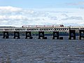
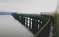
 Tay Rail Bridge - geograph.org.uk - 4108319.jpg 640 × 350; 51 KB
-
 Tay Rail Bridge - geograph.org.uk - 4129516.jpg 640 × 480; 70 KB
-
 Tay Rail Bridge 1974 - geograph.org.uk - 5225314.jpg 2 368 × 1 454; 911 KB
-
 Tay Rail Bridge, Dundee - geograph.org.uk - 5636447.jpg 640 × 480; 138 KB
-
 Tay Railway Bridge - geograph.org.uk - 4586730.jpg 4 896 × 3 672; 5,68 MB
-
 Tay Railway Bridge - geograph.org.uk - 4586734.jpg 4 896 × 3 672; 6,4 MB
-
 Tay railway bridge - geograph.org.uk - 4788347.jpg 1 200 × 900; 505 KB
-
-
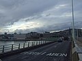
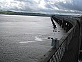
 Tay Road Bridge - geograph.org.uk - 1972369.jpg 640 × 428; 67 KB
-
 Tay Road Bridge - geograph.org.uk - 2488800.jpg 640 × 427; 321 KB
-
 Tay Road Bridge - geograph.org.uk - 2679511.jpg 640 × 480; 147 KB
-
 Tay Road Bridge - geograph.org.uk - 2819687.jpg 640 × 360; 201 KB
-
 Tay Road Bridge - geograph.org.uk - 2828170.jpg 640 × 360; 198 KB
-
 Tay Road Bridge - geograph.org.uk - 3702749.jpg 640 × 480; 43 KB
-
 Tay Road Bridge - geograph.org.uk - 4586708.jpg 4 896 × 3 672; 6,15 MB
-
 Tay Road Bridge - geograph.org.uk - 4586713.jpg 4 896 × 3 672; 5,65 MB
-
 Tay sandbanks - geograph.org.uk - 2032423.jpg 640 × 480; 77 KB
-
 The docks at Dundee and the Firth of Tay - geograph.org.uk - 5445346.jpg 800 × 607; 127 KB
-
-

-
 The Grassy Beach on the Tay - geograph.org.uk - 5000420.jpg 640 × 480; 52 KB
-
 The old sand works at Dundee - geograph.org.uk - 3987612.jpg 640 × 427; 76 KB
-
 The Rowan Norway leaves Dundee - geograph.org.uk - 5450838.jpg 640 × 480; 51 KB
-
 The Streets of Dundee (29763365927).jpg 4 608 × 3 072; 4,58 MB
-
 The Streets of Dundee (29763556137).jpg 4 608 × 3 072; 4,48 MB
-
 The Streets of Dundee (30830166768).jpg 4 608 × 3 072; 4,13 MB
-
 The Streets of Dundee (30830185688).jpg 4 608 × 3 072; 4,31 MB
-
 The Streets of Dundee (30830284988).jpg 4 608 × 3 072; 5,04 MB


.jpg)

_%C3%89glise_Saint-M%C3%A9en_-_Int%C3%A9rieur_-_11.jpg)


.jpeg)


.jpg)


_Castle_Street.jpg)


.jpg)


.jpg)


.jpg)
.jpg)


.jpg)


.jpg)
.jpg)
.jpg)
.jpg)
.jpg)