Category:Dunmore, Falkirk
Jump to navigation
Jump to search
village in Falkirk, Scotland, UK  | |||||
| Upload media | |||||
| Instance of | |||||
|---|---|---|---|---|---|
| Location |
| ||||
| official website | |||||
 | |||||
English: Dunmore is a village in the Falkirk council area of Scotland. It lies off the A905 road beside the River Forth between Throsk and Airth.
Subcategories
This category has the following 5 subcategories, out of 5 total.
D
- Dunmore Moss (3 F)
- Dunmore Park House (23 F)
- Dunmore Park Stables (8 F)
- Dunmore Pineapple (25 F)
E
- Elphinstone Tower (6 F)
Media in category "Dunmore, Falkirk"
The following 15 files are in this category, out of 15 total.
-
 Barley, Dunmore - geograph.org.uk - 180298.jpg 640 × 480; 109 KB
-
 Bowlers - geograph.org.uk - 416602.jpg 640 × 424; 64 KB
-
 Dunmore - geograph.org.uk - 181746.jpg 637 × 462; 68 KB
-
 Dunmore village, Scotland.jpg 640 × 480; 288 KB
-
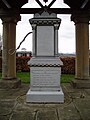 Dunmore water pump - geograph.org.uk - 138409.jpg 480 × 640; 89 KB
-
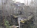 DunmoreParkHouse.jpg 4,160 × 3,120; 6.36 MB
-
 Farm - geograph.org.uk - 416589.jpg 640 × 424; 58 KB
-
 Farm track - geograph.org.uk - 416406.jpg 640 × 424; 58 KB
-
 Farmland - geograph.org.uk - 393237.jpg 640 × 424; 134 KB
-
 Front door - geograph.org.uk - 417942.jpg 640 × 493; 48 KB
-
 North Doll farm - geograph.org.uk - 199200.jpg 640 × 480; 91 KB
-
 Pylons - geograph.org.uk - 393164.jpg 640 × 385; 47 KB
-
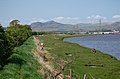 River bank - geograph.org.uk - 416512.jpg 640 × 424; 50 KB
-
 View across the Forth - geograph.org.uk - 3624535.jpg 640 × 480; 383 KB
-
 Westfield Farm - geograph.org.uk - 199224.jpg 640 × 480; 81 KB


