Category:East Bergholt
Przejdź do nawigacji
Przejdź do wyszukiwania
English: East Bergholt is a village in the south of Suffolk, England, just north of the Essex border. It is "twinned" with the village of Barbizon, France.
Français : East Bergholt est un village anglais du Suffolk.
Português: East Bergholt é um vilarejo no sul de Suffolk, Inglaterra, ao norte da fronteira de Essex.
village in Suffolk, England, UK  | |||||
| Prześlij plik multimedialny | |||||
| Jest to | |||||
|---|---|---|---|---|---|
| Miejsce | Babergh, Suffolk, Wschodnia Anglia, Anglia | ||||
| oficjalna strona internetowa | |||||
 | |||||
Podkategorie
Poniżej wyświetlono 15 spośród wszystkich 15 podkategorii tej kategorii.
B
- Bellcage, East Bergholt (14 plików)
C
- Carriers Arms, East Bergholt (2 pliki)
- Churchgate House, East Bergholt (1 plik)
E
- East Bergholt War Memorial (9 plików)
F
H
- Hare and Hounds, East Bergholt (5 plików)
K
- The Kings Head, East Bergholt (7 plików)
L
- Lattinford Hill (1 plik)
M
P
R
- The Red Lion, East Bergholt (12 plików)
V
- Valley Farmhouse, East Bergholt (12 plików)
Pliki w kategorii „East Bergholt”
Poniżej wyświetlono 200 spośród wszystkich 441 plików w tej kategorii.
(poprzednia strona) (następna strona)-
 1989 Entrance to church at East Bergholt, Suffolk - geograph.org.uk - 5232211.jpg 2300 × 3359; 5,51 MB
-

-
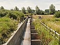 56 Gates - Flood Defences - geograph.org.uk - 3587048.jpg 640 × 481; 356 KB
-
 56 Gates - geograph.org.uk - 40576.jpg 482 × 640; 64 KB
-
 A Famous View - geograph.org.uk - 3587014.jpg 640 × 482; 343 KB
-
 A goat - geograph.org.uk - 1481583.jpg 585 × 640; 160 KB
-
 A Seat in Longhurst Copse - geograph.org.uk - 40577.jpg 482 × 640; 173 KB
-
-
 A12 descends towards Lattinford Bridge - geograph.org.uk - 3546876.jpg 3552 × 2512; 1,04 MB
-
 A12 Ipswich Road, East Bergholt - geograph.org.uk - 4100917.jpg 2342 × 1816; 476 KB
-
 A12 Ipswich Road, East Bergholt - geograph.org.uk - 4100932.jpg 2294 × 1913; 490 KB
-
 A12 Ipswich Road, Lattinford Hill - geograph.org.uk - 4135110.jpg 3072 × 2304; 1,1 MB
-
 A12 junction with B1070 - geograph.org.uk - 3546860.jpg 3484 × 2449; 1,32 MB
-
 A12 junction with Woodgates Road - geograph.org.uk - 4057692.jpg 1536 × 1152; 947 KB
-
 A12 towards Ipswich on Lattinford Hill - geograph.org.uk - 5875720.jpg 1024 × 684; 227 KB
-
 A12 Westbound - geograph.org.uk - 3846466.jpg 640 × 480; 327 KB
-
 A12 Westbound - geograph.org.uk - 3846470.jpg 640 × 480; 239 KB
-
 A12, approaching Junction 31 - geograph.org.uk - 3261339.jpg 640 × 401; 44 KB
-
 A12, Lattinford Bridge - geograph.org.uk - 3261355.jpg 640 × 430; 42 KB
-
 A12, Lattinford Hill - geograph.org.uk - 3261347.jpg 640 × 430; 43 KB
-
 A12, Lattinford Hill - geograph.org.uk - 3885637.jpg 640 × 403; 44 KB
-
 A12, Lattinford Hill - geograph.org.uk - 3885638.jpg 640 × 429; 46 KB
-
 A12, Layby near Lattinford Hill - geograph.org.uk - 3846468.jpg 640 × 480; 292 KB
-
 A12, northbound - geograph.org.uk - 3261336.jpg 640 × 428; 45 KB
-
 A12, northbound - geograph.org.uk - 3885632.jpg 640 × 354; 34 KB
-
 Access road to Flatford Mill - geograph.org.uk - 6075170.jpg 1920 × 1280; 1,38 MB
-
 Allen's Farm, East Bergholt, Suffolk - geograph.org.uk - 249387.jpg 640 × 434; 72 KB
-
 Auricularia auricula-judae - geograph.org.uk - 1189262.jpg 480 × 534; 198 KB
-
 Autumn morning in Dedham Vale - geograph.org.uk - 5946283.jpg 1600 × 1200; 460 KB
-
 Autumn slime mould species in grassland (1) - geograph.org.uk - 2110103.jpg 1216 × 912; 1,05 MB
-
 Autumn slime mould species in grassland (2) - geograph.org.uk - 2110088.jpg 1216 × 912; 897 KB
-
 Autumn slime mould species in grassland (3) - geograph.org.uk - 2115308.jpg 3648 × 2736; 4,42 MB
-
 B1070 entering East Bergholt - geograph.org.uk - 4057711.jpg 1536 × 1145; 828 KB
-
 B1070 Gaston End, East Bergholt - geograph.org.uk - 4135333.jpg 3072 × 2304; 1,71 MB
-
 B1070 Gaston End, East Bergholt - geograph.org.uk - 4135378.jpg 3072 × 2304; 1,86 MB
-
 B1070 Gaston End, East Bergholt - geograph.org.uk - 4135391.jpg 3072 × 2304; 1,9 MB
-
 B1070 Gaston End, East Bergholt - geograph.org.uk - 4135392.jpg 3072 × 2304; 1,78 MB
-
 B1070 Hadleigh Road ^ Four Sisters Bridge - geograph.org.uk - 4135589.jpg 2983 × 2241; 1,1 MB
-
 B1070 Heath Road, East Bergholt - geograph.org.uk - 4135282.jpg 3072 × 2304; 1,72 MB
-
 B1070 Heath Road, East Bergholt - geograph.org.uk - 4135298.jpg 3072 × 2304; 1,93 MB
-
 B1070 into East Bergholt - geograph.org.uk - 2947603.jpg 640 × 480; 93 KB
-
 B1070 Mill Road, East Bergholt - geograph.org.uk - 4135284.jpg 3053 × 2301; 1,33 MB
-
 Barn by Mill Road, East Bergholt - geograph.org.uk - 6068382.jpg 1846 × 1162; 1,18 MB
-
 Bell Cage, Churchyard, St Mary the Virgin - geograph.org.uk - 5954280.jpg 2104 × 1184; 426 KB
-
 Bergholt Road (B1070) - geograph.org.uk - 2947560.jpg 640 × 480; 112 KB
-
 Blackthorn blossom time - geograph.org.uk - 1263109.jpg 640 × 174; 149 KB
-
 Boats on the River Stour - geograph.org.uk - 4596635.jpg 1600 × 1048; 824 KB
-
 Brantham Mill Industrial Estate - geograph.org.uk - 6068387.jpg 1771 × 1122; 1,41 MB
-
 Bridge Cottage - geograph.org.uk - 5485945.jpg 640 × 424; 84 KB
-
 Bridge Cottage, Flatford - geograph.org.uk - 6073068.jpg 1920 × 1280; 1,08 MB
-
 Bridge Cottage, Flatford. - geograph.org.uk - 6171855.jpg 4608 × 3456; 2,04 MB
-
 Bridge over the River Stour, Flatford - geograph.org.uk - 6072095.jpg 1920 × 1280; 884 KB
-
 Bridge ^ Bridge Cottage - geograph.org.uk - 5485954.jpg 424 × 640; 67 KB
-
 Bumblebee ^ Comfry - geograph.org.uk - 5485935.jpg 424 × 640; 56 KB
-
 Burnt Oak Corner Postbox - geograph.org.uk - 4138661.jpg 2304 × 3072; 1,83 MB
-
 Burnt Oak Corner Postbox - geograph.org.uk - 4138663.jpg 2215 × 2956; 1,01 MB
-
 Burnt Oak Corner, East Bergholt - geograph.org.uk - 4057720.jpg 1536 × 1024; 868 KB
-
 By Flatford Mill - geograph.org.uk - 6103067.jpg 3105 × 2144; 706 KB
-
 Can you tell what it is yet^ - geograph.org.uk - 2822023.jpg 1328 × 1792; 1,94 MB
-
 Car park at the Carriers Arms, East Bergholt - geograph.org.uk - 6080530.jpg 1918 × 1278; 1,06 MB
-
 Cemetery Path - geograph.org.uk - 2518901.jpg 3648 × 2736; 4,26 MB
-
 Channel Island sisters - geograph.org.uk - 1166023.jpg 458 × 640; 192 KB
-
 Church of St Mary the Virgin, East Bergholt - geograph.org.uk - 5954287.jpg 2104 × 1184; 320 KB
-
 Claas Lexion 460 Combine Harvester - geograph.org.uk - 4135424.jpg 2834 × 2124; 1 MB
-
 Combining off the B1070 Gaston End - geograph.org.uk - 4135418.jpg 2872 × 2158; 1,13 MB
-
 Common Fleabane - geograph.org.uk - 5486014.jpg 424 × 640; 96 KB
-
-
 Constable's favourite church tower - geograph.org.uk - 1208702.jpg 640 × 480; 196 KB
-
 Constable's Studio - geograph.org.uk - 1206880.jpg 640 × 429; 76 KB
-
 Contorted tree by the Stour - geograph.org.uk - 4819530.jpg 2592 × 2672; 4,66 MB
-
 Cottage, East Bergholt - geograph.org.uk - 2947586.jpg 640 × 480; 84 KB
-
 Country Road - geograph.org.uk - 3730594.jpg 768 × 1024; 280 KB
-
 Cows near River Stour near Dedham - geograph.org.uk - 2948722.jpg 4000 × 3000; 4,08 MB
-
 Crossroads - geograph.org.uk - 3730560.jpg 1024 × 768; 225 KB
-
 Crossroads, East Bergholt - geograph.org.uk - 2473798.jpg 1024 × 768; 170 KB
-
 Cuckoo spit on goose grass - geograph.org.uk - 813131.jpg 480 × 640; 141 KB
-
 Cutlers Lane - geograph.org.uk - 1897720.jpg 2816 × 2112; 1,52 MB
-
 Cutlers Lane sign - geograph.org.uk - 4135128.jpg 2304 × 3072; 1,86 MB
-
 Cutlers Lane, Lattinford Hill - geograph.org.uk - 4135146.jpg 3072 × 2304; 1,55 MB
-
 Dairy Farm Cottage - East Bergholt.jpg 5489 × 4510; 18,17 MB
-
 Damselfly on yellow flag leaf - geograph.org.uk - 813150.jpg 640 × 458; 183 KB
-
 Dazeley's Lane - geograph.org.uk - 4304020.jpg 1600 × 1067; 735 KB
-
 Dedham Old River Weir - geograph.org.uk - 5917514.jpg 4608 × 3456; 3,25 MB
-
 Dedham old river. - panoramio.jpg 4000 × 3000; 4,85 MB
-
 Dedham Vale from near East Bergholt - geograph.org.uk - 1468547.jpg 640 × 460; 80 KB
-
 Double Signs - geograph.org.uk - 3730588.jpg 1024 × 768; 253 KB
-
 Down Flatford Road - geograph.org.uk - 4838245.jpg 819 × 1024; 1,48 MB
-
 Dyke on the Stour flood plain - geograph.org.uk - 2530520.jpg 3648 × 2736; 2,6 MB
-
 View northwest from churchyard gate - geograph.org.uk - 661318.jpg 480 × 640; 51 KB
-
 East Bergholt - geograph.org.uk - 3730539.jpg 1024 × 768; 277 KB
-
 East Bergholt - John Constable Studio.jpg 3000 × 2112; 6,42 MB
-
 East bergholt atelier constable.JPG 1806 × 2353; 2,85 MB
-
 East Bergholt cemetery - geograph.org.uk - 5215767.jpg 2592 × 1944; 2,94 MB
-
 East Bergholt Church - geograph.org.uk - 6073237.jpg 1844 × 1191; 906 KB
-
 East Bergholt Congregational Church - geograph.org.uk - 1481423.jpg 640 × 461; 108 KB
-
 East Bergholt Congregational Church - geograph.org.uk - 1481430.jpg 525 × 640; 98 KB
-
 East Bergholt Congregational Church - geograph.org.uk - 5335278.jpg 1600 × 1067; 505 KB
-
 East Bergholt from the air - geograph.org.uk - 3141129.jpg 640 × 480; 189 KB
-
 East Bergholt Post Office Postbox - geograph.org.uk - 4138586.jpg 2304 × 3072; 1,89 MB
-
 East Bergholt Post Office Postbox - geograph.org.uk - 4138606.jpg 2304 × 3072; 1,92 MB
-
 East Bergholt Post Office ^ Store - geograph.org.uk - 4138576.jpg 3072 × 2304; 1,79 MB
-
 East Bergholt Village Name sign - geograph.org.uk - 4135357.jpg 2260 × 3017; 1,05 MB
-
 East Bergholt Village Name sign - geograph.org.uk - 4135359.jpg 3049 × 2290; 758 KB
-
 East Bergholt Village Shop and Post Office - geograph.org.uk - 5954265.jpg 2104 × 1184; 320 KB
-
 East Bergholt, 'Dealer in Hatts' - geograph.org.uk - 4838285.jpg 819 × 1024; 1,13 MB
-
 East Bergholt, Hadleigh Road - geograph.org.uk - 3846472.jpg 640 × 480; 311 KB
-
 East Bergholt, near The King's Head - geograph.org.uk - 4838251.jpg 1024 × 682; 919 KB
-
 East Bergholt, passage under the tower - geograph.org.uk - 4837794.jpg 819 × 1024; 907 KB
-
 East Bergholt, Post Office and Store - geograph.org.uk - 3586709.jpg 640 × 481; 280 KB
-
 East Bergholt, Rectory hill - geograph.org.uk - 3586801.jpg 640 × 481; 293 KB
-
 East Bergholt, Rectory Hill - geograph.org.uk - 4837808.jpg 1024 × 1024; 1,23 MB
-
 East Bergholt, The Street - geograph.org.uk - 3586717.jpg 640 × 481; 295 KB
-
 East End Road - geograph.org.uk - 2519199.jpg 3648 × 2736; 4,11 MB
-
 East End Road near Home Farm - geograph.org.uk - 4495280.jpg 1024 × 768; 475 KB
-
 East End Road west of Home Farm - geograph.org.uk - 3580871.jpg 3648 × 2736; 1,22 MB
-
-
 Eastbound A12 at Lattinford Hill - geograph.org.uk - 3848697.jpg 640 × 480; 285 KB
-
 Elm Road Postbox - geograph.org.uk - 4138157.jpg 3072 × 2304; 1,73 MB
-
 Elm Road Postbox - geograph.org.uk - 4138177.jpg 3072 × 2304; 2,13 MB
-
 Elm Road Postbox - geograph.org.uk - 4138181.jpg 2304 × 3072; 2,57 MB
-
 Elm Road sign - geograph.org.uk - 4138184.jpg 2983 × 2241; 1,26 MB
-
 Elm Road, East Bergholt - geograph.org.uk - 4138188.jpg 3072 × 2304; 1,87 MB
-
 Elm Road, East Bergholt - geograph.org.uk - 4138203.jpg 3072 × 2304; 1,77 MB
-
 Elm Road, East Bergholt - geograph.org.uk - 4138204.jpg 3072 × 2304; 1,77 MB
-
 Elm Road, East Bergholt - geograph.org.uk - 4140379.jpg 3072 × 2304; 927 KB
-
 Entering East Bergholt on the B1070 Gaston End - geograph.org.uk - 4135350.jpg 2948 × 2214; 860 KB
-
 Entrance of Wheelers Yard - geograph.org.uk - 4135226.jpg 3072 × 2304; 1,67 MB
-

-
 Entrance to East Bergholt High School - geograph.org.uk - 4495268.jpg 1024 × 768; 515 KB
-
 Entrance to Gibbonsgate Field - geograph.org.uk - 4140306.jpg 3072 × 2304; 1,81 MB
-
 Evening Mist-Flood in Dedham Vale - geograph.org.uk - 1356533.jpg 640 × 257; 30 KB
-
 Fallen tree or primitive monster^ - geograph.org.uk - 2823624.jpg 3648 × 2736; 7,87 MB
-
 Familiar location, unfamiliar view - geograph.org.uk - 2822064.jpg 3648 × 2736; 7,4 MB
-
 Farmland near Woodgates Farm - geograph.org.uk - 1386026.jpg 3264 × 2448; 2,87 MB
-
 Farmland off Hadleigh Road - geograph.org.uk - 2947596.jpg 640 × 480; 70 KB
-
 Farmland off Manningtree Road - geograph.org.uk - 2947567.jpg 640 × 480; 66 KB
-
 Farmland off the B1070 - geograph.org.uk - 2947606.jpg 640 × 480; 134 KB
-
 Farmland, East Bergholt - geograph.org.uk - 2947602.jpg 640 × 480; 88 KB
-
 Fen Bridge - geograph.org.uk - 3707224.jpg 1024 × 768; 229 KB
-
 Fen Bridge - geograph.org.uk - 3707232.jpg 768 × 1024; 223 KB
-
 Fen Bridge - geograph.org.uk - 5917504.jpg 4608 × 3456; 3,34 MB
-
 Fen Bridge crossing The River Stour - geograph.org.uk - 2948714.jpg 4000 × 3000; 4 MB
-
 Fen Bridge over River Stour - geograph.org.uk - 4058090.jpg 1536 × 1152; 1020 KB
-
 Field Beans - geograph.org.uk - 534997.jpg 640 × 480; 93 KB
-
 Field Beside The Stour - geograph.org.uk - 4304026.jpg 1600 × 1043; 344 KB
-
 Field by Flatford Mill - geograph.org.uk - 6073026.jpg 1920 × 1280; 1,23 MB
-
 Field by Flatford Road - geograph.org.uk - 6080011.jpg 1906 × 1260; 1,81 MB
-
 Field by Manningtree Road - geograph.org.uk - 6068385.jpg 1663 × 1109; 850 KB
-
 Field Drainage - geograph.org.uk - 4304016.jpg 1600 × 1067; 610 KB
-
 Field mouse at bay - geograph.org.uk - 1295936.jpg 640 × 423; 186 KB
-
 Filming on the RSPB Reserve - geograph.org.uk - 5485989.jpg 640 × 424; 66 KB
-
 Five Bar Gate - geograph.org.uk - 3707157.jpg 1024 × 768; 241 KB
-
 Flatford Bridge Cottage - geograph.org.uk - 6253680.jpg 3544 × 2580; 2,63 MB
-
 Flatford Lock, River Stour - geograph.org.uk - 5954392.jpg 2104 × 1184; 552 KB
-
 Flatford Mill - geograph.org.uk - 4837883.jpg 1024 × 731; 1008 KB
-
 Flatford Mill - geograph.org.uk - 5583928.jpg 3888 × 5184; 3,46 MB
-
 Flatford Mill - geograph.org.uk - 5625407.jpg 858 × 557; 173 KB
-
 Flatford Mill - geograph.org.uk - 6075173.jpg 1920 × 1280; 1,64 MB
-
 Flatford Mill - geograph.org.uk - 6103062.jpg 5472 × 3648; 6 MB
-
 Flatford Mill Reflections - geograph.org.uk - 6159039.jpg 4608 × 3456; 3,29 MB
-
 Flatford Mill, East Bergholt, Suffolk - geograph.org.uk - 4714841.jpg 3319 × 2182; 6,73 MB
-
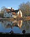 Flatford millpond and Willy Lott's House - geograph.org.uk - 4837859.jpg 819 × 1024; 1,12 MB
-
 Flatford Road - geograph.org.uk - 2942813.jpg 2560 × 1440; 830 KB
-
 Flatford Road - geograph.org.uk - 4151710.jpg 4000 × 3000; 4,35 MB
-
 Flatford Road - geograph.org.uk - 6080941.jpg 1872 × 1204; 2,23 MB
-
 Flatford Road junction - geograph.org.uk - 4138731.jpg 2948 × 2214; 1,23 MB
-
 Flatford Road junction - geograph.org.uk - 4138747.jpg 3072 × 2304; 1,94 MB
-
 Flatford Road, East Bergholt - geograph.org.uk - 4138755.jpg 3072 × 2304; 1,85 MB
-
 Flatford Road, East Bergholt - geograph.org.uk - 4140346.jpg 3072 × 2304; 1,81 MB
-
 Flatford Road, Flatford - geograph.org.uk - 4138705.jpg 2946 × 2215; 1,01 MB
-
 Flatford Road, Flatford - geograph.org.uk - 4140340.jpg 2304 × 3072; 1,85 MB
-
 Flatford roadsign - geograph.org.uk - 4138215.jpg 3072 × 2304; 2 MB
-
 Flatford, bridge and Bridge Cottage - geograph.org.uk - 4837938.jpg 819 × 1024; 1,14 MB
-
 Flatford, Bridge Cottage - geograph.org.uk - 4837915.jpg 819 × 1024; 1,12 MB
-
 Fledgling on a hot slate roof - geograph.org.uk - 1394068.jpg 640 × 519; 191 KB
-
 Flooded marshes at sunset - geograph.org.uk - 1068692.jpg 640 × 480; 190 KB
-

-
 Flyover - geograph.org.uk - 3604960.jpg 1024 × 768; 187 KB
-
 Footbridge And Pipe - geograph.org.uk - 3730909.jpg 1024 × 768; 358 KB
-
 Footbridge over Stutton Brook - geograph.org.uk - 2519435.jpg 3648 × 2736; 4,71 MB
-
 Footpath - geograph.org.uk - 3706598.jpg 768 × 1024; 328 KB
-
 Footpath across the Stour Valley - geograph.org.uk - 4134598.jpg 4000 × 3000; 3,85 MB
-
 Footpath at Dedham Vale - geograph.org.uk - 2518977.jpg 3648 × 2736; 2,45 MB
-
 Footpath at Flatford - geograph.org.uk - 4140312.jpg 3072 × 2304; 1,78 MB
-
 Footpath by the river Stour - geograph.org.uk - 4058126.jpg 1536 × 1152; 1,11 MB
-
 Footpath junction sign on the Stour Valley Path - geograph.org.uk - 2948709.jpg 4000 × 3000; 4,17 MB
-
 Footpath off Flatford Road - geograph.org.uk - 4140338.jpg 3072 × 2216; 781 KB
-
 Footpath off Putticks Lane - geograph.org.uk - 4135238.jpg 3072 × 2304; 1,94 MB
-
 Footpath Sign - geograph.org.uk - 3730575.jpg 1024 × 768; 319 KB
-
 Footpath sign near Bridge Cottage - geograph.org.uk - 4140308.jpg 2304 × 3072; 1,88 MB
-
 Footpath to Dedham - geograph.org.uk - 4140256.jpg 3072 × 2304; 1,91 MB
-
 Footpath to Manningtree - geograph.org.uk - 4140233.jpg 3072 × 2304; 1,86 MB
-
 Footpath To Warren Wood - geograph.org.uk - 3730580.jpg 1024 × 768; 305 KB
-
 Footpath towards Dedham - geograph.org.uk - 3587036.jpg 640 × 481; 272 KB
-
 Footpath ^ lane to Flatford Mill - geograph.org.uk - 4140298.jpg 2304 × 3072; 1,85 MB
-
 Frederic Wake-Walker grave.jpg 700 × 466; 114 KB
-
 Frosty morning across the grass - geograph.org.uk - 1078034.jpg 640 × 470; 191 KB
-
 Gable Cottage Peach Cottage - East Bergholt.jpg 3004 × 1794; 6,13 MB
-
 Gandish Road and power lines, East Bergholt - geograph.org.uk - 4057716.jpg 1536 × 1152; 1,02 MB
-
 Gandish Road at crossroads in East Bergholt - geograph.org.uk - 3580914.jpg 3648 × 2736; 1,47 MB


_-_geograph.org.uk_-_2110103.jpg)
_-_geograph.org.uk_-_2110088.jpg)
_-_geograph.org.uk_-_2115308.jpg)


_-_geograph.org.uk_-_2947560.jpg)


