Category:East Harptree
Jump to navigation
Jump to search
English: East Harptree is a village and civil parish in Somerset, England. It is situated south of Bristol, on the northern slope of the Mendip Hills overlooking the Chew Valley. The parish has a population of 680.
village in the United Kingdom  L'église Saint-Laurent de East Harptree. | |||||
| Upload media | |||||
| Instance of | |||||
|---|---|---|---|---|---|
| Location | Bath and North East Somerset, Somerset, South West England, England | ||||
 | |||||
Subcategories
This category has the following 4 subcategories, out of 4 total.
Media in category "East Harptree"
The following 94 files are in this category, out of 94 total.
-
 'Heaven's Light Our Guide' - geograph.org.uk - 3845323.jpg 1,704 × 2,304; 1.6 MB
-
 2012 , B3114 nearly a mile to Litton - geograph.org.uk - 3009828.jpg 3,640 × 2,725; 2.85 MB
-
 2012 , B3114 the Coley bypass - geograph.org.uk - 3009812.jpg 2,841 × 2,292; 2.56 MB
-
 A fine barn at Sherborne - geograph.org.uk - 2665850.jpg 2,592 × 1,944; 1.81 MB
-
 A Mendip stone slab stile at Shrowl Bridge - geograph.org.uk - 3912647.jpg 2,346 × 3,128; 2.33 MB
-
 A temporary ford - geograph.org.uk - 5685892.jpg 800 × 531; 128 KB
-
 Across Pound Cross - geograph.org.uk - 3845339.jpg 1,704 × 2,304; 2.16 MB
-
 Aqueduct, Harptree Combe - geograph.org.uk - 4440678.jpg 1,600 × 1,200; 725 KB
-
 Benchmark in East Harptree - geograph.org.uk - 3843490.jpg 1,704 × 2,304; 1.72 MB
-
 Box on a stick - geograph.org.uk - 3845333.jpg 1,704 × 2,304; 1.89 MB
-
 Bread and cakes on the corner - geograph.org.uk - 3843487.jpg 1,704 × 2,304; 1.46 MB
-
 Bridge crossing the River Chew - geograph.org.uk - 5684303.jpg 1,024 × 680; 323 KB
-
 Bring yer wellies^ - geograph.org.uk - 3843260.jpg 2,304 × 1,704; 1.81 MB
-
 Bristol Waterworks property - geograph.org.uk - 3845280.jpg 1,704 × 2,304; 1.65 MB
-
 Burned and levelled - geograph.org.uk - 3845260.jpg 1,704 × 2,304; 2.47 MB
-

-
 Close to a dam - geograph.org.uk - 3845229.jpg 2,304 × 1,704; 1.76 MB
-
 Combe culvert - geograph.org.uk - 3845271.jpg 2,304 × 1,704; 1.7 MB
-
 Country Lane on the Mendips - geograph.org.uk - 164430.jpg 640 × 426; 143 KB
-
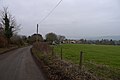
 Country road to East Harptree - geograph.org.uk - 5685100.jpg 1,024 × 680; 244 KB
-
 Dilapidated West End Farm - geograph.org.uk - 164766.jpg 640 × 426; 161 KB
-

-
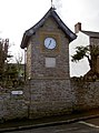
 East harptree clock.JPG 523 × 1,011; 137 KB
-
 East Harptree phone kiosk.jpg 1,704 × 2,304; 1.71 MB
-
 East Harptree school - geograph.org.uk - 3845313.jpg 2,304 × 1,704; 1.72 MB
-
 Eastwood Manor - geograph.org.uk - 164421.jpg 640 × 426; 128 KB
-
 Eastwood Manor - geograph.org.uk - 5684316.jpg 1,024 × 680; 234 KB
-
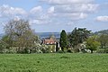
 Farmland above East Harptree - geograph.org.uk - 2569249.jpg 2,592 × 1,944; 1.68 MB
-
 Farmland and house - geograph.org.uk - 5685886.jpg 1,024 × 680; 188 KB
-
 Farmland near East Harptree - geograph.org.uk - 5684310.jpg 1,024 × 680; 258 KB
-
 Fields near Nett Wood Farm - geograph.org.uk - 2569220.jpg 2,592 × 1,944; 1.6 MB
-
 Following Western Lane down to Garrow Bottom - geograph.org.uk - 4382020.jpg 3,776 × 2,520; 3.79 MB
-
 From the outside looking in - geograph.org.uk - 3845240.jpg 2,304 × 1,704; 1.75 MB
-
 Gateway to streamlet and mud at Shrowl Bridge - geograph.org.uk - 3912646.jpg 3,128 × 2,346; 2.51 MB
-
 Glass Room - geograph.org.uk - 3845294.jpg 1,704 × 2,304; 1.61 MB
-
 Grasping the earth - geograph.org.uk - 3845255.jpg 1,704 × 2,304; 2.35 MB
-
 Gruffy ground - geograph.org.uk - 3843446.jpg 2,304 × 1,704; 1.7 MB
-
 Harptree Combe - geograph.org.uk - 3843264.jpg 2,304 × 1,704; 1.66 MB
-
 Harptree Combe - geograph.org.uk - 3845230.jpg 1,704 × 2,304; 2.21 MB
-
 Harptree Combe gate - geograph.org.uk - 3845282.jpg 2,304 × 1,704; 1.57 MB
-
 Highfield Lane - geograph.org.uk - 5685876.jpg 1,024 × 680; 206 KB
-
 Houses overlooking a pool - geograph.org.uk - 5685097.jpg 1,024 × 680; 237 KB
-
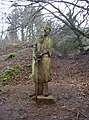 Knightly figure - geograph.org.uk - 3845235.jpg 1,704 × 2,304; 2.34 MB
-
 Learning through the ages - geograph.org.uk - 3845308.jpg 2,304 × 1,704; 1.73 MB
-
 Looking down at you - geograph.org.uk - 3843480.jpg 2,304 × 1,704; 1.76 MB
-
 Mossy bark - geograph.org.uk - 3845266.jpg 2,304 × 1,704; 1.7 MB
-
 No dirty doggies - geograph.org.uk - 3843439.jpg 1,704 × 2,304; 1.53 MB
-

-
-
 Path to the castle - geograph.org.uk - 3843268.jpg 2,304 × 1,704; 1.66 MB
-
 Public Footpath on Niver Hill - geograph.org.uk - 107189.jpg 640 × 480; 67 KB
-
 Rainbow over East Harptree - geograph.org.uk - 5685104.jpg 1,024 × 680; 175 KB
-
 Road to Smitham Hill - geograph.org.uk - 4382046.jpg 3,776 × 2,520; 3.89 MB
-
 Rocky and wild - geograph.org.uk - 3845218.jpg 2,304 × 1,704; 1.73 MB
-
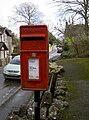
 Rural postbox - geograph.org.uk - 3845284.jpg 2,304 × 1,704; 1.62 MB
-
 Rustic steps - geograph.org.uk - 3845224.jpg 1,704 × 2,304; 2.09 MB
-
 Shrowl Bridge over the River Chew - geograph.org.uk - 3912652.jpg 3,128 × 2,346; 2.45 MB
-
 Slippery slope - geograph.org.uk - 3845212.jpg 1,704 × 2,304; 2.34 MB
-
 Smitham Chimney - geograph.org.uk - 74537.jpg 480 × 640; 100 KB
-
 Springfield Farm - geograph.org.uk - 2569240.jpg 2,592 × 1,944; 1.91 MB
-

-
 The back of a knight - geograph.org.uk - 3845236.jpg 1,704 × 2,304; 2.29 MB
-
 The Donjon - geograph.org.uk - 3845253.jpg 2,304 × 1,704; 1.75 MB
-
 The drive to Buckley Cottage - geograph.org.uk - 2665889.jpg 2,592 × 1,944; 1.97 MB
-
 The entrance gates to Eastwood Manor - geograph.org.uk - 2665938.jpg 2,592 × 1,944; 1.79 MB
-
 The house at the entrance to Eastwood Manor Farm - geograph.org.uk - 2665880.jpg 2,592 × 1,944; 1.57 MB
-
 The Monarch's Way heads uphill - geograph.org.uk - 2569278.jpg 2,592 × 1,944; 1.56 MB
-
 The River Chew downstream from Shrowl Bridge - geograph.org.uk - 3912655.jpg 2,346 × 3,128; 2.52 MB
-
 The River Chew upstream from Shrowl Bridge - geograph.org.uk - 3912657.jpg 3,128 × 2,346; 2.26 MB
-
 The Theatre - geograph.org.uk - 3845330.jpg 2,304 × 1,704; 1.67 MB
-
 The Waldegrave Arms (geograph 3845299).jpg 2,304 × 1,704; 1.78 MB
-
 This way for up, that way for down - geograph.org.uk - 3845222.jpg 1,704 × 2,304; 1.97 MB
-
 Track and footpath - geograph.org.uk - 5685879.jpg 1,024 × 680; 320 KB
-
 Tree in a hedgerow - geograph.org.uk - 5685869.jpg 1,024 × 680; 256 KB
-
 Victorian time - geograph.org.uk - 3845316.jpg 2,304 × 1,704; 1.62 MB
-
 View from Smitham Hill - geograph.org.uk - 2017330.jpg 640 × 480; 104 KB
-
 View over Pitt Farm - geograph.org.uk - 5685911.jpg 1,024 × 680; 215 KB
-
 Village hub - geograph.org.uk - 3845326.jpg 2,304 × 1,704; 1.7 MB
-
 Village shops - geograph.org.uk - 3845329.jpg 2,304 × 1,704; 1.59 MB
-
 Waldegrave Arms - geograph.org.uk - 3845291.jpg 2,304 × 1,704; 1.62 MB
-
 Weak bridge ahead - geograph.org.uk - 1957648.jpg 2,304 × 1,704; 1.66 MB
-
 Well below us - geograph.org.uk - 3845277.jpg 1,704 × 2,304; 1.95 MB
-

-
 BT microwave link, now derelict. - geograph.org.uk - 667687.jpg 640 × 480; 51 KB
-
 Entrance into East Harptree Woods - geograph.org.uk - 616461.jpg 640 × 480; 144 KB
-
 Farm Road to Nettwood Farm - geograph.org.uk - 616466.jpg 640 × 480; 97 KB
-
 Field and Woods on the Mendips - geograph.org.uk - 164439.jpg 640 × 426; 111 KB
-
 Holmwood Farm - geograph.org.uk - 164449.jpg 640 × 426; 190 KB
-
 Lane to Nettwood Farm - geograph.org.uk - 616471.jpg 640 × 480; 96 KB
-
 Minor road to East Harptree - geograph.org.uk - 616463.jpg 640 × 480; 104 KB
-
 Overhead Pipe in Harptree Combe - geograph.org.uk - 74545.jpg 640 × 480; 146 KB
-
 Pitt Farm - geograph.org.uk - 111097.jpg 640 × 480; 68 KB
-
 WT Station - geograph.org.uk - 107190.jpg 640 × 480; 61 KB
-
 Yard - geograph.org.uk - 164441.jpg 640 × 426; 107 KB


.jpg)


