Category:East Lothian
Hopp til navigering
Hopp til søk
Council areas (municipalities) of Scotland: Aberdeen · Aberdeenshire · Angus · Argyll and Bute · Clackmannanshire · Dumfries and Galloway · Dundee · East Ayrshire · East Dunbartonshire · East Lothian · East Renfrewshire · Edinburgh · Falkirk · Fife · Glasgow · Highland · Inverclyde · Midlothian · Moray · North Ayrshire · North Lanarkshire · Outer Hebrides · Orkney Islands · Perth and Kinross · Renfrewshire · Scottish Borders · Shetland Islands · South Ayrshire · South Lanarkshire · Stirling · West Dunbartonshire · West Lothian
Traditional counties (shires) of Scotland: Aberdeenshire · Angus · Argyll · Ayrshire · Banffshire · Berwickshire · Buteshire · Caithness · Clackmannanshire · Cromartyshire · Dumbartonshire · Dumfriesshire · East Lothian · Fife · Inverness-shire · Kincardineshire · Kinross-shire · Kirkcudbrightshire · Lanarkshire · Midlothian · Moray · Nairnshire · Orkney Islands · Peeblesshire · Perthshire · Renfrewshire · Ross-shire · Roxburghshire · Selkirkshire · Shetland Islands · Stirlingshire · Sutherland · West Lothian · Wigtownshire
council area of Scotland; lieutenancy area    | |||||
| Last opp mediefiler | |||||
| Forekomst av | |||||
|---|---|---|---|---|---|
| Plassering |
| ||||
| Hovedstad | |||||
| Folketall |
| ||||
| Areal |
| ||||
| Forskjellig fra | |||||
| offisielt nettsted | |||||
 | |||||


Underkategorier
Denne kategorien har følgende 24 underkategorier, av totalt 24.
A
- Aerial photographs of East Lothian (16 filer)
C
G
H
I
L
N
P
- Panoramics of East Lothian (3 filer)
S
- Sculptures in East Lothian (14 filer)
- Standing stones in East Lothian (7 filer)
T
V
Filer i kategorien «East Lothian»
Følgende 200 filer er i denne kategorien, av totalt 1 653.
(forrige side) (neste side)-
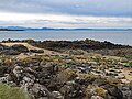
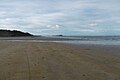
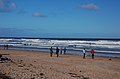
 A breaking wave at Peffer Sands - geograph.org.uk - 3217822.jpg 640 × 380; 236 KB
-
 A by-way of East Lothian - geograph.org.uk - 1301349.jpg 640 × 480; 86 KB
-
 A clear day at Seacliff - geograph.org.uk - 5361112.jpg 1 024 × 576; 301 KB
-
 A cove below Tantallon - geograph.org.uk - 352025.jpg 640 × 480; 188 KB
-
 A flooded picnic site at White Sands - geograph.org.uk - 2230902.jpg 4 416 × 3 312; 7,68 MB
-
 A good crop of field beans - geograph.org.uk - 895551.jpg 640 × 480; 107 KB
-
 A herring gull on the East Lothian coast - geograph.org.uk - 3404786.jpg 640 × 438; 210 KB
-

-
 A horse and rider at Seacliff - geograph.org.uk - 2956493.jpg 640 × 385; 255 KB
-
 A male eider duck at Great Car - geograph.org.uk - 2977474.jpg 640 × 442; 218 KB
-
 A microlight over the East Lothian coast - geograph.org.uk - 2290279.jpg 511 × 640; 163 KB
-

-
 A rocky inlet at St Baldred's Cradle - geograph.org.uk - 2077738.jpg 800 × 530; 180 KB
-
 A spring low water, Gullane - geograph.org.uk - 5256241.jpg 800 × 531; 163 KB
-
 A trio of islands from Broad Sands - geograph.org.uk - 2331961.jpg 800 × 530; 95 KB
-
 A view from the loo - geograph.org.uk - 556222.jpg 640 × 480; 86 KB
-
 A wave cut platform at Skateraw - geograph.org.uk - 3446174.jpg 480 × 640; 217 KB
-

-
 Aberlady Bay - geograph.org.uk - 2445079.jpg 424 × 640; 224 KB
-
 Aberlady Bay - geograph.org.uk - 2445152.jpg 640 × 426; 254 KB
-
 Aberlady Bay from Aberlady Point - geograph.org.uk - 5512504.jpg 1 024 × 682; 222 KB
-
 Aberlady Bay intertidal - geograph.org.uk - 5762568.jpg 1 024 × 683; 231 KB
-
 Abseiling Barns Ness Lighthouse - geograph.org.uk - 2174366.jpg 3 000 × 4 000; 3,14 MB
-
 Action on the 4th tee - geograph.org.uk - 2596861.jpg 2 592 × 1 944; 1,74 MB
-
 Active dune front, Lochhouses Links - geograph.org.uk - 1226495.jpg 640 × 359; 41 KB
-

-
 An X-craft and the East Lothian coastline - geograph.org.uk - 5761387.jpg 1 600 × 1 136; 257 KB
-
 An X-craft under threatening skies - geograph.org.uk - 5754681.jpg 1 600 × 1 200; 183 KB
-
 Anglers on the Long Craig, Torness - geograph.org.uk - 6264631.jpg 1 600 × 1 065; 663 KB
-
-
 Anti-tank defences in Links Wood - geograph.org.uk - 4872011.jpg 640 × 480; 260 KB
-

-
 Approaching the shoreline, Aberlady Bay - geograph.org.uk - 6076999.jpg 1 024 × 576; 279 KB
-
 Arthur's Seat as seen from the Graveyard.jpg 1 200 × 900; 128 KB
-
 Artifacts in the church.jpg 1 200 × 1 600; 346 KB
-
 At the edge of the sea - geograph.org.uk - 2839698.jpg 640 × 480; 66 KB
-
 Auldhame House - geograph.org.uk - 921212.jpg 640 × 480; 80 KB
-
 Barnacle-encrusted X-craft remains - geograph.org.uk - 5761358.jpg 1 178 × 1 600; 588 KB
-
 Barns Ness Lighthouse Dunbar - geograph.org.uk - 6192599.jpg 4 592 × 3 448; 3,08 MB
-
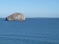
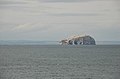
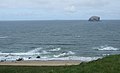
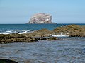
 Bass Rock - geograph.org.uk - 3790168.jpg 640 × 480; 233 KB
-
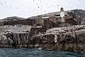
 Bass Rock - geograph.org.uk - 4520811.jpg 1 024 × 768; 106 KB
-
 Bass Rock - geograph.org.uk - 5337916.jpg 2 000 × 1 333; 1,51 MB
-
 Bass Rock - geograph.org.uk - 5422453.jpg 640 × 480; 506 KB
-
 Bass Rock - geograph.org.uk - 5517055.jpg 1 024 × 682; 134 KB
-
 Bass Rock - geograph.org.uk - 5517125.jpg 682 × 1 024; 183 KB
-
 Bass Rock - geograph.org.uk - 5517210.jpg 1 024 × 684; 145 KB
-
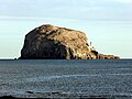 Bass Rock - geograph.org.uk - 5666222.jpg 640 × 480; 180 KB
-
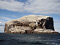 Bass Rock - geograph.org.uk - 5689196.jpg 3 264 × 2 448; 1,97 MB
-
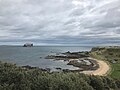
 Bass Rock across Canty Bay - geograph.org.uk - 2442376.jpg 2 304 × 1 728; 1,92 MB
-

-
 Bass Rock and North Berwick Law from Arthur's Seat - geograph.org.uk - 3118872.jpg 1 422 × 1 000; 866 KB
-
 Bass Rock and St Baldreds Boat from Seacliff - geograph.org.uk - 5070617.jpg 1 024 × 682; 172 KB
-

-
 Bass Rock and the Isle of May - geograph.org.uk - 2903875.jpg 640 × 480; 51 KB
-
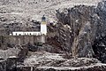
 Bass Rock castle - geograph.org.uk - 5517115.jpg 1 024 × 682; 234 KB
-
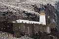
 Bass Rock Castle and Lighthouse - geograph.org.uk - 5515691.jpg 1 024 × 682; 198 KB
-
 Bass Rock from Broad Sands - geograph.org.uk - 5547573.jpg 1 024 × 768; 196 KB
-

-
 Bass Rock from Leckmoran Ness - geograph.org.uk - 3752963.jpg 1 024 × 678; 188 KB
-
 Bass Rock from Seacliff - geograph.org.uk - 5070618.jpg 1 024 × 682; 199 KB
-
 Bass Rock from St Baldred's Cradle - geograph.org.uk - 2077764.jpg 800 × 530; 175 KB
-
 Bass Rock from St Baldred's Cradle - geograph.org.uk - 2077781.jpg 800 × 530; 73 KB
-
 Bass Rock from Tantallon Castle - geograph.org.uk - 5070899.jpg 1 024 × 682; 91 KB
-
 Bass Rock from Tantallon Castle - geograph.org.uk - 5070900.jpg 1 024 × 682; 145 KB
-
 Bass Rock From Tantallon Castle - geograph.org.uk - 5397612.jpg 1 600 × 1 201; 369 KB
-
 Bass Rock from the west - geograph.org.uk - 5547607.jpg 1 024 × 767; 209 KB
-
 Bass Rock lighthouse - geograph.org.uk - 5517048.jpg 1 024 × 682; 281 KB
-
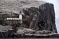 Bass Rock lighthouse - geograph.org.uk - 5517066.jpg 1 024 × 682; 257 KB
-
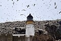 Bass Rock lighthouse - geograph.org.uk - 5517079.jpg 1 024 × 682; 164 KB
-
 Bass Rock lighthouse - geograph.org.uk - 5517082.jpg 1 024 × 682; 178 KB
-
 Bass Rock lighthouse - geograph.org.uk - 5517110.jpg 1 024 × 682; 278 KB
-
 Bass Rock lighthouse and castle - geograph.org.uk - 5517077.jpg 1 024 × 682; 216 KB
-
 Bass Rock Regatta - geograph.org.uk - 5353603.jpg 3 648 × 2 736; 2,33 MB
-
 Bass Rock seen from Cafe above Canty Bay - geograph.org.uk - 5871168.jpg 2 048 × 1 536; 890 KB
-
 Bass Rock viewed from Belhaven Bay - geograph.org.uk - 5523772.jpg 1 024 × 683; 173 KB
-
 Bathan's Strand - geograph.org.uk - 2740155.jpg 640 × 360; 166 KB
-
 Bathan's Strand - geograph.org.uk - 2744380.jpg 640 × 360; 211 KB
-
 Bathan's Strand - geograph.org.uk - 2752040.jpg 640 × 360; 173 KB
-
 Bathan's Strand - geograph.org.uk - 4515301.jpg 800 × 533; 353 KB
-
 Bathan's Strand and Frances Craig - geograph.org.uk - 2062805.jpg 1 024 × 768; 118 KB
-
 Bay at Weaklaw Rocks - geograph.org.uk - 6140812.jpg 640 × 480; 273 KB
-
 Beach along the East Lothian coast - geograph.org.uk - 5803458.jpg 800 × 600; 132 KB
-
 Beach along the East Lothian coast - geograph.org.uk - 5804996.jpg 800 × 600; 139 KB
-
 Beach and Eyebroughy - geograph.org.uk - 5484593.jpg 1 024 × 576; 330 KB
-
-
 Beach at Black Rocks - geograph.org.uk - 6140405.jpg 640 × 480; 228 KB
-
 Beach at Longniddry - geograph.org.uk - 2616966.jpg 1 600 × 1 200; 310 KB
-
 Beach at Longniddry Bents - geograph.org.uk - 5512479.jpg 1 024 × 682; 165 KB
-
 Beach at West Links - geograph.org.uk - 5803498.jpg 800 × 600; 139 KB
-
 Beach at Yellowcraigs - geograph.org.uk - 5547552.jpg 1 024 × 768; 169 KB
-
 Beach close up - Flickr - S. Rae (1).jpg 1 988 × 1 732; 1,12 MB
-
 Beach cricket, Gullane - geograph.org.uk - 5484569.jpg 1 024 × 576; 327 KB
-
 Beach east of Longskelly Rocks - geograph.org.uk - 6141112.jpg 640 × 480; 249 KB
-
 Beach near Gullane Point - geograph.org.uk - 5718146.jpg 1 600 × 1 066; 392 KB
-
 Beach on Gullane Sands - geograph.org.uk - 5824423.jpg 1 600 × 1 065; 434 KB
-
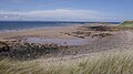
 Beach south of Barns Ness - geograph.org.uk - 4876704.jpg 640 × 480; 204 KB
-
 Beach, Barns Ness - geograph.org.uk - 5767766.jpg 1 024 × 683; 286 KB
-
 Beach, Barns Ness - geograph.org.uk - 5768916.jpg 1 024 × 576; 255 KB
-
 Beach, Ferny Ness - geograph.org.uk - 6089786.jpg 1 024 × 768; 344 KB
-
 Beach, Fernyness - geograph.org.uk - 5953428.jpg 1 024 × 576; 353 KB
-
 Beach, Gosford Sands - geograph.org.uk - 3560931.jpg 640 × 480; 301 KB
-
 Beach, Gosford Sands - geograph.org.uk - 3560935.jpg 640 × 360; 209 KB
-
 Beach, Gosford Sands - geograph.org.uk - 5145890.jpg 1 024 × 768; 345 KB
-
 Beach, Gullane - geograph.org.uk - 1998651.jpg 640 × 359; 93 KB
-
 Beach, Gullane - geograph.org.uk - 2965701.jpg 640 × 359; 224 KB
-
 Beach, Gullane - geograph.org.uk - 4091355.jpg 800 × 435; 338 KB
-
 Beach, Gullane - geograph.org.uk - 5255496.jpg 800 × 531; 157 KB
-
 Beach, Gullane - geograph.org.uk - 5256235.jpg 640 × 425; 30 KB
-
 Beach, Gullane - geograph.org.uk - 5824032.jpg 1 024 × 683; 263 KB
-
 Beach, Gullane - geograph.org.uk - 6257823.jpg 1 024 × 768; 237 KB
-
 Beach, Gullane Bay - geograph.org.uk - 6257818.jpg 1 024 × 768; 236 KB
-
 Beach, Gullane Point - geograph.org.uk - 2097867.jpg 640 × 359; 72 KB
-
 Beach, Gullane Point - geograph.org.uk - 6257015.jpg 1 024 × 768; 381 KB
-
 Beach, Gullane Sands - geograph.org.uk - 5523870.jpg 1 024 × 683; 218 KB
-
 Beach, Gullane Sands - geograph.org.uk - 5523875.jpg 1 024 × 683; 164 KB
-
 Beach, Longniddry - geograph.org.uk - 2828666.jpg 640 × 360; 216 KB
-
 Beach, Longniddry - geograph.org.uk - 3829449.jpg 640 × 480; 262 KB
-
 Beach, Longniddry - geograph.org.uk - 5570914.jpg 1 024 × 683; 346 KB
-
 Beach, Longniddry - geograph.org.uk - 5696060.jpg 1 024 × 683; 357 KB
-
 Beach, Longniddry - geograph.org.uk - 6089791.jpg 1 024 × 752; 225 KB
-
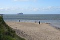
 Beach, North Berwick - geograph.org.uk - 5651042.jpg 1 024 × 576; 299 KB
-
 Beach, Scoughall - geograph.org.uk - 5222753.jpg 1 024 × 683; 227 KB
-
 Beach, Seacliff - geograph.org.uk - 3790093.jpg 640 × 480; 213 KB
-
 Beach, Seacliff - geograph.org.uk - 3790151.jpg 640 × 480; 251 KB
-
 Beach, Seacliff - geograph.org.uk - 3790174.jpg 640 × 480; 236 KB
-
 Beach, Seton Sands - geograph.org.uk - 5145041.jpg 1 024 × 768; 379 KB
-
 Beach, Yellow Craig - geograph.org.uk - 2216750.jpg 640 × 480; 251 KB
-
 Beach, Yellow Craig - geograph.org.uk - 5529913.jpg 1 024 × 683; 288 KB
-
 Beach, Yellow Craig - geograph.org.uk - 5537894.jpg 1 024 × 576; 224 KB
-
 Beach, Yellowcraig - geograph.org.uk - 4290048.jpg 800 × 450; 292 KB
-
 Beach, Yellowcraig - geograph.org.uk - 4294840.jpg 800 × 533; 330 KB
-
 Beach, Yellowcraig - geograph.org.uk - 4294852.jpg 800 × 533; 376 KB
-
 Beach, Yellowcraig - geograph.org.uk - 5234220.jpg 1 024 × 576; 350 KB
-
 Beach, Yellowcraig - geograph.org.uk - 5257794.jpg 1 024 × 680; 264 KB
-
 Beach, Yellowcraig - geograph.org.uk - 5320805.jpg 1 024 × 683; 343 KB
-
 Beach, Yellowcraig - geograph.org.uk - 5879024.jpg 1 024 × 1 024; 302 KB
-
 Beaches along the East Lothian coast - geograph.org.uk - 5763038.jpg 800 × 529; 124 KB
-
 Beehive kiln foundations and pit baths (46078879204).jpg 6 016 × 3 251; 5,88 MB
-
 Belhaven Bay - geograph.org.uk - 1880364.jpg 1 024 × 768; 117 KB
-
 Belhaven Bay - geograph.org.uk - 3094007.jpg 640 × 363; 255 KB
-
 Belhaven Bay - geograph.org.uk - 5523164.jpg 1 024 × 683; 170 KB
-
 Belhaven Bay - geograph.org.uk - 6078796.jpg 1 024 × 768; 302 KB
-
 Belhaven Bay and Winterfield - geograph.org.uk - 3094017.jpg 640 × 427; 347 KB
-
 Belhaven Beach - geograph.org.uk - 3094004.jpg 640 × 415; 338 KB
-
 Belhaven Beach - geograph.org.uk - 3666666.jpg 4 752 × 3 168; 6,31 MB
-
 Belhaven Beach - geograph.org.uk - 5317950.jpg 1 024 × 683; 241 KB
-
 Belhaven Beach - geograph.org.uk - 5317954.jpg 1 024 × 683; 243 KB
-
 Biel House Doocot - geograph.org.uk - 1753056.jpg 480 × 640; 125 KB
-
 Big brother is on the case - geograph.org.uk - 1195834.jpg 640 × 480; 94 KB
-
 Big waves, St Baldred's Cradle - geograph.org.uk - 5705182.jpg 1 200 × 675; 516 KB
-
 Birds and seals off Craigielaw Point - geograph.org.uk - 5512553.jpg 1 024 × 684; 151 KB
-
 Birds on Gosford Sands - geograph.org.uk - 5070076.jpg 1 024 × 682; 175 KB
-
 Black Rocks - geograph.org.uk - 2702830.jpg 640 × 360; 234 KB
-
 Black Rocks - geograph.org.uk - 5547225.jpg 1 024 × 768; 256 KB
-
 Black Rocks - geograph.org.uk - 5547283.jpg 1 024 × 768; 247 KB
-
 Black Rocks and Gullane Bay - geograph.org.uk - 3530839.jpg 1 024 × 768; 205 KB
-
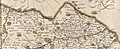 Blaeu - Atlas of Scotland 1654 - LOTHIAN AND LINLITQVO - The Lothians Had.jpg 2 991 × 1 209; 2,4 MB
-
 Bleaching Rocks, Gullane Bay - geograph.org.uk - 5236398.jpg 1 024 × 682; 141 KB
-
 Bleaching Rocks, Gullane Bay - geograph.org.uk - 5236402.jpg 1 024 × 682; 166 KB
-
 Blinkbonny Burn - geograph.org.uk - 917961.jpg 640 × 359; 78 KB
-
 Blowing sand, Longniddry - geograph.org.uk - 2422959.jpg 640 × 359; 204 KB
-
 Blowing sand, Longniddry - geograph.org.uk - 2422966.jpg 640 × 359; 122 KB
-
 Boardwalk leading to Seton Sands - geograph.org.uk - 5796703.jpg 800 × 600; 130 KB
-
 Boats at Fisherrow Sands - geograph.org.uk - 5794541.jpg 800 × 609; 110 KB
-
 Boats in Fisherrow Harbor.jpg 4 032 × 3 024; 2,59 MB
-
 Boltondoocot.jpg 495 × 640; 60 KB
-
 Bombing range marker, Aberlady Bay - geograph.org.uk - 5761403.jpg 1 176 × 1 600; 327 KB
-
 Bow view of an X-craft - geograph.org.uk - 5761342.jpg 1 082 × 1 600; 412 KB
-
 Bracken and heather - geograph.org.uk - 927200.jpg 640 × 359; 92 KB
-
 Breakwater, Torness Point - geograph.org.uk - 3007932.jpg 640 × 480; 64 KB
-
 Broad Sands (view west) - geograph.org.uk - 5547567.jpg 1 024 × 768; 201 KB
-
 Broad Sands - geograph.org.uk - 2290278.jpg 640 × 427; 166 KB
-
 Broad Sands - geograph.org.uk - 2295531.jpg 640 × 370; 158 KB
-
 Broad Sands - geograph.org.uk - 5257798.jpg 1 024 × 680; 201 KB
-
 Broad Sands - geograph.org.uk - 5532513.jpg 1 024 × 683; 256 KB
-
 Broad Sands and the Brigs of Fidra - geograph.org.uk - 5805286.jpg 800 × 600; 140 KB
-
 Broad Sands near North Berwick - geograph.org.uk - 5546541.jpg 1 024 × 768; 170 KB
-
 Broad Sands towards North Berwick - geograph.org.uk - 5547562.jpg 1 024 × 768; 119 KB
-
 Broken up igneous rock - geograph.org.uk - 4983028.jpg 4 608 × 3 456; 2,02 MB
-
 Brox Burn - geograph.org.uk - 1260368.jpg 640 × 360; 84 KB
-
 Burn mouth, Gosford Sands - geograph.org.uk - 1899092.jpg 640 × 359; 103 KB
-
 Burnet Moths on Viper's Bugloss - geograph.org.uk - 3093998.jpg 634 × 640; 500 KB
-
 Burnt area, Blinkbonny Burn - geograph.org.uk - 927202.jpg 640 × 359; 75 KB
-
 Busy beach at Belhaven Bay - geograph.org.uk - 2084901.jpg 800 × 530; 105 KB
-
 Canty Bay - geograph.org.uk - 2953577.jpg 640 × 387; 47 KB
-
 Canty Bay - geograph.org.uk - 3404779.jpg 640 × 475; 241 KB
-
 Canty Bay - geograph.org.uk - 3413099.jpg 640 × 475; 211 KB
-
 Canty Bay - geograph.org.uk - 5906229.jpg 2 048 × 1 536; 2,27 MB
-
 Canty Bay North Berwick - geograph.org.uk - 5871146.jpg 2 048 × 1 536; 1,03 MB
-
 Canty Burn - geograph.org.uk - 4767289.jpg 1 024 × 683; 313 KB
-
 Canty Burn - geograph.org.uk - 5015408.jpg 800 × 534; 169 KB
-
 Canty Burn - geograph.org.uk - 5015411.jpg 800 × 534; 196 KB
-
 Canty Burn, Longniddry - geograph.org.uk - 5208282.jpg 800 × 533; 212 KB
-
 Canty Burn, Seton Sands - geograph.org.uk - 5696073.jpg 1 024 × 576; 232 KB
-
 Car park, Barns Ness - geograph.org.uk - 5768931.jpg 1 024 × 576; 352 KB
-
 Car Rocks, Seacliff - geograph.org.uk - 5070614.jpg 1 024 × 682; 184 KB
-
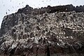
 Caves in the Bass Rock - geograph.org.uk - 3072039.jpg 640 × 427; 426 KB
-
-
 Channel wrack at Ferny Ness - geograph.org.uk - 2084669.jpg 1 024 × 768; 168 KB
-
 Channel, Gullane Sands - geograph.org.uk - 5255398.jpg 640 × 425; 38 KB


.jpg)


.jpg)


_-_geograph.org.uk_-_5547567.jpg)


