Category:Eastside, Pentland Hills
Jump to navigation
Jump to search
Media in category "Eastside, Pentland Hills"
The following 18 files are in this category, out of 18 total.
-
 Access road to Eastside - geograph.org.uk - 1203620.jpg 640 × 483; 83 KB
-
 Eastside - Bavelaw path - geograph.org.uk - 1201802.jpg 640 × 359; 69 KB
-
 Eastside - geograph.org.uk - 1201779.jpg 640 × 480; 76 KB
-
 Eastside - geograph.org.uk - 1203624.jpg 640 × 480; 71 KB
-
 Eastside - geograph.org.uk - 411579.jpg 640 × 480; 62 KB
-
 Farmland, Eastside - geograph.org.uk - 1203659.jpg 640 × 480; 120 KB
-

-
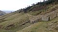
 Old railway waggon, Eastside - geograph.org.uk - 1203604.jpg 640 × 480; 79 KB
-
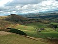 Over Eastside to South Black Hill - geograph.org.uk - 343593.jpg 640 × 482; 80 KB
-
 Pass, Eastside. - geograph.org.uk - 74942.jpg 640 × 480; 61 KB
-
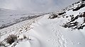
 Path, Eastside - geograph.org.uk - 1203292.jpg 640 × 359; 71 KB
-
 Plantation above Eastside - geograph.org.uk - 1187849.jpg 640 × 360; 63 KB
-
 Road from Eastside - geograph.org.uk - 1203641.jpg 640 × 480; 149 KB
-
 Road to Eastside - geograph.org.uk - 1204086.jpg 640 × 480; 115 KB
-
 Shelter belt at Eastside - geograph.org.uk - 1497252.jpg 640 × 480; 114 KB
-
 Track up from Eastside - geograph.org.uk - 411597.jpg 480 × 640; 78 KB
-
 Tree, Eastside - geograph.org.uk - 1203289.jpg 640 × 359; 70 KB
-
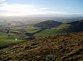 View from East Kip - geograph.org.uk - 330792.jpg 640 × 477; 99 KB


