Category:Exeter
둘러보기로 이동
검색으로 이동
city in Devon, England    | |||||
| 미디어 올리기 | |||||
| 다음 종류에 속함 |
| ||||
|---|---|---|---|---|---|
| 위치 | Exeter, Devon, 데번주, 사우스웨스트잉글랜드, 잉글랜드 | ||||
| 특기할 만한 관련 사건 |
| ||||
| 인구 수 |
| ||||
| 면적 |
| ||||
| 해발고도 |
| ||||
| 공식 웹사이트 | |||||
 | |||||

하위 분류
다음은 이 분류에 속하는 하위 분류 33개 가운데 33개입니다.
- Aerial photographs of Exeter (17 F)
*
- Quality images of Exeter (11 F)
- Valued images of Exeter (1 F)
A
- Allotments in Exeter (16 F)
C
- Exeter Christmas Market (20 F)
- Exeter City Council (8 F)
D
E
- Exeter Golf and Country Club (1 F)
- Exeter motorway services (33 F)
F
- Exe Flood Relief Channel (110 F)
G
- Geology of Exeter (3 F)
- Ghost signs in Exeter (7 F)
- Graffiti in Exeter (28 F)
H
I
M
- Murals in Exeter (5 F)
N
P
- HM Prison Exeter (12 F)
R
- Rougemont Gardens, Exeter (35 F)
S
- Stoke Hill (hill) (12 F)
T
U
- Exeter Underground Passages (7 F)
"Exeter" 분류에 속하는 미디어
다음은 이 분류에 속하는 파일 2,852개 가운데 200개입니다.
(이전 페이지) (다음 페이지)-
 Exeter Flag.png 3,753 × 2,250; 2.53 MB
-
 "The place to eat"^ - geograph.org.uk - 3296553.jpg 640 × 419; 44 KB
-

-
 'The Firs', Queens Terrace - geograph.org.uk - 2750497.jpg 1,024 × 683; 243 KB
-
 ... so it's O.K. to park on the yellow lines then ... Exeter (2354951413).jpg 1,280 × 960; 249 KB
-
 1 Mile to junction 30 M5 eastbound - geograph.org.uk - 4735680.jpg 640 × 443; 131 KB
-
 19th century houses in Victoria Park Road, Exeter (2) - geograph.org.uk - 4801667.jpg 1,600 × 1,200; 479 KB
-
 19th century houses, Victoria Park Road, Exeter - geograph.org.uk - 4801664.jpg 1,600 × 1,200; 359 KB
-

-
 9th Queens Royal Lancers 1860 monument, Exeter Cathedral - geograph.org.uk - 3749680.jpg 2,275 × 2,194; 1.9 MB
-
-
 A block of townhouses arranged as a circle, Exeter - geograph.org.uk - 5694379.jpg 1,600 × 1,200; 744 KB
-
 A bridge to nowhere by Bridge Road, Exeter - geograph.org.uk - 5266555.jpg 1,600 × 1,200; 803 KB
-
 A cob wall that needs repair - geograph.org.uk - 2993980.jpg 800 × 600; 365 KB
-
 A creek through the rushes - geograph.org.uk - 1109049.jpg 640 × 430; 109 KB
-

-
 A doorway hiding a stable block, Alphington Road, Exeter - geograph.org.uk - 6268007.jpg 1,600 × 1,022; 543 KB
-
 A fiddler - geograph.org.uk - 4204000.jpg 1,704 × 2,304; 1.6 MB
-
 A footbridge over Hill Barton Road - geograph.org.uk - 3507279.jpg 640 × 475; 96 KB
-
 A Freezing, Foggy Night - panoramio.jpg 2,048 × 1,536; 1.09 MB
-
 A giant replaced by a giant - geograph.org.uk - 4203029.jpg 1,704 × 2,304; 2.11 MB
-
 A green top - geograph.org.uk - 4217439.jpg 2,304 × 1,704; 1.49 MB
-
 A little bit of Devon's geology - geograph.org.uk - 3306467.jpg 1,024 × 768; 236 KB
-
-
 A misprint on a gravestone - geograph.org.uk - 2594866.jpg 600 × 800; 501 KB
-
-
 A patch of crocuses beside Matford Lane - geograph.org.uk - 2274635.jpg 800 × 600; 523 KB
-

-
 A pedestrian in Victoria Park Road, Exeter - geograph.org.uk - 4290374.jpg 1,600 × 1,199; 1.78 MB
-
 A place to change - geograph.org.uk - 2962492.jpg 1,024 × 768; 206 KB
-
-

-
 A quick short cut - geograph.org.uk - 4637555.jpg 1,024 × 768; 146 KB
-
 A redundant postbox and council office building - geograph.org.uk - 5499600.jpg 1,200 × 1,600; 826 KB
-
 A sad surprise - geograph.org.uk - 1189510.jpg 640 × 471; 92 KB
-
 A short cut from the park - geograph.org.uk - 3052069.jpg 1,024 × 768; 220 KB
-
 A Slice Through Exeter's Earth - geograph.org.uk - 3275686.jpg 2,560 × 1,920; 3.04 MB
-
 A small amount of landscaping, Marsh Barton, Exeter - geograph.org.uk - 3669559.jpg 1,536 × 1,152; 1.06 MB
-

-
 A solitary rower on the Exe - geograph.org.uk - 2540850.jpg 3,872 × 2,592; 4.6 MB
-
 A splash of colour on a wet New Year's Day - geograph.org.uk - 5240653.jpg 1,600 × 1,200; 818 KB
-
 A tree in the middle - geograph.org.uk - 2796063.jpg 1,024 × 768; 237 KB
-
 A wet path in the grounds of County Hall, Exeter - geograph.org.uk - 4780196.jpg 1,600 × 1,200; 511 KB
-
 A115 road junction - geograph.org.uk - 2479532.jpg 640 × 480; 74 KB
-
 A30 approaches interchange with A377 - geograph.org.uk - 3226197.jpg 3,451 × 1,923; 1.25 MB
-
 A30 Approaching Exeter - geograph.org.uk - 4427173.jpg 3,786 × 2,294; 3.66 MB
-

-
 A30 crossed by footbridge from Ide Bridge - geograph.org.uk - 3226189.jpg 3,057 × 1,886; 1.24 MB
-
 A30 crosses minor road near Ide - geograph.org.uk - 2006307.jpg 640 × 480; 91 KB
-
 A30 near Alphington - geograph.org.uk - 5564898.jpg 2,048 × 1,536; 257 KB
-
 A30 near Alphington - geograph.org.uk - 5564905.jpg 2,039 × 1,485; 197 KB
-
 A30 north of Ide - geograph.org.uk - 3226185.jpg 3,648 × 2,048; 1.19 MB
-
 A30 turning, M5 - geograph.org.uk - 2428066.jpg 640 × 457; 59 KB
-
 A3015 (Topsham Road) bridge over Northbrook, Exeter - geograph.org.uk - 5183943.jpg 1,600 × 1,200; 750 KB
-
 A377 - geograph.org.uk - 4550779.jpg 640 × 492; 90 KB
-
 A377 - geograph.org.uk - 4838448.jpg 640 × 426; 64 KB
-
 A377 - geograph.org.uk - 5046985.jpg 640 × 426; 101 KB
-
 A377 approaching Cowley - geograph.org.uk - 1984173.jpg 640 × 480; 73 KB
-
 A377 Cowley Bridge Road - geograph.org.uk - 5488686.jpg 2,096 × 1,420; 1.47 MB
-
 A377 over Cowley Bridge - geograph.org.uk - 5488705.jpg 1,600 × 1,054; 352 KB
-

-
 A377, Alphington Rd - geograph.org.uk - 5294298.jpg 640 × 426; 65 KB
-
 A377, Station Rd junction - geograph.org.uk - 3350556.jpg 640 × 430; 54 KB
-
 A379 - geograph.org.uk - 5759761.jpg 640 × 425; 48 KB
-
 A379 at Sandy Park - geograph.org.uk - 5425402.jpg 3,072 × 2,048; 1.29 MB
-
 A379 at Sandy Park - geograph.org.uk - 5425421.jpg 3,072 × 2,048; 1.51 MB
-
 A379 at Sandy Park - geograph.org.uk - 5425522.jpg 3,072 × 2,048; 1.38 MB
-
 A379 Countess Wear Exeter - geograph.org.uk - 4668311.jpg 640 × 490; 57 KB
-
 A379 Near Junction With M5 Exeter - geograph.org.uk - 5125503.jpg 640 × 480; 63 KB
-
 A379 To Sandy Gate - geograph.org.uk - 3990738.jpg 4,000 × 3,000; 3.95 MB
-
 A379, Bridge Rd - geograph.org.uk - 3367759.jpg 640 × 430; 42 KB
-
 A379, the link between M5 J30 and Exeter - geograph.org.uk - 4712796.jpg 1,600 × 1,200; 1.39 MB
-
 A396 passing Stoke Woods - geograph.org.uk - 2139332.jpg 640 × 480; 295 KB
-
 A396 passing Stoke Woods - geograph.org.uk - 2139350.jpg 640 × 480; 275 KB
-
 A396 passing Stoke Woods - geograph.org.uk - 2139367.jpg 640 × 480; 264 KB
-
 Abbeville Close, Exeter - geograph.org.uk - 4096272.jpg 1,024 × 768; 147 KB
-
 Access road to part of Exeter College, off Queen Street - geograph.org.uk - 5240220.jpg 1,200 × 1,600; 882 KB
-

-
 Access road to The Senate office building - geograph.org.uk - 6235725.jpg 1,600 × 1,200; 928 KB
-
 Access to footpath off Ludwell Lane, Exeter - geograph.org.uk - 4714685.jpg 1,600 × 1,200; 1.6 MB
-
 Access track off Woodwater Lane, Exeter - geograph.org.uk - 4803713.jpg 1,600 × 1,200; 472 KB
-
 Acer leaves, Exeter - geograph.org.uk - 3780920.jpg 1,920 × 1,512; 787 KB
-
 Acland Road, Exeter - geograph.org.uk - 4435404.jpg 1,600 × 1,200; 1.41 MB
-
 Across Goosemoor Nature Reserve - geograph.org.uk - 5120971.jpg 3,049 × 1,240; 641 KB
-
 Across the Exe - geograph.org.uk - 3266100.jpg 3,648 × 2,736; 4.6 MB
-
 Across the Exe - geograph.org.uk - 4206364.jpg 2,304 × 1,704; 1.65 MB
-
 Advertising space - geograph.org.uk - 3750529.jpg 1,704 × 2,304; 1.56 MB
-
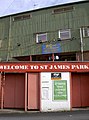
 Adverts outside St James Park, Exeter - geograph.org.uk - 5090539.jpg 800 × 600; 129 KB
-
 Afloat on the Exe - geograph.org.uk - 3098632.jpg 1,024 × 768; 570 KB
-
 Alas, poor snowman - geograph.org.uk - 1152434.jpg 499 × 640; 122 KB
-
 Albion Place, Exeter - geograph.org.uk - 4660451.jpg 1,200 × 1,600; 1.38 MB
-
 Aldrin Road - geograph.org.uk - 5091942.jpg 1,024 × 679; 172 KB
-
 All for one and one for all - geograph.org.uk - 1111055.jpg 640 × 446; 65 KB
-

-
 Alphin Brook, Exeter - geograph.org.uk - 3795183.jpg 640 × 480; 68 KB
-
 Alphington post office in Church Road - geograph.org.uk - 6267016.jpg 1,600 × 918; 578 KB
-
 Alphington Roundabout - geograph.org.uk - 3382219.jpg 1,024 × 768; 167 KB
-

-
 An aggregate HGV - geograph.org.uk - 6046813.jpg 1,024 × 681; 169 KB
-
 An apparently peaceful path near Ide - geograph.org.uk - 5074195.jpg 4,896 × 3,672; 3.01 MB
-
 An old eagle - geograph.org.uk - 4217455.jpg 1,704 × 2,304; 1.42 MB
-
 An open goal - geograph.org.uk - 3750544.jpg 2,304 × 1,704; 1.78 MB
-
 Annual Report for 1923, Vital Statistics, S Wellcome L0029928.jpg 1,142 × 1,832; 1,013 KB
-
 Another Field Gone - geograph.org.uk - 5187607.jpg 3,701 × 2,391; 2.56 MB
-
 Antonine Crescent leading to Hadrian Drive - geograph.org.uk - 3910728.jpg 1,024 × 615; 103 KB
-
 Antonine Crescent, Redhills, Exeter - geograph.org.uk - 5074125.jpg 1,600 × 1,200; 362 KB
-
 Apparelmaster Laundry, Cowley Bridge Road - geograph.org.uk - 5093077.jpg 3,900 × 2,306; 1.61 MB
-
 Apple Farm Grange, Digby - geograph.org.uk - 2788416.jpg 640 × 472; 62 KB
-
 Apple Lane - geograph.org.uk - 2978326.jpg 1,024 × 768; 179 KB
-
 Apple Lane - geograph.org.uk - 3297050.jpg 1,024 × 768; 153 KB
-
 Apple Lane - geograph.org.uk - 5423609.jpg 3,072 × 2,048; 1.28 MB
-
 Apple Lane - geograph.org.uk - 5424593.jpg 3,015 × 1,874; 1.11 MB
-
 Apple Lane - geograph.org.uk - 5424851.jpg 3,072 × 2,048; 1.56 MB
-

-
 Approaching footpath leaving the A396 - geograph.org.uk - 4735028.jpg 640 × 480; 213 KB
-
 Approaching Junction 30, M5 - geograph.org.uk - 3092533.jpg 640 × 430; 37 KB
-

-
 Arch, New North Road Bridge - geograph.org.uk - 4550786.jpg 640 × 426; 69 KB
-
 Archery on the playing field of Exeter School - geograph.org.uk - 4448139.jpg 1,600 × 800; 859 KB
-
-
 Argee Bhajee - geograph.org.uk - 5095269.jpg 1,600 × 1,092; 345 KB
-
 Argyll Road, Exeter - geograph.org.uk - 3092838.jpg 640 × 501; 111 KB
-
 Art House - geograph.org.uk - 2592342.jpg 800 × 600; 395 KB
-
 Artillery Court, Barrack Road - geograph.org.uk - 4711436.jpg 1,600 × 1,200; 1.3 MB
-
 Artillery Court, Barrack Road, Exeter - geograph.org.uk - 4711439.jpg 1,600 × 1,200; 1.39 MB
-
 Artwork at entrance to Heavitree Pleasure Ground - geograph.org.uk - 4815626.jpg 1,200 × 1,600; 293 KB
-
 Artwork at Sainsbury's - geograph.org.uk - 3189937.jpg 1,024 × 768; 547 KB
-
 Artwork under Exe Bridges - geograph.org.uk - 5266499.jpg 1,600 × 1,200; 791 KB
-

-
 Athelstan Road, Exeter - geograph.org.uk - 4800497.jpg 1,600 × 1,200; 303 KB
-
 Atlas house, Exeter - geograph.org.uk - 6186946.jpg 4,115 × 2,348; 699 KB
-
 Autumn by the M5 - geograph.org.uk - 5316398.jpg 640 × 356; 75 KB
-
 Autumn colour and waymarked path, Pynes Hill, Exeter - geograph.org.uk - 5183908.jpg 1,200 × 1,600; 798 KB
-
 Autumn colour at Devon County Hall - geograph.org.uk - 3219597.jpg 768 × 1,024; 649 KB
-
 Autumn colour in Exeter Higher Cemetery - geograph.org.uk - 4735377.jpg 1,600 × 1,200; 1.73 MB
-
 Autumn colour in Matford Avenue - geograph.org.uk - 2148878.jpg 640 × 480; 220 KB
-
 Autumn colour in the grounds of County Hall, Exeter - geograph.org.uk - 5163459.jpg 1,200 × 1,600; 785 KB
-
 Autumn leaves by Bad Homburg Way - geograph.org.uk - 5174182.jpg 1,600 × 1,200; 822 KB
-
 Autumn leaves, Bedford Street, Exeter - geograph.org.uk - 3780905.jpg 1,920 × 1,515; 845 KB
-
 Autumn Tints - geograph.org.uk - 2117431.jpg 1,600 × 1,200; 445 KB
-
 Avenue of trees in Belle Isle Park, Exeter - geograph.org.uk - 5639733.jpg 1,600 × 1,200; 773 KB
-
 Avocet Road looking eastwards - geograph.org.uk - 3506943.jpg 2,560 × 1,920; 1.04 MB
-
 Avocet Road looking South West - geograph.org.uk - 3506950.jpg 2,560 × 1,920; 1.04 MB
-
 B3181 approaching Venny Bridge - geograph.org.uk - 6220977.jpg 640 × 569; 52 KB
-
 B3212 - geograph.org.uk - 5399048.jpg 640 × 426; 81 KB
-
 B3212 - geograph.org.uk - 6040449.jpg 1,024 × 681; 163 KB
-
 Back End of a Bus... (35746803544).jpg 2,749 × 3,296; 1.06 MB
-
 Back street off Bonville Avenue - geograph.org.uk - 5759733.jpg 640 × 426; 49 KB
-
 Bagshot Avenue, Exeter - geograph.org.uk - 3249426.jpg 1,024 × 768; 525 KB
-
 Balmoral Gardens - geograph.org.uk - 3490520.jpg 640 × 430; 53 KB
-
 Bampfylde Street meets Paris Street, Exeter - geograph.org.uk - 3845931.jpg 1,920 × 2,560; 886 KB
-
 Baring Crescent, Exeter - geograph.org.uk - 1812260.jpg 640 × 480; 230 KB
-
 Baring Crescent, Exeter - geograph.org.uk - 4218397.jpg 1,600 × 1,200; 1.55 MB
-
 Barley Lane - geograph.org.uk - 3426354.jpg 480 × 640; 108 KB
-
 Barley Lane, Exeter - geograph.org.uk - 2748931.jpg 640 × 480; 73 KB
-
 Barley Mount, Exeter - geograph.org.uk - 3910748.jpg 1,024 × 768; 137 KB
-
 Barley Valley Local Nature Reserve - geograph.org.uk - 1740031.jpg 640 × 443; 97 KB
-
 Barley Valley Local Nature Reserve - geograph.org.uk - 1740035.jpg 640 × 480; 101 KB
-
 Barley Valley Local Nature Reserve - geograph.org.uk - 1740065.jpg 640 × 480; 111 KB
-
 Barnfield Hill, Exeter - geograph.org.uk - 4599579.jpg 1,600 × 1,200; 1.39 MB
-
 Barnfield Road, Exeter - geograph.org.uk - 3736427.jpg 1,152 × 1,536; 1.1 MB
-
 Barnfield Road, Exeter and Western Way - geograph.org.uk - 3736430.jpg 1,536 × 1,152; 1.11 MB
-
 Barrack Road, Exeter - geograph.org.uk - 4211384.jpg 1,600 × 1,200; 1.35 MB
-

-
 Bartholomew House, Bartholomew Street, Exeter - geograph.org.uk - 6177482.jpg 1,116 × 1,600; 268 KB
-
 Bartholomew Street from Bonhay Road, Exeter - geograph.org.uk - 3910776.jpg 1,024 × 768; 118 KB
-
 Bartholomew Terrace - geograph.org.uk - 3644722.jpg 1,704 × 2,304; 1.32 MB
-
 Barton Place Farm Shop - geograph.org.uk - 3911548.jpg 1,024 × 768; 102 KB
-
 Barton Place Wood - geograph.org.uk - 5220455.jpg 640 × 368; 50 KB
-
 Barton Place Wood - geograph.org.uk - 5841662.jpg 1,024 × 681; 124 KB
-
 Barton Place Wood - geograph.org.uk - 5841663.jpg 1,024 × 681; 90 KB
-
 Barton Place, 2000 (geograph 5576184).jpg 2,186 × 1,440; 265 KB
-
 Bear Street, Exeter - geograph.org.uk - 2967090.jpg 1,024 × 609; 644 KB
-
 Beauty salon, Wellington Place, Exeter - geograph.org.uk - 6268151.jpg 1,200 × 1,600; 927 KB
-
 Bee orchid, Sandy Park - geograph.org.uk - 5427247.jpg 1,565 × 2,390; 742 KB
-
 Beech trees in Stokehill Plantation - geograph.org.uk - 4726637.jpg 480 × 640; 140 KB
-
 Beer Cottage - geograph.org.uk - 5428120.jpg 640 × 426; 40 KB
-
 Beer Cottage - geograph.org.uk - 5450232.jpg 640 × 426; 40 KB
-
 Beer Cottages - geograph.org.uk - 5679440.jpg 640 × 426; 48 KB
-
 Before the car was invented - geograph.org.uk - 3643870.jpg 1,704 × 2,304; 1.73 MB
-
 Bella Italia - geograph.org.uk - 6274707.jpg 4,032 × 3,024; 3.08 MB
-
 Belmont Park and community centre, Exeter - geograph.org.uk - 6268535.jpg 1,200 × 1,600; 1.14 MB
-
 Below Lower Rollestone - geograph.org.uk - 1189532.jpg 640 × 427; 64 KB
-
 Belvidere Road - geograph.org.uk - 5490529.jpg 1,200 × 1,600; 784 KB
-
 Belvidere Road, Exeter - geograph.org.uk - 137160.jpg 640 × 480; 156 KB
-
 Bend in A396 approaching Stoke Woods - geograph.org.uk - 4735020.jpg 640 × 462; 246 KB
-

-
 Bends in Pennsylvania Road - geograph.org.uk - 4726641.jpg 640 × 480; 93 KB
-
 Bendy yew hedge, Reed Hall, Exeter - geograph.org.uk - 1039529.jpg 480 × 640; 141 KB
-
 Beware extreme bikers^ - geograph.org.uk - 3644704.jpg 2,304 × 1,704; 1.61 MB
-
 Beware low flying excavator^ - geograph.org.uk - 4412396.jpg 640 × 480; 78 KB
-
 BG Spirit - geograph.org.uk - 5841650.jpg 1,024 × 681; 122 KB
-
 Bickleigh Close, Pinhoe - geograph.org.uk - 5090483.jpg 1,600 × 1,098; 404 KB
-
 Bicycles, Exeter Central station - geograph.org.uk - 6006624.jpg 1,862 × 962; 260 KB
-
 Big baubles, Exeter - geograph.org.uk - 3780950.jpg 1,920 × 1,440; 415 KB
-
 Birchy Barton Hill, Heavitree - geograph.org.uk - 268049.jpg 482 × 640; 120 KB
-
 Birds on Ice Exeter - geograph.org.uk - 1111034.jpg 464 × 640; 58 KB
-
 Birds, Bowling Green Marsh - geograph.org.uk - 2341596.jpg 640 × 355; 59 KB
-
 Birds, Goosemoor Nature Reserve - geograph.org.uk - 5121026.jpg 1,892 × 1,233; 459 KB
-
 Birdwatchers at Riversmeet - geograph.org.uk - 5122002.jpg 976 × 689; 176 KB


.jpg)

_-_geograph.org.uk_-_4801667.jpg)


_bridge_over_Northbrook,_Exeter_-_geograph.org.uk_-_5183943.jpg)


.jpg)


.jpg)


