Category:First Military Mapping Survey of Austrian Empire
Zur Navigation springen
Zur Suche springen
Internationalization
Deutsch: Josephinische Landesaufnahme
English: 1st Military Mapping Survey of Austria
Magyar: I. katonai felmérés
Română: Ridicarea topografică iozefină
English: Maps were created between 1764 and 1768 and rectified between 1780 and 1783. Scale 1:28 800.
- See:
- Category:First Military Mapping Survey of Austrian Empire (1764 – 1768), called „Josephinische Landesaufnahme“ or „1. Landesaufnahme“
- Category:Second Military Mapping Survey of Austrian Empire (1836 – 1852), called „Franziszeische Landesaufnahme“ or „2. Landesaufnahme“
- Category:3rd Military Mapping Survey of Austria-Hungary (1868 – 1880), called „Franzisco-Josephinische Landesaufnahme“ or „3. Landesaufnahme“
Clickable maps[Bearbeiten]
-
 Arad County
 -
 Bihor, Solnoc, Crasna County
 -
 Maramureş County
 -
 Grand Duchy of Transylvania
 -
 Banat region
 -
 Sătmar County
 -
 Gros Honter County
 -
 Kingdom of Hungary


.jpg)


| Keine Wikidata-ID gefunden! Suche nach First Military Mapping Survey of Austrian Empire auf Wikidata | |
| Medium hochladen |
Unterkategorien
Es werden 4 von insgesamt 4 Unterkategorien in dieser Kategorie angezeigt:
In Klammern die Anzahl der enthaltenen Kategorien (K), Seiten (S), Dateien (D)
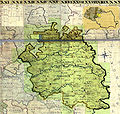
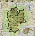
Medien in der Kategorie „First Military Mapping Survey of Austrian Empire“
Folgende 52 Dateien sind in dieser Kategorie, von 52 insgesamt.
-
 Budapest 1785.png 1.186 × 599; 1,6 MB
-
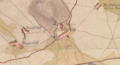
 Crangul Mieilor 1789 Battle of Ramnic.png 1.276 × 1.058; 1,52 MB
-
 Duisitzkar Josephinische Landesaufnahme.jpg 2.000 × 1.617; 541 KB
-
 Focsani 1789 Austrian deployment.png 996 × 1.016; 1,39 MB
-
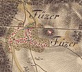 Füzér az első katonai felmérés idején.jpg 601 × 525; 82 KB
-
 Giglachseen Josephinische Landesaufnahme.jpg 1.979 × 1.272; 353 KB
-
 Gledisova.jpg 1.387 × 825; 300 KB
-
 Gárdony-első-katonai-felmérés-térképe.jpg 838 × 681; 196 KB
-
 Iborfia-első-katonai-felmérés-térképe.jpg 666 × 673; 154 KB
-
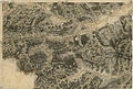
 Image-Josephinische Landesaufnahme 113 Weinebene und Speikkogel.jpg 8.472 × 5.460; 16,21 MB
-
 Josephinische Landaufnahme 1764 Brigittenau.jpg 1.425 × 1.030; 489 KB
-
 Josephinische Landesaufnahme 097 Hebalm Rosenkogel.jpg 8.416 × 5.486; 17,48 MB
-
 Josephinische Landesaufnahme 098 Preitenegg.jpg 8.464 × 5.498; 17,69 MB
-
 Josephinische Landesaufnahme 114 Deutschlandsberg.jpg 8.448 × 5.483; 17,74 MB
-
 Josephinische Landesaufnahme Aspang.JPEG 7.424 × 4.919; 21,57 MB
-
 Josephinische Landesaufnahme Aspnang, Edlitz, Pittental.JPEG 7.408 × 4.933; 23,05 MB
-
 Josephinische Landesaufnahme Gablitz Laab.JPEG 7.360 × 4.902; 15,43 MB
-
 Josephinische Landesaufnahme Gloggnitz, Kirchberg.JPEG 7.424 × 4.985; 22,07 MB
-
 Josephinische Landesaufnahme Gross Enzersdorf.JPEG 7.424 × 4.969; 13,15 MB
-
 Josephinische Landesaufnahme Kirchschlag in der Buckligen Welt.JPEG 7.448 × 4.958; 16,2 MB
-
 Josephinische Landesaufnahme Liesing Laxenburg Himberg.JPEG 7.400 × 4.954; 13,49 MB
-
 Josephinische Landesaufnahme Mooskirchen Grazer Feld.jpg 8.448 × 5.471; 9,02 MB
-
 Josephinische Landesaufnahme Prein.JPEG 7.400 × 4.973; 16,14 MB
-
 Josephinische Landesaufnahme Puchberg, Schneeberg.JPEG 7.360 × 4.928; 22,37 MB
-
 Josephinische Landesaufnahme Rax, Höllental, Naßwald.jpg 7.360 × 4.955; 33,89 MB
-
 Josephinische Landesaufnahme Schwanberg.jpg 8.424 × 5.468; 10,01 MB
-
 Josephinische Landesaufnahme Semmering, Prein steirische Seite.JPEG 8.440 × 5.489; 19,84 MB
-
 Josephinische Landesaufnahme Stainz Wildon.jpg 8.392 × 5.449; 11,71 MB
-
 Josephinische Landesaufnahme Sulz Alland Perchtoldsdorf.JPEG 7.384 × 4.915; 17,15 MB
-
 Josephinische Landesaufnahme Wechsel Kranichberg.JPEG 7.392 × 4.923; 17,57 MB
-
 Josephinische Landesaufnahme Wien.jpeg 7.320 × 4.874; 20,16 MB
-
 Josephinische Landesaufnahme Wismath.JPEG 7.408 × 4.972; 16,92 MB
-
 JosLA Leibnitz.jpg 8.448 × 5.473; 12,13 MB
-
 Kaiserwald Josephinische Landesaufnahme.jpg 5.000 × 7.657; 11,17 MB
-
 Kápolnásnyék-első-katonai-felmérés-térképe.jpg 838 × 681; 184 KB
-
 Nadap-első-katonai-felmérés-térképe.jpg 838 × 681; 266 KB
-
 Oberkärnten Karte Surgant um 1750.jpg 2.388 × 2.008; 2,49 MB
-
 Pusztaszabolcs-első-katonai felmérésének-térképe.jpg 839 × 681; 158 KB
-
 Pákozd-első-katonai-felmérés-térképe.jpg 837 × 680; 238 KB
-
 Pázmánd-első-katonai-felmérés-térképe.jpg 838 × 681; 212 KB
-
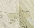
 Senec - First Military Survey (1763-1787).png 1.167 × 636; 1,28 MB
-
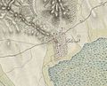
 September 1789 Austrian forces deployment near Ciorasti.png 1.158 × 695; 952 KB
-
 Seregélyes-első-katonai-felmérés-térképe.jpg 838 × 680; 198 KB
-
 Sukoró-első-katonai-felmérés-térképe.jpg 838 × 681; 219 KB
-
 Szabadegyháza-első-katonai-felmérés-térképe.jpg 838 × 681; 150 KB
-
 Sárbogárd-első-katonai-felmérése.jpg 839 × 680; 194 KB
-
 Sárosd-első-katonai-felmérés-térképe.jpg 838 × 680; 165 KB
-
 Söréd-első-katonai-felmérés-térképe.jpg 835 × 680; 211 KB
-
 Velence-első-katonai-felmérés-térképe.jpg 838 × 681; 206 KB
-
 Vereb-első-katonai-felmérés-térképe.jpg 838 × 681; 239 KB
-
 Zichyújfalu-1.-katonai-felmérés-térképe.jpg 838 × 681; 134 KB
-
 Свитазів (загальний план). Перша військова карта (1779-1783).jpg 1.185 × 650; 645 KB


.png)


._%D0%9F%D0%B5%D1%80%D1%88%D0%B0_%D0%B2%D1%96%D0%B9%D1%81%D1%8C%D0%BA%D0%BE%D0%B2%D0%B0_%D0%BA%D0%B0%D1%80%D1%82%D0%B0_(1779-1783).jpg)