Category:Fontmell Magna
Jump to navigation
Jump to search
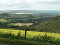
English: Fontmell Magna is a village in north Dorset, England, situated in the Blackmore Vale under Cranborne Chase on the A350 road five miles south of Shaftesbury and eight miles north of Blandford Forum. The village has a population of 671 (2001). The chalk hill just outside the village to the east, Fontmell Down, is a nature reserve.
village in the United Kingdom  | |||||
| Upload media | |||||
| Instance of | |||||
|---|---|---|---|---|---|
| Location | Dorset, South West England, England | ||||
| Said to be the same as | Fontmell Magna (Wikimedia duplicated page, civil parish) | ||||
 | |||||
Subcategories
This category has the following 4 subcategories, out of 4 total.
Media in category "Fontmell Magna"
The following 139 files are in this category, out of 139 total.
-
 Across Fontmell Down (2) - geograph.org.uk - 5433829.jpg 640 × 427; 107 KB
-
 Across Fontmell Down - geograph.org.uk - 5433825.jpg 640 × 427; 94 KB
-
 Approaching Green Farm - geograph.org.uk - 5124731.jpg 2,726 × 1,628; 957 KB
-
 Approaching Green Farm - geograph.org.uk - 5124758.jpg 3,051 × 1,880; 1.21 MB
-
 Bench Mark, Piper's Mill Bridge - geograph.org.uk - 1859131.jpg 480 × 640; 199 KB
-
 Bench Mark, Woodbridge - geograph.org.uk - 1859441.jpg 640 × 480; 214 KB
-
 Blackven Farm - geograph.org.uk - 1357830.jpg 640 × 481; 162 KB
-
 Brookland Wood dedication plaque - geograph.org.uk - 2194424.jpg 1,024 × 712; 120 KB
-
 Brookland Wood recently planted - geograph.org.uk - 2194410.jpg 1,024 × 719; 194 KB
-

-
 Busy Sheep - geograph.org.uk - 369241.jpg 640 × 480; 77 KB
-
 Catkins, Littlecombe Bottom - geograph.org.uk - 2279373.jpg 640 × 480; 67 KB
-
 Cattle on Fontmell Down - geograph.org.uk - 5433831.jpg 640 × 427; 102 KB
-
 Cattle on Fontmell Down - geograph.org.uk - 5433836.jpg 640 × 427; 82 KB
-
 Churchyard, St Andrew's Church - geograph.org.uk - 1859099.jpg 640 × 480; 119 KB
-
 Cleeve Cottage, Fontmell Magna - geograph.org.uk - 370224.jpg 640 × 480; 114 KB
-
 Common Spotted Orchid, Fontmell Down - geograph.org.uk - 3507898.jpg 3,456 × 4,608; 1.46 MB
-

-
 Cottages in Fontmell Magna - geograph.org.uk - 370194.jpg 640 × 480; 125 KB
-
 Cross Dyke on Fontmell Down - geograph.org.uk - 5433858.jpg 640 × 427; 65 KB
-
 Downland Sheep - geograph.org.uk - 369219.jpg 640 × 480; 42 KB
-
 Field by Green Lane - geograph.org.uk - 5124874.jpg 3,063 × 1,834; 1.15 MB
-
 Field by Green Lane - geograph.org.uk - 5124908.jpg 2,923 × 1,759; 1.05 MB
-
 Field by Green Lane - geograph.org.uk - 5124915.jpg 3,072 × 1,714; 1.02 MB
-
 Fifi the cow, on Fontmell Down - geograph.org.uk - 5433839.jpg 640 × 427; 89 KB
-
 Fontmell Down Nature Reserve - geograph.org.uk - 2787342.jpg 640 × 604; 71 KB
-
 Fontmell Down, Dorset Wildlife Trust - geograph.org.uk - 3507889.jpg 4,608 × 3,456; 5.8 MB
-

-
 Fontmell Magna - geograph.org.uk - 1297705.jpg 640 × 480; 108 KB
-
 Fontmell Magna Toll House - geograph.org.uk - 6115157.jpg 640 × 494; 158 KB
-
 Fontmell Magna Village Hall - geograph.org.uk - 370252.jpg 640 × 480; 68 KB
-
 Fontmell Magna, bridleway - geograph.org.uk - 4013129.jpg 1,024 × 768; 196 KB
-
-

-
 Fontmell Magna, farm track - geograph.org.uk - 4013147.jpg 1,024 × 768; 351 KB
-
 Fontmell Magna, former Crown Brewery - geograph.org.uk - 5793407.jpg 751 × 1,024; 325 KB
-
 Fontmell Magna, Littlecombe Bottom - geograph.org.uk - 4013143.jpg 1,024 × 768; 244 KB
-

-
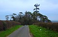
 Fontmell Magna, new road - geograph.org.uk - 4013151.jpg 1,024 × 768; 222 KB
-
 Fontmell Magna, path - geograph.org.uk - 4013135.jpg 1,024 × 768; 337 KB
-
 Fontmell Magna, Plum Tree Cottage - geograph.org.uk - 506020.jpg 640 × 429; 112 KB
-

-

-

-

-
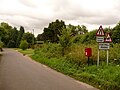 Fontmell Magna, postbox No. SP7 97 - geograph.org.uk - 1410157.jpg 640 × 480; 78 KB
-

-
 Fontmell Magna, The Fontmell - geograph.org.uk - 4013121.jpg 1,024 × 768; 144 KB
-
 Fontmell Magna, the post office - geograph.org.uk - 3907991.jpg 640 × 480; 97 KB
-
 Fontmell Magna, the thatched pump - geograph.org.uk - 506021.jpg 429 × 640; 108 KB
-

-
 Footpath to Fontwell Magna - geograph.org.uk - 5433749.jpg 640 × 427; 94 KB
-

-
 Gardens at Springhead, Fontmell Magna - geograph.org.uk - 1824375.jpg 640 × 480; 105 KB
-
 George VI postbox, Fontmell Magna - geograph.org.uk - 985609.jpg 480 × 640; 105 KB
-
 Green Lane - geograph.org.uk - 4971365.jpg 3,059 × 1,922; 1.4 MB
-
 Junction on Green Lane - geograph.org.uk - 5123659.jpg 3,056 × 1,848; 1.27 MB
-

-
 Lane at Green Farm - geograph.org.uk - 5124817.jpg 3,072 × 2,048; 1.2 MB
-
 Lane to Marsh Common - geograph.org.uk - 5124997.jpg 3,072 × 2,048; 1.37 MB
-
 Lane, Margaret Marsh - geograph.org.uk - 5124667.jpg 3,060 × 1,860; 1.4 MB
-
 Littlecombe Bottom - geograph.org.uk - 4013162.jpg 1,024 × 768; 149 KB
-
 Littlecombe Bottom, footpath - geograph.org.uk - 4013159.jpg 1,024 × 768; 263 KB
-
 Littlecombe Bottom, gate ^ stile - geograph.org.uk - 4013172.jpg 1,024 × 768; 289 KB
-
 Littlecombe Bottom, rape field - geograph.org.uk - 4013168.jpg 1,024 × 768; 191 KB
-
 Littlecombe Down - geograph.org.uk - 4013318.jpg 1,024 × 768; 247 KB
-
 Littlecombe Down, farm track - geograph.org.uk - 4013300.jpg 1,024 × 768; 262 KB
-
 Littlecombe Down, gate - geograph.org.uk - 4013294.jpg 1,024 × 768; 283 KB
-
 Littlecombe Down, gates - geograph.org.uk - 4013274.jpg 1,024 × 768; 282 KB
-
 Littlecombe Down, path - geograph.org.uk - 4013268.jpg 1,024 × 768; 188 KB
-
 Littlecombe Down, path - geograph.org.uk - 4013313.jpg 1,024 × 768; 218 KB
-
 Littlecombe Down, track - geograph.org.uk - 4013283.jpg 1,024 × 768; 312 KB
-
 Littlecombe Down, view - geograph.org.uk - 4013260.jpg 1,024 × 768; 227 KB
-

-

-

-
 Melbury Down from Melbury Wood - geograph.org.uk - 619965.jpg 430 × 640; 154 KB
-
 Mixed Land Use - geograph.org.uk - 369234.jpg 640 × 480; 92 KB
-

-

-

-
 Open access land near Fontmell Magna - geograph.org.uk - 2279363.jpg 640 × 480; 81 KB
-
 Open access land near Fontmell Magna - geograph.org.uk - 2279368.jpg 640 × 480; 69 KB
-
 Open access land near Fontmell Magna - geograph.org.uk - 2279376.jpg 640 × 480; 62 KB
-

-
 Parapet, Piper's Mill Bridge - geograph.org.uk - 1859115.jpg 640 × 480; 196 KB
-

-

-

-
 Sheep wash, Fontmell Magna - geograph.org.uk - 1950410.jpg 480 × 640; 212 KB
-

-
 Signpost in Green Lane - geograph.org.uk - 3642359.jpg 480 × 640; 151 KB
-
 Stile and dog gate, Fontmell Down - geograph.org.uk - 2787329.jpg 640 × 482; 81 KB
-
 Stile on the path into Fontwell Magna - geograph.org.uk - 5433753.jpg 640 × 427; 127 KB
-

-

-
 Strip lynchets on Fontmell Down - geograph.org.uk - 5433809.jpg 640 × 427; 69 KB
-
 Thatched cottages, Fontmell Magna - geograph.org.uk - 906922.jpg 640 × 480; 97 KB
-
 The Bridge at Woodbridge - geograph.org.uk - 1859433.jpg 640 × 480; 151 KB
-
 The Crown Inn, Fontmell Magna - geograph.org.uk - 954470.jpg 640 × 480; 98 KB
-
 The K herd at Fontwell Magna - geograph.org.uk - 5433744.jpg 640 × 427; 93 KB
-
 The wooded side of Fontmell Down - geograph.org.uk - 5433810.jpg 640 × 427; 72 KB
-
 Timber, Fontmell Woods - geograph.org.uk - 1360207.jpg 640 × 480; 201 KB
-
 Timber, Fontmell Woods - geograph.org.uk - 1360211.jpg 640 × 480; 175 KB
-

-

-
 Village pump, Fontmell Magna - geograph.org.uk - 370217.jpg 640 × 480; 125 KB
-
 Village scene, Bedchester - geograph.org.uk - 1859386.jpg 640 × 480; 147 KB
-
 Water trough near Fontmell Magna - geograph.org.uk - 2279356.jpg 640 × 480; 82 KB
-
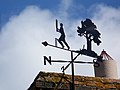 Weather vane, Fontmell Magna - geograph.org.uk - 906925.jpg 640 × 480; 52 KB
-
 Woodland track, Fontmell Woods - geograph.org.uk - 1360319.jpg 640 × 480; 205 KB
-
 Alington's - geograph.org.uk - 1172507.jpg 640 × 480; 180 KB
-
 Bridleway to Ashmore - geograph.org.uk - 516540.jpg 640 × 480; 137 KB
-
 Brookway Farm from Pen Hill - geograph.org.uk - 369393.jpg 640 × 480; 105 KB
-
 Collyer's Brook Sluice, Fontmell Magna - geograph.org.uk - 369212.jpg 640 × 480; 110 KB
-

-

-

-
-
 Edge of Fontmell Wood - geograph.org.uk - 589635.jpg 640 × 430; 320 KB
-
 Fontmell Brook, Fontmell Magna - geograph.org.uk - 370246.jpg 640 × 480; 146 KB
-

-
 Fontmell Magna, the pond - geograph.org.uk - 506025.jpg 640 × 429; 113 KB
-
 Footpath to Iwerne Minster - geograph.org.uk - 516549.jpg 480 × 640; 136 KB
-
 Gourd's Farm, East Compton - geograph.org.uk - 369929.jpg 640 × 480; 84 KB
-
 Longcombe Bottom - geograph.org.uk - 323620.jpg 640 × 427; 112 KB
-
 Methodist Church, Fontmell Magna - geograph.org.uk - 258945.jpg 640 × 473; 112 KB
-

-
 Permissive bridleway in Fontmell Wood - geograph.org.uk - 516367.jpg 640 × 480; 148 KB
-
 Piper's Mill Bridge - geograph.org.uk - 370282.jpg 640 × 480; 124 KB
-
 Ploughing on the downs - geograph.org.uk - 622860.jpg 640 × 480; 87 KB
-
 Satan's Square - geograph.org.uk - 369371.jpg 640 × 480; 65 KB
-
 Spot the Communication mast - geograph.org.uk - 369229.jpg 640 × 404; 53 KB
-
 Sunset over Combe Bottom - geograph.org.uk - 588908.jpg 640 × 430; 238 KB
-

-
 Top edge of Combe Bottom - geograph.org.uk - 588895.jpg 640 × 430; 210 KB
-
 Track above Combe Bottom - geograph.org.uk - 623027.jpg 640 × 480; 105 KB
-
 Track beside Fontmell Wood - geograph.org.uk - 589646.jpg 430 × 640; 214 KB
-
 Track into Fontmell Wood - geograph.org.uk - 588782.jpg 430 × 640; 173 KB
_-_geograph.org.uk_-_5433829.jpg)


_-_geograph.org.uk_-_2134044.jpg)


,_Fontmell_Woods_-_geograph.org.uk_-_1360239.jpg)


_(2).jpg)


_-_geograph.org.uk_-_5433771.jpg)


_-_geograph.org.uk_-_455027.jpg)
_-_geograph.org.uk_-_455031.jpg)
_-_geograph.org.uk_-_455038.jpg)
_-_geograph.org.uk_-_527570.jpg)


