Category:Forton, Staffordshire
Направо към навигацията
Направо към търсенето
English: Forton is a small village on the Staffordshire/Shropshire situated east of the market town of Newport.
village and civil parish in Staffordshire, UK  | |||||
| Качване на файл | |||||
| Екземпляр на | |||||
|---|---|---|---|---|---|
| Местоположение | Стафорд, Staffordshire, Стафордшър, Уест Мидландс, Англия | ||||
| Същото като | Forton (Wikimedia duplicated page, civil parish) | ||||
 | |||||
Подкатегории
Показани са 3 от общо 3 подкатегории на тази категория.
A
- All Saints, Forton, Staffordshire (0 К, 0 С, 11 Ф)
- Aqualate Hall (0 К, 0 С, 1 Ф)
F
- Forton Hall, Forton (0 К, 0 С, 5 Ф)
Файлове в категория „Forton, Staffordshire“
Показани са 141 от общо 141 файла в тази категория.
-
 A track down to the lane - geograph.org.uk - 3231230.jpg 1142 × 857; 710 КБ
-
 A518 Stafford Road south of Aqualate Hall - geograph.org.uk - 4095957.jpg 1142 × 857; 438 КБ
-
 A519 at Forton village boundary - geograph.org.uk - 3551859.jpg 640 × 480; 52 КБ
-
 A519 westbound nears Sutton - geograph.org.uk - 3551855.jpg 640 × 481; 66 КБ
-
 According to the map it's a Roman road - geograph.org.uk - 2030809.jpg 640 × 480; 251 КБ
-
 Acrocephalus scirpaceus - geograph.org.uk - 464317.jpg 640 × 427; 62 КБ
-
 Along Walkley Bank Lane - geograph.org.uk - 4173868.jpg 734 × 979; 445 КБ
-
 Aqualate Mere - geograph.org.uk - 1883255.jpg 640 × 457; 197 КБ
-
 Aqualate Mere - geograph.org.uk - 3230847.jpg 1088 × 814; 515 КБ
-
 Aqualate Mere - geograph.org.uk - 4794487.jpg 3264 × 2448; 1,37 МБ
-
 At the end of the surfaced cycleway - geograph.org.uk - 4095981.jpg 857 × 1142; 605 КБ
-
 Barn and house at Forton (geograph 1926351).jpg 640 × 480; 89 КБ
-
 Barn conversions - Sutton Barns - geograph.org.uk - 3232421.jpg 1142 × 857; 699 КБ
-
 Barn near Forton - geograph.org.uk - 1926362.jpg 640 × 480; 92 КБ
-
 Below The Frances Cole Wood - geograph.org.uk - 4389977.jpg 1142 × 857; 349 КБ
-
 Bird hide - geograph.org.uk - 1883268.jpg 640 × 457; 223 КБ
-

-
 Bridge on the lane near Sutton - geograph.org.uk - 3231307.jpg 1142 × 857; 622 КБ
-
 Bridge over a dried up canal - geograph.org.uk - 2031151.jpg 640 × 480; 193 КБ
-
 Bridge over the Humesford Brook - geograph.org.uk - 4293907.jpg 1142 × 857; 417 КБ
-
 Bridleway alongside Thistleyfield Covert - geograph.org.uk - 3230827.jpg 811 × 665; 386 КБ
-
 Bridleway bridge near New Guild - geograph.org.uk - 3230830.jpg 979 × 734; 497 КБ
-
 Bridleway gate and fence south of Sutton - geograph.org.uk - 3230806.jpg 978 × 814; 612 КБ
-
 Bridleway heading towards Aqualate Mere - geograph.org.uk - 3230824.jpg 951 × 754; 472 КБ
-

-
 Bridleway through the woods - geograph.org.uk - 3230833.jpg 979 × 734; 529 КБ
-

-
 Cattle grazing at Walkley Bank - geograph.org.uk - 4173872.jpg 1142 × 857; 382 КБ
-
 Cliff's Lane - geograph.org.uk - 1275083.jpg 640 × 457; 166 КБ
-
 Cliff's Lane - geograph.org.uk - 1275085.jpg 640 × 457; 180 КБ
-
 Cliffs Lane - geograph.org.uk - 4389982.jpg 734 × 979; 387 КБ
-
 Cliffs Lane canal bridge - geograph.org.uk - 4389992.jpg 1142 × 857; 575 КБ
-
 Comparison of employment in Forton Staffs.png 573 × 764; 53 КБ
-
 Cottage at Whitley Ford farm - geograph.org.uk - 4381441.jpg 1142 × 857; 379 КБ
-
 Countryside near Fernhill - geograph.org.uk - 5772549.jpg 800 × 562; 85 КБ
-
 Course of former canal - geograph.org.uk - 1275077.jpg 640 × 457; 190 КБ
-
 Course of the former canal - geograph.org.uk - 4389986.jpg 1142 × 857; 406 КБ
-
 Deer on Aqualate Park - geograph.org.uk - 566467.jpg 640 × 480; 87 КБ
-
 Disused track to Aqualate Hall - geograph.org.uk - 4173880.jpg 979 × 734; 384 КБ
-
 Down the track towards Park Farm - geograph.org.uk - 4095961.jpg 1142 × 857; 385 КБ
-
 Drainage Brook - geograph.org.uk - 464048.jpg 427 × 640; 90 КБ
-
 Entrance to Sutton Bank Farm - geograph.org.uk - 2030912.jpg 640 × 480; 194 КБ
-
 Farm in Forton village - geograph.org.uk - 1354756.jpg 640 × 457; 185 КБ
-
 Farm track in the Lonco valley - geograph.org.uk - 4381432.jpg 979 × 734; 422 КБ
-
 Farm track near Fernhill - geograph.org.uk - 4381430.jpg 734 × 979; 349 КБ
-
 Farmland - geograph.org.uk - 1275300.jpg 640 × 457; 169 КБ
-
 Farmland - geograph.org.uk - 1275324.jpg 640 × 480; 183 КБ
-
 Farmland near Fernhill - geograph.org.uk - 5772522.jpg 800 × 563; 117 КБ
-
 Fernhill Farm and Fernhill Road - geograph.org.uk - 5772543.jpg 800 × 619; 226 КБ
-
 Field and Woodland Border - geograph.org.uk - 464062.jpg 640 × 427; 80 КБ
-
 Fields along side Weston Jones Mill - geograph.org.uk - 597403.jpg 640 × 480; 106 КБ
-
 Fields near to Aqualate Mere - geograph.org.uk - 464057.jpg 640 × 427; 69 КБ
-
 Filled-in canal to Norbury Junction - geograph.org.uk - 3231311.jpg 1142 × 857; 691 КБ
-
 Fishing club jetty - geograph.org.uk - 1883232.jpg 640 × 457; 208 КБ
-
 Flooded path to Aqualate bird hide - geograph.org.uk - 4794469.jpg 3264 × 2448; 2,57 МБ
-
 Flooded path to Aqualate bird hide - geograph.org.uk - 4794475.jpg 3264 × 2448; 3,81 МБ
-

-
 Footpath Over the Fields - geograph.org.uk - 464259.jpg 640 × 427; 84 КБ
-
 Footpath to Forton church - geograph.org.uk - 797883.jpg 640 × 480; 72 КБ
-
 Former canal bridge - geograph.org.uk - 1275066.jpg 457 × 640; 170 КБ
-
 Former canal bridge, Sutton - geograph.org.uk - 1275048.jpg 640 × 457; 186 КБ
-
 Former fish pond - geograph.org.uk - 1883227.jpg 640 × 457; 261 КБ
-
 Forton Aqueduct - geograph.org.uk - 98665.jpg 640 × 480; 104 КБ
-
 Forton nursery - geograph.org.uk - 3230763.jpg 975 × 784; 535 КБ
-
 Forton Nursery - geograph.org.uk - 936224.jpg 640 × 427; 73 КБ
-
 Forton windmill - ruins - geograph.org.uk - 1356574.jpg 640 × 480; 40 КБ
-
 Forton, Staffordshire - geograph.org.uk - 465338.jpg 640 × 429; 59 КБ
-
 Gauging station next to Lonco Brook - geograph.org.uk - 5772515.jpg 800 × 632; 260 КБ
-
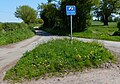
 Give way at the junction - geograph.org.uk - 2031165.jpg 640 × 480; 156 КБ
-
 Guild Lane near Sutton - geograph.org.uk - 5772583.jpg 800 × 553; 136 КБ
-
 Guild Lane near Sutton village - geograph.org.uk - 3231257.jpg 1142 × 857; 598 КБ
-
 Guild Lane, or Via Devana - geograph.org.uk - 3231244.jpg 979 × 734; 466 КБ
-
 Guild Lane, SE of Sutton - geograph.org.uk - 4390003.jpg 857 × 1142; 370 КБ
-
 Guild Lane, SE of Sutton - geograph.org.uk - 4390016.jpg 857 × 1142; 359 КБ
-
 Hatchwell's Covert - geograph.org.uk - 1275310.jpg 640 × 457; 176 КБ
-
 Heading up to Broom Hill - geograph.org.uk - 4173877.jpg 979 × 734; 375 КБ
-

-
 Lane juncntion in Sutton - geograph.org.uk - 2030918.jpg 640 × 480; 358 КБ
-
 Little-used footpath from Broom Hill - geograph.org.uk - 4173882.jpg 1142 × 857; 315 КБ
-
 Mature trees - geograph.org.uk - 1354764.jpg 640 × 457; 161 КБ
-
 Meretown Cottage - geograph.org.uk - 4173908.jpg 1142 × 857; 357 КБ
-
 Meretown Mere - geograph.org.uk - 797878.jpg 640 × 480; 82 КБ
-
 Misty Morning 2 - geograph.org.uk - 432046.jpg 640 × 480; 45 КБ
-
 Misty Morning 3 - geograph.org.uk - 432050.jpg 640 × 480; 72 КБ
-
 Misty morning 4 - geograph.org.uk - 432057.jpg 640 × 480; 43 КБ
-
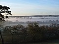
 Misty Morning over Forton - geograph.org.uk - 432033.jpg 640 × 480; 55 КБ
-
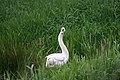 Mute Swan, Cygnus Olor - geograph.org.uk - 464052.jpg 640 × 427; 84 КБ
-
 OS benchmark - Park Farm railway bridge - geograph.org.uk - 4095968.jpg 857 × 1142; 658 КБ
-
 OS benchmark, Meretown, Skew Bridge - geograph.org.uk - 4173912.jpg 734 × 979; 487 КБ
-
 OS pivot mark - Aqualate Lodge building - geograph.org.uk - 4095953.jpg 857 × 1142; 504 КБ
-
 Park Farm railway bridge - geograph.org.uk - 4095977.jpg 1142 × 857; 542 КБ
-
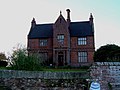
 Photo of Forton Hall and All Saints church.jpg 500 × 311; 46 КБ
-
 Population of Forton Satffs.png 484 × 293; 10 КБ
-
 Properly boggy ground - geograph.org.uk - 4173928.jpg 1044 × 783; 350 КБ
-
 Public footpath to Oulton - geograph.org.uk - 5772576.jpg 800 × 717; 192 КБ
-
 Rather vague footpath - geograph.org.uk - 4173923.jpg 979 × 734; 334 КБ
-
 Reed beds and lily pads - geograph.org.uk - 797880.jpg 640 × 480; 103 КБ
-
 River gauging station on the Lonco Brook - geograph.org.uk - 1926335.jpg 640 × 480; 122 КБ
-
 Road near New Guild - geograph.org.uk - 1275346.jpg 457 × 640; 160 КБ
-
 Roman Road to the southeast - geograph.org.uk - 4382200.jpg 1142 × 857; 356 КБ
-
 Rural bus stop - geograph.org.uk - 590591.jpg 640 × 480; 341 КБ
-
 Sharp bend to the left - geograph.org.uk - 2031155.jpg 640 × 480; 175 КБ
-
 Shay Lane at the junction with Fernhill Road - geograph.org.uk - 4381436.jpg 1142 × 857; 363 КБ
-
 Shay Road-Fernhill Road junction - geograph.org.uk - 5772531.jpg 800 × 557; 181 КБ
-
 Sheep in fields at Meretown - geograph.org.uk - 4173901.jpg 1142 × 857; 402 КБ
-
 Shelmore House - geograph.org.uk - 4297739.jpg 1306 × 979; 411 КБ
-
 Small pond just off Fernhill Road - geograph.org.uk - 4381424.jpg 979 × 734; 482 КБ
-
 Stile and footpath at Weston Jones Mill - geograph.org.uk - 597401.jpg 640 × 480; 108 КБ
-
 Stocking Bank plantation - geograph.org.uk - 4173892.jpg 1142 × 857; 474 КБ
-

-
 Sutton trig in detail - geograph.org.uk - 3296470.jpg 857 × 1142; 519 КБ
-
 Sutton trig, a field and a hedge - geograph.org.uk - 3296465.jpg 1142 × 857; 377 КБ
-
 Sutton, Staffordshire - geograph.org.uk - 465337.jpg 640 × 429; 86 КБ
-
 The bridge over the Wood Brook - geograph.org.uk - 3231232.jpg 1142 × 857; 665 КБ
-
 The bridleway back towards Forton - geograph.org.uk - 3230875.jpg 1142 × 857; 692 КБ
-
 The mere - geograph.org.uk - 1883250.jpg 640 × 457; 185 КБ
-

-
 The Red Lion along the A519 at Sutton - geograph.org.uk - 5772556.jpg 800 × 584; 174 КБ
-
 The west side of Thistleyfield Covert - geograph.org.uk - 3230812.jpg 974 × 792; 527 КБ
-
 There's no avoiding it... - geograph.org.uk - 3230809.jpg 979 × 813; 608 КБ
-
 Through a Gateway - geograph.org.uk - 464211.jpg 640 × 427; 110 КБ
-
 Track to Aqualate - geograph.org.uk - 1275351.jpg 640 × 457; 173 КБ
-
 Trees along Guild Lane - geograph.org.uk - 5772596.jpg 800 × 600; 217 КБ
-
 View from the birdhide - geograph.org.uk - 1883264.jpg 640 × 457; 202 КБ
-
 Walkley Bank, near Newport - geograph.org.uk - 5506531.jpg 1024 × 682; 253 КБ
-
 Warwick Cottage on Walkley Bank lane - geograph.org.uk - 4173894.jpg 1142 × 857; 417 КБ
-
 Wood Brook - geograph.org.uk - 3231236.jpg 612 × 816; 298 КБ
-
 Wood Brook next to Guild Lane - geograph.org.uk - 5772592.jpg 800 × 613; 209 КБ
-
 Dated farm building - geograph.org.uk - 281979.jpg 640 × 482; 45 КБ
-
 Drainage Channel - geograph.org.uk - 464042.jpg 427 × 640; 81 КБ
-
 Fern Hill - geograph.org.uk - 507051.jpg 640 × 480; 162 КБ
-
 Footbridge Over a Brook, Take 2 - geograph.org.uk - 464307.jpg 640 × 427; 121 КБ
-
 Hannibal Heifer - geograph.org.uk - 325030.jpg 640 × 480; 43 КБ
-
 Lodge at Aqualate Park - geograph.org.uk - 190189.jpg 640 × 480; 133 КБ
-
 Lodge to Aqualate Hall - geograph.org.uk - 182391.jpg 640 × 495; 110 КБ
-
 Meretown Canal Bridge - geograph.org.uk - 319316.jpg 640 × 480; 99 КБ
-
 Meretown Manor House - geograph.org.uk - 281975.jpg 640 × 482; 72 КБ
-
 Park Farm - geograph.org.uk - 609395.jpg 640 × 480; 69 КБ
-
 Silhouetted farm animals - geograph.org.uk - 281981.jpg 640 × 482; 39 КБ
-
 Sutton - geograph.org.uk - 287306.jpg 480 × 640; 95 КБ
-
 The Swan, Forton - geograph.org.uk - 151214.jpg 640 × 480; 72 КБ


.jpg)


