Category:Foxearth
Jump to navigation
Jump to search
English: Foxearth is a village and civil parish in the Braintree district, in the county of Essex, England. In the reign of Edward the Confessor, the parish was in the possession of nineteen sochmen and four freemen; The Domesday survey shows that the small manor of Foxearth Hall had become the property of Richard Fitz-Gilbert, ancestor of the lords of Clare.

village on the borders of north Essex and Suffolk in England  .jpg) | |||||
| Upload media | |||||
| Instance of | |||||
|---|---|---|---|---|---|
| Location | Braintree, Essex, East of England, England | ||||
 | |||||
Subcategories
This category has the following 7 subcategories, out of 7 total.
L
- Liston Garden (1 F)
R
- Rectory Lodge, Foxearth (3 F)
T
- Temple End, Essex (4 F)
V
- Foxearth Village Hall (8 F)
- Foxearth Village Sign (10 F)
W
- Weston Hall, Essex (1 F)
Media in category "Foxearth"
The following 65 files are in this category, out of 65 total.
-
 B1064 Pentlow Hill, Foxearth (geograph 4036391).jpg 3,072 × 2,304; 991 KB
-
 B1064 The Street, Foxearth (geograph 4038874).jpg 3,029 × 2,276; 1.21 MB
-
 B1064 The Street, Foxearth (geograph 4039164).jpg 3,072 × 2,304; 1.3 MB
-
 B1064 The Street, Foxearth (geograph 4039267).jpg 3,072 × 2,304; 1.79 MB
-
 B1064 The Street, Foxearth (geograph 4039343).jpg 3,072 × 2,235; 774 KB
-
 Barn at Foxearth Hall (geograph 7537205).jpg 1,600 × 960; 713 KB
-
 Blocked bridleway - geograph.org.uk - 907588.jpg 640 × 480; 95 KB
-
 Bridge over the River Stour (geograph 4363206).jpg 4,320 × 3,240; 5.26 MB
-
 Bridge over the River Stour at Rodbridge - geograph.org.uk - 971901.jpg 640 × 480; 106 KB
-
 Bridleway to Pentlow Street (geograph 4036353).jpg 3,072 × 2,304; 1.7 MB
-
 Cattle surround a Lone Pill box - geograph.org.uk - 995640.jpg 640 × 480; 63 KB
-
 Cereal crop west of Foxearth - geograph.org.uk - 5399757.jpg 640 × 480; 58 KB
-
 Close up, George V postbox, Foxearth - geograph.org.uk - 5401724.jpg 1,290 × 2,503; 650 KB
-
 Constables - geograph.org.uk - 293655.jpg 640 × 480; 73 KB
-
 Country Lane - geograph.org.uk - 2960279.jpg 768 × 1,024; 223 KB
-

-

-
 Disused Railway Bridge - geograph.org.uk - 2998123.jpg 3,875 × 2,925; 1.86 MB
-
 Entering Foxearth on the B1064 The Street (geograph 4039148).jpg 3,072 × 2,304; 2.28 MB
-
 Entering Suffolk on Pentlow Road (geograph 4035933).jpg 3,030 × 2,276; 1.56 MB
-
 Farmland near Brook Hall - geograph.org.uk - 5399776.jpg 640 × 480; 51 KB
-
 Field entrance off School Lane - geograph.org.uk - 5399790.jpg 640 × 480; 65 KB
-
 Field near Place Farm - geograph.org.uk - 5399783.jpg 640 × 480; 56 KB
-
 Footpath And Sign (geograph 2960260).jpg 768 × 1,024; 221 KB
-

-
 Footpath Sign - geograph.org.uk - 2960265.jpg 768 × 1,024; 292 KB
-
 Footpath sign off Pentlow Road (geograph 4035959).jpg 2,189 × 2,922; 1.84 MB
-
 Footpath to Liston Gardens (geograph 4035958).jpg 2,304 × 3,072; 2.29 MB
-
 Former Railway Bridge near Rodbridge - geograph.org.uk - 2026594.jpg 4,000 × 3,000; 2.41 MB
-
 Former Rodbridge Crossing Cottage - geograph.org.uk - 2019202.jpg 1,200 × 842; 229 KB
-
 Foxearth George V Postbox (geograph 4039299).jpg 1,622 × 2,794; 1.05 MB
-
 Foxearth George V Postbox (geograph 4039301).jpg 2,258 × 3,025; 1.51 MB
-
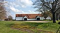
 Foxearth Hall Byre (geograph 7536779).jpg 1,600 × 900; 623 KB
-
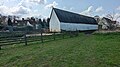
 Foxearth Hall Large Barn (geograph 7536755).jpg 1,600 × 900; 758 KB
-
 Foxearth Village Name sign on the B1064 The Street (geograph 4039154).jpg 2,206 × 2,944; 2 MB
-
 Foxearth Village Name sign on the B1064 The Street (geograph 4039157).jpg 2,275 × 689; 338 KB
-
 Houses on The Street, Foxearth - geograph.org.uk - 5399762.jpg 640 × 480; 55 KB
-
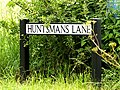 Huntsmans Lane sign (geograph 4038886).jpg 3,072 × 2,304; 1.65 MB
-
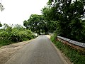
 Huntsmans Lane, Foxearth (geograph 4038890).jpg 3,072 × 2,304; 1.49 MB
-
 Liston Lane, Foxearth (geograph 4036355).jpg 3,072 × 2,304; 1.38 MB
-
 Lone Pill box - geograph.org.uk - 541251.jpg 640 × 480; 96 KB
-
 Meadow For Sale - geograph.org.uk - 2960276.jpg 1,024 × 768; 252 KB
-
 Minor road towards Pentlow - geograph.org.uk - 5399760.jpg 640 × 480; 59 KB
-
 National Cycle Route 13 - geograph.org.uk - 5399787.jpg 640 × 480; 49 KB
-
 Old School House, Foxearth - geograph.org.uk - 5399768.jpg 640 × 480; 79 KB
-
 Pentlow Road, Foxearth (geograph 4036346).jpg 3,072 × 2,304; 682 KB
-
 Pentlow Road, Foxearth (geograph 4036388).jpg 3,028 × 2,157; 872 KB
-
 Pentlow Road, Foxearth (geograph 4039347).jpg 3,029 × 2,276; 1.12 MB
-
 Pentlow Road, Glemsford - geograph.org.uk - 4035948.jpg 3,072 × 2,304; 1.7 MB
-
 Pentlow Road, Glemsford - geograph.org.uk - 4035963.jpg 3,072 × 2,304; 1.02 MB
-
 Pond off the B1064 The Street (geograph 4039159).jpg 3,072 × 2,304; 2.37 MB
-
 River Stour - geograph.org.uk - 4035389.jpg 3,072 × 2,304; 2.31 MB
-
 River Stour - geograph.org.uk - 4035392.jpg 3,072 × 2,304; 2.09 MB
-
 River Stour - geograph.org.uk - 4035952.jpg 3,072 × 2,304; 1.66 MB
-
 Road Bridge - geograph.org.uk - 4558482.jpg 3,200 × 1,800; 2.12 MB
-
 Roadsign on Pentlow Road (geograph 4036351).jpg 2,206 × 2,944; 2.44 MB
-
 Roadsign on the B1064 The Street (geograph 4038880).jpg 2,304 × 3,072; 1.88 MB
-
 Roadsign on the B1064 The Street - geograph.org.uk - 4039345.jpg 2,103 × 2,801; 1.01 MB
-
 Roadsingn on the B1064 The Street (geograph 4039313).jpg 2,164 × 2,888; 1.61 MB
-
 School Street, Foxearth - geograph.org.uk - 5399770.jpg 640 × 480; 79 KB
-
 Suffolk Border sign (geograph 4035937).jpg 2,914 × 2,189; 1.06 MB
-
 To Foxearth - geograph.org.uk - 907596.jpg 640 × 480; 48 KB
-
 Tombstone to Maria Aged 7 years, Foxearth Churchyard (geograph 7536734).jpg 1,600 × 900; 739 KB
-
 Track (footpath) to Brook Hall - geograph.org.uk - 5399779.jpg 640 × 480; 49 KB
-
 The B1064 - geograph.org.uk - 271126.jpg 640 × 422; 67 KB
.jpg)
.jpg)
.jpg)
.jpg)
.jpg)
.jpg)

.jpg)

.jpg)


.jpg)
.jpg)


.jpg)


.jpg)
.jpg)


.jpg)
.jpg)
.jpg)
.jpg)
.jpg)

.jpg)
.jpg)
.jpg)


.jpg)
.jpg)
.jpg)


.jpg)


.jpg)
.jpg)

.jpg)

.jpg)

.jpg)
_to_Brook_Hall_-_geograph.org.uk_-_5399779.jpg)

.jpg)