Category:Frampton Cotterell
Jump to navigation
Jump to search
village and civil parish in Gloucestershire, England, UK  | |||||
| Upload media | |||||
| Instance of | |||||
|---|---|---|---|---|---|
| Location | South Gloucestershire, Gloucestershire, South West England, England | ||||
| official website | |||||
 | |||||
English: Frampton Cotterell is a village and parish in South Gloucestershire, England on the banks of the River Frome. Located approx. 8 miles north-east from Bristol city centre. The village is continuous with Winterbourne to the south-west and Coalpit Heath to the east. The parish also borders Iron Acton to the North and Westerleigh to the south-east, the large town of Yate is approx. 3 miles away. The village has evolved from a once rural Gloucestershire village, to a partial dormitory village for Bristol. The population in the 2001 census was around 6,800 .
Subcategories
This category has the following 2 subcategories, out of 2 total.
G
P
Media in category "Frampton Cotterell"
The following 126 files are in this category, out of 126 total.
-
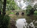
 A convenient bridge over the Frome - geograph.org.uk - 6222309.jpg 2,472 × 3,296; 3.31 MB
-
 A delicate roofline - geograph.org.uk - 6225435.jpg 3,296 × 2,472; 3.53 MB
-
 A face on St Peter's - geograph.org.uk - 6225420.jpg 2,472 × 3,296; 3.41 MB
-
 A face on the porch - geograph.org.uk - 6225422.jpg 2,472 × 3,296; 3.41 MB
-
 A pound gate at St Peter's church - geograph.org.uk - 6225910.jpg 2,472 × 3,296; 3.46 MB
-
 Allotments in Mill Lane - geograph.org.uk - 6222298.jpg 3,296 × 2,472; 3.32 MB
-
 Barns at Brickhouse Farm - geograph.org.uk - 2746114.jpg 1,024 × 769; 206 KB
-
 Benchmark on St Peter's - geograph.org.uk - 6225898.jpg 3,296 × 2,472; 3.54 MB
-
 Bracket fungus by the River Frome - geograph.org.uk - 6223186.jpg 3,296 × 2,472; 3.2 MB
-
 Bridge over the old tramline - geograph.org.uk - 6222318.jpg 3,296 × 2,472; 3.55 MB
-
 Bristol Road (B4058) - geograph.org.uk - 6248429.jpg 800 × 600; 87 KB
-
-
 Cereal crop off Harris Barton Lane - geograph.org.uk - 3538675.jpg 3,648 × 2,736; 2.7 MB
-
 Church Bridge - geograph.org.uk - 2763586.jpg 1,024 × 769; 333 KB
-
 Church Road allotments - geograph.org.uk - 6224190.jpg 3,296 × 2,472; 3.53 MB
-
 Cogmill Lane - geograph.org.uk - 6248428.jpg 800 × 497; 77 KB
-
 Community Orchard - geograph.org.uk - 5506447.jpg 3,264 × 2,448; 2.68 MB
-

-

-
 Drain beside Old Gloucester Road - geograph.org.uk - 3402674.jpg 640 × 480; 148 KB
-
 Eating away at the riverbank - geograph.org.uk - 6222300.jpg 3,296 × 2,472; 3.55 MB
-

-

-
 Farmland and pylons - geograph.org.uk - 3402684.jpg 640 × 480; 42 KB
-
 Farmland by the Frome - geograph.org.uk - 3757555.jpg 1,920 × 1,403; 557 KB
-
 Farmland off Old Gloucester Road - geograph.org.uk - 3402677.jpg 640 × 480; 73 KB
-
 Field and trees by the Frome - geograph.org.uk - 3757567.jpg 1,920 × 1,440; 529 KB
-
 Field in the Frome valley - geograph.org.uk - 3757286.jpg 1,920 × 1,261; 341 KB
-
 Flow Measuring Station - geograph.org.uk - 6222299.jpg 3,296 × 2,472; 3.34 MB
-
 Footpath heading down to Nightingale's Bridge - geograph.org.uk - 3538677.jpg 3,648 × 2,736; 3.33 MB
-
 Footpath to Nightingale's Bridge - geograph.org.uk - 3757289.jpg 1,920 × 2,560; 946 KB
-
 Ford at Iron Acton - geograph.org.uk - 3663125.jpg 3,264 × 2,448; 3.86 MB
-
 Frampton Cotterell Church of England Primary School.jpg 4,000 × 3,000; 5.05 MB
-
 Frampton Cotterell Church Road.JPG 3,072 × 2,304; 2.69 MB
-
 Frampton Cotterell from Frampton Common.JPG 2,918 × 1,094; 1.53 MB
-
 Frampton Cotterell's place of worship - geograph.org.uk - 6225906.jpg 3,296 × 2,472; 3.55 MB
-
 Frampton Cotterell.jpg 1,280 × 960; 520 KB
-
 Frampton End Road - geograph.org.uk - 6222294.jpg 2,472 × 3,296; 3.16 MB
-
 Framptonmill.JPG 3,072 × 2,304; 2.94 MB
-
 Framptonmill2.jpg 3,072 × 2,019; 840 KB
-
 Frome valley - geograph.org.uk - 3757111.jpg 1,920 × 1,313; 371 KB
-
 Frome Valley Walkway - geograph.org.uk - 3757572.jpg 1,920 × 1,448; 784 KB
-
 Frome Valley Walkway - geograph.org.uk - 3757618.jpg 1,920 × 1,331; 688 KB
-
 Gardens of Serridge House - geograph.org.uk - 141161.jpg 640 × 480; 232 KB
-
 Gas pipeline adjacent to the B4427, the Old Gloucester Road - geograph.org.uk - 3493177.jpg 3,648 × 2,736; 3.58 MB
-
 Heathcote Drive, Badminton Road, Coalpit Heath - geograph.org.uk - 3536906.jpg 3,648 × 2,736; 2.21 MB
-
 Hover's Lane - geograph.org.uk - 6224199.jpg 3,296 × 2,472; 3.48 MB
-
 Hover's Lane ford - geograph.org.uk - 6223173.jpg 3,296 × 2,472; 3.27 MB
-
 Hover's Lane ford - geograph.org.uk - 6223181.jpg 3,296 × 2,472; 3.21 MB
-
 Inconsistent apostrophes - geograph.org.uk - 2747156.jpg 715 × 1,024; 269 KB
-
 Junction of Perrinpit Road and Bristol Road - geograph.org.uk - 2746153.jpg 3,824 × 2,884; 2.16 MB
-
 Junior school in Frampton Cotterell - geograph.org.uk - 6222288.jpg 3,296 × 2,472; 3.35 MB
-
 Live and Let Live - geograph.org.uk - 6122610.jpg 3,807 × 2,855; 1.88 MB
-
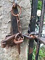 Locking pin - geograph.org.uk - 6225909.jpg 2,472 × 3,296; 3.26 MB
-
 Lower Chapel Road, Coalpit Heath - geograph.org.uk - 3757025.jpg 1,920 × 1,365; 352 KB
-
 Maize by the Frome Valley Walkway - geograph.org.uk - 3757628.jpg 1,920 × 1,402; 445 KB
-
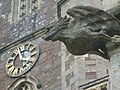 Monster time - geograph.org.uk - 6225430.jpg 3,296 × 2,472; 3.18 MB
-
 New school for Frampton - geograph.org.uk - 6222283.jpg 3,296 × 2,472; 3.46 MB
-
 Nightingale Bridge - panoramio.jpg 3,660 × 2,440; 9.35 MB
-
 Nightingale's Bridge - geograph.org.uk - 3757547.jpg 1,920 × 1,386; 657 KB
-
 Nightingale's Bridge over the River Frome - geograph.org.uk - 3538680.jpg 3,648 × 2,736; 3.31 MB
-
 Occupation Bridge, Sayscourt Farm. - panoramio.jpg 2,657 × 1,849; 1.98 MB
-
 Old Boundary Marker by the B4427, Frogland Cross - geograph.org.uk - 6048385.jpg 709 × 1,024; 288 KB
-
 Old Gloucester Road (B4427) - geograph.org.uk - 3402675.jpg 640 × 480; 94 KB
-
 Old Gloucester Road (B4427) - geograph.org.uk - 3402680.jpg 640 × 480; 105 KB
-
 Old Gloucester Road (B4427) - geograph.org.uk - 3402683.jpg 640 × 480; 106 KB
-
 Old Gloucester Road (B4427) - geograph.org.uk - 3402687.jpg 640 × 480; 56 KB
-
 Old telephone box - geograph.org.uk - 2763595.jpg 769 × 1,024; 173 KB
-
 Park Lane (Frampton Cotterell) phone box - geograph.org.uk - 2495800.jpg 1,024 × 546; 108 KB
-
 Parkland near the Grange Hotel - geograph.org.uk - 3402670.jpg 640 × 480; 128 KB
-
 Path to Frampton Court - geograph.org.uk - 3757298.jpg 1,920 × 1,257; 385 KB
-
 Perrinpit Farm - geograph.org.uk - 2746161.jpg 1,024 × 769; 134 KB
-
 Perrinpit Road - geograph.org.uk - 2746173.jpg 1,024 × 769; 282 KB
-
 Perrinpit Road, Frampton Cotterell - geograph.org.uk - 6248434.jpg 800 × 600; 91 KB
-
 Playground, Park Farm Village Green - geograph.org.uk - 3757071.jpg 1,920 × 1,440; 604 KB
-
 Pond, Park Farm Village Green - geograph.org.uk - 3757080.jpg 1,920 × 1,460; 618 KB
-
 Pond, Park Farm Village Green - geograph.org.uk - 3757094.jpg 1,920 × 1,440; 752 KB
-
-
 Power cables crossing Perrinpit Road - geograph.org.uk - 990385.jpg 640 × 480; 76 KB
-
 Public footpath through grazing pasture - geograph.org.uk - 3493184.jpg 3,648 × 2,736; 3.03 MB
-
 Pylons and public footpath at Marle Hills - geograph.org.uk - 3493174.jpg 3,648 × 2,736; 3.03 MB
-
 Pylons near Gaunt's Earthcott - geograph.org.uk - 2354149.jpg 640 × 480; 71 KB
-
 River Frome - geograph.org.uk - 32979.jpg 640 × 480; 132 KB
-
 River Frome at Rockwell Wood - geograph.org.uk - 3757636.jpg 1,920 × 1,440; 947 KB
-
 Roadworks on Church Road Frampton Cotterell - geograph.org.uk - 3990025.jpg 1,024 × 998; 124 KB
-
 Rock layers in the river bed - geograph.org.uk - 6222302.jpg 3,296 × 2,472; 3.59 MB
-
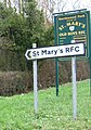
 Rugby club gateway - geograph.org.uk - 2746129.jpg 1,024 × 769; 306 KB
-
 Shops at Frampton Cotterell.JPG 3,072 × 2,304; 3.02 MB
-
 Shops at Frampton Cotterell2.jpg 3,072 × 1,637; 649 KB
-
 Shops on Church Road - geograph.org.uk - 6222289.jpg 3,296 × 2,472; 3.3 MB
-
 Single track lane to Gaunt's Earthcott - geograph.org.uk - 2495829.jpg 1,024 × 768; 177 KB
-
 Something for light rain^ - geograph.org.uk - 6225908.jpg 3,296 × 2,472; 3.4 MB
-
 Sort It, Coalpit Heath - geograph.org.uk - 3757019.jpg 1,125 × 1,426; 245 KB
-
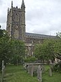 St Peter's, Frampton Cotterell - geograph.org.uk - 6225902.jpg 2,472 × 3,296; 3.07 MB
-
 Taking a deeper channel - geograph.org.uk - 6222301.jpg 3,296 × 2,472; 3.39 MB
-
 Taking measurements of the sewage - geograph.org.uk - 6223171.jpg 2,472 × 3,296; 3.4 MB
-
 Telephone box on Church Road - geograph.org.uk - 2763577.jpg 1,024 × 769; 134 KB
-
 Texaco - Spar on Bristol Road - geograph.org.uk - 1392486.jpg 640 × 480; 67 KB
-
 The end of Harris Barton Lane - geograph.org.uk - 3538672.jpg 3,648 × 2,736; 3.62 MB
-
 The Frome from the footbridge - geograph.org.uk - 6222303.jpg 2,472 × 3,296; 3.16 MB
-
 The Frome near Cog Mill Farm - geograph.org.uk - 6222304.jpg 2,472 × 3,296; 3.13 MB
-
 The Globe - geograph.org.uk - 5506455.jpg 2,179 × 1,632; 560 KB
-
 The River Frome upstream from Nightingale's Bridge - geograph.org.uk - 3538684.jpg 3,648 × 2,736; 3.99 MB
-
 To St Peter's church - geograph.org.uk - 6224200.jpg 3,296 × 2,472; 2.51 MB
-

-
 Truly Scrumptious - geograph.org.uk - 716101.jpg 640 × 400; 52 KB
-
 Tyning's Lane, Perrinpit Road - geograph.org.uk - 3493165.jpg 3,648 × 2,736; 4.9 MB
-
 Upper Chapel Lane, Coalpit Heath - geograph.org.uk - 3757055.jpg 1,920 × 1,177; 311 KB
-
 Use me - but use me properly^ - geograph.org.uk - 6222295.jpg 2,472 × 3,296; 3.3 MB
-
 VV29, an ex-SWEB 132kV pylon in field with horses - geograph.org.uk - 2953685.jpg 1,405 × 1,873; 1.17 MB
-
 War memorial in St Peter's churchyard - geograph.org.uk - 6225903.jpg 2,472 × 3,296; 3.44 MB
-
 Watermore Primary School.jpg 4,000 × 3,000; 3.62 MB
-
 West Country Water Park - geograph.org.uk - 2746125.jpg 769 × 1,024; 105 KB
-
 White lodge building - geograph.org.uk - 2746119.jpg 1,024 × 660; 170 KB
-
 Bridge - geograph.org.uk - 376702.jpg 480 × 640; 65 KB
-

-
 Farmland near the M4 motorway - geograph.org.uk - 141175.jpg 640 × 480; 138 KB
-
 Field - geograph.org.uk - 376686.jpg 640 × 480; 62 KB
-
 Fields adjacent to Serridge House - geograph.org.uk - 141167.jpg 640 × 480; 182 KB
-
 Frampton End - geograph.org.uk - 33333.jpg 640 × 480; 56 KB
-

-
 Mast and Marquees - geograph.org.uk - 376806.jpg 640 × 480; 54 KB
-
 Not Another Field - geograph.org.uk - 376788.jpg 640 × 480; 74 KB
-
 Not the Church - geograph.org.uk - 376769.jpg 640 × 219; 32 KB
-

-
 Towards Tubbs Bottom - geograph.org.uk - 33334.jpg 640 × 480; 66 KB


_-_geograph.org.uk_-_6248429.jpg)


_-_geograph.org.uk_-_6248025.jpg)


_-_geograph.org.uk_-_3402675.jpg)
_-_geograph.org.uk_-_3402680.jpg)
_-_geograph.org.uk_-_3402683.jpg)
_-_geograph.org.uk_-_3402687.jpg)

_phone_box_-_geograph.org.uk_-_2495800.jpg)


