Category:Frechen
Навигацияға өту
Іздеуге өту
Rhein-Erft-Kreis  Bedburg · Bergheim · Brühl · Elsdorf · Erftstadt · Frechen · Hürth · Kerpen · Pulheim · Wesseling ·
town and municipality in North Rhine-Westphalia, Germany    | |||||
| Медиа жүктеу | |||||
| Бірі болып табылады |
| ||||
|---|---|---|---|---|---|
| Орналасқан жері | Rhein-Erft District, Cologne Government Region, Солтүстік Рейн-Вестфалия, Германия | ||||
| Head of government |
| ||||
| Population |
| ||||
| Area |
| ||||
| Elevation above sea level |
| ||||
| Different from | |||||
| ресми сайт | |||||
 | |||||
Субсанаттар
Бұл санатта барлығы 18 субсанаттан келесі 18 субсанат бар.
- Maps of Frechen (3 F)
*
- Aerial photographs of Frechen (25 F)
C
D
H
L
N
- Nature of Frechen (6 F)
O
S
- Sports in Frechen (2 F)
T
«Frechen» санатындағы медиа
Бұл санатта барлығы 23 файлдан келесі 23 файл бар.
-
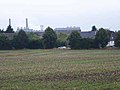 Agriculture and industry - geo.hlipp.de - 41304.jpg 640 × 480;42 КБ
-
 Beware the hunting season! - geo.hlipp.de - 41303.jpg 640 × 480;108 КБ
-
 Farm road near Buschbell - geo.hlipp.de - 41357.jpg 640 × 480;34 КБ
-
 Field at Weiden West - geo.hlipp.de - 41361.jpg 640 × 480;43 КБ
-
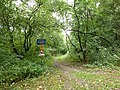
 Forest path - geo.hlipp.de - 41306.jpg 640 × 480;87 КБ
-

-
 KölnFrechenKarte.png 2834 × 2000;7,36 MB
-
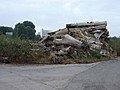 Logpile at Buschbell - geo.hlipp.de - 41358.jpg 640 × 480;40 КБ
-
 Path alongside the Kaskadenweg - geo.hlipp.de - 41297.jpg 640 × 480;62 КБ
-
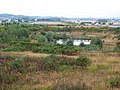 Pond at the interchange - geo.hlipp.de - 41359.jpg 640 × 480;51 КБ
-
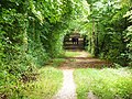
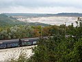
 Rail overbridge in the woods - geo.hlipp.de - 41302.jpg 480 × 640;110 КБ
-
 Rehbergweg, Frechen - geo.hlipp.de - 41305.jpg 640 × 480;41 КБ
-
 Rosenkranzkapelle 2, Waldstraße in Königsdorf.jpg 3024 × 4032;3,74 MB
-
 Rosenkranzkapelle Detail, Waldstraße in Königsdorf.jpg 2996 × 2997;2,41 MB
-
 Rosenkranzkapelle, Waldstraße in Königsdorf.jpg 3024 × 4032;2,35 MB
-
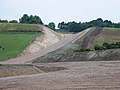
 Sand quarry at Buschbell - geo.hlipp.de - 41300.jpg 640 × 480;50 КБ
-
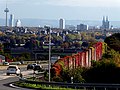 Stadt Köln von Frechen aus ostwärts.jpg 4000 × 3000;8,02 MB
-
 Sunflowers at Weiden West - geo.hlipp.de - 41362.jpg 640 × 480;77 КБ
-

-
-
 Track across the sand quarry - geo.hlipp.de - 41307.jpg 640 × 480;69 КБ
-
 Tree nursery near Buschbell - geo.hlipp.de - 41317.jpg 640 × 480;67 КБ
-
 View of Habbelrath across the fields - geo.hlipp.de - 41312.jpg 640 × 480;32 КБ


