Category:Fremont, California
Zur Navigation springen
Zur Suche springen
Stadt im US-Bundesstaat Kalifornien     | |||||
| Medium hochladen | |||||
| Ist ein(e) |
| ||||
|---|---|---|---|---|---|
| Benannt nach | |||||
| Ort | Alameda County, Kalifornien, Pacific States Region | ||||
| Leiter der Regierung oder Verwaltung |
| ||||
| Datum der Gründung, Erstellung, Entstehung, Erbauung |
| ||||
| Einwohnerzahl |
| ||||
| Fläche |
| ||||
| Höhe über dem Meeresspiegel |
| ||||
| Verschieden von | |||||
| offizielle Website | |||||
 | |||||
Unterkategorien
Es werden 25 von insgesamt 25 Unterkategorien in dieser Kategorie angezeigt:
In Klammern die Anzahl der enthaltenen Kategorien (K), Seiten (S), Dateien (D)
A
- Alameda Creek (18 D)
- Mount Allison (1 S, 7 D)
B
C
- California School for the Blind (10 D)
- California State Route 238 (10 D)
- California State Route 262 (4 D)
- Coyote Hills Regional Park (40 D)
F
I
- Interview with Roan McClure (11 D)
M
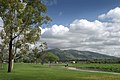
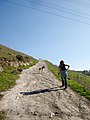
- Mission Peak (1 S, 63 D)
N
P
Q
R
S
- Shinry Lamian (10 D)
W
- Warm Springs Yard (5 D)
Medien in der Kategorie „Fremont, California“
Folgende 200 Dateien sind in dieser Kategorie, von 202 insgesamt.
(vorherige Seite) (nächste Seite)-
 "WATER STINKS," WRITES THE PHOTOGRAPHER ABOUT THIS SCENE - NARA - 544681.jpg 3.000 × 2.024; 833 KB
-
 "WATER STINKS," WRITES THE PHOTOGRAPHER ABOUT THIS SCENE - NARA - 544685.jpg 3.000 × 2.020; 546 KB
-
 "Water stinks," writes the photographer about this scene - NARA - 544692.jpg 2.000 × 2.967; 2,21 MB
-
 17th Mile (20266175).jpeg 2.048 × 1.365; 451 KB
-
 1878 Washington Corners T&W p129 e.jpg 1.414 × 1.230; 961 KB
-

-
 2015 Mayhem Festival .jpg 3.072 × 4.096; 3,45 MB
-

-

-

-

-

-
-

-
 500px photo (53485148).jpeg 2.048 × 1.639; 565 KB
-
 500px photo (55806322).jpeg 2.048 × 1.132; 386 KB
-
 500px photo (55847440).jpeg 2.048 × 1.360; 516 KB
-
 500px photo (55874882).jpeg 2.048 × 1.360; 1,17 MB
-
 500px photo (55874940).jpeg 2.048 × 1.638; 677 KB
-
 500px photo (55874964).jpeg 2.048 × 1.553; 502 KB
-
 500px photo (55874976).jpeg 1.360 × 2.048; 653 KB
-
 500px photo (55875076).jpeg 1.576 × 2.048; 1,02 MB
-
 500px photo (55875148).jpeg 2.048 × 1.365; 712 KB
-
 500px photo (55877600).jpeg 2.048 × 1.638; 996 KB
-
 500px photo (55877722).jpeg 1.466 × 2.048; 1,33 MB
-
 500px photo (55877824).jpeg 1.027 × 2.048; 712 KB
-
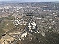
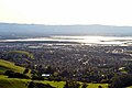
 Aerial view of Fremont looking northeast 2.jpg 4.608 × 3.456; 9,43 MB
-
 Aerial view of Fremont looking northeast.jpg 4.608 × 3.456; 8,71 MB
-
 Aerial view of Fremont, California and Newark, California in 2021.jpg 4.596 × 3.194; 6,98 MB
-
 Aerial view of Fremont, California in 2021.jpg 4.608 × 3.084; 7,36 MB
-
 Aerial view of Irvington station site, September 2018.JPG 3.806 × 2.859; 2,41 MB
-
 Aerial view of office park in Ardenwood, September 2018.JPG 4.432 × 2.963; 2,72 MB
-
 Aerial view of Ohlone College, September 2019.JPG 5.184 × 3.888; 4,35 MB
-
 Aerial view of planned Irvington station site, June 2017.JPG 3.822 × 2.849; 2,68 MB
-
 Aerial view of southern Fremont and Milpitas.jpg 4.608 × 3.456; 10,88 MB
-
 Aerial view of suburban development in Fremont, December 2018.JPG 5.184 × 3.888; 4,28 MB
-

-
 Amax logo.png 200 × 101; 11 KB
-
 American Herring Gull 1149 (Larus smithsonianus).jpg 2.859 × 2.288; 4,01 MB
-
 American Herring Gull 1180 (Larus smithsonianus).jpg 1.759 × 2.214; 2,19 MB
-
 American Herring Gull 2001 (Larus smithsonianus).jpg 1.806 × 1.398; 1,41 MB
-
 Aushak.jpg 1.280 × 960; 324 KB
-
 Auto Mall Parkway, Fremont California.jpg 3.629 × 2.080; 7,17 MB
-
 Warm Springs, Alameda Co. From the road (NYPL b11707279-G89F342 007F).tiff 3.072 × 1.695; 14,9 MB
-
 Warm Springs, Alameda Co. From the road (NYPL b11707279-G89F342 007B).tiff 3.072 × 1.732; 15,22 MB
-
 BART train crossing over the Niles Subdivision, April 2018.JPG 4.636 × 3.484; 2,21 MB
-
 BART-WS-extension-map.png 521 × 537; 85 KB
-
 Bed Of Clover (55875056).jpeg 2.048 × 1.638; 1,86 MB
-
 Black-Beard2.jpg 406 × 944; 149 KB
-
 Bridges-baptism-062.jpg 1.764 × 2.048; 1,01 MB
-
 CALIFORNIA-NEAR SAN FRANCISCO BAY - NARA - 544723.jpg 3.000 × 2.019; 830 KB
-
 CAMap-doton-Fremont.PNG 811 × 607; 13 KB
-
 CAMap-doton-Fremont.png 209 × 230; 4 KB
-
 Cassie Catching Up (140437181).jpeg 2.048 × 1.536; 1,19 MB
-
 Centerville Presbyterian Pioneer Cemetery.jpg 1.280 × 960; 731 KB
-
 Clarkia purpurea (cropped).jpg 1.229 × 1.229; 858 KB
-
 Clarkia purpurea.jpg 2.048 × 1.536; 1,41 MB
-
 Corrugated Road - Fremont California.jpg 3.198 × 2.399; 3,34 MB
-
 Coyote hills park.jpg 4.032 × 3.024; 1,99 MB
-
 Coyote Hills Regional Park, Fremont, United States Feb 23, 2017 052359.jpeg 4.032 × 3.024; 2,07 MB
-
 Coyote Hills Regional Park-1.jpg 2.048 × 1.536; 1,43 MB
-
 CSB Main Entrance 1.jpg 3.008 × 2.008; 1,79 MB
-
 CSB Main Entrance 2.jpg 4.192 × 2.016; 2,32 MB
-
 Don Edwards refuge 2005-2.jpg 3.072 × 2.048; 1,27 MB
-
 Don Edwards refuge 2005.jpg 3.072 × 2.048; 1,45 MB
-
 Drawbridge CA from Train.jpg 4.032 × 3.024; 1,32 MB
-
 Dredge making polders 2743.JPG 2.048 × 1.536; 723 KB
-
 Dumbarton Bridge Fremont sign April 2011.jpg 4.368 × 2.912; 2,76 MB
-
 East Bay banner Fremont park.jpg 3.072 × 439; 482 KB
-
 Escallonia (53485190).jpg 1.320 × 1.362; 358 KB
-
 FCS Campus.jpg 514 × 309; 18 KB
-
 Fields Of Gold (42709818).jpeg 2.048 × 1.366; 587 KB
-
 Flag of Fremont California.jpg 2.560 × 1.347; 476 KB
-
 Flag of Fremont, California.gif 324 × 216; 8 KB
-
 Flickr pointnshoot 642959103--Patty melt.jpg 1.024 × 683; 307 KB
-
 Four Leaves (55875022).jpeg 2.048 × 1.550; 581 KB
-
 Fremont - panoramio (1).jpg 1.456 × 2.592; 706 KB
-
 Fremont - panoramio (2).jpg 1.456 × 2.592; 1,21 MB
-
 Fremont - panoramio (3).jpg 1.456 × 2.592; 901 KB
-
 Fremont USA CA - panoramio (1).jpg 2.592 × 1.728; 1,05 MB
-
 Fremont USA CA - panoramio.jpg 1.728 × 2.592; 1,47 MB
-
 Fremont's Ranche.jpg 340 × 415; 47 KB
-
 Fremont, CA - panoramio (1).jpg 2.592 × 1.456; 868 KB
-
 Fremont, CA - panoramio.jpg 2.592 × 1.456; 683 KB
-
 Fremont, CA, USA - panoramio (1).jpg 2.032 × 1.143; 1,55 MB
-
 Fremont, CA, USA - panoramio (10).jpg 3.264 × 2.448; 4,73 MB
-
 Fremont, CA, USA - panoramio (11).jpg 2.154 × 1.600; 1,6 MB
-
 Fremont, CA, USA - panoramio (12).jpg 2.178 × 1.632; 1,74 MB
-
 Fremont, CA, USA - panoramio (15).jpg 2.150 × 1.596; 1,91 MB
-
 Fremont, CA, USA - panoramio (16).jpg 3.264 × 2.448; 3,66 MB
-
 Fremont, CA, USA - panoramio (17).jpg 2.149 × 1.596; 1,2 MB
-
 Fremont, CA, USA - panoramio (2).jpg 2.592 × 1.552; 2,86 MB
-
 Fremont, CA, USA - panoramio (3).jpg 2.592 × 1.552; 2,49 MB
-
 Fremont, CA, USA - panoramio (4).jpg 3.264 × 2.448; 4,61 MB
-
 Fremont, CA, USA - panoramio (5).jpg 2.112 × 1.540; 2,25 MB
-
 Fremont, CA, USA - panoramio (6).jpg 2.178 × 1.632; 2,07 MB
-
 Fremont, CA, USA - panoramio (7).jpg 3.264 × 2.448; 4,58 MB
-
 Fremont, CA, USA - panoramio (8).jpg 2.649 × 1.961; 3,24 MB
-
 Fremont, CA, USA - panoramio (9).jpg 2.158 × 1.606; 2,35 MB
-
 Fremont, CA, USA - panoramio.jpg 2.592 × 1.456; 852 KB
-
 Fremont, California (10753673185).jpg 4.000 × 3.000; 3,19 MB
-
 Fremont, California (10753673785).jpg 4.000 × 3.000; 2,51 MB
-
 Fremont, California (10753755966).jpg 4.000 × 3.000; 2,14 MB
-
 Fremont, California (10753759296).jpg 4.000 × 3.000; 2,75 MB
-
 Fremont, California (10753774254).jpg 4.000 × 2.304; 2,11 MB
-
 Fremont, California (10753971133).jpg 4.000 × 3.000; 2,79 MB
-
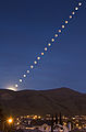 Fremont-Lunar-eclipse-2008.jpg 1.428 × 2.173; 611 KB
-
 FremontCA.jpg 646 × 464; 140 KB
-
 FremontLegislature.svg 360 × 185; 1 KB
-
 FremontTechnicalRescue 3897.jpg 2.508 × 1.672; 2,86 MB
-

-

-
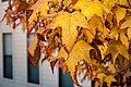
 Ginkgo-biloba-tree-in-fall.jpg 2.592 × 3.888; 5,3 MB
-
 Harrys endcap at Target in Fremont July 2017.jpg 2.860 × 3.958; 2,22 MB
-
 HaywardFaultCreep.jpg 880 × 880; 436 KB
-
 HaywardFaultExposed5911.JPG 2.048 × 1.536; 1,38 MB
-
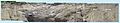 HaywardFaultExposedComposite.jpg 6.190 × 1.190; 3,34 MB
-
 HaywardFaultExposedNoted.jpg 3.095 × 595; 904 KB
-
 I M Screwed (55874786).jpeg 2.048 × 1.362; 900 KB
-
 Kato Road underpass 2359 01.JPG 2.048 × 1.536; 1,09 MB
-
 Kato Road underpass 2360 02.JPG 2.048 × 1.536; 606 KB
-
 KosanPrisen 1985 HKain 1.jpg 4.032 × 2.268; 2,01 MB
-
 KosanPrisen 1985 HKain 2.jpg 4.032 × 2.268; 2,04 MB
-
 Lasthenia californica in Fremont, California.jpg 2.048 × 1.536; 1,52 MB
-
 Let S Groom (41499466).jpeg 2.048 × 1.638; 570 KB
-
 Lichen3 (kevincollins).jpg 2.560 × 1.706; 1,85 MB
-

-
 Alameda Creek flows under Mission Boulevard 3326.JPG 2.048 × 1.536; 831 KB
-
 Mission Boulevard over Alameda Creek 3323.JPG 2.048 × 1.536; 643 KB
-
 Mission Peak from across Lake Elizabeth.jpg 5.312 × 2.988; 2,58 MB
-
 Mission Peak from Union City after weeks of rain.jpg 3.926 × 2.898; 3,94 MB
-
 Mission peak landslide.jpg 489 × 285; 61 KB
-
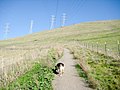
 Mission Peak Trail 01.jpg 4.160 × 3.120; 4,44 MB
-
 Mission Peak Trail 02.jpg 4.160 × 3.120; 3,57 MB
-
 Mission Peak Trail 03.jpg 4.160 × 3.120; 3,47 MB
-
 Mission Peak Trail 04.jpg 4.160 × 3.120; 3,48 MB
-
 Mission Peak Trail 05.jpg 4.160 × 3.120; 3,89 MB
-
 Mission Peak Trail 06.jpg 3.120 × 4.160; 3,41 MB
-
 Mission Peak Trail 07.jpg 4.160 × 3.120; 3,34 MB
-
 Mission Peak Trail 08.jpg 4.160 × 3.120; 4,01 MB
-
 Mission Peak Trail 09.jpg 4.160 × 3.120; 4,13 MB
-
 Mission Peak Trail 10.jpg 4.160 × 3.120; 4,26 MB
-
 Mission Peak Trail 11.jpg 4.160 × 3.120; 3,86 MB
-
 Mission Peak Trail 13.jpg 4.160 × 3.120; 4,01 MB
-
 Mission San Jose High School April 2011.jpg 2.216 × 3.848; 2,41 MB
-
 Mission-Peak-2006.jpg 3.072 × 2.048; 1,46 MB
-
 Mission-Peak-Snow.jpg 3.504 × 924; 454 KB
-
 More Climbing (140437201).jpeg 1.536 × 2.048; 1.008 KB
-
 Mount Allison.JPG 4.000 × 3.000; 907 KB
-
 MPlowres.jpg 1.279 × 818; 474 KB
-
 National Wildlife Refuge - panoramio.jpg 4.000 × 2.664; 2,39 MB
-
 Niles Depot Museum in Fremont, California.jpg 6.000 × 4.000; 5,83 MB
-
 NUMMIplantMissionPeakPanorama 3199.jpg 2.912 × 800; 1,52 MB
-
 Oakland ARTCC.jpg 4.000 × 2.250; 2,62 MB
-
 Omega Flightmaster (55877420).jpeg 2.048 × 1.747; 953 KB
-
 On Kimber Hill (52566240).jpeg 2.048 × 1.131; 844 KB
-
 Oorja logo.gif 212 × 73; 5 KB
-
 Open (55875176).jpeg 2.048 × 1.360; 781 KB
-
 P052610PS-0267 (4673118406).jpg 4.096 × 2.731; 2,91 MB
-
 Paseo Padre overpass construction 0911.JPG 2.048 × 1.536; 703 KB
-
 Patch of the Fremont Police Department.png 293 × 357; 170 KB
-
 Patterson-House.JPG 12.028 × 3.048; 20,54 MB
-
 Push Button For (55875092).jpeg 1.639 × 2.048; 609 KB
-
 Quarry Lakes landscape (17220375539).jpg 4.272 × 2.848; 4,45 MB
-
 Rain On Clamp (55875412).jpeg 1.956 × 1.565; 751 KB
-
 Rufous-crowned Sparrow.jpg 2.747 × 2.028; 2,1 MB
-
 Sancturary-Fremont-CA.JPG 3.008 × 2.000; 1,48 MB
-

-
 Seal of Fremont, California.png 187 × 187; 74 KB
-
 Setting In The East (42709820).jpeg 2.048 × 1.366; 317 KB
-
 Sierra Atlantic HQ Fremont.jpg 583 × 460; 82 KB
-
 Soft shopping bags.jpg 4.032 × 3.024; 2,47 MB
-
 SolyndraLogo 202x41.png 202 × 41; 12 KB
-
 Some of Roger Puta's Western Pacific Photos (27217538290).jpg 2.000 × 1.552; 2,32 MB
-
 South Gimmer bridge equipment 0918.JPG 2.048 × 1.536; 835 KB
-
 South San Francisco Bay viewed from Mission Peak in Fremont, California.JPG 4.608 × 3.072; 2,92 MB
-
 Starting The Hike (140437209).jpeg 2.048 × 1.536; 1,27 MB
-
 Stock Image Candidate (42709822).jpeg 2.048 × 1.365; 483 KB
-
 Summer Solstice Silicon Valley Panorama.jpg 9.163 × 3.695; 26,48 MB
-
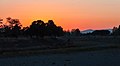
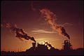 SUNSET AND SMOKE - NARA - 544684.jpg 2.728 × 1.818; 503 KB
-
 SUNSET AND SMOKE - NARA - 544688.jpg 3.000 × 2.008; 609 KB
-
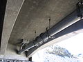 Suspended pipe under Mission Blvd 3327.JPG 2.048 × 1.536; 783 KB
-
 Tavis Place view of Warm Springs extension 0919.JPG 2.048 × 1.536; 904 KB
-
 That's the way we climb the mountain - panoramio.jpg 2.592 × 1.552; 645 KB
-

-
 Train Of Lights (236972801).jpeg 1.367 × 2.048; 751 KB
-
 Two American Pelicans and a Great Egret, Fremont, California (24736677021).jpg 5.184 × 3.456; 5,64 MB
-
 Underwater Life is Joy, trompe l'oeil mural by John Pugh.png 1.640 × 624; 1,88 MB
-
 UP over Alameda Creek 3328.JPG 2.048 × 1.536; 922 KB
-

-

-

-
 Black cow @ Fremont, Ca.jpg 3.276 × 2.184; 5,68 MB
-
 Walkabout (138595005).jpeg 2.048 × 1.365; 881 KB
-
 Warm Springs Court 0921.JPG 2.048 × 1.536; 924 KB
-
 Warm Springs from Auto Mall 0915.JPG 2.048 × 1.536; 841 KB
-
 Warm Springs from Auto Mall 0916.JPG 2.048 × 1.536; 824 KB
-
 WHSFrontFacade.JPG 3.456 × 2.304; 1,85 MB
-
 Workers at California Nursery Company, fremont ca.JPG 400 × 254; 33 KB
-
 Yellow Rose (53485018).jpeg 2.048 × 1.730; 589 KB


.jpeg)


_crossing_from_left_to_right_in_the_lower_portion_of_the_view.jpg)
_crossing_from_left_to_right_in_the_lower_portion_of_the_view.jpg)
_crossing_from_left_to_right_near_the_center.jpg)

,_Union_City_(center)_and_Fremont_(right)_visible_in_the_distance.jpg)
.jpeg)
.jpeg)
.jpeg)
.jpeg)
.jpeg)
.jpeg)
.jpeg)
.jpeg)
.jpeg)
.jpeg)
.jpeg)
.jpeg)


.jpg)
.jpg)
.jpg)


.jpeg)


.jpeg)

.jpg)


.jpg)

.jpeg)


.jpeg)
.jpg)
.jpg)
.jpg)
.jpg)


.jpg)

.jpg)
.jpg)
.jpg)
.jpg)
.jpg)
.jpg)
.jpg)
.jpg)
.jpg)
.jpg)
.jpg)
.jpg)
.jpg)
.jpg)
.jpg)

.jpg)
.jpg)
.jpg)
.jpg)
.jpg)
.jpg)


.jpeg)


.jpeg)
.jpg)


.jpeg)


.jpeg)
.jpeg)
.jpeg)
.jpg)


.jpeg)
.jpg)
.jpeg)


.jpeg)


.jpg)


.jpeg)
.jpeg)


_(14586562378).jpg)
.jpeg)
.jpg)


.jpeg)


.jpeg)