Category:Garstang
Vai alla navigazione
Vai alla ricerca
town in Lancashire, England  | |||||
| Carica un file multimediale | |||||
| Istanza di | |||||
|---|---|---|---|---|---|
| Luogo | Wyre, Lancashire, Nord Ovest dell'Inghilterra, Inghilterra | ||||
| Popolazione |
| ||||
 | |||||
English: Garstang is a town and civil parish within the Wyre borough of Lancashire, England. It is ten miles north-northwest of the city of Preston and eleven miles south of Lancaster, and has a total resident population of 4,074.
Polski: Garstang - miasto w Wielkiej Brytanii, w Anglii, w regionie North West England, w hrabstwie Lancashire. W 2001r. miasto to zamieszkiwało 4 074 osób.
Sottocategorie
Questa categoria contiene le 9 sottocategorie indicate di seguito, su un totale di 9.
2
E
- Eagle and Child, Garstang (2 F)
G
- Garstang Bridge (4 F)
- Garstang Methodist Church (2 F)
- Garstang Town Hall (5 F)
M
R
- Royal Oak Hotel, Garstang (6 F)
S
File nella categoria "Garstang"
Questa categoria contiene 200 file, indicati di seguito, su un totale di 235.
(pagina precedente) (pagina successiva)-
 14th Green - Garstang Golf ^ Country Club - geograph.org.uk - 4613895.jpg 1 600 × 1 200; 433 KB
-
 A lane in Garstang - geograph.org.uk - 5957765.jpg 1 536 × 1 536; 1,07 MB
-
 A6 Preston Lancaster New Road, Garstang - geograph.org.uk - 6089100.jpg 1 024 × 769; 101 KB
-
 Barge and Bridge - geograph.org.uk - 1157867.jpg 640 × 480; 106 KB
-
 Basin, Lancaster Canal at Garstang - geograph.org.uk - 5994079.jpg 640 × 480; 57 KB
-
 Between Park Hill Road and High St, Garstang - geograph.org.uk - 5957764.jpg 1 536 × 1 536; 1,17 MB
-

-
 Bollards - geograph.org.uk - 1139189.jpg 640 × 426; 149 KB
-
 Booths, Garstang - geograph.org.uk - 2716129.jpg 640 × 480; 119 KB
-
 Breaking the Ice - geograph.org.uk - 1064107.jpg 640 × 426; 107 KB
-
 Bridge 62 over Lancaster Canal - geograph.org.uk - 528668.jpg 640 × 437; 33 KB
-
 Bridge 63 Lancaster Canal - geograph.org.uk - 999159.jpg 640 × 426; 116 KB
-
 Bridge 67 Lancaster Canal - geograph.org.uk - 998971.jpg 640 × 426; 137 KB
-
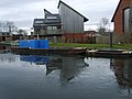
 Bridge House Marina, Garstang Canal - geograph.org.uk - 995885.jpg 640 × 427; 102 KB
-
 Bridge Number 60 - geograph.org.uk - 1158005.jpg 640 × 480; 81 KB
-
 Broom Hill - geograph.org.uk - 5147374.jpg 4 588 × 2 607; 2,01 MB
-
 Canal Basin - geograph.org.uk - 1157991.jpg 640 × 480; 63 KB
-
 Canal Basin - Lancaster Canal - geograph.org.uk - 4612800.jpg 640 × 426; 59 KB
-
 Canal Basin at Garstang - geograph.org.uk - 2527449.jpg 1 280 × 962; 514 KB
-
 Canal basin at Garstang - geograph.org.uk - 5924344.jpg 640 × 449; 63 KB
-
 Canal basin at Garstang - geograph.org.uk - 5924350.jpg 640 × 447; 66 KB
-
 Canal basin reflections - geograph.org.uk - 4535632.jpg 800 × 533; 99 KB
-
 Canal boat on Lancaster canal in spring - panoramio.jpg 905 × 680; 671 KB
-
 Canal Bridges - geograph.org.uk - 1157916.jpg 640 × 480; 92 KB
-
 CathouseBridgeGarstang.jpg 3 030 × 2 036; 5,86 MB
-
 Church Street Bridge, Garstang - geograph.org.uk - 2527434.jpg 640 × 477; 195 KB
-
 Congregational Church - geograph.org.uk - 2527271.jpg 1 280 × 960; 593 KB
-
 Construction of New Supermarket - geograph.org.uk - 1138502.jpg 640 × 426; 77 KB
-
 Cornmill Residential Nursing Home - geograph.org.uk - 1147513.jpg 640 × 426; 102 KB
-
 Council Offices, Garstang - geograph.org.uk - 436278.jpg 640 × 480; 99 KB
-
 Croston Road at Station Way - geograph.org.uk - 3293563.jpg 640 × 480; 47 KB
-
 Croston Road, Garstang - geograph.org.uk - 3811677.jpg 640 × 480; 82 KB
-
 Crown Hotel - geograph.org.uk - 4593615.jpg 1 600 × 1 064; 369 KB
-
 Crown Hotel, High Street, Garstang - geograph.org.uk - 436258.jpg 640 × 477; 71 KB
-
 Crown Hotel, High Street, Garstang - geograph.org.uk - 995645.jpg 640 × 480; 173 KB
-

-
 Ducks on Ice - geograph.org.uk - 1158013.jpg 640 × 480; 44 KB
-
 Eco Houses - geograph.org.uk - 1138545.jpg 640 × 426; 67 KB
-
 Eco Reflection - geograph.org.uk - 3901326.jpg 2 327 × 1 696; 2,03 MB
-
 End of the Road - geograph.org.uk - 1138517.jpg 640 × 426; 87 KB
-
 Entrance Drive to Barnacre Lodge - geograph.org.uk - 111889.jpg 640 × 427; 128 KB
-
 Entrance to Marina at Garstang - geograph.org.uk - 1237399.jpg 576 × 395; 200 KB
-
 Entry to Garstang from the south - geograph.org.uk - 1089529.jpg 640 × 426; 53 KB
-
 Flow Measurement Station - geograph.org.uk - 1107966.jpg 640 × 426; 101 KB
-
 Foot of a car park, Garstang - geograph.org.uk - 5569933.jpg 1 024 × 576; 270 KB
-
 Footbridge on Millennium Way to Scorton - geograph.org.uk - 1670857.jpg 640 × 426; 337 KB
-
 Footbridge over River Wyre near Garstang - geograph.org.uk - 2026126.jpg 3 072 × 2 304; 2,89 MB
-
 Footbridge over the Lancaster Canal - geograph.org.uk - 3811636.jpg 640 × 480; 101 KB
-
 Footpath by-pass - geograph.org.uk - 1670868.jpg 640 × 426; 324 KB
-
 Footsteps from Canal to River - geograph.org.uk - 1138531.jpg 640 × 426; 145 KB
-
 Ford at Garstang - geograph.org.uk - 4251421.jpg 3 872 × 2 592; 4,86 MB
-

-
 Free Methodist Church, Garstang - geograph.org.uk - 1138487.jpg 640 × 426; 65 KB
-
 Free Methodist Church, Garstang - geograph.org.uk - 3049633.jpg 2 599 × 1 997; 1,82 MB
-

-
 Garstang - panoramio - jim walton (1).jpg 1 000 × 750; 200 KB
-
 Garstang - panoramio - jim walton (2).jpg 1 000 × 750; 166 KB
-
 Garstang - panoramio - jim walton (3).jpg 1 000 × 750; 162 KB
-
 Garstang - panoramio - jim walton (4).jpg 1 000 × 750; 178 KB
-
 Garstang - panoramio - jim walton (5).jpg 1 000 × 750; 188 KB
-
 Garstang - panoramio - jim walton.jpg 1 000 × 750; 201 KB
-
 Garstang - panoramio.jpg 1 000 × 750; 296 KB
-
 Garstang Arts Centre - geograph.org.uk - 2527066.jpg 1 280 × 953; 605 KB
-
 Garstang Arts Centre - geograph.org.uk - 5957619.jpg 1 461 × 1 156; 832 KB
-
 Garstang Basin - geograph.org.uk - 951317.jpg 640 × 480; 69 KB
-
 Garstang Basin, Lancaster Canal - geograph.org.uk - 950079.jpg 640 × 480; 75 KB
-
 Garstang Bridge (Wyre Bridge) - geograph.org.uk - 2526957.jpg 1 280 × 945; 677 KB
-
 Garstang Cross and Market Place 239-25.jpg 2 085 × 1 495; 958 KB
-
 Garstang Free Methodist Church - geograph.org.uk - 4624435.jpg 4 267 × 2 573; 6,2 MB
-
 Garstang High Street - geograph.org.uk - 3049676.jpg 4 000 × 3 000; 4,97 MB
-
 Garstang High Street - geograph.org.uk - 4590960.jpg 1 024 × 768; 658 KB
-
 Garstang Library - geograph.org.uk - 4624492.jpg 4 400 × 2 458; 7,4 MB
-
 Garstang Market Cross - geograph.org.uk - 2527015.jpg 640 × 853; 310 KB
-
 Garstang Market Place - geograph.org.uk - 2527040.jpg 1 280 × 960; 592 KB
-
 Garstang Methodist Church - geograph.org.uk - 2527418.jpg 1 280 × 960; 564 KB
-
 Garstang Methodist Church - geograph.org.uk - 3901912.jpg 2 229 × 1 482; 1,49 MB
-
 Garstang Millennium Green Sculpture - geograph.org.uk - 2039096.jpg 3 264 × 2 448; 3,27 MB
-
 Garstang Millennium Green Sculpture plaque - geograph.org.uk - 2039114.jpg 3 264 × 2 448; 3,18 MB
-
 Garstang Town Centre - geograph.org.uk - 3201361.jpg 2 560 × 1 920; 1,38 MB
-
 Garstang Town station site geograph-3884010-by-Ben-Brooksbank.jpg 2 372 × 1 351; 2,76 MB
-
 Garstang United Reformed Church - geograph.org.uk - 2527410.jpg 1 280 × 953; 584 KB
-
 Garstang United Reformed Church - geograph.org.uk - 3811669.jpg 640 × 480; 76 KB
-
 Garstang War Memorial and Memorial Garden - geograph.org.uk - 2527407.jpg 1 280 × 956; 660 KB
-
 Garstang, market cross - geograph.org.uk - 2956531.jpg 1 024 × 753; 161 KB
-
 Gate and sheep pen, Hazelhurst Lane - geograph.org.uk - 1670890.jpg 640 × 426; 305 KB
-
 Green Lane West, Garstang - geograph.org.uk - 3813273.jpg 640 × 480; 93 KB
-
 Gubberford Bridge - geograph.org.uk - 951455.jpg 640 × 480; 173 KB
-
 Gubberford Bridge - geograph.org.uk - 951457.jpg 640 × 480; 193 KB
-
 Gubberford Bridge, River Wyre - geograph.org.uk - 872377.jpg 640 × 480; 68 KB
-
 Hang 'em High - geograph.org.uk - 1064121.jpg 640 × 426; 156 KB
-
 High Street, Garstang - geograph.org.uk - 2716169.jpg 640 × 480; 148 KB
-
 High Street, Garstang - geograph.org.uk - 2716172.jpg 640 × 480; 112 KB
-
 High Street, Garstang - geograph.org.uk - 436242.jpg 640 × 468; 73 KB
-
 High Street, Garstang - geograph.org.uk - 5067356.jpg 2 668 × 1 998; 2,89 MB
-
 High Street, Garstang - geograph.org.uk - 5569924.jpg 1 024 × 576; 275 KB
-
 High Street, Garstang - geograph.org.uk - 6010283.jpg 1 280 × 851; 550 KB
-
 High Street, Garstang. - geograph.org.uk - 1026778.jpg 640 × 480; 87 KB
-
 Houses, Church Street, Garstang - geograph.org.uk - 435690.jpg 640 × 480; 84 KB
-

-
 Kings Arms, High Street, Garstang - geograph.org.uk - 995650.jpg 640 × 480; 180 KB
-
 Kirkland Hall, near Churchtown - geograph.org.uk - 77849.jpg 640 × 480; 142 KB
-
 Lancaster Canal - geograph.org.uk - 1157904.jpg 640 × 480; 68 KB
-
 Lancaster Canal at Garstang - geograph.org.uk - 5924359.jpg 640 × 454; 66 KB
-
 Lancaster Canal, Bridge 59, B6430 - geograph.org.uk - 1089519.jpg 640 × 426; 77 KB
-
 Lancaster Canal, Bridge Number 62 at Garstang - geograph.org.uk - 2527445.jpg 1 280 × 960; 770 KB
-
 Lancaster Canal, Garstang - geograph.org.uk - 1754206.jpg 640 × 480; 91 KB
-
 Lancaster Canal, Garstang - geograph.org.uk - 2527440.jpg 1 280 × 960; 675 KB
-
 Lancaster Canal, Garstang - geograph.org.uk - 2527441.jpg 1 280 × 961; 568 KB
-
 Lanky at Garstang.jpg 1 536 × 1 024; 566 KB
-
 M6 Motorway near Garstang - geograph.org.uk - 72056.jpg 640 × 480; 80 KB
-
 Many Pads Footpath - geograph.org.uk - 1107947.jpg 400 × 600; 102 KB
-
 Marina - geograph.org.uk - 1157842.jpg 640 × 480; 58 KB
-
 Marina - geograph.org.uk - 1157843.jpg 640 × 480; 64 KB
-
 Market Place, Garstang - geograph.org.uk - 2716134.jpg 640 × 480; 149 KB
-
 Methodist Church, Garstang - geograph.org.uk - 3811647.jpg 640 × 480; 50 KB
-
 Milestone on the B6430 at Cabus, Garstang.jpg 3 024 × 4 032; 2,38 MB
-
 Millennium Way Footpath, Garstang - geograph.org.uk - 1670855.jpg 640 × 426; 233 KB
-
 Moss Lane Sanitary Station - geograph.org.uk - 1157880.jpg 640 × 480; 65 KB
-
 Muddy Path Through the Corn - geograph.org.uk - 995847.jpg 640 × 480; 164 KB
-
 New Supermarket - geograph.org.uk - 1532271.jpg 640 × 426; 78 KB
-
 Nickson's Weind, Garstang - geograph.org.uk - 3049650.jpg 3 619 × 2 464; 4,94 MB
-
 No. 42, High Street - geograph.org.uk - 4535409.jpg 800 × 533; 90 KB
-
 Oak Tree Beside River Wyre - geograph.org.uk - 1009444.jpg 640 × 426; 134 KB
-
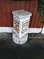
 Old Boundary Marker on the B6430 in Garstang (geograph 6068610).jpg 535 × 800; 143 KB
-
 Old Garstang Council Offices - geograph.org.uk - 2527257.jpg 640 × 480; 225 KB
-
 Old Leat next to River Wyre - geograph.org.uk - 1147501.jpg 640 × 426; 165 KB
-
 Pat Seed Memorial Gardens, Garstang - geograph.org.uk - 2527273.jpg 1 280 × 958; 767 KB
-
 Pipe and Bridge - geograph.org.uk - 1158021.jpg 640 × 480; 87 KB
-
 Post Box and Old Clinic, Windsor Road - geograph.org.uk - 1138492.jpg 640 × 426; 112 KB
-
 Public Library, Garstang - geograph.org.uk - 1138498.jpg 640 × 426; 92 KB
-
 River Wyre - geograph.org.uk - 1157995.jpg 480 × 640; 107 KB
-
 River Wyre - geograph.org.uk - 2527485.jpg 1 280 × 957; 930 KB
-
 River Wyre at Garstang - geograph.org.uk - 1168447.jpg 640 × 426; 119 KB
-
 River Wyre at Garstang - geograph.org.uk - 1169436.jpg 640 × 480; 81 KB
-
 River Wyre at Garstang - geograph.org.uk - 1232911.jpg 640 × 480; 89 KB
-
 River Wyre at Garstang - geograph.org.uk - 5067354.jpg 1 280 × 960; 1,03 MB
-
 River Wyre from Garstang Bridge - geograph.org.uk - 995674.jpg 640 × 480; 197 KB
-
 River Wyre, Garstang - geograph.org.uk - 1039372.jpg 640 × 480; 94 KB
-
 River Wyre, Garstang - geograph.org.uk - 2526949.jpg 1 280 × 957; 796 KB
-
 River Wyre, Garstang - geograph.org.uk - 2527489.jpg 1 280 × 960; 1,01 MB
-
 Riverside walk, Garstang - geograph.org.uk - 3049715.jpg 4 000 × 3 000; 6,35 MB
-
 Road Junction A6, Garstang - geograph.org.uk - 2557594.jpg 640 × 426; 252 KB
-

-
 Roundabout on Park Hill Road, Garstang - geograph.org.uk - 5841496.jpg 1 024 × 768; 299 KB
-
 Royal Oak Hotel, Garstang - geograph.org.uk - 5957622.jpg 1 337 × 1 180; 660 KB
-
 Royal Oak Hotel, Market Place, Garstang - geograph.org.uk - 995656.jpg 626 × 468; 165 KB
-
 Salvatore's Wine Bar - geograph.org.uk - 1754182.jpg 640 × 480; 66 KB
-
 Service Pipes - geograph.org.uk - 1009997.jpg 450 × 600; 123 KB
-
 Shoreway Fisheries, 2 Bridge Street, Garstang.jpg 4 032 × 3 024; 2,32 MB
-
 Sign at 'The Crown' - geograph.org.uk - 4593647.jpg 1 200 × 1 600; 223 KB
-
 Six-Way Crossroads - geograph.org.uk - 1139209.jpg 640 × 426; 94 KB
-
 SS Mary and Michael Primary School - geograph.org.uk - 1039359.jpg 640 × 480; 54 KB
-
 St Thomas Parish Hall - geograph.org.uk - 4612785.jpg 1 600 × 1 200; 382 KB
-
 St Thomas' Church, Garstang - geograph.org.uk - 3811640.jpg 640 × 480; 62 KB
-
 St. Thomas's, Garstang - geograph.org.uk - 3049705.jpg 2 668 × 2 221; 1,97 MB
-
 Supermarket Going Up - geograph.org.uk - 1138510.jpg 640 × 426; 109 KB
-
 Swan on Canal - geograph.org.uk - 1157871.jpg 480 × 640; 64 KB
-
 Swanning on the Canal - geograph.org.uk - 1138538.jpg 640 × 426; 84 KB
-
 Th'owd Tithebarn - geograph.org.uk - 1157987.jpg 640 × 480; 68 KB
-
 Th'Owd Tithebarn - geograph.org.uk - 1754205.jpg 640 × 480; 79 KB
-
 Th'Owd Tithebarn - geograph.org.uk - 4535410.jpg 800 × 533; 105 KB
-
 Th'Owd Tithebarn, Garstang - geograph.org.uk - 528677.jpg 640 × 387; 34 KB
-
 Th'Owd Tithebarn, Garstang - geograph.org.uk - 950377.jpg 640 × 480; 162 KB
-
-
 The A6 passes the Great Season at Garstang - geograph.org.uk - 2376705.jpg 1 600 × 1 474; 364 KB
-
 The Arts Centre - geograph.org.uk - 2527263.jpg 1 280 × 960; 622 KB
-
-
 The B6340 road in Garstang. - geograph.org.uk - 1026783.jpg 640 × 480; 88 KB
-
 The Bell ^ Bottle, Garstang - geograph.org.uk - 3811643.jpg 640 × 480; 66 KB
-
 The Church Inn, Bonds lane, Garstang - geograph.org.uk - 950348.jpg 640 × 480; 224 KB
-

-
 The Crown, Garstang - geograph.org.uk - 6010310.jpg 851 × 1 280; 410 KB
-
 The Farmers Arms, Church Street, Garstang - geograph.org.uk - 950353.jpg 640 × 480; 208 KB
-

-
 The King's Arms, High Street, Garstang - geograph.org.uk - 436269.jpg 640 × 480; 103 KB
-
 The Kings Arms, Garstang - geograph.org.uk - 3811664.jpg 640 × 480; 56 KB
-
 The Lancaster Canal - geograph.org.uk - 3811633.jpg 640 × 480; 78 KB
-
 The Lancaster Canal - geograph.org.uk - 4535413.jpg 800 × 533; 120 KB
-
 The Lancaster Canal - geograph.org.uk - 4535626.jpg 800 × 533; 94 KB
-

-

-
 The Market Cross, Garstang - geograph.org.uk - 436190.jpg 471 × 640; 77 KB
-

-
-

-
 The River Wyre and Garstang Bridge - geograph.org.uk - 436369.jpg 640 × 480; 143 KB
-
-

-
 The Wheatsheaf - geograph.org.uk - 2527425.jpg 1 280 × 960; 553 KB
-

-
 The Wheatsheaf, Garstang - geograph.org.uk - 220805.jpg 640 × 428; 100 KB
-
 The Wheatsheaf, Garstang - geograph.org.uk - 3811659.jpg 640 × 480; 58 KB
-
 The wind turbine is not bothered by the rain - geograph.org.uk - 4624733.jpg 4 140 × 1 897; 2,79 MB
-
 The Wyre Aqueduct - geograph.org.uk - 4535635.jpg 800 × 533; 133 KB
-
 Thomas's Weind - geograph.org.uk - 3049699.jpg 4 000 × 3 000; 4,75 MB
-
 Three shops, High Street, Garstang - geograph.org.uk - 436200.jpg 640 × 478; 82 KB
-
 Towards Park Hill Road, Garstang - geograph.org.uk - 5569921.jpg 1 024 × 576; 271 KB
-
 Towpath, Lancaster Canal - geograph.org.uk - 3811502.jpg 640 × 480; 86 KB
-
 United Reformed Church, Garstang - geograph.org.uk - 220803.jpg 540 × 640; 143 KB
-
 Water Control - geograph.org.uk - 1168453.jpg 640 × 426; 97 KB


.jpg)
.jpg)
.jpg)
.jpg)
.jpg)


_-_geograph.org.uk_-_2526957.jpg)


.jpg)


