Category:Geography of Canada
পরিভ্রমণে চলুন
অনুসন্ধানে চলুন
geographic features of Canada | |||||
| মিডিয়া আপলোড করুন | |||||
| নিদর্শন |
| ||||
|---|---|---|---|---|---|
| যার উপশ্রেণী | |||||
| এর বিশেষ দিক | |||||
| অবস্থান |
| ||||
| |||||
উপবিষয়শ্রেণীসমূহ
এই বিষয়শ্রেণীতে অন্তর্ভুক্ত মোট ৩১টি উপবিষয়শ্রেণীর মধ্যে ৩১টি উপবিষয়শ্রেণী নিচে দেখানো হয়েছে।
"Geography of Canada" বিষয়শ্রেণীতে অন্তর্ভুক্ত মিডিয়া ফাইলগুলি
এই বিষয়শ্রেণীতে অন্তর্ভুক্ত মোট ১৮টি পাতার মধ্যে ১৮টি পাতা নিচে দেখানো হলো।
-
 Report of the Geographic Board of Canada containing all decisions to 30th June, 1910. (IA 1911v45i13p21a 0745).pdf ৫৭০ × ৯১২, ৪৬০টি পাতা; ২৯.৫৩ মেগাবাইট
-
-
 Altitudes in the dominion of Canada (IA altitudesindomi00whit).pdf ৯৩৫ × ১,৪৩৫, ৬৫২টি পাতা; ৩৪.৬২ মেগাবাইট
-
 Canadianshield.gif ৫০০ × ৫২০; ৯৮ কিলোবাইট
-
 Comparison Size with Canada map.GIF ৫১৯ × ১,৩৬৯; ২৪ কিলোবাইট
-
 Dictionary of altitudes in the Dominion of Canada (IA dictionaryofalt00whit).pdf ৯৯৫ × ১,৪৫৬, ২৭২টি পাতা; ১৫.২৪ মেগাবাইট
-
 Dictionary of altitudes in the Dominion of Canada with a relief map of Canada (IA dictionaryofalti00whit).pdf ৯২২ × ১,৪৪৭, ১৬৮টি পাতা; ১১.৪৭ মেগাবাইট
-
 Dominion-land-survey-township.png ৪০০ × ৫৪০; ২৮ কিলোবাইট
-
 Dominion-land-system-overview.png ৪০০ × ২৫০; ২০ কিলোবাইট
-
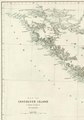 Notes on the Physical Geography of Vancouver Island (IA jstor-1798470).pdf ১,০৫০ × ১,৫০০, ২৩টি পাতা; ৬.০১ মেগাবাইট
-
 LG3 Reservoir Rocks - panoramio.jpg ৩,০৭২ × ২,৩০৪; ২.৬৯ মেগাবাইট
-
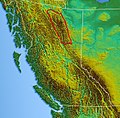 Northwest-relief MuskwaRanges.jpg ৬০৯ × ৫৯৭; ৪০৪ কিলোবাইট
-
Pass over Canada and Central United States at Night.ogv ৩২ সে, ৮৪০ × ৫৬০; ৭.০৬ মেগাবাইট
-
 Pokrywa lodowa 1999.jpg ৬৪৮ × ৪৮৬; ২৮ কিলোবাইট
-
 Sheep Mountain (HS85-10-20115) original.tif ৩,৩১৫ × ২,৭০০; ২৬.২৫ মেগাবাইট
-
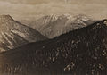 Sheep Mountain (HS85-10-20115).jpg ১,৮৯৬ × ১,৩২০; ৩.১৬ মেগাবাইট
-
 US east coast ne appalachian physio map.jpg ২৬৯ × ৫০০; ৩৯ কিলোবাইট
-
 US-Canadian border along the 49th parallel.png ২,১০৮ × ৭০৮; ৬৪ কিলোবাইট


.jpg)
