Category:Geography of Kenya
跳转到导航
跳转到搜索
区域地理概述   | |||||
| 上传媒体 | |||||
| 隶属于 |
| ||||
|---|---|---|---|---|---|
| 上级分类 | |||||
| 话题方面 | |||||
| 位置 |
| ||||
| 最高点 |
| ||||
| 面积 |
| ||||
 | |||||
子分类
本分类有以下15个子分类,共有15个子分类。
B
E
- Equator in Kenya (8 F)
G
L
M
P
S
- Savanna in Kenya (20 F)
T
U
- Underwater in Kenya (2 F)
- Urbanization in Kenya (4 F)
W
分类“Geography of Kenya”中的媒体文件
以下25个文件属于本分类,共25个文件。
-
 Aiyangiyang mud polygons.jpg 450 × 295;132 KB
-
 Area of Kenya in the Southern Hemisphere.png 955 × 645;255 KB
-
 Athifloden.png 961 × 738;115 KB
-
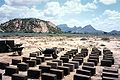 Brick construction samburu.jpg 567 × 379;62 KB
-
 Burial in the Storm.jpg 1,280 × 960;1.48 MB
-
 Chalbi Desert Panorama.jpg 2,997 × 1,333;1.37 MB
-
 Dhows in Kilifi Creek.JPG 1,000 × 1,500;428 KB
-
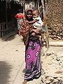 KangaSiyu1.jpg 1,704 × 2,272;766 KB
-
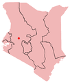
 KE-Busia.png 488 × 572;8 KB
-
 KE-Isiolo.png 488 × 572;8 KB
-
 KE-Maralal.png 488 × 572;7 KB
-
 KE-Marsabit.png 488 × 572;8 KB
-
 KE-Webuye.png 488 × 572;7 KB
-
 Kenya Topography.png 1,229 × 1,315;2.33 MB
-
 Kenya-Eastern.png 488 × 572;7 KB
-
 Kenya-Nyanza.png 488 × 572;7 KB
-
 Loita plains and hills.jpg 3,022 × 1,488;1.22 MB
-
 Map showing counties under the new Kenyan constitution.gif 620 × 804;56 KB
-
 Marafa Depression 2011.JPG 640 × 480;142 KB
-
 Nanyuki main street.jpg 1,000 × 750;434 KB
-
 Rift valley panorama (5232661210).jpg 2,048 × 485;1.06 MB
-
 Shimoni & Wasini.jpg 773 × 575;168 KB
-
 Siyu town at low tide..JPG 1,024 × 608;139 KB
-
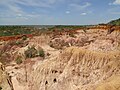
 Stone pit near Marsabit, North Kenya.jpg 3,456 × 2,592;4.04 MB
-
 Tracks Chalbi Desert.jpg 3,000 × 1,753;5 MB


.jpg)