Category:Geography of Krishnagiri district
Jump to navigation
Jump to search
Subcategories
This category has the following 3 subcategories, out of 3 total.
Media in category "Geography of Krishnagiri district"
The following 47 files are in this category, out of 47 total.
-
 14 SW View of Ootra-Durgum.jpg 10,788 × 7,538; 15.72 MB
-
 Alexander Allan - Woodia Droog.jpg 1,024 × 749; 75 KB
-
 Anchitty-Droog.jpg 930 × 712; 184 KB
-
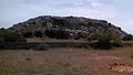
 Bargur, Krishnagiri Hills.JPG 3,888 × 2,592; 2.84 MB
-
 Calm Catchment.jpg 2,816 × 2,112; 2.23 MB
-
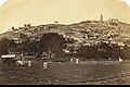 Chandra choodehwarar temple in 1860.jpg 714 × 477; 223 KB
-
 Farmer in villageatNH.jpg 2,016 × 1,512; 1.33 MB
-
 Gaganagarh or periyamalai.jpg 1,352 × 761; 136 KB
-
 Hosur bramma malai cave.jpg 1,600 × 900; 250 KB
-
 Hosur nealakke betta or bramman malai.jpg 1,600 × 900; 231 KB
-
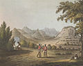
 Jag Deo and Warrangur, hill forts in the Barramah'l.jpg 712 × 505; 105 KB
-
 Kalavarapelli (also called Avalapalli) Dam.jpg 2,816 × 2,112; 2.28 MB
-
 Koosu Malai - panoramio.jpg 4,320 × 3,240; 5.29 MB
-
 Krish dam.jpg 800 × 600; 158 KB
-
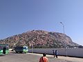
 Krishnagiri Bus Stand.jpg 1,280 × 720; 190 KB
-
 Lake in Hosur 4-19-2014 12-40-17 PM.JPG 1,600 × 1,200; 452 KB
-
 Landscape at Neel-Droog with horseriders, near Mysore, Karna Wellcome V0050511.jpg 3,100 × 2,309; 2.45 MB
-
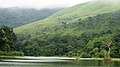 Misty Pamba Dam @ Gavi - panoramio (1).jpg 1,496 × 840; 384 KB
-
 Misty Pamba Dam @ Gavi - panoramio.jpg 1,496 × 840; 480 KB
-
 Neel Droog.jpg 931 × 712; 175 KB
-
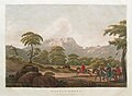
 Ourry Durgam, The Head Of The Pass Into The Barrah Mauhl.jpg 712 × 564; 132 KB
-
 Pamba Dam @ Gavi - panoramio (3).jpg 1,496 × 840; 732 KB
-
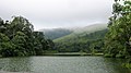 Pamba Dam @ Gavi - panoramio (6).jpg 1,496 × 840; 409 KB
-
 Pamba Dam @ Gavi - panoramio.jpg 1,496 × 840; 631 KB
-
 Pangapalli hills.jpeg 1,280 × 960; 167 KB
-
 Pangappalli dam.jpeg 1,280 × 960; 329 KB
-
 S.W. view of Ootra-Durgum (South West view of Ootra Durgum) (cropped).jpg 7,376 × 5,300; 9.38 MB
-
 SUPER HILL.jpg 3,264 × 2,448; 1.19 MB
-
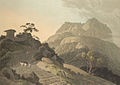
 Thomas Daniell - Near Anchetti Durgum - B2000.6.37 - Yale Center for British Art.jpg 1,920 × 1,351; 184 KB
-
 Verapadroog, in the Barramah'l.jpg 712 × 502; 101 KB
-
 View from Anchittidrug (Mysore). 1791.jpg 976 × 671; 133 KB
-
 View of Anchittidrug (Mysore). Between 1790 and 1792.jpg 976 × 635; 188 KB
-
 View of Hudedurgum in the Baramahal Hills. 7 May 1792.jpg 960 × 712; 122 KB
-

-

-
 William Daniell - Anchetti - B2000.6.38 - Yale Center for British Art.jpg 1,920 × 1,347; 172 KB
-
 Woodia Droog.jpg 954 × 712; 242 KB
-
 அஞ்செட்டி துர்கம் மலைக் குன்று.jpg 4,208 × 3,120; 4.15 MB
-
 கிருஷ்ணகிரி அணை 2.jpg 2,690 × 1,793; 1.89 MB
-
 கிருஷ்ணகிரி அணை.jpg 2,780 × 1,853; 2.93 MB
-
 நீலகிரி துர்கம் 1.jpg 4,208 × 3,120; 6.9 MB
-
 நீலகிரி துர்கம் 2.jpg 4,208 × 3,120; 6.39 MB
-
 நீலகிரி துர்கம் 3.jpg 4,208 × 3,120; 6.4 MB
-
 நீலகிரி துர்கம் 4.jpg 4,208 × 3,120; 3.39 MB
-
 நெடுங்கல் ஊரில் உள்ள நெடுங்கல்.jpg 1,280 × 960; 210 KB
-
 நெடுங்கல் ஊரில் ஏரி நீரில் பிரதிபலிக்கும் நெடுங்கல்.jpg 1,280 × 960; 164 KB
-
 பேவநத்தம் மலை.jpg 3,264 × 2,448; 528 KB


_Dam.jpg)


.jpg)


.jpg)
.jpg)


_(cropped).jpg)


._1791.jpg)
._Between_1790_and_1792.jpg)


