Category:Geography of South Australia
Перайсьці да навігацыі
Перайсьці да пошуку
States of Australia: New South Wales · Queensland · South Australia · Tasmania · Victoria · Western Australia
Internal territories of Australia: Australian Capital Territory · Jervis Bay · Northern Territory
External territories of Australia: Ashmore and Cartier Islands · Australian Antarctic Territory · Christmas Island · Cocos (Keeling) Islands · Coral Sea Islands · Heard Island and McDonald Islands · Norfolk Island
English: Geography of South Australia
| Загрузіць мэдыя | |||||
| Асобны выпадак панятку |
| ||||
|---|---|---|---|---|---|
| Падкляса ад | |||||
| Частка больш агульнага | |||||
| Цяперашняе месцазнаходжаньне |
| ||||
 | |||||
Падкатэгорыі
Гэтая катэгорыя зьмяшчае наступныя 14 падкатэгорыяў з 14 агулам.
Файлы ў катэгорыі «Geography of South Australia»
Паказаны 31 файл гэтай катэгорыі з 31.
-
 20040611 View West From Victor Harbor Bluff.jpg 2400 × 1800; 2,28 Мб
-
 Arkaringa.jpg 565 × 365; 49 кб
-
 Ausgeolbasic.jpg 918 × 845; 129 кб
-
 Complex Liesegang Ring at Witchelina .jpg 4864 × 2736; 2,83 Мб
-
 Detail of Liesegang Rings Fragments.jpg 4864 × 2736; 2,84 Мб
-
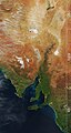 Eastern South Australia Satellite Photo.jpg 319 × 598; 41 кб
-
 Endless Stations 10 - On The Rim.jpg 2945 × 3000; 8,87 Мб
-
 Endless Stations 14 - A Small Peek at St Mary's Peak.jpg 3000 × 3000; 8,89 Мб
-
 GeographyOfSouthAustraliaJapaneseVersion.jpg 1440 × 1827; 534 кб
-
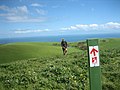 Heysen Trail near Waitpinga.jpg 2592 × 1944; 2,45 Мб
-
 Hiking in Aus banner 3.jpg 2592 × 370; 416 кб
-
 Hindmarsh District Council 1853.png 3088 × 2656; 12,33 Мб
-
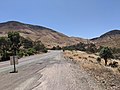 Horrocks Pass lookout.jpg 4032 × 3024; 5,37 Мб
-
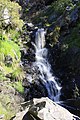 Ingalalla Waterfalls.jpg 3456 × 5184; 9,8 Мб
-
 Karoonda East Murray LGA.png 400 × 456; 30 кб
-
 Kychering Rocks, South Australia(GN00363).jpg 3264 × 2448; 1013 кб
-
 Lavender Federation Trail marker.JPG 3429 × 4572; 2,72 Мб
-
 Liesegang Ring at Witchelina Photo 1.jpg 4864 × 2736; 2,82 Мб
-
 Liesegang Ring at Witchelina Photo 2.jpg 4864 × 2736; 2,78 Мб
-
 Liesegang Rings at Witchelina Photo 1.jpg 4864 × 2736; 2,84 Мб
-
 Liesegang Rings at Witchelina Photo 2.jpg 4864 × 2736; 2,81 Мб
-
 MawsonPlateau-02.jpg 1024 × 768; 518 кб
-
 Mount Hill, South Australia.jpg 2048 × 1360; 940 кб
-
 Mount Lofty View Night.jpg 3000 × 1000; 1,33 Мб
-
 Multiple Liesegang Rings on face.jpg 4864 × 2736; 2,83 Мб
-
 Rabbit-erosion.jpg 341 × 256; 25 кб
-
 South Australia- Exploring Expedition into the Interior of the Continent (IA jstor-1799466).pdf 808 × 1241, 3 старонкі; 154 кб
-

-
 Wallaroo Town 1874.png 832 × 716; 1,08 Мб
-
 Witchelina Liesegang Ring Photo 1.jpg 4864 × 2736; 2,84 Мб
-
 Yatala District Council 1853.png 3200 × 2355; 13,16 Мб


.jpg)


_(1918)_(14756603746).jpg)