Category:Geological maps of the Czech Republic
Jump to navigation
Jump to search
Countries of Europe: Albania · Andorra · Armenia‡ · Austria · Azerbaijan‡ · Belgium · Bosnia and Herzegovina · Bulgaria · Croatia · Cyprus‡ · Czech Republic · Denmark · Estonia · Finland · France‡ · Georgia‡ · Germany · Greece · Hungary · Iceland · Republic of Ireland · Italy · Kazakhstan‡ · Latvia · Liechtenstein · Lithuania · Luxembourg · Moldova · Montenegro · Netherlands‡ · Norway · Poland · Portugal‡ · Romania · Russia‡ · Serbia · Slovakia · Slovenia · Spain‡ · Sweden · Switzerland · Turkey‡ · Ukraine · United Kingdom
Specific status: Svalbard
‡: partly located in Europe
Specific status: Svalbard
‡: partly located in Europe
Media in category "Geological maps of the Czech Republic"
The following 25 files are in this category, out of 25 total.
-

-
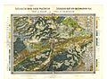
 Archiv für die naturwissenschaftliche Landesdurchforschung von Böhmen (1915) (20139638620).jpg 7,196 × 5,436; 13.14 MB
-
 Barrandium katzer 1891.jpg 2,671 × 2,435; 926 KB
-
 BoehmischerPfahl.svg 390 × 565; 151 KB
-
 GEO15.jpg 461 × 444; 118 KB
-
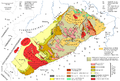
 Geological map of Moravia and Austrian Silesia.jpg 2,144 × 1,646; 1.67 MB
-
 Geological map prague bohemia 1877.jpg 3,882 × 2,856; 1.48 MB
-
 GeologicalMap.png 865 × 503; 63 KB
-
 Geologische-Karte-von-Böhmen-II-Umgebung-von-Teplitz-bis-Reichenberg.jpg 8,464 × 6,492; 12.59 MB
-
 Gliederung der Varisziden in Deutschland.jpg 1,323 × 1,356; 273 KB
-
 Gliederung der Varisziden in Mitteleuropa.jpg 1,910 × 1,290; 510 KB
-
 Hercynian structures Europe-en.svg 850 × 555; 131 KB
-
 Hercynian structures Europe-es.svg 2,239 × 1,455; 516 KB
-
 Hercynian structures Europe-it.svg 850 × 555; 104 KB
-
 Hercynides CS.svg 550 × 370; 108 KB
-
 Hibsch, GK100 Böhmisches Mittelgebirge, 1924.jpg 6,896 × 4,680; 7.94 MB
-
 Krusne Hory Erzgebirge.png 3,534 × 2,392; 1.4 MB
-
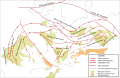
 Location of teschenite rocks.jpg 4,720 × 1,777; 372 KB
-
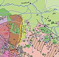
 Lokality v okolí Úžlabí u Voznice.jpg 1,000 × 750; 174 KB
-
 Nw europe grav plot 2.png 742 × 841; 880 KB
-
 Ottův slovník naučný - 2 Geologická mapa.jpg 2,408 × 1,810; 2.92 MB
-
 TBU-prezentace.jpg 2,186 × 1,424; 2.78 MB
-
 Varisztidák.png 603 × 288; 116 KB
-
 Vienna basin.png 2,194 × 1,890; 2.1 MB
-
 Železné hory - Hornosázavská vrchovina (geologická mapa) hrubý obrys hranic.jpg 1,002 × 493; 310 KB

_(20139638620).jpg)


_hrub%C3%BD_obrys_hranic.jpg)