Category:Global Positioning System
Mine navigeerimisribale
Mine otsikasti
American satellite-based radio navigation service   | |||||
| Laadi fail üles | |||||
| Üksikjuht nähtusest |
| ||||
|---|---|---|---|---|---|
| Mille alamklass |
| ||||
| Asukoht |
| ||||
| Kasutus | |||||
| Käitaja | |||||
| Koosseisu osa | |||||
| koduleht | |||||
| |||||
Alamkategooriad
Järgmised 28 alamkategooriat on selles kategoorias (kokku 28).
A
- Assisted GPS (11 P)
C
D
G
- Golf GPS (5 P)
- GPS drawing (2 P)
- GPS Logos (5 P)
I
- GPS integrated circuits (18 P)
N
- No GPS signs (8 P)
P
- Bradford Parkinson (5 P)
- People using GPS (39 P)
R
S
- GPS stations (8 P)
T
V
W
- Gladys West (8 P)
- Wherigo (13 P)
- Wide Area Augmentation System (14 P)
Leheküljed kategoorias "Global Positioning System"
Järgmised 2 lehekülge on selles kategoorias (kokku 2).
Failid kategoorias "Global Positioning System"
Järgmised 200 faili on selles kategoorias (kokku 200).
-
LL-Q188 (deu)-Jeuwre-GPS (d͡ʒiːpiːˈʔɛs).wav 1,8 s; 155 KB
-
LL-Q188 (deu)-Jeuwre-GPS (ɡeːpeːˈʔɛs).wav 1,8 s; 151 KB
-
 01 gpx coordinates.jpg 137 × 20; 23 KB
-
 02 gpx coordinates.jpg 191 × 46; 35 KB
-
 1992 CollierTrophyGPS.jpg 1063 × 2000; 1,76 MB
-
 A-GPS-Receiver.svg 512 × 648; 2 KB
-
 A-GPS.png 1124 × 991; 131 KB
-
 A-GPS.svg 1552 × 1038; 137 KB
-
 AFSPC and Lockheed Martin unveil GPS III model (151016-F-IN231-001).jpg 3000 × 2400; 5,03 MB
-
AIM SmartyCam Bike Diss Salzburgring 2009.webm 1 min 31 s, 426 × 240; 9,09 MB
-
 Altitudes Terre-Lune.svg 4600 × 800; 1,28 MB
-

-
Autonomous-Visual-Navigation-of-an-Indoor-Environment-Using-a-Parsimonious-Insect-Inspired-pone.0153706.s001.ogv 3,2 s, 1920 × 1080; 1,71 MB
-
Autonomous-Visual-Navigation-of-an-Indoor-Environment-Using-a-Parsimonious-Insect-Inspired-pone.0153706.s002.ogv 5,8 s, 1920 × 1080; 2,91 MB
-
Autonomous-Visual-Navigation-of-an-Indoor-Environment-Using-a-Parsimonious-Insect-Inspired-pone.0153706.s003.ogv 6,0 s, 1920 × 1080; 3,87 MB
-
Autonomous-Visual-Navigation-of-an-Indoor-Environment-Using-a-Parsimonious-Insect-Inspired-pone.0153706.s004.ogv 5,2 s, 1920 × 1080; 4,71 MB
-
-
-
 Bad gdop screen.svg 400 × 400; 14 KB
-
 Beijing mobility trajectories from the GeoLife dataset.png 1610 × 966; 1,15 MB
-
 Caposaldo centrino GPS (Cavanella d'Adige, Chioggia).jpg 3968 × 2976; 2,74 MB
-
 CelineLeBohec-CNRS-CSM GPS-TDR-Biologger.jpg 2560 × 1920; 1,16 MB
-
 CelineLeBohec-CNRS-CSM PIT-tag.jpg 1920 × 2560; 1,06 MB
-
 Circle sphere 2.jpg 800 × 600; 107 KB
-
 Col Bradford Parkinson USAF official photo.png 1100 × 1288; 1,21 MB
-
 Collar GPS Goiat.jpg 2048 × 3642; 1,2 MB
-
 Collar Os Goiat Canvi.jpg 2048 × 1152; 358 KB
-
 Common view - ilustrace.png 1834 × 1347; 30 KB
-
 Comparison of several satellite navigation system orbits-uk.svg 512 × 512; 55 KB
-
 Control Survey Pillar.jpg 3000 × 4000; 7,07 MB
-
 Costellazione satelliti GPS.jpg 425 × 330; 29 KB
-

-
 Deutsche Telekom, IFA 2018, Berlin (P1070260).jpg 3000 × 4000; 5,3 MB
-
 DGPS2.jpg 600 × 450; 119 KB
-
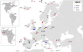 EGNOS map.svg 1600 × 1000; 778 KB
-
EN simpleshow foundation Maths GPS Satellite Navigation educational video.webm 3 min 33 s, 1920 × 1080; 21,37 MB
-
 Evolution of space, 2SOPS prepares for GPS Block III (5662972).jpg 5536 × 3327; 3,97 MB
-
 Evolution of space, 2SOPS prepares for GPS Block III (5662974).jpg 6975 × 2719; 5,65 MB
-
 Evolution of space, 2SOPS prepares for GPS Block III (5662976).jpg 5508 × 4032; 4,79 MB
-

-
 EXIF Reveal - GPS Info.png 463 × 580; 58 KB
-
-
 Forbes Visits 2 SOPS (8078326).jpg 5078 × 3385; 2,29 MB
-
 Forbes Visits 2 SOPS (8078327).jpg 4313 × 2875; 1,55 MB
-
 Forbes Visits 2 SOPS (8078330).jpg 4437 × 2958; 2,04 MB
-
 Forbes Visits 2 SOPS (8078334).jpg 4976 × 3317; 2,69 MB
-
 Forbes Visits 2 SOPS (8078335).jpg 3560 × 2373; 1,74 MB
-
 Geo09b4 700.jpg 700 × 394; 48 KB
-
 GeoFence.jpg 1145 × 601; 99 KB
-
 Geoid EGM96.gif 481 × 370; 78 KB
-
 Geolocalisation GPS GPRS.png 1024 × 768; 291 KB
-
 Geolocalisation GPS SAT.png 1024 × 768; 269 KB
-
 Geolocalisation.png 1536 × 1131; 398 KB
-
 Geometric Dilution Of Precision.svg 560 × 450; 13 KB
-
 Geotagging gThumb.png 501 × 645; 227 KB
-
 Gladys West and Sam Smith.jpg 1024 × 695; 78 KB
-
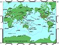 Global plate motion.jpg 700 × 530; 234 KB
-
 Gnss bandwidth.svg 600 × 350; 82 KB
-
 Good gdop screen.svg 400 × 400; 14 KB
-
 GPS 2.jpg 665 × 1440; 214 KB
-
 GPS Block1 ExplodedView.png 3012 × 2288; 700 KB
-
 Gps ca gold.svg 864 × 509; 12 KB
-
 Gps compass galileo frequency allocation Asimsky 05 2008.jpg 799 × 315; 32 KB
-
 GPS delay.svg 512 × 346; 40 KB
-
 Gps error diagram 2.svg 512 × 663; 36 KB
-
 Gps error diagram.svg 395 × 245; 12 KB
-
 GPS FOC 20th Anniversary is July 17, 2015 (150715-F-YZ649-001).jpg 1500 × 900; 167 KB
-
 GPS Hall Of Famers visit SMC's Heritage Center (1909776).jpeg 2524 × 1803; 3,73 MB
-
 GPS icon.gif 300 × 241; 28 KB
-
GPS III SV-06 arrives to the Space Coast (862373).webm 12 min 17 s, 3840 × 2160; 1,17 GB
-
 GPS III Twitter Infographic (5000606).jpeg 2500 × 2500; 4,4 MB
-
 GPS III.jpg 2400 × 1600; 369 KB
-
 GPS Interferometric Reflectometry at Friday Harbor.jpg 714 × 349; 27 KB
-
 Gps pic state of the art 2000 p 26.png 604 × 340; 89 KB
-
 GPS reflections cartoon.png 765 × 775; 53 KB
-
 GPS Refraction.svg 658 × 515; 13 KB
-
 GPS segmentation.png 766 × 601; 109 KB
-
 GPS signal modulation scheme bg.svg 950 × 625; 18 KB
-
 GPS signal modulation scheme Ja.svg 950 × 625; 17 KB
-
 GPS signal modulation scheme.svg 950 × 625; 18 KB
-
 GPS signal modulation scheme2.svg 750 × 625; 39 KB
-
 Gps signal.svg 350 × 440; 40 KB
-
 GPS Signals.png 1502 × 810; 221 KB
-
 GPS Spheres.svg 623 × 382; 39 KB
-
 GPS Toyota Rav4.jpg 614 × 367; 58 KB
-
 GPS tracker Hardware Architecture.png 751 × 620; 39 KB
-
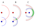
 GPS trilateration fig p1.jpg 743 × 378; 45 KB
-
 GPS trilateration fig p2.jpg 496 × 352; 31 KB
-
 GPS trilateration fig p3.jpg 712 × 419; 51 KB
-
 GPS trilateration fig1.jpg 831 × 1190; 158 KB
-
 Gps-atmosphericefects.xcf 849 × 837; 539 KB
-
 GPS-Empfang.png 1181 × 1004; 27 KB
-
 GPS-Genauigkeit yx-Abweichung.jpg 800 × 552; 46 KB
-
 Gps-kalibrierungspunkt daun-eifel.jpg 4000 × 2248; 1,66 MB
-
 Gps-multipath-efect.png 600 × 386; 513 KB
-
 Gps-multipath-efect.xcf 1486 × 956; 4,32 MB
-
 GPS-Tracking-Breakdown-LARGE-1024x511.png 1024 × 511; 150 KB
-
 GPS-treker.kg.gif 454 × 339; 26 KB
-
GPS.webm 3 min 32 s, 854 × 480; 15,42 MB
-
 GPS; Internet (5941021732).jpg 1602 × 2400; 883 KB
-
 GPS接收機方塊圖.JPG 558 × 240; 14 KB
-
 GRAVIMETRIC DATUM ORIENTATION mk.SVG 813 × 750; 321 KB
-
 GRAVIMETRIC DATUM ORIENTATION.GIF 650 × 691; 158 KB
-
 GRAVIMETRIC DATUM ORIENTATION.SVG 813 × 750; 20 KB
-
 HD@DH.nrw Prozesse begleiten 2.svg 512 × 349; 30 KB
-
 HD@DH.nrw Prozesse begleiten.svg 512 × 240; 31 KB
-
 IMG-20201018-WA0014.jpg 809 × 1080; 111 KB
-
 InitialAcquisition.png 1122 × 985; 237 KB
-
 IPP.svg 304 × 176; 45 KB
-
Jer-Pliaich'chie globale à satellite.ogg 2,1 s; 22 KB
-

-
 LaasArchitecture.jpg 400 × 273; 19 KB
-
 Lat 2spheres 2.jpg 800 × 600; 118 KB
-
 Lat 2spheres 2.svg 201 × 308; 29 KB
-
 Light cones.svg 344 × 310; 1,62 MB
-
 LoraGPS HAT sch.png 848 × 582; 97 KB
-

-
 Managers for the Timation program.jpg 2736 × 2096; 476 KB
-
 Map20070212 090000.gif 720 × 540; 89 KB
-
 Myagps.jpeg 220 × 229; 7 KB
-
 N2K-CABLING.jpg 3072 × 2304; 2,54 MB
-
 Navigation message GPS.png 1063 × 400; 63 KB
-
 Navigation Technology Satellite – II.jpg 1620 × 2649; 1,26 MB
-
 Ndrivelogo.jpg 280 × 200; 17 KB
-
 Nds-logo.png 110 × 78; 3 KB
-
 PAJ GPS.jpg 615 × 331; 13 KB
-
 Phase modulation BPSK GPS lang agnostic.svg 484 × 338; 16 KB
-
 Phase modulation BPSK GPS ru.svg 450 × 400; 21 KB
-
 Phase modulation BPSK GPS ua.svg 450 × 400; 22 KB
-
 Phase modulation BPSK GPS-Ja.svg 450 × 400; 21 KB
-
 Phase modulation BPSK GPS-ru.svg 762 × 666; 2 KB
-
 Phase modulation BPSK GPS.svg 450 × 400; 21 KB
-
 Pks2gps.png 512 × 512; 25 KB
-
 Poifile.jpg 480 × 360; 44 KB
-
 PRNExample.png 1080 × 720; 17 KB
-
 Retard marque horaire GPS.JPG 427 × 176; 6 KB
-
 Retard marque horaire GPS.svg 376 × 87; 7 KB
-
 Retardo señal horaria GPS.svg 376 × 87; 10 KB
-
 Rigid body rotation example for a tectonic plate.png 982 × 630; 108 KB
-
 Rigid body rotation example from a Ferris Wheel.png 987 × 579; 192 KB
-
 Roger Easton.jpg 372 × 271; 22 KB
-
 Réseau GNSS RTK Centipède.png 902 × 683; 232 KB
-
 SatelliteSignals1.png 966 × 707; 151 KB
-
 SatelliteSignals2.png 1007 × 663; 175 KB
-
 Segments2.png 465 × 313; 7 KB
-
 Shipping Satellites (5210876).jpg 7000 × 4667; 13,06 MB
-
 Shipping Satellites (5210890).jpg 7000 × 4350; 17,63 MB
-
 Shipping Satellites (5210893).jpg 7000 × 4667; 7,43 MB
-
 Shipping Satellites (5210906).jpg 7000 × 4667; 7,54 MB
-
 Shipping Satellites (5210966).jpg 7000 × 4841; 19,25 MB
-
 Shipping Satellites (5210969).jpg 7000 × 5384; 12,07 MB
-
 Shipping Satellites (5210971).jpg 7000 × 4667; 6,59 MB
-
 Shipping Satellites (5210976).jpg 7000 × 4667; 4,54 MB
-
 Shipping Satellites (5210987).jpg 7000 × 4667; 17,42 MB
-
 Shipping Satellites (5210996).jpg 7000 × 4667; 16,59 MB
-
 Shipping Satellites (5211003).jpg 7000 × 4667; 10,33 MB
-
 Shipping Satellites (5211017).jpg 7000 × 4364; 8,99 MB
-
 Shipping Satellites (5211029).jpg 7000 × 4667; 13,58 MB
-
 Shipping Satellites (5211031).jpg 7000 × 3976; 9,09 MB
-
 Shipping Satellites (5211044).jpg 7000 × 4369; 14,39 MB
-
 Shipping Satellites (5211064).jpg 7000 × 4667; 13,24 MB
-
 Shipping Satellites (5211093).jpg 7000 × 4667; 11,79 MB
-
 Shipping Satellites (5211107).jpg 7000 × 6198; 8,24 MB
-
 Shipping Satellites (5211123).jpg 7000 × 5326; 12,57 MB
-
 Shipping Satellites (5211132).jpg 7000 × 4667; 10,49 MB
-
 Shipping Satellites (5211137).jpg 7000 × 4667; 9,16 MB
-
 Shipping Satellites (5211139).jpg 7000 × 4667; 15,64 MB
-
 Shipping Satellites (5211141).jpg 7000 × 5148; 12,35 MB
-
 SiRFatlasIV.jpg 600 × 600; 227 KB
-
 Sistema de Coordenadas e Datum GPS Garmin.jpg 160 × 240; 15 KB
-
 Sphere clock cor.svg 637 × 522; 5 KB
-
 Sphere-intersect.png 581 × 419; 122 KB
-
 Sphere-intersect.svg 552 × 419; 9 KB
-
 Sphere2-intersect.svg 552 × 419; 8 KB
-
 Sphere3-intersect.svg 552 × 419; 16 KB
-
 Spilker Bldg Dedication 61 cropped.jpg 400 × 560; 86 KB
-
 Spilker Bldg Dedication 61.jpg 1770 × 1429; 1,38 MB
-
 Spilker Bldg Dedication 73.jpg 1346 × 1950; 1,55 MB
-
 TCP GPSoverIP Vergleich2.jpg 836 × 515; 59 KB
-
 TCPIP GPSoverIP Vergleich.jpg 836 × 513; 96 KB
-
 Temps de parcours GPS es.png 898 × 514; 215 KB
-
 Temps de parcours GPS.JPG 518 × 246; 14 KB
-
 Temps de parcours GPS.PNG 898 × 514; 182 KB
-
 Tibet - Trek 2 - 00 Tsurpu to Yangpachen Trek GPS coordinates pg1 (6336855991).jpg 1935 × 2592; 2,92 MB
-
 Tibet - Trek 2 - 00 Tsurpu to Yangpachen Trek GPS coordinates pg2 (6337611332).jpg 1935 × 2592; 2,78 MB
-
 Timation I (rectangular object in center of photo).jpg 2831 × 2265; 1,95 MB
-
 Trilaterazione esempio passo 2.png 1800 × 1242; 2,74 MB
-
 Trilaterazione Passo n. 1.png 1039 × 616; 671 KB
-
 Trilaterazione terzo passaggio.png 1800 × 1242; 2,73 MB
-
 Twstft de.svg 512 × 507; 14 KB
-
 VICSPopup.jpg 1425 × 950; 102 KB
-
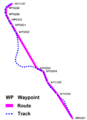 Wayroutrackp.png 323 × 444; 10 KB
-
 Waze logo 2022.png 1024 × 296; 18 KB
-
 Wialon gps tracking solution.jpg 1673 × 1126; 1008 KB
-
 Wialon telematics solution.png 1440 × 880; 924 KB
-
 WORLDWIDE GEOMETRIC SATELLITE TRIANGULATION NETWORK, BC-4 CAMERAS.GIF 1322 × 875; 121 KB
-
 WT-LOGO-2013.jpg 456 × 361; 29 KB
-
 Мохові поля о. Галіндез, привязка коодинат до місця.jpg 4162 × 2736; 4,24 MB
-
 ردیاب خودرو ماهواره ای.png 1024 × 511; 140 KB
-
 জিপিএস.png 480 × 638; 51 KB


.jpg)


.jpg)


.jpg)


.jpg)
.jpg)
_for_simple_Triangulation.png)

.jpg)
.jpg)
.jpg)
.jpg)
.jpg)


.jpg)
.jpeg)
.jpeg)


.jpg)


.jpeg)


.jpeg)


.jpg)
.jpg)
.jpg)
.jpg)
.jpg)
.jpg)
.jpg)
.jpg)
.jpg)
.jpg)
.jpg)
.jpg)
.jpg)
.jpg)
.jpg)
.jpg)
.jpg)
.jpg)
.jpg)
.jpg)
.jpg)
.jpg)
.jpg)


.jpg)
.jpg)
.jpg)


.jpg)
%E2%80%93Based_Offender_Tracking_System_(23355849050).jpg)