Category:Glungezer
Vai alla navigazione
Vai alla ricerca
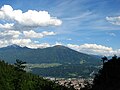
Deutsch: Der Glungezer ist ein 2.677 Meter hoher Berg in den Tuxer Alpen im österreichischen Bundesland Tirol.
English: Glungezer is a 2.677 Meter high mountain in the Tuxer Alpen, Tyrol, Austria
mountain _von_Innsbruck.JPG) | |||||
| Carica un file multimediale | |||||
| Istanza di | |||||
|---|---|---|---|---|---|
| Materiale usato | |||||
| Luogo | Tirolo, Austria | ||||
| Catena montuosa | |||||
| Prominenza topografica |
| ||||
| Isolamento topografico |
| ||||
| Altezza sul mare |
| ||||
 | |||||
Sottocategorie
Questa categoria contiene le 2 sottocategorie indicate di seguito, su un totale di 2.
B
- Glungezerbahn (20 F)
G
- Glungezerhütte (21 F)
File nella categoria "Glungezer"
Questa categoria contiene 30 file, indicati di seguito, su un totale di 30.
-
 12-06-05-aut-rom-freundschaftsspiel-485.jpg 3 216 × 2 136; 2,53 MB
-
 12-06-05-innsbruck-by-ralfr-172.jpg 3 216 × 2 136; 2,76 MB
-
 2767-2770 - Innsbruck - View from Weiherburggasse.jpg 8 136 × 2 544; 2,13 MB
-
 Blick vom Glungezer in das Inntal.JPG 2 048 × 1 536; 1,27 MB
-
 Blick vom Glungezer Richtung Osten.jpg 2 592 × 1 944; 2,3 MB
-
 Flugzeugunglück 1964.jpg 2 048 × 1 536; 509 KB
-
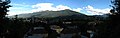
 Glungezer (Sonnenspitze) von Innsbruck.JPG 2 892 × 1 156; 659 KB
-
 Glungezer von Baumkirchen.jpg 3 456 × 2 304; 2,52 MB
-
 Glungezer von Osten.jpg 1 536 × 1 024; 1,52 MB
-
 Glungezer.jpg 2 000 × 1 342; 1,97 MB
-
 Glungezergipfel.jpg 2 062 × 2 480; 4,1 MB
-
 Glungezerhütte mit Sonnenspitze.JPG 4 527 × 3 253; 10,08 MB
-
 IMG 9060-Innsbruck.JPG 2 112 × 2 816; 6,85 MB
-
 Inn Muehlauer Bruecke.jpg 3 264 × 2 448; 2,37 MB
-
 Inn Shore and Mountains.jpg 3 000 × 4 000; 6,2 MB
-
 Inn und Innsbruck von oben.jpg 3 648 × 5 472; 4,33 MB
-
 Innsbruck - 29-47 - Patscherkofel, Innsbruck Südost.png 625 × 420; 771 KB
-
 Innsbruck-Arzl-Kalvarienbergkapelle.jpg 3 264 × 2 448; 3,36 MB
-
 Kalvarienbergkirche Arzl Norden.jpg 4 896 × 3 672; 6,53 MB
-
 Mils and Absam from N.jpg 3 476 × 2 076; 4,48 MB
-
 Panoramic view of Innsbruck from Hungerburg.jpg 9 968 × 2 477; 4,35 MB
-
 Patscherkofel aus dem Höttinger Graben.jpg 1 024 × 768; 608 KB
-
 Patscherkofel von Hötting.jpg 1 024 × 768; 667 KB
-
 Rechts Glungezer links Rosenjoch.JPG 4 608 × 2 891; 4,5 MB
-
 Schartenkogel.JPG 4 608 × 2 904; 9,3 MB
-
 Snow storm on Glungezer.JPG 3 872 × 2 592; 4,26 MB
-
 Tiroler Mittelland 2013-07 Mattes (230).JPG 3 648 × 2 736; 3,54 MB
-
 Tiroler Mittelland 2013-07 Mattes (249).JPG 2 592 × 1 944; 2,91 MB
-
 Voldertal mit westlicher Talumrahmung.jpg 3 872 × 2 592; 7,41 MB
-
 Von Windegg Richtung Glungenzer.JPG 4 394 × 2 290; 3,19 MB


.JPG)
.JPG)

