Category:Goole
Hopp til navigering
Hopp til søk
English: Goole is a town, civil parish and port located approximately 45 miles (72 km) inland on the confluence of the rivers Don and Ouse in the East Riding of Yorkshire, England.
town, civil parish and inland port in the East Riding of Yorkshire, England  | |||||
| Last opp mediefiler | |||||
| Forekomst av | |||||
|---|---|---|---|---|---|
| Plassering | East Riding of Yorkshire, Yorkshire og Humber, England | ||||
| Folketall |
| ||||
| Forskjellig fra | |||||
| offisielt nettsted | |||||
 | |||||
Underkategorier
Denne kategorien har følgende 19 underkategorier, av totalt 19.
B
C
- Cemeteries in Goole (2 filer)
G
H
I
M
O
- Old Goole (6 filer)
P
- Plaques in Goole (1 fil)
R
S
- Ships scrapped in Goole (tom)
T
W
- Woods of Goole (bus company) (3 filer)
Y
Filer i kategorien «Goole»
Følgende 200 filer er i denne kategorien, av totalt 471.
(forrige side) (neste side)-
 "Dog Crap Alley" - geograph.org.uk - 2930452.jpg 1 024 × 768; 197 KB
-
 "Fast Julia" manoeuvres into Goole Docks - geograph.org.uk - 5767389.jpg 1 024 × 768; 151 KB
-
 "Macintosh Arms" pub sign in Goole - geograph.org.uk - 4788401.jpg 3 704 × 4 842; 4,87 MB
-
 "Salt and Pepper" Water Towers, Goole - geograph.org.uk - 5459498.jpg 640 × 481; 420 KB
-
 "The Gate" community theatre, Goole - geograph.org.uk - 2249597.jpg 2 608 × 1 952; 1,11 MB
-
 "The Peacock" in Goole - geograph.org.uk - 4788392.jpg 4 764 × 3 613; 3,81 MB
-
 "The Port in Green Fields" - geograph.org.uk - 878238.jpg 640 × 433; 59 KB
-
 A walk from Goole ^1 - geograph.org.uk - 1991655.jpg 800 × 600; 286 KB
-
 A walk from Goole ^2 - geograph.org.uk - 1991661.jpg 800 × 600; 316 KB
-
 A walk from Goole ^4 - geograph.org.uk - 1991665.jpg 800 × 600; 210 KB
-
 A walk from Goole ^54 - geograph.org.uk - 1992027.jpg 800 × 600; 300 KB
-
 A walk from Goole ^55 - geograph.org.uk - 1992040.jpg 800 × 600; 247 KB
-
 A walk from Goole ^56 - geograph.org.uk - 1992042.jpg 800 × 600; 259 KB
-
 A walk from Goole ^57 - geograph.org.uk - 1992046.jpg 800 × 600; 166 KB
-
 A walk from Goole ^58 - geograph.org.uk - 1992051.jpg 800 × 600; 196 KB
-
 A walk from Goole ^59 - geograph.org.uk - 1992057.jpg 800 × 600; 238 KB
-
 A walk from Goole ^60 - geograph.org.uk - 1992063.jpg 800 × 600; 223 KB
-
 A walk from Goole ^61 - geograph.org.uk - 1992074.jpg 800 × 600; 212 KB
-
 A walk from Goole ^62 - geograph.org.uk - 1992080.jpg 800 × 600; 294 KB
-
 A walk from Goole ^63 - geograph.org.uk - 1992085.jpg 800 × 600; 174 KB
-
 A walk from Goole ^7 - geograph.org.uk - 1991683.jpg 800 × 600; 183 KB
-
 A. J. Jansen - 'Blazer' ERY WM 2008 4 1.jpg 800 × 445; 55 KB
-
 A. J. Jansen - 'Goole No. 10' ERY WM 2008 4 2.jpg 800 × 490; 55 KB
-
 A. J. Jansen - SS 'Douglas' ERY GOO G287.jpg 800 × 500; 68 KB
-
 A161 towards Crowle - geograph.org.uk - 2549796.jpg 1 600 × 1 200; 450 KB
-
 A161 towards Old Goole - geograph.org.uk - 2276079.jpg 1 600 × 1 200; 357 KB
-
 A614 Airmyn Road - geograph.org.uk - 5922682.jpg 1 024 × 710; 88 KB
-
 A614 Rawcliffe Road - geograph.org.uk - 5922677.jpg 1 024 × 769; 121 KB
-
 Abandoned crane - geograph.org.uk - 2533162.jpg 768 × 1 024; 102 KB
-

-
 Aire Street, Goole - geograph.org.uk - 4158428.jpg 1 600 × 1 064; 455 KB
-
 Aire ^ Calder Navigation with railway bridges - geograph.org.uk - 2741663.jpg 1 500 × 843; 1,11 MB
-
 Airmyn Road (A614) towards Goole - geograph.org.uk - 2024134.jpg 640 × 480; 64 KB
-
 Airmyn Road, Goole - geograph.org.uk - 5147180.jpg 1 600 × 1 200; 587 KB
-
 Aldham Dock and St. John's Church - geograph.org.uk - 2478062.jpg 1 024 × 768; 137 KB
-
 Aldham Dock, Goole (2) - geograph.org.uk - 2478049.jpg 1 024 × 768; 116 KB
-
 Aldham Dock, Goole (3) - geograph.org.uk - 2478056.jpg 1 024 × 768; 124 KB
-
 Aldham Dock, Goole - geograph.org.uk - 2478038.jpg 1 024 × 768; 133 KB
-
 Allotment shed by the track to Stanewell Farm - geograph.org.uk - 6085522.jpg 3 755 × 4 962; 5,14 MB
-
 Allotments off Moorland Road - geograph.org.uk - 5918608.jpg 1 600 × 1 064; 917 KB
-
 Allotments south of Old Goole - geograph.org.uk - 5918590.jpg 1 600 × 1 064; 696 KB
-

-
 Andrew Percy MP constituency office - geograph.org.uk - 5920625.jpg 1 600 × 1 064; 568 KB
-
 Approaching Goole (South Dock) Bridge - geograph.org.uk - 5459583.jpg 640 × 480; 367 KB
-
 At the entrance to Ouse Dock from Ship Dock, Goole - geograph.org.uk - 4788399.jpg 5 184 × 3 888; 5,77 MB
-
 Bandstand, riverside gardens - geograph.org.uk - 5278462.jpg 1 024 × 768; 124 KB
-
 Bank Chambers, Goole - geograph.org.uk - 1965182.jpg 1 024 × 768; 215 KB
-
 Barge Dock in Goole - geograph.org.uk - 4904190.jpg 4 608 × 3 456; 3,47 MB
-
 Barge Dock, Goole - geograph.org.uk - 5263621.jpg 1 024 × 768; 90 KB
-
 Barge on the Aire and Calder Navigation - geograph.org.uk - 5459586.jpg 640 × 481; 464 KB
-
 Barge Sobriety berthed at Yorkshire Waterways Museum - geograph.org.uk - 3136783.jpg 4 000 × 3 000; 2,38 MB
-
 Beneath Goole Bridge - geograph.org.uk - 2930349.jpg 1 024 × 768; 160 KB
-
 Big empty ship, Aldam Dock - geograph.org.uk - 2586496.jpg 1 024 × 768; 102 KB
-
 Boat Hoist Detail, Goole South Dock - geograph.org.uk - 5459059.jpg 640 × 481; 307 KB
-

-
 Boats on the Aire and Calder - geograph.org.uk - 1983405.jpg 768 × 1 024; 454 KB
-
 Boothferry Road goes over the M62 - geograph.org.uk - 2112438.jpg 800 × 600; 173 KB
-
 Boothferry Road, Goole - geograph.org.uk - 5920633.jpg 1 600 × 1 064; 503 KB
-
 Boothferry Road, Goole - geograph.org.uk - 5920643.jpg 1 600 × 1 064; 672 KB
-
 Bric-a-Brac shop, Marshfield Avenue, Goole - geograph.org.uk - 6082548.jpg 1 024 × 768; 169 KB
-
 Bridge over Earnshaw's Warping Drain - geograph.org.uk - 3803241.jpg 640 × 427; 49 KB
-
 Bridge Street at Albert Road - geograph.org.uk - 5463123.jpg 1 024 × 576; 114 KB
-
 Bridged access to West Dock, Goole - geograph.org.uk - 4695295.jpg 1 024 × 768; 123 KB
-
 Building site, Captains Close, Goole - geograph.org.uk - 2204970.jpg 640 × 480; 71 KB
-
 Building site, Old Goole - geograph.org.uk - 2204966.jpg 640 × 480; 59 KB
-
 Bungalows on Clifton Gardens - geograph.org.uk - 2224276.jpg 1 024 × 768; 130 KB
-

-
 Business premises, Aldam Dock, Goole - geograph.org.uk - 4695320.jpg 1 024 × 768; 110 KB
-

-
 Canal craft berthed at Yorkshire Waterways Museum - geograph.org.uk - 3136790.jpg 4 000 × 3 000; 2,28 MB
-
 Cemetery, Goole - geograph.org.uk - 2023572.jpg 640 × 480; 121 KB
-
 Centenary Road, Goole - geograph.org.uk - 2110880.jpg 800 × 600; 227 KB
-
 Centenary Road, Goole - geograph.org.uk - 5920450.jpg 1 600 × 1 064; 751 KB
-
 Centenary Road, Goole - geograph.org.uk - 5920454.jpg 1 600 × 1 064; 443 KB
-
 Centenary Road, Goole - geograph.org.uk - 5920458.jpg 1 600 × 1 064; 531 KB
-
 Centenary Road, Goole - geograph.org.uk - 5920483.jpg 1 600 × 1 064; 690 KB
-
 Centenary Road, Goole - geograph.org.uk - 5920486.jpg 1 600 × 1 064; 509 KB
-
 Centenary Road, Goole - geograph.org.uk - 5920489.jpg 1 600 × 1 064; 601 KB
-
 Church Close, Old Goole - geograph.org.uk - 2018187.jpg 1 024 × 768; 98 KB
-
 City ^ County on North Street, Goole - geograph.org.uk - 5920660.jpg 1 600 × 1 064; 506 KB
-
 City ^ County on North Street, Goole - geograph.org.uk - 5920662.jpg 1 370 × 1 600; 657 KB
-
 Clock tower, Goole - geograph.org.uk - 2422367.jpg 1 600 × 1 200; 396 KB
-
 Coal Wagon Hoist, Railway Dock - geograph.org.uk - 5459463.jpg 640 × 480; 352 KB
-

-
 Container crane, Ship Dock, Goole - geograph.org.uk - 4695289.jpg 1 024 × 768; 126 KB
-
 Container stack behind St. John's church - geograph.org.uk - 1965176.jpg 768 × 1 024; 136 KB
-
 Containers on the dockside - geograph.org.uk - 2483589.jpg 1 024 × 768; 128 KB
-
 Control room, Ocean Lock, Goole - geograph.org.uk - 3570782.jpg 1 024 × 768; 105 KB
-
 Converted windmill, Goole - geograph.org.uk - 5278451.jpg 1 024 × 768; 143 KB
-
 Corner of Grange Road and Dunhill Road, Goole - geograph.org.uk - 2249604.jpg 2 446 × 1 828; 968 KB
-
 Council Offices on Church Street, Goole - geograph.org.uk - 5920710.jpg 1 600 × 1 064; 717 KB
-
 Council Offices on Church Street, Goole - geograph.org.uk - 5920712.jpg 1 600 × 1 064; 602 KB
-

-
 Cross Street West, Goole - geograph.org.uk - 2249608.jpg 2 608 × 1 952; 1,2 MB
-
 Cycleway and footpath, M62 trading estate - geograph.org.uk - 2171814.jpg 1 024 × 768; 126 KB
-
 Dereliction in South Street - geograph.org.uk - 2477978.jpg 1 024 × 768; 144 KB
-
 Disused windmill and supermarket, Goole - geograph.org.uk - 2429411.jpg 1 600 × 1 200; 401 KB
-
 Dock gates, Goole - geograph.org.uk - 2478046.jpg 1 024 × 768; 160 KB
-
 Doorway, St. John's Street, Goole - geograph.org.uk - 1965179.jpg 2 448 × 3 264; 3,32 MB
-

-
 Dry Dock, Goole - geograph.org.uk - 5147161.jpg 1 600 × 1 200; 480 KB
-
 Dutch River Bridge - geograph.org.uk - 5538782.jpg 1 499 × 931; 1,4 MB
-

-
 Dutch River Mouth, Goole, at high tide - geograph.org.uk - 5513781.jpg 1 024 × 768; 114 KB
-
 Dutch River, Goole - geograph.org.uk - 2549743.jpg 1 600 × 1 200; 312 KB
-
 Dutch River, Goole - geograph.org.uk - 5920812.jpg 1 600 × 1 064; 707 KB
-
 Edible oil tanks at Goole Docks - geograph.org.uk - 5864174.jpg 1 499 × 1 006; 1,35 MB
-
 Entrance to Goole Joint Cadet Centre - geograph.org.uk - 4063316.jpg 1 024 × 768; 161 KB
-
 Entrance to Humber Street workshops - geograph.org.uk - 2018184.jpg 1 024 × 768; 133 KB
-
 Ex Pilot Cutter T. W. Prickett - geograph.org.uk - 4997784.jpg 2 289 × 3 067; 2,12 MB
-

-

-
 Farmland north of Rawcliffe Road - geograph.org.uk - 6082504.jpg 1 024 × 768; 127 KB
-
 Field with emerging crop - geograph.org.uk - 3824006.jpg 1 500 × 926; 1,16 MB
-
 Fields north of the A614 on the edge of Goole - geograph.org.uk - 5263164.jpg 1 024 × 768; 122 KB
-
 Flood bank along the Ouse - geograph.org.uk - 2018196.jpg 1 024 × 768; 149 KB
-
 Flood defences, River Ouse - geograph.org.uk - 2023569.jpg 640 × 480; 98 KB
-
 Flooded Drydock Goole Docks - geograph.org.uk - 3136765.jpg 4 000 × 3 000; 2,49 MB
-
 FolkSail event at the Yorkshire Waterways Museum - geograph.org.uk - 2586463.jpg 1 024 × 768; 123 KB
-
 Footpath and Flood bank by the River Ouse - geograph.org.uk - 4903973.jpg 4 552 × 3 390; 3,8 MB
-
 Former Lancashire ^ Yorkshire Railway Building - geograph.org.uk - 5920723.jpg 1 064 × 1 600; 660 KB
-
 Former School - geograph.org.uk - 2308204.jpg 1 024 × 768; 120 KB
-
 Former School on Moorland Road, Old Goole - geograph.org.uk - 5920854.jpg 1 600 × 1 064; 641 KB
-
 Former Yorkshire Electric Power Company - geograph.org.uk - 5920729.jpg 1 600 × 1 064; 527 KB
-
 Former Yorkshire Electric Power Company - geograph.org.uk - 5920756.jpg 1 600 × 1 064; 483 KB
-
 Gates to nowhere - geograph.org.uk - 2930455.jpg 1 024 × 768; 204 KB
-
 George VI postbox on Centenary Road, Goole - geograph.org.uk - 5920462.jpg 1 064 × 1 600; 818 KB
-
 Gibraltar Court Flats, North Street, Goole - geograph.org.uk - 4158438.jpg 1 600 × 1 071; 593 KB
-
 Goole - adult education buildings - geograph.org.uk - 3267852.jpg 1 184 × 1 600; 451 KB
-
 Goole - Arden House - geograph.org.uk - 3210228.jpg 1 600 × 1 312; 612 KB
-
 Goole - Bank Chambers - geograph.org.uk - 3268156.jpg 1 600 × 1 232; 688 KB
-
 Goole - Clock Tower and Bank Chambers - geograph.org.uk - 3268187.jpg 1 600 × 1 176; 556 KB
-
 Goole - Conservative Club - geograph.org.uk - 3268179.jpg 1 600 × 1 224; 486 KB
-
 Goole - former goods offices - geograph.org.uk - 3267849.jpg 1 600 × 1 239; 525 KB
-

-
 Goole - Fst 'N' Last Inn - geograph.org.uk - 1824463.jpg 1 600 × 1 200; 295 KB
-
 Goole - Haig Memorial Hall - geograph.org.uk - 3210237.jpg 640 × 267; 52 KB
-
 Goole - houses on Clifton Gardens - geograph.org.uk - 3210376.jpg 1 222 × 1 600; 547 KB
-
 Goole - Market Hall - geograph.org.uk - 3268191.jpg 1 600 × 1 207; 508 KB
-
 Goole - Methodist Church Hall - geograph.org.uk - 3210382.jpg 1 600 × 1 187; 484 KB
-
 Goole - Ocean Lock - geograph.org.uk - 1824449.jpg 1 600 × 1 192; 524 KB
-
 Goole - Parish Church spire - geograph.org.uk - 3268166.jpg 1 171 × 1 600; 497 KB
-
 Goole - shops on Boothferry Road - geograph.org.uk - 3210211.jpg 1 600 × 1 199; 566 KB
-
 Goole - shops on Pasture Road - geograph.org.uk - 3211574.jpg 1 600 × 877; 385 KB
-
 Goole - St Johns Street - geograph.org.uk - 3268160.jpg 468 × 640; 107 KB
-
 Goole - terrace on Hook Road - geograph.org.uk - 1824427.jpg 1 200 × 1 600; 449 KB
-
 Goole - The City ^ County - geograph.org.uk - 3267855.jpg 1 600 × 1 200; 475 KB
-
 Goole - The City ^ County and Art Deco building - geograph.org.uk - 3268173.jpg 1 600 × 1 181; 543 KB
-
 Goole - The Courtyard - geograph.org.uk - 3211581.jpg 1 600 × 1 233; 568 KB
-
 Goole - The Seaman's Memorial - geograph.org.uk - 4788388.jpg 3 772 × 4 977; 5,06 MB
-
 Goole - Yorkshire (Penny) Bank - geograph.org.uk - 3268182.jpg 1 600 × 1 217; 468 KB
-
 Goole Boathouse - geograph.org.uk - 5458949.jpg 640 × 480; 423 KB
-
 Goole Bridge carries Hull to Doncaster railway lines - geograph.org.uk - 4996749.jpg 3 068 × 2 302; 1,94 MB
-
 Goole Cemetery - geograph.org.uk - 6225144.jpg 1 600 × 1 065; 874 KB
-
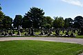 Goole Cemetery - geograph.org.uk - 6225147.jpg 1 600 × 1 065; 638 KB
-
 Goole Cemetery - geograph.org.uk - 6225149.jpg 1 600 × 1 065; 720 KB
-
 Goole Cemetery - geograph.org.uk - 6225151.jpg 1 600 × 1 065; 715 KB
-
 Goole Clock Tower, Goole - geograph.org.uk - 5920653.jpg 1 600 × 1 064; 459 KB
-
 Goole Docks - geograph.org.uk - 1881666.jpg 3 456 × 2 304; 4,92 MB
-
 Goole Docks - geograph.org.uk - 2549736.jpg 640 × 480; 54 KB
-
 Goole Docks - geograph.org.uk - 3737543.jpg 640 × 480; 69 KB
-
 Goole Docks - geograph.org.uk - 3737575.jpg 640 × 480; 58 KB
-
 Goole Docks - geograph.org.uk - 3737824.jpg 640 × 480; 61 KB
-
 Goole Docks - geograph.org.uk - 3737844.jpg 640 × 480; 55 KB
-
 Goole Docks - geograph.org.uk - 3742549.jpg 640 × 480; 38 KB
-
 Goole Docks - geograph.org.uk - 3742558.jpg 640 × 480; 59 KB
-
 Goole Docks - geograph.org.uk - 3758492.jpg 640 × 473; 60 KB
-

-
 Goole Docks - railway waggon lift. - geograph.org.uk - 3742531.jpg 480 × 640; 65 KB
-

-
 Goole Docks, Aldam Dock - geograph.org.uk - 1881660.jpg 3 456 × 2 304; 4,55 MB
-
 Goole Docks, Looking west - geograph.org.uk - 1881681.jpg 3 456 × 2 304; 4,71 MB
-
 Goole Docks, Lowther Bridge - geograph.org.uk - 5459425.jpg 640 × 481; 346 KB
-
 Goole Docks, Ocean Lock - geograph.org.uk - 1881665.jpg 3 456 × 2 304; 4,51 MB
-
 Goole Docks, Ocean Lock - geograph.org.uk - 1881668.jpg 3 456 × 2 304; 4,05 MB
-
 Goole Docks, Ocean Lock - geograph.org.uk - 5459548.jpg 640 × 427; 250 KB
-
 Goole Docks, The Iron Bridge - geograph.org.uk - 1881662.jpg 3 456 × 2 304; 4,37 MB
-
 Goole Grammar School - geograph.org.uk - 2249584.jpg 1 952 × 2 608; 1,27 MB
-
 Goole Harbour, South Dock - geograph.org.uk - 5459055.jpg 640 × 481; 366 KB
-
 Goole High School Academy playing fields - geograph.org.uk - 4280384.jpg 800 × 600; 197 KB
-
 Goole in distance - panoramio.jpg 3 264 × 2 448; 3,54 MB
-
 Goole Joint Cadet Centre, from the east - geograph.org.uk - 4063335.jpg 1 024 × 768; 141 KB
-
 Goole Joint Cadet Centre, from the rear (west) - geograph.org.uk - 4063321.jpg 1 024 × 768; 138 KB
-
 Goole Leisure Centre - geograph.org.uk - 3922964.jpg 640 × 480; 55 KB
-
 Goole Marina - geograph.org.uk - 5458973.jpg 640 × 427; 343 KB
-
 Goole Market Hall - geograph.org.uk - 4280375.jpg 800 × 600; 126 KB
-
 Goole Market Hall - geograph.org.uk - 5920649.jpg 1 600 × 1 064; 685 KB
-

-
 Goole rail bridge - geograph.org.uk - 6020374.jpg 1 024 × 768; 179 KB
-
 Goole railway station - geograph.org.uk - 2023559.jpg 640 × 480; 57 KB
-
 Goole Railway Station - geograph.org.uk - 4052868.jpg 640 × 480; 51 KB
-
 Goole railway station, Yorkshire - geograph.org.uk - 3259672.jpg 1 024 × 731; 153 KB
-
 Goole Reach (2) - geograph.org.uk - 2309236.jpg 1 024 × 768; 131 KB
-
 Goole Reach - geograph.org.uk - 2304058.jpg 1 024 × 768; 162 KB
-

-

-
 Goole shipyard offices - geograph.org.uk - 2098309.jpg 2 000 × 1 096; 1,65 MB
-
 Goole Siemens plant location.jpg 3 000 × 1 500; 963 KB
-
 Goole signal box - geograph.org.uk - 1881292.jpg 3 456 × 2 304; 4,51 MB
-
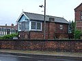 Goole Signal Box - geograph.org.uk - 4052877.jpg 640 × 480; 69 KB


_towards_Goole_-_geograph.org.uk_-_2024134.jpg)


_-_geograph.org.uk_-_2478049.jpg)
_-_geograph.org.uk_-_2478056.jpg)


_Bridge_-_geograph.org.uk_-_5459583.jpg)


_(26481289082).jpg)


_(28537127233).jpg)


_Bank_-_geograph.org.uk_-_3268182.jpg)


_-_geograph.org.uk_-_4063321.jpg)


_-_geograph.org.uk_-_2309236.jpg)

_(26481288932).jpg)
_(26507570401).jpg)


