Category:Haven (straat)
Jump to navigation
Jump to search
| Camera location | | View all coordinates using: OpenStreetMap |
|---|
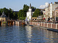
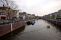
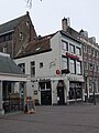
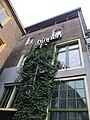
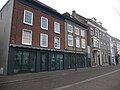
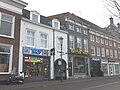
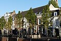
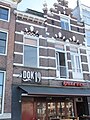
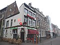
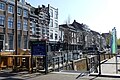
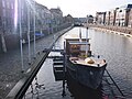
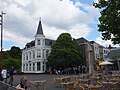
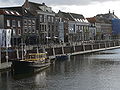
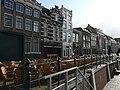
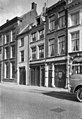
Nederlands: Afbeeldingen van de straat Haven, de straat aan de oostelijke kade van de Nieuwe Mark in de haven van Breda. Gelegen nabij de binnenstad van Breda in Breda in de provincie Noord-Brabant in het zuiden van Nederland. In de straat de Haven zijn diverse horeca-gelegenheden gevestigd met een terras langs de haven van Breda. In de straat de Haven is ook de aanlegsteiger voor een rondvaart door de singels van Breda (bron [1])
street in Breda, the Netherlands _DSCF2714.JPG) | |||||
| Upload media | |||||
| Instance of | |||||
|---|---|---|---|---|---|
| Named after | |||||
| Location | Breda, North Brabant, Netherlands | ||||
| Street address |
| ||||
 | |||||
Subcategories
This category has the following 16 subcategories, out of 16 total.
D
- Den Anker (21 F)
H
- Haven 1, Breda (6 F)
- Haven 10, Breda (3 F)
- Haven 14, Breda (5 F)
- Haven 15, Breda (5 F)
- Haven 2, Breda (9 F)
- Haven 20, Breda (5 F)
- Haven 22A, Breda (3 F)
- Haven 5, Breda (4 F)
- Haven 6, Breda (5 F)
- Haven 7, Breda (4 F)
- Haven 8, Breda (5 F)
- Haven 9, Breda (3 F)
- Havenbeeld (4 F)
R
- Rondvaart Breda (20 F)
V
- Vishal (Breda) (39 F)
Media in category "Haven (straat)"
The following 82 files are in this category, out of 82 total.
-
 07-17-2007 Nieuwe Haven 010.jpg 2,816 × 2,112; 2.92 MB
-
 13-06-27-breda-by-RalfR-081.jpg 2,848 × 4,288; 10.03 MB
-
 13-06-27-breda-by-RalfR-083.jpg 4,288 × 2,848; 9.02 MB
-
 13-06-27-breda-by-RalfR-086.jpg 4,288 × 2,848; 6.45 MB
-
 1403Haven Breda.JPG 2,304 × 1,728; 1.45 MB
-
 2010-04-25-breda-by-RalfR-21.jpg 3,008 × 2,000; 2.4 MB
-
 2010-04-25-breda-by-RalfR-22.jpg 3,008 × 2,000; 2.26 MB
-
 2010-04-25-breda-by-RalfR-23.jpg 3,008 × 2,000; 2.23 MB
-
 2010-05-21-breda-by-RalfR-05.jpg 3,008 × 2,000; 2.54 MB
-
 2010-05-21-breda-by-RalfR-06.jpg 3,008 × 2,000; 2.51 MB
-
 2010-05-21-breda-by-RalfR-07 pagebanner.jpg 6,617 × 945; 3.07 MB
-
 2010-05-21-breda-by-RalfR-07.jpg 6,617 × 2,862; 5.66 MB
-
 Betoverend Breda 2018 P1330749.jpg 4,000 × 2,672; 5.72 MB
-
 Breda city centre.JPG 2,736 × 3,648; 2.13 MB
-
 Breda Haven1.jpg 2,736 × 3,648; 4.49 MB
-
 Cafe de Huiskamer DSCF1976copy.jpg 2,112 × 2,816; 1.37 MB
-
 Detail Haven (straat) DDSCF2147.JPG 2,112 × 2,816; 2.76 MB
-
 Detail Haven (straat) DSCF2145.JPG 2,112 × 2,816; 2.76 MB
-
 Detail Haven (straat) DSCF2146.JPG 2,112 × 2,816; 2.7 MB
-
 Gevel Haven (straat) DSCF2150.JPG 2,816 × 2,112; 2.69 MB
-
 Haven (Breda) DSCF2693.JPG 2,816 × 2,112; 2.19 MB
-
 Haven (Breda) DSCF2694.JPG 2,816 × 2,112; 2.25 MB
-
 Haven (Breda) DSCF2696.JPG 2,816 × 2,112; 2.53 MB
-
 Haven (Breda) DSCF2705.JPG 2,816 × 2,112; 2.68 MB
-
 Haven (Breda) DSCF2708.JPG 2,112 × 2,816; 2.59 MB
-
 Haven (Breda) DSCF2711.JPG 2,112 × 2,816; 2.62 MB
-
 Haven (Breda) DSCF2712.JPG 2,816 × 2,112; 2.59 MB
-
 Haven (Breda) DSCF2720.JPG 2,816 × 2,112; 2.48 MB
-
 Haven (Breda) DSCF2731.JPG 2,816 × 2,112; 2.87 MB
-
 Haven (Breda) DSCF7644.jpg 2,816 × 1,864; 2.6 MB
-
 Haven (Breda) DSCF7646.jpg 2,816 × 1,864; 2.51 MB
-
 Haven (Breda) DSCF7650.jpg 2,816 × 1,864; 2.57 MB
-
 Haven (Breda) DSCF7655.jpg 2,816 × 1,864; 2.51 MB
-
 Haven (Breda) DSCF8562.JPG 2,816 × 2,112; 2.74 MB
-
 Haven (Breda) DSCF8569.JPG 2,816 × 2,112; 2.81 MB
-
 Haven (Breda) DSCF8718.JPG 2,816 × 2,112; 2.66 MB
-
 Haven (Breda) P1050829.JPG 3,264 × 2,448; 3.75 MB
-
 Haven (Straat) Breda P1320589.jpg 4,000 × 2,672; 5.93 MB
-
 Haven (straat) Breda P1320591.jpg 4,000 × 2,672; 6.1 MB
-
 Haven (straat) DSCF1646.JPG 2,112 × 2,816; 2.68 MB
-
 Haven (straat) DSCF2144.JPG 2,816 × 2,112; 2.67 MB
-
 Haven (straat) DSCF2151.JPG 2,112 × 2,816; 2.67 MB
-
 Haven (straat) DSCF2169.JPG 2,112 × 2,816; 2.59 MB
-
 Haven (straat) DSCF2185.JPG 2,112 × 2,816; 2.59 MB
-
 Haven (straat) DSCF2701.JPG 2,816 × 2,112; 2.23 MB
-
 Haven (straat) DSCF2702.JPG 2,816 × 2,112; 2.48 MB
-
 Haven (straat) DSCF2706.JPG 2,816 × 2,112; 2.24 MB
-
 Haven (straat) DSCF7647.jpg 2,816 × 1,864; 2.59 MB
-
 Haven (straat) DSCF7648.jpg 2,816 × 1,864; 2.54 MB
-
 Haven (straat) DSCF7649.jpg 2,816 × 1,864; 2.55 MB
-
 Haven (straat) DSCF7658.jpg 2,816 × 1,864; 2.48 MB
-
 Haven (straat) DSCF7659.jpg 2,816 × 1,864; 2.53 MB
-
 Haven (straat) DSCF7974.jpg 2,816 × 1,864; 2.45 MB
-
 Haven (straat) DSCF7981.jpg 2,816 × 1,864; 2.54 MB
-
 Haven (straat) DSCF7999.jpg 2,816 × 1,864; 2.54 MB
-
 Haven (straat) P1460821.jpg 4,000 × 2,672; 5.59 MB
-
 Haven (straat) P1460822.jpg 4,000 × 2,672; 6.12 MB
-
 Haven (Straat) P1460827.jpg 4,000 × 2,672; 6.15 MB
-
 Haven Breda DSCF1644.JPG 2,816 × 2,112; 2.75 MB
-
 Haven Breda DSCF1647.JPG 2,112 × 2,816; 2.66 MB
-
 Haven Breda DSCF2709.JPG 2,112 × 2,816; 2.52 MB
-
 Haven Breda DSCF8608.JPG 2,816 × 2,112; 2.6 MB
-
 Haven Breda DSCF8755.JPG 2,816 × 2,112; 2.86 MB
-
 Hoge Brug DSCF2692.JPG 2,816 × 2,112; 2.32 MB
-
 P1000876Haven.JPG 3,264 × 2,448; 3.85 MB
-
 P1000879Straat Haven.JPG 3,264 × 2,448; 3.71 MB
-
 P1000887copyHaven Breda.jpg 3,264 × 2,448; 4.33 MB
-
 P1000894copyHaven Breda.jpg 3,264 × 2,448; 5.24 MB
-
 P1000896 copyHoge brug Haven Breda.jpg 3,264 × 2,448; 5.39 MB
-
 P1020424Haven Breda.JPG 3,264 × 2,448; 3.72 MB
-
 P1030239 copyHaven Breda.jpg 3,264 × 2,448; 5.2 MB
-
 P1030783 copyHavenBreda.jpg 3,264 × 2,448; 2.17 MB
-
 P1030784 copyHavenBreda.jpg 3,264 × 2,448; 2.19 MB
-
 P1030785HavenBreda.JPG 3,264 × 2,448; 3.63 MB
-
 P1030786 copyHavenBreda.jpg 3,264 × 2,448; 1.83 MB
-
 Terras Haven DSCF8561.JPG 2,816 × 2,112; 2.74 MB
-
 Terras Havermarkt Breda DSCF8604.JPG 2,816 × 2,112; 2.77 MB
-
 Terras restaurant Binnen DSCF4894.jpg 2,048 × 1,536; 1.55 MB
-
 Vismarkt, Breda (14821969166).jpg 4,000 × 6,016; 19.52 MB
-
 Voorgevels - Breda - 20041228 - RCE.jpg 826 × 1,200; 229 KB
-
 Voorgevels - Breda - 20041234 - RCE.jpg 826 × 1,200; 273 KB
-
 Wageningen and Groningen (Netherlands, July-August 2020) - 28 (50553188958).jpg 5,472 × 3,648; 20.71 MB


_DDSCF2147.JPG)
_DSCF2145.JPG)
_DSCF2146.JPG)
_DSCF2150.JPG)
_DSCF2693.JPG)
_DSCF2694.JPG)
_DSCF2696.JPG)
_DSCF2705.JPG)
_DSCF2708.JPG)
_DSCF2711.JPG)
_DSCF2712.JPG)
_DSCF2720.JPG)
_DSCF2731.JPG)
_DSCF7644.jpg)
_DSCF7646.jpg)
_DSCF7650.jpg)
_DSCF7655.jpg)
_DSCF8562.JPG)
_DSCF8569.JPG)
_DSCF8718.JPG)
_P1050829.JPG)
_Breda_P1320589.jpg)
_Breda_P1320591.jpg)
_DSCF1646.JPG)
_DSCF2144.JPG)
_DSCF2151.JPG)
_DSCF2169.JPG)
_DSCF2185.JPG)
_DSCF2701.JPG)
_DSCF2702.JPG)
_DSCF2706.JPG)
_DSCF7647.jpg)
_DSCF7648.jpg)
_DSCF7649.jpg)
_DSCF7658.jpg)
_DSCF7659.jpg)
_DSCF7974.jpg)
_DSCF7981.jpg)
_DSCF7999.jpg)
_P1460821.jpg)
_P1460822.jpg)
_P1460827.jpg)


.jpg)


_-_28_(50553188958).jpg)