Category:Helmingham
Jump to navigation
Jump to search
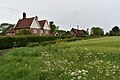
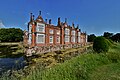
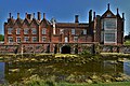
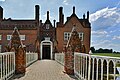
English: Helmingham is a village near Stowmarket, Suffolk. It is best known for its manor house Helmingham Hall. Its village church of St Mary's was first built as the estate church for the Hall. The village was the birthplace of Faith Emmeline Backhouse, mother of the war poet John Gillespie Magee.
village and civil parish in Suffolk, United Kingdom  Eglwys y Santes Fair, Helmingham | |||||
| Upload media | |||||
| Instance of | |||||
|---|---|---|---|---|---|
| Location | Mid Suffolk, Suffolk, East of England, England | ||||
 | |||||
Subcategories
This category has the following 3 subcategories, out of 3 total.
Media in category "Helmingham"
The following 200 files are in this category, out of 285 total.
(previous page) (next page)-
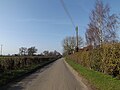
 A smart turnout. - geograph.org.uk - 2126364.jpg 3,648 × 2,736; 1.26 MB
-
 B1077 at the junction with B1079 - geograph.org.uk - 2552064.jpg 3,072 × 2,304; 1.46 MB
-
 B1077 at the junction with New Road - geograph.org.uk - 2552044.jpg 3,072 × 2,304; 1.17 MB
-
 B1077 Helmingham Road ^ footpath - geograph.org.uk - 4894498.jpg 3,072 × 2,304; 1.81 MB
-
 B1077 Helmingham Road ^ footpath - geograph.org.uk - 4894502.jpg 3,072 × 2,304; 1.82 MB
-
 B1077 Helmingham Road ^ footpath - geograph.org.uk - 4896014.jpg 3,072 × 2,304; 1.7 MB
-
 B1077 Helmingham Road ^ footpaths - geograph.org.uk - 4894486.jpg 3,072 × 2,304; 2.02 MB
-
 B1077 Helmingham Road, Helmingham - geograph.org.uk - 4689338.jpg 3,072 × 2,304; 1.99 MB
-
 B1077 Helmingham Road, Helmingham - geograph.org.uk - 4690650.jpg 3,072 × 2,304; 1.92 MB
-
 B1077 Helmingham Road, Helmingham - geograph.org.uk - 4690652.jpg 3,072 × 2,304; 1.85 MB
-
 B1077 Helmingham Road, Helmingham - geograph.org.uk - 4690691.jpg 3,072 × 2,304; 1.93 MB
-
 B1077 Helmingham Road, Helmingham - geograph.org.uk - 4690698.jpg 3,072 × 2,304; 1.8 MB
-
 B1077 Helmingham Road, Helmingham - geograph.org.uk - 4890177.jpg 3,072 × 2,304; 1.81 MB
-
 B1077 Helmingham Road, Helmingham - geograph.org.uk - 4894469.jpg 3,072 × 2,304; 1.86 MB
-
 B1077 Helmingham Road, Helmingham - geograph.org.uk - 4894485.jpg 3,072 × 2,304; 1.86 MB
-
 B1077 Helmingham Road, Helmingham - geograph.org.uk - 4946034.jpg 3,072 × 2,304; 1.68 MB
-
 B1077 Helmingham Road. Ashbocking - geograph.org.uk - 4895182.jpg 3,072 × 2,304; 1.68 MB
-
 B1077 Helmingham Road. Helmingham - geograph.org.uk - 4690988.jpg 3,072 × 2,304; 1.84 MB
-
 B1077 Helmingham Road. Helmingham - geograph.org.uk - 4946134.jpg 3,072 × 2,304; 1.89 MB
-
 B1077 Junction, Helmingham - geograph.org.uk - 4689170.jpg 3,072 × 2,304; 1.85 MB
-
 B1077 looking towards Framsden - geograph.org.uk - 2548920.jpg 3,072 × 2,304; 1.32 MB
-
 B1077 looking towards New Road - geograph.org.uk - 2552042.jpg 2,304 × 3,072; 1.65 MB
-
 B1077 near the footpath to Framsden - geograph.org.uk - 2557488.jpg 3,072 × 2,304; 1.25 MB
-
 B1077 to Framsden - geograph.org.uk - 2030266.jpg 3,072 × 2,304; 1.33 MB
-
 B1077 to Helmingham - geograph.org.uk - 2030262.jpg 3,072 × 2,304; 1.31 MB
-
 B1077 ^ the footpath to Framsden - geograph.org.uk - 2557498.jpg 3,072 × 2,304; 1.67 MB
-
 B1079 and footpaths to Gipsy and Hall Lanes - geograph.org.uk - 2552295.jpg 3,072 × 2,304; 1.45 MB
-
 B1079 approaching the junction with B1077 - geograph.org.uk - 2552063.jpg 3,072 × 2,304; 1.46 MB
-
 B1079 Helmingham Road - geograph.org.uk - 2558051.jpg 3,072 × 2,304; 1.35 MB
-
 B1079 Helmingham Road ^ Elm Farm - geograph.org.uk - 2558034.jpg 3,072 × 2,304; 1.41 MB
-
 B1079 Helmingham Road ^ the footpath to Hall Road - geograph.org.uk - 2558048.jpg 3,072 × 2,304; 1.5 MB
-
 B1079 Looking towards Otley - geograph.org.uk - 2558031.jpg 3,072 × 2,304; 1.51 MB
-
 B1079 near to Elm Farm - geograph.org.uk - 2557707.jpg 3,072 × 2,304; 1.4 MB
-
 Barn near Valley Farm - geograph.org.uk - 2557663.jpg 3,072 × 2,304; 1.39 MB
-
 Barn opposite Valley Farm - geograph.org.uk - 2432408.jpg 3,648 × 2,736; 2.67 MB
-
 Barns and sheds at Valley Farm - geograph.org.uk - 2432420.jpg 3,648 × 2,736; 1.97 MB
-
 Barns at Elm Farm - geograph.org.uk - 2557700.jpg 3,072 × 2,304; 1.39 MB
-
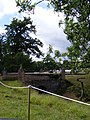 Bridge at Helmingham Hall - geograph.org.uk - 3574514.jpg 2,304 × 3,072; 1.45 MB
-
 Bridleway sign off Helmingham Road - geograph.org.uk - 4890988.jpg 2,304 × 3,072; 4.61 MB
-
 Bridleway to Pettaugh Lane - geograph.org.uk - 4890200.jpg 3,072 × 2,304; 1.93 MB
-
 Bridleway to Pettaugh Lane - geograph.org.uk - 4890215.jpg 2,304 × 3,072; 2.43 MB
-
 Bridleway to Pettaugh Lane - geograph.org.uk - 4894440.jpg 3,072 × 2,304; 1.94 MB
-
 Bus Shelter on the B1077 Helmingham Road - geograph.org.uk - 4946142.jpg 2,970 × 2,225; 4.21 MB
-
 Bus Shelter, Helmingham - geograph.org.uk - 1120513.jpg 3,072 × 2,304; 1.62 MB
-
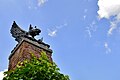
 Cobra Replica (33721212931).jpg 4,928 × 3,280; 4.27 MB
-
 'Helmingham Dell' by John Constable.jpg 2,000 × 1,477; 731 KB
-
 Constable - Study of trees in a park, perhaps Helmingham Park, 598-1888.jpg 1,875 × 2,500; 895 KB
-
 Cut path beside drainage ditch - geograph.org.uk - 2554761.jpg 2,448 × 3,264; 2.69 MB
-
 Dried-out watercourse, Helmingham Park - geograph.org.uk - 6237980.jpg 1,600 × 1,067; 758 KB
-
 Dunwich Dynamo 2015, Helmingham stop (2) - geograph.org.uk - 4562160.jpg 4,320 × 3,240; 3.38 MB
-
 Dunwich Dynamo 2015, Helmingham stop - geograph.org.uk - 4562154.jpg 4,320 × 3,240; 3.68 MB
-
 East Lodge at Helmingham Hall - geograph.org.uk - 4486982.jpg 1,024 × 768; 233 KB
-
 Edge Of Round Wood - geograph.org.uk - 3101753.jpg 1,024 × 768; 272 KB
-
 Elm Farm Barn, Helmingham - geograph.org.uk - 6167477.jpg 6,000 × 4,000; 6.67 MB
-
 Elm Farm sign - geograph.org.uk - 2557697.jpg 2,304 × 3,072; 1.38 MB
-
 Entrance to Helmingham Community Primary School - geograph.org.uk - 2552022.jpg 3,072 × 2,304; 1.51 MB
-
 Entrance to North Park Farm - geograph.org.uk - 2030302.jpg 3,072 × 2,304; 1.31 MB
-
 Entrance to Paris Farm ^ Bridleway to Gosbeck Road - geograph.org.uk - 4892566.jpg 3,072 × 2,304; 1.84 MB
-
 Farmhouse at Gables Farm, Ashbocking - geograph.org.uk - 6167501.jpg 6,000 × 4,000; 6.74 MB
-
 Farmyard at Elm Farm - geograph.org.uk - 2557701.jpg 3,072 × 2,304; 1.37 MB
-
 Field and gate near North Park Farm - geograph.org.uk - 2562459.jpg 3,648 × 2,736; 2.31 MB
-
 Field entrance off Gosbeck Road - geograph.org.uk - 4891035.jpg 3,072 × 2,304; 1.9 MB
-
 Field entrance off Gosbeck Road - geograph.org.uk - 4891041.jpg 2,304 × 3,072; 2.02 MB
-
 Field Of Wheat - geograph.org.uk - 3101836.jpg 1,024 × 768; 259 KB
-
 Field off the B1077 Helmingham Road - geograph.org.uk - 4894720.jpg 3,072 × 2,304; 1.8 MB
-
 Footpath - geograph.org.uk - 3100169.jpg 768 × 1,024; 387 KB
-
 Footpath - geograph.org.uk - 3101649.jpg 1,024 × 768; 207 KB
-
 Footpath - geograph.org.uk - 3101739.jpg 768 × 1,024; 302 KB
-
 Footpath - geograph.org.uk - 3101759.jpg 1,024 × 768; 280 KB
-
 Footpath Junction - geograph.org.uk - 3101780.jpg 1,024 × 768; 233 KB
-
 Footpath near Pearl's Farm - geograph.org.uk - 2286877.jpg 3,648 × 2,048; 2.03 MB
-
 Footpath off Gosbeck Road - geograph.org.uk - 4891028.jpg 3,072 × 2,304; 1.92 MB
-
 Footpath off Gosbeck Road - geograph.org.uk - 4891040.jpg 2,304 × 3,072; 2.59 MB
-
 Footpath off Gosbeck Road - geograph.org.uk - 4891586.jpg 3,072 × 2,304; 1.86 MB
-
 Footpath Off New Road - geograph.org.uk - 3111729.jpg 1,024 × 768; 270 KB
-
 Footpath off the B1077 Helmingham Road - geograph.org.uk - 4894499.jpg 3,072 × 2,304; 1.94 MB
-
 Footpath off the B1077 Helmingham Road - geograph.org.uk - 4894503.jpg 3,072 × 2,304; 2.04 MB
-
 Footpath off the B1077 Helmingham Road - geograph.org.uk - 4896018.jpg 3,072 × 2,304; 1.85 MB
-
 Footpath off the B1077 Helmingham Rosad - geograph.org.uk - 4690098.jpg 2,304 × 3,072; 2.75 MB
-
 Footpath sign off Gosbeck Road - geograph.org.uk - 4890976.jpg 2,304 × 3,072; 3.42 MB
-
 Footpath sign on the footpath to Ipswich Way - geograph.org.uk - 4946078.jpg 2,216 × 2,947; 5.95 MB
-
 Footpath through Helmingham Park - geograph.org.uk - 2554757.jpg 3,264 × 2,448; 2.35 MB
-
 Footpath to Basting Hall - geograph.org.uk - 2552314.jpg 3,072 × 2,304; 1.69 MB
-
 Footpath to Framsden - geograph.org.uk - 2552066.jpg 3,072 × 2,304; 1.64 MB
-
 Footpath to Framsden - geograph.org.uk - 2552069.jpg 3,072 × 2,304; 1.36 MB
-
 Footpath to Framsden - geograph.org.uk - 2557649.jpg 3,072 × 2,304; 1.47 MB
-
 Footpath to Framsden ^ Helmingham Primary School - geograph.org.uk - 2552041.jpg 3,072 × 2,304; 1.4 MB
-
 Footpath to Gosbeck Road - geograph.org.uk - 4894487.jpg 3,072 × 2,304; 1.96 MB
-
 Footpath to Gosbeck Road - geograph.org.uk - 4894489.jpg 3,072 × 2,304; 1.87 MB
-
 Footpath to Hall Lane - geograph.org.uk - 2557706.jpg 3,072 × 2,304; 1.51 MB
-
 Footpath to Hall Lane - geograph.org.uk - 2558021.jpg 3,072 × 2,304; 1.48 MB
-
 Footpath to Helmingham Church and the B1077 - geograph.org.uk - 2549467.jpg 3,072 × 2,304; 1.61 MB
-
 Footpath to Helmingham Church and the B1077 - geograph.org.uk - 2549645.jpg 2,304 × 3,072; 1.28 MB
-
 Footpath to Helmingham Church and the B1077 - geograph.org.uk - 2549647.jpg 3,072 × 2,304; 1.35 MB
-
 Footpath to Ipswich Way - geograph.org.uk - 4946064.jpg 3,072 × 2,304; 1.94 MB
-
 Footpath to Ipswich Way - geograph.org.uk - 4946073.jpg 3,072 × 2,304; 1.9 MB
-
 Footpath to New Road - geograph.org.uk - 2552032.jpg 3,072 × 2,304; 1.35 MB
-
 Footpath to North Park Farm, Helmingham Church ^ the A1120 - geograph.org.uk - 2030224.jpg 2,304 × 3,072; 1.44 MB
-
 Footpath to the B1077 - geograph.org.uk - 2030280.jpg 2,304 × 3,072; 1.52 MB
-
 Footpath to the B1077 - geograph.org.uk - 2552093.jpg 3,072 × 2,304; 1.27 MB
-
 Footpath to the B1077 - geograph.org.uk - 2557681.jpg 2,304 × 3,072; 1.66 MB
-
 Footpath to the B1077 - geograph.org.uk - 2557682.jpg 2,304 × 3,072; 1.38 MB
-
 Footpath to the B1077 - geograph.org.uk - 2557688.jpg 3,072 × 2,304; 1.43 MB
-
 Footpath to the B1077 at Framsden - geograph.org.uk - 2030194.jpg 3,072 × 2,304; 1.27 MB
-
 Footpath to the B1077 at Framsden - geograph.org.uk - 2549448.jpg 3,072 × 2,304; 1.69 MB
-
 Footpath to the B1077 Helmingham Road - geograph.org.uk - 4890211.jpg 3,072 × 2,304; 2 MB
-
 Footpath to the B1077 ^ Highrow Wood - geograph.org.uk - 2552017.jpg 2,304 × 3,072; 1.63 MB
-
 Footpath to the B1077 ^ Paris Farm - geograph.org.uk - 2548926.jpg 2,304 × 3,072; 1.62 MB
-
 Footpath to the B1077 ^ Paris Farm - geograph.org.uk - 2548932.jpg 3,072 × 2,304; 1.4 MB
-
 Footpath to the B1077 ^ Paris Farm - geograph.org.uk - 2549452.jpg 2,304 × 3,072; 1.63 MB
-
 Footpath to the B1079 - geograph.org.uk - 2552092.jpg 3,072 × 2,304; 1.49 MB
-
 Footpath to the B1079 - geograph.org.uk - 4690658.jpg 2,291 × 2,577; 3.64 MB
-
 Footpath to the B1079 - geograph.org.uk - 4690659.jpg 2,304 × 3,072; 3.03 MB
-
 Footpath to the B1079 - geograph.org.uk - 4894490.jpg 3,072 × 2,304; 1.66 MB
-
 Footpath ^ Bus Shelter - geograph.org.uk - 3574637.jpg 3,072 × 2,304; 1.63 MB
-
 Front Lodges and gateway (1) - geograph.org.uk - 5115848.jpg 4,309 × 3,233; 2.4 MB
-
 Front Lodges and gateway (2) - geograph.org.uk - 5115850.jpg 4,320 × 3,240; 3.91 MB
-
 Front Lodges and gateway (3) - geograph.org.uk - 5115851.jpg 4,161 × 3,121; 3 MB
-
 Front Lodges and gateway (4) - geograph.org.uk - 5115856.jpg 4,320 × 3,240; 4.04 MB
-
 Gate - geograph.org.uk - 3101663.jpg 768 × 1,024; 238 KB
-
 Gate Houses - geograph.org.uk - 3101720.jpg 1,024 × 768; 229 KB
-
 Gate of the footpath to the B1077 ^ Paris Farm - geograph.org.uk - 2548929.jpg 2,304 × 3,072; 1.51 MB
-
 Gates of St.Mary's Church - geograph.org.uk - 4690655.jpg 3,072 × 2,304; 2.01 MB
-
 Gosbeck Road ^ Bridleway - geograph.org.uk - 4890207.jpg 3,072 × 2,304; 1.91 MB
-
 Gosbeck Road ^ Bridleway - geograph.org.uk - 4894431.jpg 3,072 × 2,304; 1.91 MB
-
 Gosbeck Road ^ footpath - geograph.org.uk - 4890201.jpg 3,072 × 2,304; 1.8 MB
-
 Gosbeck Road ^ footpath - geograph.org.uk - 4890983.jpg 3,072 × 2,304; 1.82 MB
-
 Gosbeck Road ^ footpath - geograph.org.uk - 4891022.jpg 3,072 × 2,304; 1.93 MB
-
 Gosbeck Road, Helmingham - geograph.org.uk - 4890183.jpg 3,072 × 2,304; 1.68 MB
-
 Gosbeck Road, Helmingham - geograph.org.uk - 4890190.jpg 3,072 × 2,304; 1.82 MB
-
 Gosbeck Road, Helmingham - geograph.org.uk - 4890999.jpg 3,072 × 2,304; 1.63 MB
-
 Gosbeck Road, Helmingham - geograph.org.uk - 4891009.jpg 3,072 × 2,304; 1.78 MB
-
 Gosbeck Road, Helmingham - geograph.org.uk - 4891013.jpg 3,072 × 2,304; 1.74 MB
-
 Gosbeck Road, Helmingham - geograph.org.uk - 4891026.jpg 3,072 × 2,304; 1.76 MB
-
 Gosbeck Road, Helmingham - geograph.org.uk - 4891030.jpg 3,072 × 2,304; 2.09 MB
-
 Gosbeck Road, Helmingham - geograph.org.uk - 4891039.jpg 3,072 × 2,304; 2.09 MB
-
 Gosbeck Road, Helmingham - geograph.org.uk - 4891599.jpg 3,072 × 2,304; 1.75 MB
-
 Gosbeck Road, Helmingham - geograph.org.uk - 4891610.jpg 3,072 × 2,304; 1.66 MB
-
 Gosbeck Road, Helmingham - geograph.org.uk - 4891669.jpg 3,072 × 2,304; 1.89 MB
-
 Gosbeck Road, Helmingham - geograph.org.uk - 4894424.jpg 2,946 × 2,207; 1.7 MB
-
 Gosbeck Road, Helmingham - geograph.org.uk - 4894427.jpg 3,072 × 2,267; 3.84 MB
-
 Gosbeck Road, Helmingham - geograph.org.uk - 4894434.jpg 3,072 × 2,304; 1.74 MB
-
 Gosbeck Road, Helmingham - geograph.org.uk - 4894445.jpg 2,912 × 2,181; 3.33 MB
-
 Green Tree - geograph.org.uk - 3100087.jpg 768 × 1,024; 242 KB
-
 Harvested Field - geograph.org.uk - 3100115.jpg 1,024 × 768; 215 KB
-
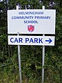 Helmingham Community Primary School sign - geograph.org.uk - 2552019.jpg 2,304 × 3,072; 1.42 MB
-
 Helmingham Estate Yard - geograph.org.uk - 2251821.jpg 3,648 × 2,736; 2.11 MB
-
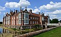
 Helmingham Hall - geograph.org.uk - 5352974.jpg 2,942 × 1,956; 1.56 MB
-
 Helmingham Hall - geograph.org.uk - 5434012.jpg 3,662 × 2,431; 4.29 MB
-
 Helmingham Hall - geograph.org.uk - 5435927.jpg 4,206 × 2,629; 5.43 MB
-
 Helmingham Hall - geograph.org.uk - 5435967.jpg 5,042 × 3,080; 7.7 MB
-
 Helmingham Hall - geograph.org.uk - 5435971.jpg 4,337 × 2,662; 7.13 MB
-
 Helmingham Hall - geograph.org.uk - 5465098.jpg 5,520 × 3,680; 4.98 MB
-
 Helmingham Hall - geograph.org.uk - 5465101.jpg 5,520 × 3,680; 4.96 MB
-
 Helmingham Hall - geograph.org.uk - 5465104.jpg 4,390 × 2,928; 2.88 MB
-
 Helmingham Hall - geograph.org.uk - 5465107.jpg 5,353 × 3,569; 3.7 MB
-
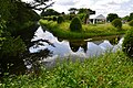
 Helmingham Hall across the lake - geograph.org.uk - 4486981.jpg 3,456 × 2,592; 3.89 MB
-
 Helmingham Hall and gardens (10) (geograph 6730904).jpg 4,223 × 3,167; 3.25 MB
-
 Helmingham Hall and gardens (11) (geograph 6730906).jpg 3,240 × 4,320; 3.79 MB
-
 Helmingham Hall and gardens (12) (geograph 6730908).jpg 3,167 × 4,223; 4.15 MB
-
 Helmingham Hall and gardens (23) (geograph 6730964).jpg 4,135 × 3,101; 2.91 MB
-
 Helmingham Hall and gardens (24) (geograph 6730973).jpg 4,067 × 3,051; 3.3 MB
-
 Helmingham Hall and gardens (3) (geograph 6730895).jpg 2,911 × 3,881; 2.51 MB
-
 Helmingham Hall from the lakes - geograph.org.uk - 4486979.jpg 1,024 × 768; 181 KB
-
 Helmingham Hall from the Rose Garden - geograph.org.uk - 5435950.jpg 3,611 × 2,345; 5.3 MB
-
 Helmingham Hall from the Walled Kitchen Garden - geograph.org.uk - 5465082.jpg 5,319 × 3,547; 4.12 MB
-
 Helmingham Hall gates - geograph.org.uk - 3648250.jpg 640 × 427; 110 KB
-
 Helmingham Hall Lodge - geograph.org.uk - 3648232.jpg 640 × 427; 107 KB
-
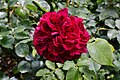 Helmingham Hall Rose Garden, Rosa "William Shakespeare" - geograph.org.uk - 5435947.jpg 3,678 × 2,456; 3.28 MB
-
 Helmingham Hall, Centaurea macrocephala - geograph.org.uk - 5436070.jpg 3,678 × 2,456; 4.49 MB
-
 Helmingham Hall, Clematis at the entry to the Topiary Border - geograph.org.uk - 5434013.jpg 3,679 × 2,456; 5.29 MB
-
 Helmingham Hall, Drawbridge - geograph.org.uk - 5435934.jpg 3,678 × 2,456; 4.79 MB
-
 Helmingham Hall, Drawbridge - geograph.org.uk - 5435965.jpg 4,390 × 2,901; 7.42 MB
-
 Helmingham Hall, Entrance to the Walled Kitchen Garden - geograph.org.uk - 5436044.jpg 3,678 × 2,455; 3.29 MB
-
 Helmingham Hall, Lily in the Colour Themed Border - geograph.org.uk - 5436040.jpg 3,678 × 2,456; 4.08 MB
-
 Helmingham Hall, Meadow Brown butterfly - geograph.org.uk - 5436067.jpg 3,678 × 2,456; 4.58 MB
-
 Helmingham Hall, Moat and Yew Walk on its left - geograph.org.uk - 5435974.jpg 3,678 × 2,456; 4.96 MB
-

-
 Helmingham Hall, Poppies 1 - geograph.org.uk - 5436046.jpg 3,678 × 2,456; 4.98 MB
-
 Helmingham Hall, Poppies 2 - geograph.org.uk - 5436053.jpg 3,678 × 2,455; 4.3 MB
-
 Helmingham Hall, Poppies 3 - geograph.org.uk - 5436063.jpg 3,678 × 2,456; 6.37 MB
-
 Helmingham Hall, Rose and fruit tree arch - geograph.org.uk - 5436004.jpg 3,678 × 2,455; 5.58 MB
-
 Helmingham Hall, Rose garlanded sculpture in the Rose Garden - geograph.org.uk - 5435939.jpg 3,678 × 2,456; 5.76 MB
-

-
 Helmingham Hall, south west aspect - geograph.org.uk - 5435978.jpg 4,941 × 3,226; 7.24 MB
-
 Helmingham Hall, The entrance to the Colour Themed Border - geograph.org.uk - 5465089.jpg 4,709 × 3,140; 3.41 MB
-
-
 Helmingham Hall, The Hot Border and Topiary Border - geograph.org.uk - 5435989.jpg 3,678 × 2,456; 5.43 MB
-
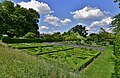
 Helmingham Hall, The Knot and Herb Gardens - geograph.org.uk - 5435936.jpg 4,472 × 2,896; 6.83 MB
-
 Helmingham Hall, The North Border - geograph.org.uk - 5436007.jpg 3,679 × 2,455; 4.61 MB
-
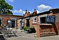 Helmingham Hall, The shop and ice cream parlour - geograph.org.uk - 5434015.jpg 4,119 × 2,771; 5.57 MB
-
 Helmingham Hall, The Sweet Pea Tunnel - geograph.org.uk - 5436012.jpg 4,196 × 2,312; 6.29 MB
-
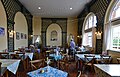 Helmingham Hall, The tea room - geograph.org.uk - 5434018.jpg 4,858 × 3,124; 5.85 MB
-
 Helmingham Hall, The Topiary Border - geograph.org.uk - 5465069.jpg 3,680 × 5,520; 4.79 MB
-
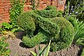
 Helmingham Hall, The Topiary Border, king frog - geograph.org.uk - 5465077.jpg 5,520 × 3,680; 7.01 MB
-
 Helmingham Hall, The Topiary Border, rabbit - geograph.org.uk - 5465074.jpg 5,520 × 3,680; 6.36 MB
-
 Helmingham Hall, The wooden bridge to the Wildflower Garden - geograph.org.uk - 5465095.jpg 4,897 × 3,264; 4.85 MB
-
 Helmingham Hall, Topiary Border, "The Snowman" - geograph.org.uk - 5435994.jpg 3,634 × 2,375; 5.93 MB
-
 Helmingham Hall, Yellow scabious - geograph.org.uk - 5436034.jpg 3,679 × 2,456; 3.8 MB
-
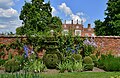
 Helmingham Park - geograph.org.uk - 3574519.jpg 3,072 × 2,304; 1.38 MB


.jpg)


_-_geograph.org.uk_-_4562160.jpg)


_-_geograph.org.uk_-_5115848.jpg)
_-_geograph.org.uk_-_5115850.jpg)
_-_geograph.org.uk_-_5115851.jpg)
_-_geograph.org.uk_-_5115856.jpg)


_(geograph_6730904).jpg)
_(geograph_6730906).jpg)
_(geograph_6730908).jpg)
_(geograph_6730964).jpg)
_(geograph_6730973).jpg)
_(geograph_6730895).jpg)


