Category:Hemswell Cliff
Jump to navigation
Jump to search
English: Hemswell Cliff is a village and civil parish in the West Lindsey district of Lincolnshire, England. According to the 2001 census it had a population of 683. It is on the A631 between Caenby Corner and Gainsborough and on the escarpment of Lincoln Cliff.
human settlement in United Kingdom  | |||||
| Upload media | |||||
| Instance of | |||||
|---|---|---|---|---|---|
| Location | West Lindsey, Lincolnshire, East Midlands, England | ||||
 | |||||
Media in category "Hemswell Cliff"
The following 104 files are in this category, out of 104 total.
-
 A load of rubbish - geograph.org.uk - 5933003.jpg 6,032 × 4,014; 6.47 MB
-
 A U turn on Spital Lane - geograph.org.uk - 3514843.jpg 1,336 × 839; 1,001 KB
-
 A15 - geograph.org.uk - 5350408.jpg 640 × 426; 80 KB
-
 A15 - geograph.org.uk - 5350414.jpg 640 × 426; 42 KB
-
 A15 - geograph.org.uk - 5350418.jpg 640 × 426; 53 KB
-
 A15 approaching junction with Norton Lane - geograph.org.uk - 3791581.jpg 2,666 × 1,784; 2.35 MB
-
 A15 towards Lincoln - geograph.org.uk - 3111794.jpg 640 × 480; 41 KB
-
 A631 towards Gainsborough - geograph.org.uk - 2987781.jpg 640 × 480; 63 KB
-
 Abandoned courts - geograph.org.uk - 2495420.jpg 1,024 × 768; 124 KB
-
 Abandoned shop, Hemswell Cliff - geograph.org.uk - 2495381.jpg 1,024 × 768; 186 KB
-
 B1398 heading north - geograph.org.uk - 3110123.jpg 640 × 480; 56 KB
-
 Behind the cafe - geograph.org.uk - 5933000.jpg 6,032 × 4,014; 3.45 MB
-

-
 BP garage at Caenby Corner - geograph.org.uk - 6231824.jpg 1,920 × 1,280; 1.27 MB
-
 BP garage at Caenby Corner - geograph.org.uk - 6231825.jpg 1,888 × 1,232; 1.17 MB
-
 BP garage at Caenby Corner - geograph.org.uk - 6231826.jpg 1,920 × 1,280; 1.44 MB
-
 Buchanan Road at the junction of Capper Avenue - geograph.org.uk - 5651234.jpg 2,004 × 1,476; 793 KB
-
 Building 2 from Building 1 - geograph.org.uk - 4325552.jpg 640 × 480; 51 KB
-
 Buildings at the former RAF Hemswell - geograph.org.uk - 2291211.jpg 800 × 600; 302 KB
-
 Burger Bar - geograph.org.uk - 5932998.jpg 6,032 × 4,014; 3.86 MB
-
 Caenby Corner cafe - geograph.org.uk - 1956733.jpg 640 × 480; 57 KB
-
 Canberra Antiques - geograph.org.uk - 2495409.jpg 1,024 × 768; 174 KB
-
 Capper Avenue, Hemswell Cliff - geograph.org.uk - 5651238.jpg 2,048 × 1,536; 1.48 MB
-
 Cherry Blossom - geograph.org.uk - 418099.jpg 640 × 472; 110 KB
-
 Cherry blossom avenue - geograph.org.uk - 418090.jpg 640 × 480; 90 KB
-
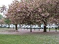 Cherry blossom time - geograph.org.uk - 418088.jpg 640 × 480; 130 KB
-
 Clugston Lorry - geograph.org.uk - 5933005.jpg 6,032 × 4,014; 5.04 MB
-
 Craft Centre - geograph.org.uk - 2495424.jpg 1,024 × 768; 176 KB
-
 Cromwell House and former Inn Spital in the Street - geograph.org.uk - 4472770.jpg 5,184 × 3,456; 7.44 MB
-
 Crop field east of Harpswell - geograph.org.uk - 3110132.jpg 640 × 480; 87 KB
-
 Crop field, Hemswell Cliff - geograph.org.uk - 2987784.jpg 640 × 480; 94 KB
-

-
 Entering Hemswell Cliff on A631 - geograph.org.uk - 4569020.jpg 640 × 327; 64 KB
-
 Entering Spital in the Street, A15 - geograph.org.uk - 5350400.jpg 640 × 426; 56 KB
-
 Entrance to Canberra Crescent - geograph.org.uk - 4569130.jpg 640 × 301; 68 KB
-
 Entrance to Hemswell Antique Centre - geograph.org.uk - 4325416.jpg 640 × 385; 64 KB
-
 Farm track off the A631 - geograph.org.uk - 2987779.jpg 640 × 480; 98 KB
-
 Farmland off Middle Street - geograph.org.uk - 3110171.jpg 640 × 480; 78 KB
-
 Farmland, Harpswell Hill - geograph.org.uk - 3110121.jpg 640 × 480; 86 KB
-
 Farmland, Old Street Farm - geograph.org.uk - 3111792.jpg 640 × 480; 64 KB
-
 Field, Spital - geograph.org.uk - 5350410.jpg 640 × 426; 53 KB
-

-
 Former Bomber Command aerodrome Hemswell - geograph.org.uk - 4645789.jpg 1,024 × 759; 101 KB
-
 Former R.A.F. Hemswell, aerial 2014 - geograph.org.uk - 4163230.jpg 640 × 382; 39 KB
-
 Former RAF Hemswell from the air - geograph.org.uk - 5950927.jpg 1,024 × 930; 177 KB
-
 Former RAF Hemswell, aerial - geograph.org.uk - 3125171.jpg 640 × 427; 67 KB
-
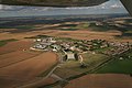 Former RAF Hemswell, aerial - geograph.org.uk - 3125174.jpg 640 × 427; 62 KB
-
 Former RAF Hemswell, hangars seen from the north - geograph.org.uk - 2172558.jpg 1,024 × 736; 191 KB
-

-
 Gated track to Hemswell Cliff - geograph.org.uk - 3110178.jpg 640 × 480; 63 KB
-
 Gibraltar Road, Hemswell Cliff - geograph.org.uk - 5651255.jpg 1,940 × 1,401; 754 KB
-
 Gibson House - geograph.org.uk - 2495392.jpg 1,024 × 768; 142 KB
-
 Hangar at the former RAF Hemswell - geograph.org.uk - 2495407.jpg 1,024 × 768; 168 KB
-
 Hemswell Antique building no 3 - geograph.org.uk - 4567252.jpg 640 × 480; 82 KB
-

-
 Hemswell Antiques - geograph.org.uk - 2495417.jpg 1,024 × 768; 144 KB
-

-

-

-
 Highfields Lorry - geograph.org.uk - 5933007.jpg 6,032 × 4,014; 3.65 MB
-
 Housing at Hemswell Cliff - geograph.org.uk - 2495383.jpg 1,024 × 768; 160 KB
-
 How do I get out of here^ - geograph.org.uk - 4645795.jpg 1,024 × 768; 87 KB
-

-
 Layby at Hemswell Cliff - geograph.org.uk - 4645802.jpg 1,024 × 707; 219 KB
-

-

-
 Meat Inc. Burger House, Caenby Corner - geograph.org.uk - 5651903.jpg 1,982 × 1,446; 731 KB
-

-
 Memorial to former RAF Helmswell - geograph.org.uk - 3720081.jpg 2,736 × 3,648; 4.15 MB
-
 Memorial to former RAF Helmswell - geograph.org.uk - 3720092.jpg 3,648 × 2,736; 3.19 MB
-
 Memorial to former RAF Helmswell - geograph.org.uk - 3720098.jpg 3,648 × 2,736; 3.42 MB
-
 Middle Street (B1398) heading north - geograph.org.uk - 3110175.jpg 640 × 480; 48 KB
-
 Minden Place, Hemswell Cliff - geograph.org.uk - 5651245.jpg 2,048 × 1,536; 1.55 MB
-
 New memorial at ex RAF Hemswell - geograph.org.uk - 6269844.jpg 3,072 × 4,608; 2.5 MB
-
 OB vehicles BEM.jpg 3,122 × 1,098; 2.62 MB
-
 On the old campus of RAF Hemswell - geograph.org.uk - 5037660.jpg 4,877 × 3,560; 3.09 MB
-
 One of the many antique centres at Hemswell - geograph.org.uk - 4645793.jpg 1,024 × 768; 168 KB
-
 Overcast day at Caenby Corner - geograph.org.uk - 5933008.jpg 6,032 × 4,014; 4.08 MB
-
 Plassey Road - geograph.org.uk - 326801.jpg 640 × 480; 74 KB
-
 RAF Hemswell - Harpswell Memorial - geograph.org.uk - 6269857.jpg 4,608 × 3,072; 6.24 MB
-
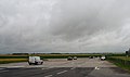
 Service area at Caenby Corner - geograph.org.uk - 5651890.jpg 2,012 × 1,486; 847 KB
-
 Service area at Caenby Corner - geograph.org.uk - 5651895.jpg 1,990 × 1,454; 734 KB
-

-
 Sign on the A631, Harpswell - geograph.org.uk - 5651292.jpg 1,974 × 1,430; 699 KB
-
 Spital Lane at the junction with the A631 - geograph.org.uk - 5651261.jpg 2,048 × 1,536; 1.46 MB
-
 Spital Lane near Caenby Corner - geograph.org.uk - 4645804.jpg 1,024 × 768; 118 KB
-
 The A631 at Hemswell Cliff - geograph.org.uk - 4069109.jpg 1,600 × 1,108; 334 KB
-
 The A631, Hemswell Cliff - geograph.org.uk - 5656168.jpg 1,426 × 1,968; 624 KB
-
 The entrance to ex RAF Hemswell - geograph.org.uk - 6269838.jpg 4,608 × 3,072; 5.03 MB
-
 The entrance to Hemswell Market - geograph.org.uk - 4069134.jpg 1,600 × 950; 450 KB
-
 The entrance to Norton Place - geograph.org.uk - 2495365.jpg 1,024 × 768; 185 KB
-

-
 The old water tower at RAF Hemswell - geograph.org.uk - 5037651.jpg 3,660 × 4,963; 3.26 MB
-
 Track to Old Street Farm - geograph.org.uk - 3111793.jpg 640 × 480; 83 KB
-
 View towards Bettesworth Road - geograph.org.uk - 2495399.jpg 1,024 × 768; 163 KB
-
 Village sign Helmswell Cliff - geograph.org.uk - 3720126.jpg 3,648 × 2,736; 2.67 MB
-
 Water Tower at the former RAF Hemswell - geograph.org.uk - 2495415.jpg 768 × 1,024; 161 KB
-
 WWII Memorial to 170 Sqn RAF - geograph.org.uk - 3720118.jpg 3,648 × 2,736; 4.42 MB
-

-
 Creampoke Crescent - geograph.org.uk - 468710.jpg 640 × 480; 137 KB
-

-
 Laynes Farm, off Old Leys Lane - geograph.org.uk - 545665.jpg 623 × 455; 97 KB
-
 Powder pink - geograph.org.uk - 418095.jpg 640 × 554; 56 KB
-
 Sheep on Willoughton Cliff - geograph.org.uk - 545672.jpg 640 × 480; 78 KB


_heading_north_-_geograph.org.uk_-_3110175.jpg)


