Category:Hervormde Kerk, Valkkoog
Jump to navigation
Jump to search
| Object location | | View all coordinates using: OpenStreetMap |
|---|
church building in Schagen, Netherlands  | |||||
| Upload media | |||||
| Instance of | |||||
|---|---|---|---|---|---|
| Part of | |||||
| Location | Sint Maarten, North Holland, Netherlands | ||||
| Street address |
| ||||
| Heritage designation |
| ||||
| Inception |
| ||||
| Religion or worldview | |||||
 | |||||
Toren:
|
This is a category about rijksmonument number 33625
|
Kerk:
|
This is a category about rijksmonument number 498844
|
| Address |
|
Media in category "Hervormde Kerk, Valkkoog"
The following 58 files are in this category, out of 58 total.
-
 Exterieur NOORDGEVEL, GEDEELTE - Valkkoog - 20274393 - RCE.jpg 1,200 × 943; 361 KB
-
 Exterieur OOSTGEVEL - Valkkoog - 20274392 - RCE.jpg 953 × 1,200; 330 KB
-
 Exterieur OVERZICHT, ZUIDGEVEL - Valkkoog - 20274390 - RCE.jpg 1,200 × 951; 262 KB
-
 Exterieur ZUIDOOSTGEVEL - Valkkoog - 20274391 - RCE.jpg 1,200 × 950; 306 KB
-
 Ingangspartij - Valkkoog - 20238488 - RCE.jpg 950 × 1,200; 286 KB
-
 Interieur - Valkkoog - 20238486 - RCE.jpg 1,200 × 953; 200 KB
-
 Interieur - Valkkoog - 20238487 - RCE.jpg 1,200 × 964; 215 KB
-
 Interieur naar het westen - Valkkoog - 20238485 - RCE.jpg 964 × 1,200; 213 KB
-
 Interieur, aanzicht orgel, orgelnummer 1538 - Valkkoog - 20369428 - RCE.jpg 824 × 1,200; 146 KB
-
 Interieur, detail kapvoet met windligger - Valkkoog - 20238521 - RCE.jpg 1,192 × 1,200; 316 KB
-

-

-

-
 Interieur, dichtgemetselde deuropening zuidgevel - Valkkoog - 20238502 - RCE.jpg 1,200 × 1,193; 358 KB
-
 Interieur, dichtgemetselde muuropening noordgevel - Valkkoog - 20238499 - RCE.jpg 1,195 × 1,200; 376 KB
-
 Interieur, dichtgemetselde muuropening noordgevel - Valkkoog - 20238500 - RCE.jpg 1,200 × 1,200; 353 KB
-
 Interieur, gedeelte van de windligger op de trekbalken - Valkkoog - 20238518 - RCE.jpg 1,192 × 1,200; 284 KB
-

-

-

-
 INTERIEUR, HERENBANK - Valkkoog - 20274398 - RCE.jpg 956 × 1,200; 165 KB
-

-
 Interieur, huidige sporenkap boven gewelf - Valkkoog - 20238503 - RCE.jpg 1,198 × 1,200; 328 KB
-

-
 Interieur, kapvoet oorspronkelijke kap - Valkkoog - 20238505 - RCE.jpg 1,198 × 1,200; 257 KB
-
 Interieur, korbeel aan de noordwand - Valkkoog - 20238522 - RCE.jpg 1,200 × 1,195; 325 KB
-
 INTERIEUR, NAAR HET OOSTEN - Valkkoog - 20274394 - RCE.jpg 1,200 × 961; 186 KB
-
 INTERIEUR, NAAR HET WESTEN - Valkkoog - 20274395 - RCE.jpg 1,200 × 955; 182 KB
-

-
 INTERIEUR, ORGEL - Valkkoog - 20274396 - RCE.jpg 960 × 1,200; 188 KB
-

-

-
 Interieur, overzicht windligger op trekbalken - Valkkoog - 20238517 - RCE.jpg 1,195 × 1,200; 272 KB
-
 INTERIEUR, PREEKSTOEL - Valkkoog - 20274397 - RCE.jpg 951 × 1,200; 155 KB
-

-

-

-

-
 Interieur, verankeringsblok met spanstaven - Valkkoog - 20238508 - RCE.jpg 1,195 × 1,200; 323 KB
-
 Interieur, windligger op trekbalk met spantbeen - Valkkoog - 20238514 - RCE.jpg 1,186 × 1,200; 288 KB
-
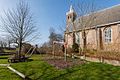
 Kerk, noord-west - Valkkoog - 20238494 - RCE.jpg 1,200 × 1,191; 328 KB
-
 Kerk, noord-west - Valkkoog - 20238495 - RCE.jpg 1,198 × 1,200; 491 KB
-
 Kerk, zuid-west - Valkkoog - 20238496 - RCE.jpg 1,193 × 1,200; 332 KB
-
 Kerk, zuid-west - Valkkoog - 20238497 - RCE.jpg 1,196 × 1,200; 510 KB
-
 Noord-gevel - Valkkoog - 20238491 - RCE.jpg 1,200 × 958; 297 KB
-
 Noord-gevel - Valkkoog - 20238492 - RCE.jpg 952 × 1,200; 233 KB
-
 Oost-zijde - Valkkoog - 20238490 - RCE.jpg 959 × 1,200; 254 KB
-
 Preekstoel - Valkkoog - 20238484 - RCE.jpg 958 × 1,200; 175 KB
-
 Valkkoog - Valkkogerweg 39 - Consistorie Hervormde Kerk 2.jpg 3,844 × 2,563; 6.92 MB
-
 Valkkoog - Valkkogerweg 39 - Consistorie Hervormde Kerk.jpg 2,592 × 3,888; 8.27 MB
-
 Valkkoog - Valkkogerweg 39 - Hervormde Kerk en consistorie.jpg 2,592 × 3,888; 7.38 MB
-
 Valkkoog - Valkkogerweg 39 - Toegangshek kerkhof.jpg 3,888 × 2,592; 8.52 MB
-
 Valkkoog - Valkkogerweg 39 1.jpg 3,888 × 2,592; 7.71 MB
-
 Valkkoog - Valkkogerweg 39.jpg 3,888 × 2,592; 5.95 MB
-
 Valkkoog, de Nederlands Hervormde kerk RM498844 foto8 2015-10-12 12.14.jpg 4,332 × 3,249; 9.64 MB
-
 Valkkoog-MSD-20120322-255691.jpg 1,200 × 800; 388 KB
-
 Zuid-gevel - Valkkoog - 20238489 - RCE.jpg 1,200 × 958; 335 KB
-
 Zuidzijde toren - Valkkoog - 20238493 - RCE.jpg 1,198 × 1,200; 289 KB


