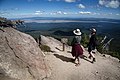
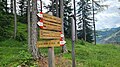
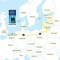
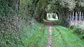
Category:Hiking trails
Zur Navigation springen
Zur Suche springen
Deutsch: Wanderwege
· Français : Sentier de randonnée
· mit Wegzeichen markierter Fußweg  | |||||
| Medium hochladen | |||||
| Unterklasse von | |||||
|---|---|---|---|---|---|
| Aspekt von | |||||
| Verschieden von | |||||
| |||||
Unterkategorien
Es werden 12 von insgesamt 12 Unterkategorien in dieser Kategorie angezeigt:
In Klammern die Anzahl der enthaltenen Kategorien (K), Seiten (S), Dateien (D)
- Hiking trail construction (2 D)
B
C
D
- Deserted Village Trail (1 D)
- Dooagh Trail (10 D)
- Dutch Mountain Trail (3 D)
M
- Metropolitan Trails (4 D)
S
T
- Trail registers (20 D)
Medien in der Kategorie „Hiking trails“
Folgende 200 Dateien sind in dieser Kategorie, von 237 insgesamt.
(vorherige Seite) (nächste Seite)-
 14025-Krupka-1912-Mückentürmchen-Brück & Sohn Kunstverlag.jpg 1.543 × 1.000; 706 KB
-
 1HikeBike Route opt.svg 179 × 285; 24 KB
-

-
 2HikeBike Routes opt.svg 179 × 285; 24 KB
-
 A stone path.jpg 4.032 × 3.024; 3,09 MB
-
 Abri gr65 faycelles lot.jpg 1.432 × 1.070; 203 KB
-
 Admiring The View.jpg 2.815 × 3.519; 6,17 MB
-
 Aich-Uhlberg.jpg 1.080 × 1.566; 404 KB
-
 AllTrails User Interface.png 640 × 1.136; 460 KB
-
 Alltrails-logo.png 1.200 × 512; 16 KB
-
 Alltrails.png 256 × 256; 7 KB
-
 Anstieg Seebergspitze.jpg 1.280 × 1.920; 691 KB
-
 Austrian RedWhiteRed Marking 01.jpg 4.272 × 2.856; 11,69 MB
-
 Austrian RedWhiteRed Marking 02.jpg 4.272 × 2.856; 9,91 MB
-
 Awesome view form the Three Peaks in El Yunque.jpg 3.008 × 2.000; 3,67 MB
-
 Balisage de sentiers de randonnée.jpg 5.152 × 3.864; 7,76 MB
-
 Balise de randonnée.jpg 5.152 × 3.864; 7,87 MB
-
 Barranco de los cerniculos, Gran Canaria, doube waterfall.jpg 3.566 × 2.765; 3,29 MB
-
 Barranco de los cerniculos, Gran Canaria, entry.jpg 4.000 × 3.000; 6,27 MB
-
 Barranco de los cerniculos, Gran Canaria, exit.jpg 4.000 × 3.000; 6,91 MB
-
 Barranco de los cerniculos, Gran Canaria, medium waterfall.jpg 4.000 × 3.000; 6,64 MB
-
 Barranco de los cerniculos, Gran Canaria, small waterfall.jpg 3.541 × 2.656; 3,85 MB
-
 Barranco de los cerniculos, Gran Canaria, view to the east.jpg 4.000 × 3.000; 6,06 MB
-
 Bell Creek Nature Preserve Trail Map.jpg 1.170 × 704; 864 KB
-
 Bell Creek Preserve Historical Marker 1.jpg 3.024 × 4.032; 3,87 MB
-
 Bell Creek Preserve Historical Marker 2.jpg 3.024 × 4.032; 3,51 MB
-
 Bergwanderweg.jpg 1.638 × 2.048; 615 KB
-
 Boathouse in Point au Roche state park.jpg 1.800 × 1.013; 1,31 MB
-
 Bridge on the Chefna River.jpg 5.184 × 3.888; 7,75 MB
-
 Buddhi National Forest - Maitland Bay 01.jpg 1.668 × 370; 305 KB
-
 Buddhi National Forest - Maitland Bay 02.jpg 1.668 × 368; 246 KB
-
 Buddhi National Forest - Maitland Bay 03.jpg 1.668 × 361; 221 KB
-
 Bukit Kodiang.jpg 3.024 × 4.032; 2,08 MB
-

-
 Cap d'Agde réserve du Bagnas ruines de distillerie.jpg 1.920 × 2.560; 1,7 MB
-
 Carmel Valley Hiking Trail.jpg 4.032 × 3.024; 609 KB
-
 Cartel informativo "espinillo".jpg 3.072 × 4.096; 4,54 MB
-
 Carthew-Alderson Trail.jpg 6.000 × 4.000; 17,39 MB
-
 Castlewellan forest Park, peace maze.jpg 4.032 × 3.024; 3,2 MB
-
 Catherine Pass Trail.jpg 2.700 × 1.800; 2,02 MB
-
 Chefna river.jpg 5.184 × 3.888; 9,94 MB
-
 Ck donnerspark-1351.jpg 4.928 × 3.280; 3,16 MB
-
 Connor's Bay beach.jpg 1.800 × 3.200; 4,71 MB
-
 Cows on trail.jpg 2.424 × 1.616; 2,59 MB
-
 Cranberry Wilderness trail.jpg 3.024 × 4.032; 5,87 MB
-
 Crater Lake Mt Scott Trail 1.jpg 5.472 × 3.648; 16,87 MB
-
 Crater Lake Mt Scott Trail 10.jpg 5.472 × 3.648; 7,5 MB
-
 Crater Lake Mt Scott Trail 11.jpg 5.472 × 3.648; 7,09 MB
-
 Crater Lake Mt Scott Trail 12.jpg 5.472 × 2.736; 9,78 MB
-
 Crater Lake Mt Scott Trail 13.jpg 6.918 × 2.747; 12,13 MB
-
 Crater Lake Mt Scott Trail 15.jpg 5.472 × 3.648; 14,48 MB
-
 Crater Lake Mt Scott Trail 2.jpg 5.472 × 3.648; 19,08 MB
-
 Crater Lake Mt Scott Trail 3.jpg 5.472 × 2.736; 10,32 MB
-
 Crater Lake Mt Scott Trail 4.jpg 5.472 × 2.736; 11,37 MB
-
 Crater Lake Mt Scott Trail 5.jpg 5.472 × 2.736; 12,01 MB
-
 Crater Lake Mt Scott Trail 6.jpg 5.472 × 3.648; 12,74 MB
-
 Crater Lake Mt Scott Trail 8.jpg 4.908 × 3.300; 10,45 MB
-
 Crater Lake Mt Scott Trail 9.jpg 23.210 × 3.910; 41,7 MB
-
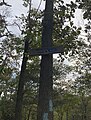
 Croce con icona in ceramica presso Monte Rinaldo - Brisighella (RA).jpg 3.024 × 4.032; 5,45 MB
-
 Crossing of Appalachian Trail and Long Path (2013).jpg 1.540 × 2.053; 1,06 MB
-
 CST 2 PequeaCreek.jpg 4.096 × 3.072; 6,52 MB
-
 DHT 5B pipeline vista left.jpg 4.160 × 2.340; 3,49 MB
-
 Dolomites hiking route 12 and 15 crossing sign - 20230714T143435.jpg 4.032 × 2.268; 4,13 MB
-
 Dolomites hiking route 12, 14 and 15 crossing sign.jpg 4.032 × 2.268; 4,62 MB
-
 E11 Overview map.jpg 1.182 × 1.182; 527 KB
-
 Ella-lookout.jpg 2.000 × 1.269; 2 MB
-
 Entrée d'un gîte de montagne sur l'île de La Réunion.jpg 3.024 × 3.024; 2,6 MB
-
 EtangDuNord.Trail.jpg 600 × 387; 145 KB
-
 Firgas, Gran Canaria, muddy hiking trail.jpg 4.000 × 3.000; 3,94 MB
-
 Fischbeker Heide.jpg 4.032 × 2.268; 4,35 MB
-
 Footpath Normandie.jpg 6.000 × 3.376; 4,44 MB
-
 Forest-trees-hiker-hiking (23700043303).jpg 1.920 × 1.280; 2,81 MB
-
 Fossil Rock magic place.jpg 3.024 × 4.032; 2,23 MB
-
 Freudenberger Märchenweg, "Das fliegende Kästchen".jpg 2.828 × 4.283; 1,6 MB
-
 Freudenberger Märchenweg, "Das goldene Pantofferl".jpg 3.456 × 4.608; 3,46 MB
-
 Freudenberger Märchenweg, "Das Holzfräulein.jpg 3.456 × 4.608; 3,45 MB
-
 Freudenberger Märchenweg, "Das Wieserl".jpg 3.456 × 4.608; 3,33 MB
-
 Freudenberger Märchenweg, "Der Teufel und der Besenbinder".jpg 3.456 × 4.608; 3,51 MB
-
 Freudenberger Märchenweg, "Des Windes Heulen".jpg 3.456 × 4.608; 3,45 MB
-
 Freudenberger Märchenweg, Stele "Das fliegende Kästchen".jpg 3.456 × 4.608; 5,55 MB
-
 Freudenberger Märchenweg, Stele "Das goldene Pantofferl".jpg 3.456 × 4.608; 6,01 MB
-
 Freudenberger Märchenweg, Stele "Das Holzfräulein".jpg 3.456 × 4.608; 6 MB
-
 Freudenberger Märchenweg, Stele "Das Wieserl".jpg 3.456 × 4.608; 5,94 MB
-
 Freudenberger Märchenweg, Stele "Der Teufel und der Besenbinder".jpg 3.456 × 4.608; 5,93 MB
-
 Freudenberger Märchenweg, Stele "Des Windes Heulen".jpg 3.456 × 4.608; 5,96 MB
-
 Gandstock, Plattengrat, Guldergrat.jpg 6.537 × 4.910; 7,38 MB
-
 Glendalough32234.JPG 2.816 × 2.112; 1,45 MB
-
 Gopher tortoise in Bell Creek Preserve.jpg 4.032 × 3.024; 3,25 MB
-
 Gopher tortoise.jpg 4.032 × 3.024; 8,34 MB
-
 Hiking in Abuja.jpg 2.992 × 2.000; 4,17 MB
-
 Hiking in Deliblato Sands.jpg 5.397 × 3.598; 10,98 MB
-
 Hiking on the highest mountain in west Africa,Mount Cameroon.jpg 4.608 × 2.184; 3,09 MB
-
 Hiking path on Jebel Shams.jpg 3.264 × 4.912; 6,53 MB
-
 Hiking trails in Jebel Hafeet.jpg 4.032 × 3.024; 4,23 MB
-
 Hiking trails rendering proposal 1.png 909 × 413; 12 KB
-
 Hiking trails rendering proposal 2.png 867 × 403; 12 KB
-
 Hobbit Beach trail, Oregon.jpg 3.120 × 4.160; 3,39 MB
-
 Holy Jim Volunteer Fire Station.jpg 4.032 × 3.024; 4,4 MB
-
 Ice and Snow on Fort Mountain.jpg 3.024 × 4.032; 5,39 MB
-
 Ice lake Manag.jpg 800 × 600; 603 KB
-
 IMG Crater Lake Mt Scott Trail 7.jpg 5.472 × 3.648; 13,2 MB
-
 Incredible spring flora at Cavagrande.jpg 4.608 × 3.456; 9,11 MB
-
 Into the Rocks.jpg 2.732 × 2.049; 4,64 MB
-
 Jemez Valley Hot Springs.jpg 2.048 × 1.536; 1,76 MB
-
 Jendegraziatucson20090403 140429.jpg 960 × 642; 533 KB
-
 Jordan trail map.png 545 × 600; 69 KB
-
 Jordan Trail marker.jpg 958 × 996; 331 KB
-
 Kaerntner Grenzweg.png 919 × 386; 348 KB
-
 Kegeti George.jpg 6.000 × 4.000; 14,95 MB
-
 Küstenbereiche der Flensburger Förde-19.jpg 2.189 × 3.892; 3,94 MB
-
 Küstenbereiche der Flensburger Förde-20.jpg 2.250 × 4.000; 2,73 MB
-
 Küstenbereiche der Flensburger Förde-25.jpg 4.000 × 2.250; 4,02 MB
-
 La trei pasi de moarte (three steps from death).jpg 1.024 × 768; 921 KB
-
 Lambir Hills National Park - trail.jpg 3.120 × 4.160; 6,31 MB
-
 Landscape at Jebel Hafeet Desert Park 06.jpg 4.032 × 3.024; 4,38 MB
-
 LDB-gruen-OSM.svg 64 × 64; 6 KB
-
 Limestone rock path.jpeg 3.024 × 4.032; 4,87 MB
-
 Llyn Lluncaws, Berwyn.jpg 4.032 × 3.024; 2,89 MB
-
 Loch Raven Reservoir Trail lined with Japanese Stiltgrass.jpg 4.032 × 3.024; 9 MB
-
 Logo Wanderweg Rothaarsteig 2014.jpg 983 × 657; 855 KB
-
 Long pond greenbelt rules 20200829 102145.jpg 4.032 × 3.024; 3,15 MB
-
 Long Trail View.jpg 2.448 × 3.264; 1,95 MB
-
 Long Trail.jpg 2.448 × 3.264; 2,71 MB
-
 Louny - Stezka Ohře - Hiking Trail along River Ohře 01.jpg 3.915 × 2.592; 11,79 MB
-
 Louny - Stezka Ohře - Hiking Trail along River Ohře 02.jpg 2.592 × 3.915; 12,29 MB
-
 Louny - Stezka Ohře - Hiking Trail along River Ohře 03.jpg 2.592 × 3.915; 15,22 MB
-
 Louny - Stezka Ohře - Hiking Trail along River Ohře 04.jpg 2.592 × 3.915; 13,07 MB
-
 Louny - Stezka Ohře - Hiking Trail along River Ohře 05.jpg 3.915 × 2.592; 12,78 MB
-
 Louny - Stezka Ohře - Hiking Trail along River Ohře 06.jpg 2.592 × 3.915; 14,47 MB
-
 Louny - Stezka Ohře - Hiking Trail along River Ohře 07.jpg 3.915 × 2.592; 12,15 MB
-
 Louny - Stezka Ohře - Hiking Trail along River Ohře 08.jpg 3.915 × 2.592; 12,03 MB
-
 Louny - Stezka Ohře - Hiking Trail along River Ohře 09.jpg 3.915 × 2.592; 13,33 MB
-
 Louny - Stezka Ohře - Hiking Trail along River Ohře 10.jpg 2.592 × 3.915; 14,54 MB
-
 Louny - Stezka Ohře - Hiking Trail along River Ohře 11.jpg 2.592 × 3.915; 11,29 MB
-
 Louny - Stezka Ohře - Hiking Trail along River Ohře 12.jpg 3.915 × 2.592; 15,61 MB
-
 Louny - Stezka Ohře - Hiking Trail along River Ohře 13.jpg 3.915 × 2.592; 14,23 MB
-
 Louny - Stezka Ohře - Hiking Trail along River Ohře 14.jpg 3.915 × 2.592; 9,97 MB
-
 Lower-birch-creek-trailhead-at-the-shandaken-wild-forest.jpg 3.840 × 2.160; 3,14 MB
-
 Low and variable visitor compliance rates at voluntary trail registers (IA lowvariablevisit326luca).pdf 962 × 1.500, 10 Seiten; 382 KB
-
 Macchabée Trail (4823302179).jpg 1.600 × 1.200; 396 KB
-
 Macchabée Trail (4823338883).jpg 1.600 × 1.200; 713 KB
-
 Macchabée Trail (4823896696).jpg 1.600 × 1.200; 634 KB
-
 Macchabée Trail Crossroad (4823283023).jpg 1.600 × 1.200; 717 KB
-
 Macchabée Trail Crossroad (4823899820).jpg 1.600 × 1.200; 724 KB
-
 Malet e Goleshit.jpg 1.500 × 2.247; 2,28 MB
-
 Mappa dei sentieri di Monteviale.jpg 3.072 × 3.450; 2,11 MB
-
 Mareit Weg DxO DxO.jpg 6.000 × 3.375; 33,33 MB
-
 Maspalomas Dunes, Gran Canaria, deep clouds.jpg 4.000 × 3.000; 2,87 MB
-
 Mi'gmaq hiking trail turtle.jpg 3.000 × 2.000; 3,3 MB
-
 Minnehaha Trail north entrance Minneapolis June 2020.jpg 640 × 640; 209 KB
-
 Monumento Natural Municipal da Lagoa do Peri - João Aguiar (01).jpg 6.960 × 4.640; 40,82 MB
-
 Monumento Natural Municipal da Lagoa do Peri - João Aguiar (02).jpg 4.640 × 6.960; 41,91 MB
-
 Moorea trail map.jpg 4.032 × 3.024; 3,87 MB
-
 Mount Kinabalu Summit Trail.jpg 4.000 × 2.248; 5,68 MB
-
 Mount Old Baldy Trail View 2.jpg 8.200 × 1.634; 10,47 MB
-
 Mountain stone wall.jpg 3.024 × 4.032; 4,34 MB
-
 Mountaineering Man Trail Path Mountains.jpg 5.906 × 3.543; 2,28 MB
-
 Mulattiera near Malcesine.jpg 1.836 × 3.264; 3,44 MB
-
 Nature trail 20200829 102128.jpg 4.032 × 3.024; 5,29 MB
-
 Niwärch Stollen.jpg 676 × 793; 380 KB
-
 Norissteig Einstieg.jpg 2.560 × 1.712; 3,46 MB
-
 Obstgartenweg- Handschuhsheim - Dossenheim.jpg 2.560 × 1.920; 1,77 MB
-
 Opportunities to hike national wildlife refuge trails abound.jpg 3.504 × 2.336; 717 KB
-
 Ortisei - St. Ulrich-6411 - Flickr - Ragnhild & Neil Crawford.jpg 1.400 × 933; 604 KB
-
 Oznaka markacije planinarskog puta.jpg 200 × 142; 6 KB
-
 Pacific Northwest Trail.jpg 6.000 × 4.000; 16,75 MB
-
 Palina Culmine S.Pietro.jpg 3.366 × 5.984; 9,7 MB
-
 Panoramic bench.png 3.024 × 4.032; 20,03 MB
-
 Path At Tijuana Estuary.jpg 2.837 × 3.783; 3,44 MB
-
 PCT-List-2600.png 1.612 × 812; 126 KB
-
 Percorsi della Rana a Monte di Malo.jpg 3.072 × 4.080; 3,89 MB
-
 Photo-OldStoneWall.jpg 450 × 600; 47 KB
-
 PleasantMountainMaine.jpg 4.032 × 3.024; 2,88 MB
-
 Podragu.jpg 3.264 × 2.448; 3,95 MB
-
 Podragu2.jpg 7.376 × 3.066; 7,96 MB
-
 Pogigiintangan mantad nulu Bukit Perahu, Tamparuli,Sabah (View).jpg 4.032 × 3.024; 1,41 MB
-
 Point au Roche NY.jpg 1.800 × 3.200; 3,33 MB
-
 Point au Roche Trails.jpg 1.218 × 2.165; 2,29 MB
-
 Rabid act of forest trying to eat a hiker.jpg 2.604 × 4.624; 6,7 MB
-
 Ralan (a path).jpg 3.024 × 4.032; 3,38 MB
-
 Randonneurs suivant le tracé d'une randonnée.jpg 5.152 × 3.864; 7,81 MB
-
 Recknitz Valley, Ribnitz-Damgarten (P1090236).jpg 3.456 × 4.608; 13,61 MB
-
 Regicides Trail marker on the north end of west rock 2021.jpg 732 × 969; 296 KB
-
 Resting hiker.jpg 3.581 × 2.686; 3,68 MB
-
 RIm Trail 7.jpg 3.024 × 4.032; 4,54 MB
-
 Roberts Point Track, Franz Josef.jpg 5.392 × 3.595; 18,47 MB
-
 Rotunda View deck tower. Photo taken- February 25, 2024.jpg 4.160 × 3.120; 2,68 MB
-
 S 90 towards Tamadaba, Gran Canaria.jpg 4.000 × 3.000; 5,53 MB
-
 S 90, Gran Canaria, eucalypus.jpg 4.000 × 3.000; 4,99 MB
-
 S 90, Gran Canaria, view of the north coast.jpg 4.000 × 3.000; 2,54 MB
-
 S 90, Gran Canaria, view to San Pedro.jpg 4.000 × 3.000; 3,92 MB
-
 Schautafel am Ruhrradweg.JPG 2.796 × 2.372; 1,71 MB
-
 Schild Regensburger Burgensteige.jpg 1.600 × 900; 380 KB
-
 Seminole County South Flagler Trail Flag.jpg 1.275 × 1.125; 45 KB
-
 Sentiero Alta Versilia - Tappa 4 - Vista su antica mulattiera pavimentata.jpg 1.833 × 1.833; 2 MB
-
 Sign of GR571 near Stoumont.jpg 5.184 × 3.888; 6,4 MB
-
 SL 1 Playa Guayedra, Gran Canaria, view south.jpg 4.000 × 3.000; 3,2 MB
-
 SL 1, Playa Guayedra, Gran Canaria, view north.jpg 4.000 × 3.000; 5,04 MB
-
 SL 3, Gran Canaria, view of mountains.jpg 4.000 × 3.000; 3,63 MB
-
 SL 3, Gran Canaria, view to San Pedro.jpg 4.000 × 3.000; 3,6 MB


.jpg)
.jpg)


.jpg)


.jpg)


.jpg)
.jpg)
.jpg)
.jpg)
.jpg)


.jpg)
.jpg)


.jpg)


.jpg)

.jpg)


