Category:Hinterautal
Jump to navigation
Jump to search
| NO WIKIDATA ID FOUND! Search for Hinterautal on Wikidata | |
| Upload media |
Subcategories
This category has the following 2 subcategories, out of 2 total.
I
R
- Rossloch (Karwendel) (5 F)
Media in category "Hinterautal"
The following 35 files are in this category, out of 35 total.
-
 GrosseSeekarspitzePano.jpg 4,997 × 600; 987 KB
-
 Hauptkette Mitte von Kaskarspitze HQ.jpg 1,280 × 960; 324 KB
-
 Hinterautal - Isar von der Gleirschhöhe.JPG 4,608 × 3,456; 7.58 MB
-
 Hinterautal - panoramio.jpg 1,600 × 1,200; 928 KB
-
 Hinterautal - Radweg über Gleirschhöhe.JPG 4,608 × 3,456; 8.22 MB
-
 Hinterautal - Weg zu Kastenalm.JPG 4,608 × 3,456; 7.36 MB
-
 Hinterautal - Wegweiser.JPG 4,608 × 3,456; 8.55 MB
-
 Hinterautal 2007-08.jpg 2,896 × 1,944; 1.28 MB
-
 Hinterautal Karwendel.jpg 1,024 × 768; 634 KB
-
 Hinterautal Vomper Kette.jpg 4,279 × 800; 1.28 MB
-
 Hinterautal von der Gleirschhöhe.JPG 4,608 × 3,456; 7.81 MB
-
 Hinterautal.jpg 1,700 × 2,500; 1,014 KB
-
 Hinterautal1.jpg 2,592 × 1,456; 1.29 MB
-
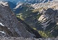
 Hoher Gleirsch N.JPG 3,252 × 2,544; 5.03 MB
-
 Innsbruck und Achen-See. NYPL1226618.tiff 5,419 × 4,496; 69.75 MB
-
 Isar Hinterautal.jpg 1,024 × 768; 723 KB
-
 Isar im Hinterautal (1).JPG 4,123 × 2,527; 4.9 MB
-
 Isar im Hinterautal (2).JPG 3,459 × 3,259; 4.54 MB
-
 Isar im Hinterautal (3).JPG 4,608 × 3,456; 6.31 MB
-
 Isar im Hinterautal (4).JPG 4,608 × 2,805; 6.63 MB
-
 Isar im Hinterautal (5).JPG 4,227 × 2,591; 5.44 MB
-
 Isar Quellgebiet (1).JPG 4,608 × 3,456; 8.39 MB
-
 Isar Quellgebiet (2).JPG 4,608 × 3,456; 7.07 MB
-
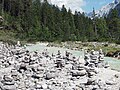 Isar Steinpyramiden.JPG 4,608 × 3,456; 7.49 MB
-
 Isar Ursprung Hinterautal 2.jpg 2,500 × 1,700; 1.52 MB
-
 Isar Ursprung Hinterautal.jpg 1,400 × 2,200; 1.13 MB
-
 Isarursprung Infotafel.JPG 4,608 × 3,456; 6.58 MB
-
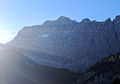 Jägerkarspitzen N.JPG 3,468 × 2,436; 3.96 MB
-
 Karwendel - 2.jpg 4,128 × 2,322; 3.14 MB
-
 Karwendel Alps, Austria.jpg 1,050 × 1,418; 558 KB
-
 Lafatsch.jpg 2,732 × 1,878; 3.4 MB
-
 Pleisenspitze2.jpg 1,024 × 768; 574 KB
-
 Rossloch2.jpg 397 × 706; 83 KB
-
 Rosslochkamm 1.jpg 1,505 × 1,024; 403 KB
-
 Specialkarte des Karwendelgebirges.jpg 11,201 × 9,890; 41.64 MB


.JPG)
.JPG)
.JPG)
.JPG)
.JPG)
.JPG)
.JPG)


