Category:Historical maps of ethnic groups in Vojvodina
Jump to navigation
Jump to search
Subcategories
This category has the following 4 subcategories, out of 4 total.
A
Y
Media in category "Historical maps of ethnic groups in Vojvodina"
The following 65 files are in this category, out of 65 total.
-
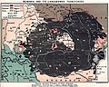
 1910年奧匈帝國民族組成.svg 1,360 × 1,052; 919 KB
-
 Austria hungary 1911 and post war borders.jpg 1,525 × 1,166; 389 KB
-
 Austria hungary 1911.gif 907 × 687; 397 KB
-
 Austria hungary 1911.jpg 1,521 × 1,155; 1.76 MB
-
 Austria Hungary ethnic UK.svg 512 × 396; 287 KB
-
 Austria Hungary ethnic-ar.svg 1,360 × 1,052; 1,000 KB
-
 Austria Hungary ethnic.svg 1,360 × 1,052; 1.56 MB
-
 Austria-Hungary (ethnic).JPG 5,150 × 3,395; 4.73 MB
-
 Austria-Hungary (ethnic).jpg 4,314 × 2,820; 3.63 MB
-
 Austria-Hungary ethnic map.jpg 1,623 × 1,276; 312 KB
-
 Austro-Ungaria si Romania (harta etnica).jpg 6,245 × 3,505; 6.73 MB
-
 Backa ethnic map 1715.png 1,202 × 1,958; 269 KB
-
 Backa ethnic map 1720.png 1,202 × 1,767; 239 KB
-
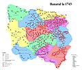 Banatul la 1743.jpg 2,526 × 2,168; 2.45 MB
-
 Banatul la 1774.jpg 2,526 × 2,168; 2.83 MB
-
 Bevoelkerungsgruppen-Jugoslawien hu.svg 896 × 896; 255 KB
-
 Bevoelkerungsgruppen-Jugoslawien.png 700 × 700; 231 KB
-
 Bunjevci migrations hu.svg 937 × 900; 88 KB
-
 Bunjevci migrations-sr.png 937 × 900; 107 KB
-
 Bunjevci migrations.png 937 × 900; 128 KB
-
 Carte ethnographique de la Péninsule balkanique, cropped.jpg 436 × 394; 305 KB
-

-
 Dispersal of Slavs as of 1900 (1910 map).jpg 1,200 × 1,031; 212 KB
-
 Ernst-Ravenstein-Balkans-Ethnic-Map-1880.jpg 716 × 563; 160 KB
-
 Ethnic Germans in Hungary and parts of adjacent Austrian territories.JPG 3,930 × 2,842; 4.68 MB
-

-
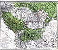
 Ethnographic map of austrian monarchy czoernig 1855.jpg 7,997 × 5,862; 23.73 MB
-
 Ethnographic map of Czoernig.jpg 1,202 × 910; 372 KB
-
 Ethnographic map of hungary 1910 by teleki carte rouge.jpg 4,962 × 3,509; 5.18 MB
-
 Ethnographic map of Slavs, Lubor Niederle.JPG 1,017 × 847; 366 KB
-
 Ethnographical map of Hungary based on density of population, Census of 1910.jpg 12,000 × 9,751; 25.69 MB
-
 Ethnographische Karte der Österreichischen Monarchie - Kartenteil 4.png 9,429 × 7,116; 67.8 MB
-
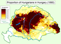 Hungarians in Hungary (1890).png 1,064 × 766; 159 KB
-
 Hungary 1941 ethnic hu.svg 860 × 490; 339 KB
-
 Hungary 1941 ethnic.svg 860 × 490; 475 KB
-
 Hungary-ethnic groups.jpg 2,913 × 2,250; 2.18 MB
-
 Kogutowicz Károly Magyarország Néprajzi Térképe.jpg 2,062 × 1,372; 4.06 MB
-
 Localitatile din Banatul sarbesc locuite de romani, 1941.jpg 4,062 × 5,304; 3.42 MB
-
 Magiarizzazione in Ungheria (1890).png 1,064 × 766; 193 KB
-
 Magyarization of Vojvodina, 1720-1910.png 1,179 × 1,248; 84 KB
-
 Magyars (Hungarians) in Hungary, census 1890.jpg 1,064 × 800; 760 KB
-
 Meyers b12 s0486a.jpg 2,048 × 1,683; 1.35 MB
-
 Ottoman vojvodina ethnicity religion-sr.png 1,122 × 1,272; 90 KB
-
 Ottoman vojvodina ethnicity religion.png 1,122 × 1,272; 128 KB
-
 RizMap22.jpg 770 × 600; 172 KB
-
 RizMap23.jpg 3,200 × 3,110; 6.71 MB
-
 RizMap24.jpg 2,046 × 1,839; 2.78 MB
-
 Romanians before WW1.jpg 800 × 640; 229 KB
-
 Serbia ethnic 6 8 century-sr.png 638 × 1,146; 66 KB
-
 Serbia ethnic 6 8 century.png 638 × 1,146; 68 KB
-
 Slaven.jpg 3,216 × 2,754; 5.22 MB
-
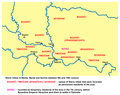
 Slavs Vojvodina01 map sr.png 1,020 × 836; 67 KB
-
 Slavs Vojvodina01 map.png 1,020 × 836; 69 KB
-
 Slavs Vojvodina02 map-sr.png 989 × 783; 63 KB
-
 Slavs Vojvodina02 map.png 989 × 783; 65 KB
-
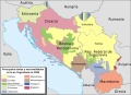
 South slavic vojv map sr.png 1,259 × 1,161; 128 KB
-
 South slavic vojv map.png 1,259 × 1,161; 124 KB
-
 The Balkan Peninsula, Distribution of Races. EB 1911.png 1,057 × 1,510; 91 KB
-
 Voivodeship of serbia ethnic map 1855.jpg 1,751 × 1,211; 1.15 MB
-
 Yugo ethnic.gif 325 × 300; 15 KB
-
 Yugoslav ethnic map 2.jpg 849 × 1,102; 169 KB
-
 Yugoslavia 1998 ethnic map es.svg 1,734 × 1,256; 1.42 MB
-
 Yugoslavia 1998 ethnic map fr.svg 1,734 × 1,256; 1.03 MB
-
 Yugoslavia 1998 ethnic map pt.svg 1,734 × 1,256; 1.18 MB
-
 Yugoslavia ethnic map.jpg 1,643 × 1,715; 837 KB


.JPG)
.jpg)

.jpg)


.jpg)
.jpg)


.png)


.png)

_in_Hungary,_census_1890.jpg)


