Category:Holwell, Dorset
Jump to navigation
Jump to search
English: Holwell is a village in north west Dorset, England, situated in the Blackmore Vale five miles south east of Sherborne. The village has a population of 380 .
village and civil parish in Dorset, UK  | |||||
| Upload media | |||||
| Instance of | |||||
|---|---|---|---|---|---|
| Location | Dorset, South West England, England | ||||
| Said to be the same as | Holwell (Wikimedia duplicated page, civil parish) | ||||
 | |||||
Subcategories
This category has the following 3 subcategories, out of 3 total.
Media in category "Holwell, Dorset"
The following 65 files are in this category, out of 65 total.
-
 A peaceful sign - geograph.org.uk - 458327.jpg 437 × 640; 114 KB
-
 Barnes Cross near Holwell - geograph.org.uk - 380082.jpg 640 × 480; 200 KB
-

-
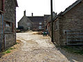
 Buildings at Woodbridge Farm - geograph.org.uk - 3422176.jpg 640 × 429; 59 KB
-
 Converted chapel, Holwell - geograph.org.uk - 1093503.jpg 640 × 495; 110 KB
-
 Cornford Bridge - geograph.org.uk - 386194.jpg 640 × 480; 140 KB
-
 Cottages at Sandhills - geograph.org.uk - 2366787.jpg 640 × 480; 95 KB
-
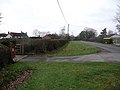
 Countryside near Hill Street - geograph.org.uk - 2439530.jpg 640 × 480; 91 KB
-
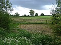
 Countryside near Holwell - geograph.org.uk - 2366778.jpg 640 × 480; 108 KB
-
 Countryside near Packers bridge - geograph.org.uk - 2441306.jpg 640 × 438; 69 KB
-
 Crouch Hill Farm (geograph 7184691).jpg 4,134 × 2,697; 1.12 MB
-
 Double bends at Woodbridge - geograph.org.uk - 3422168.jpg 640 × 456; 56 KB
-
 Elm Tree Farm Holwell - geograph.org.uk - 549201.jpg 640 × 480; 196 KB
-
 Farm Track, Crouch Hill - geograph.org.uk - 2366665.jpg 640 × 480; 89 KB
-
 Former chapel at Holwell - geograph.org.uk - 6240260.jpg 1,024 × 683; 178 KB
-
 Grassland near Holwell - geograph.org.uk - 2429831.jpg 640 × 480; 75 KB
-
 Holwell Drove - geograph.org.uk - 6240255.jpg 1,024 × 683; 241 KB
-
 Holwell Farmhouse - geograph.org.uk - 5521939.jpg 1,024 × 768; 222 KB
-
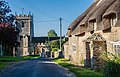
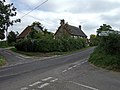
 Holwell Village - geograph.org.uk - 380093.jpg 640 × 480; 115 KB
-
-
 Holwell, a former chapel - geograph.org.uk - 1915931.jpg 640 × 480; 74 KB
-
 Holwell, Barnes Cross Cottage - geograph.org.uk - 1915947.jpg 640 × 480; 127 KB
-

-
 Holwell, footpath - geograph.org.uk - 3473127.jpg 1,024 × 768; 191 KB
-
 Holwell, footpath - geograph.org.uk - 5521947.jpg 1,024 × 768; 278 KB
-
 Holwell, gate ^ stile - geograph.org.uk - 3473102.jpg 1,024 × 768; 228 KB
-
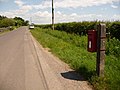
 Holwell, Packers Hill - geograph.org.uk - 2245885.jpg 640 × 480; 66 KB
-
 Holwell, postbox № DT9 124 - geograph.org.uk - 1915922.jpg 640 × 480; 85 KB
-
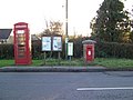
 Holwell, postbox № DT9 44 and phone - geograph.org.uk - 1915926.jpg 640 × 480; 104 KB
-
 Holwell, postbox № DT9 77, Packers Hill - geograph.org.uk - 2245887.jpg 640 × 480; 100 KB
-
 Holwell, Sixpenny Tap - geograph.org.uk - 5521914.jpg 1,024 × 749; 179 KB
-
 Holwell, stubble field - geograph.org.uk - 5521958.jpg 1,024 × 768; 184 KB
-
 Holwell, track - geograph.org.uk - 5522005.jpg 1,024 × 768; 270 KB
-
 Holwell, tractor - geograph.org.uk - 5521897.jpg 1,024 × 768; 149 KB
-
 House at Woodbridge - geograph.org.uk - 2439538.jpg 640 × 480; 68 KB
-
 Houses at Sandhills - geograph.org.uk - 5186542.jpg 1,600 × 1,088; 518 KB
-
 Lower Wood Bridge, east of Bishop's Caundle - geograph.org.uk - 4832145.jpg 1,600 × 1,278; 338 KB
-
 Lush pastures in Pleck Green - geograph.org.uk - 2439544.jpg 640 × 480; 127 KB
-
 Manor Farm - Caundle Marsh - geograph.org.uk - 408895.jpg 640 × 480; 189 KB
-
 Packers Hill - geograph.org.uk - 2441316.jpg 640 × 480; 106 KB
-

-

-
 Pheasant Pens near Buckshaw House - geograph.org.uk - 2369894.jpg 640 × 420; 48 KB
-
 Repairing Higher Wood Bridge, Bishop's Caundle - geograph.org.uk - 4832142.jpg 1,600 × 1,067; 364 KB
-
 Sandhills Manor House - geograph.org.uk - 367062.jpg 640 × 478; 160 KB
-
 Storm Clouds at Pleck Green - geograph.org.uk - 2439547.jpg 640 × 451; 48 KB
-
 Village communication, Holwell - geograph.org.uk - 1093513.jpg 640 × 480; 119 KB
-
 Westrow House - geograph.org.uk - 2366736.jpg 640 × 481; 97 KB
-
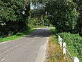
 Wide verge beside Holwell Drove - geograph.org.uk - 6240245.jpg 1,024 × 683; 215 KB
-
 Woodbridge Farm - Woodbridge - geograph.org.uk - 386188.jpg 640 × 480; 165 KB
-
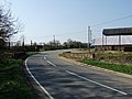 Woodbridge on the Sherborne Road - geograph.org.uk - 386180.jpg 640 × 480; 146 KB
-

-
 Buckshaw House Estate Cottages - geograph.org.uk - 386202.jpg 640 × 480; 181 KB
-
 Building Site near Buckshaw House - geograph.org.uk - 386206.jpg 640 × 480; 156 KB
-
 Coombe House Packers Hill - geograph.org.uk - 549206.jpg 640 × 472; 142 KB
-
 Cottage at Bishop's Down - geograph.org.uk - 553024.jpg 640 × 480; 132 KB
-
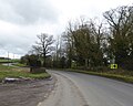
 Crossroads near Bishop's Caundle - geograph.org.uk - 549153.jpg 640 × 480; 157 KB
-
 Entrance to Hawkins Farm - geograph.org.uk - 549156.jpg 640 × 480; 182 KB
-
 Fading light at Glanvilles Wootton - geograph.org.uk - 677742.jpg 480 × 640; 80 KB
-
 Hartmoor Farm - geograph.org.uk - 560087.jpg 640 × 480; 196 KB
-
 Hill Street Farm Holwell - geograph.org.uk - 549184.jpg 640 × 480; 181 KB
-

-
 Pulham village sign - geograph.org.uk - 387145.jpg 640 × 427; 112 KB
-
-


.jpg)


