Category:Horaikyo
Jump to navigation
Jump to search
| Object location | | View all coordinates using: OpenStreetMap |
|---|
| Upload media | |||||
| Instance of | |||||
|---|---|---|---|---|---|
| Located in protected area | |||||
| Location |
| ||||
| Mountain range | |||||
 | |||||
Media in category "Horaikyo"
The following 12 files are in this category, out of 12 total.
-
 Deep Horai Valley.jpg 2,560 × 1,920; 1.96 MB
-
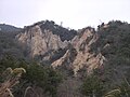
 Horaikyo badland01.jpg 1,024 × 768; 690 KB
-
 Horaikyo Zato-dani ja01.jpg 1,024 × 768; 809 KB
-
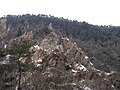
 Horaikyo1.jpg 3,264 × 2,448; 4.18 MB
-
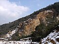
 HoraiValley1.JPG 2,560 × 1,920; 1.67 MB
-
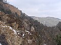
 HoraiValley2.JPG 2,560 × 1,920; 1.56 MB
-
 HoraiValley3.JPG 2,560 × 1,920; 1.92 MB
-
 HoraiValley4.JPG 2,560 × 1,920; 1.98 MB
-
 HoraiValley6.JPG 2,560 × 1,920; 1.79 MB
-
 HoraiValley7.JPG 2,560 × 1,920; 1.88 MB
-
 HoraiValley8.JPG 2,560 × 1,920; 1.88 MB
-
 HoraiValley9.JPG 2,560 × 1,920; 1.92 MB


