Category:Hunda
Aller à la navigation
Aller à la recherche
île britannique  | |||||
| Téléverser des médias | |||||
| Nature de l’élément | |||||
|---|---|---|---|---|---|
| Partie de | |||||
| Lieu | Orcades, Écosse | ||||
| Baigné par | |||||
| Population |
| ||||
| Superficie |
| ||||
 | |||||
Sous-catégories
Cette catégorie comprend seulement la sous-catégorie ci-dessous.
H
- Hunda Sandstone Formation (2 F)
Média dans la catégorie « Hunda »
Cette catégorie comprend 38 fichiers, dont les 38 ci-dessous.
-
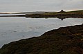
 Bar Taing, Hunda - geograph.org.uk - 1314329.jpg 640 × 393 ; 90 kio
-
 Bar Taing, Hunda - geograph.org.uk - 1314419.jpg 640 × 400 ; 59 kio
-
 Bullterriersvartvit.JPG 2 048 × 1 536 ; 1,56 Mio
-
 Burray Gun WW2.jpg 640 × 480 ; 65 kio
-
 Burray Littlequoy.jpg 640 × 480 ; 57 kio
-
 Causeway and old farm, Hunda - geograph.org.uk - 1069678.jpg 640 × 426 ; 70 kio
-
 Derelict Enclosure, Hunda - geograph.org.uk - 3266132.jpg 1 500 × 909 ; 883 kio
-
 Empty Farm Building, Hunda - geograph.org.uk - 3266276.jpg 1 500 × 974 ; 969 kio
-
 Empty Farm Building, Hunda - geograph.org.uk - 3266293.jpg 1 500 × 997 ; 898 kio
-
 Exposed strata, Hunda - geograph.org.uk - 1069667.jpg 640 × 426 ; 84 kio
-
 Farmyard Flowers at Hunda Reef - panoramio.jpg 2 111 × 1 319 ; 2,7 Mio
-
 Hunda Causeway - geograph.org.uk - 1069687.jpg 640 × 426 ; 84 kio
-
 Hunda Causeway.jpg 640 × 427 ; 82 kio
-
 Hunda Coastline - geograph.org.uk - 3264253.jpg 1 019 × 1 500 ; 814 kio
-
 Hunda Coastline - geograph.org.uk - 3264277.jpg 1 041 × 1 500 ; 799 kio
-
 Hunda Coastline - geograph.org.uk - 3264281.jpg 1 062 × 1 500 ; 947 kio
-
 Hunda Coastline - geograph.org.uk - 3264290.jpg 1 072 × 1 500 ; 1,05 Mio
-
 Hunda Moorland looking towards Burray and South Ronaldsay - geograph.org.uk - 3265606.jpg 1 184 × 1 500 ; 1,04 Mio
-
 Hunda Orkney.svg 1 110 × 1 424 ; 731 kio
-
 Hunda Reef towards Burray - panoramio.jpg 2 218 × 1 386 ; 2,8 Mio
-
 Hunda Summit - geograph.org.uk - 4007132.jpg 2 560 × 1 920 ; 2,71 Mio
-
 Hunda, heath and boulders - geograph.org.uk - 1069698.jpg 640 × 426 ; 63 kio
-
 Hunda, looking inland - geograph.org.uk - 3265544.jpg 1 500 × 961 ; 948 kio
-
 Laminated Sandstone, Hunda - geograph.org.uk - 3266283.jpg 1 500 × 997 ; 1,01 Mio
-
 Laxigar, Hunda - geograph.org.uk - 1069636.jpg 640 × 412 ; 75 kio
-
 Looking along East Ayre, Hunda - geograph.org.uk - 3266150.jpg 1 500 × 983 ; 875 kio
-
 Looking towards East Ayre, Hunda - geograph.org.uk - 3266138.jpg 1 500 × 912 ; 877 kio
-
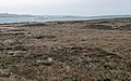
 Moorland on Hunda - geograph.org.uk - 1314113.jpg 640 × 404 ; 67 kio
-
 Old quarry, Hunda - geograph.org.uk - 1069633.jpg 640 × 426 ; 85 kio
-
 Peat Moorland, Hunda - geograph.org.uk - 3265567.jpg 1 500 × 906 ; 836 kio
-
 Pentland Ferry from Hunda Reef - panoramio.jpg 1 418 × 886 ; 1,1 Mio
-
 Setting sun, Hunda - geograph.org.uk - 1069704.jpg 640 × 426 ; 59 kio
-
 Strange Perspective, Hunda - geograph.org.uk - 3265519.jpg 1 500 × 932 ; 796 kio
-
 The Hope, Hunda - geograph.org.uk - 1314118.jpg 640 × 398 ; 92 kio
-
 The Hope, Hunda - geograph.org.uk - 1314128.jpg 640 × 400 ; 85 kio
-
 The Hope, Hunda - geograph.org.uk - 3264153.jpg 1 500 × 979 ; 813 kio
-
 Towards East Ayre, Hunda - geograph.org.uk - 1069702.jpg 640 × 426 ; 81 kio
-
 Water Sound and the Isle of Hunda - geograph.org.uk - 4475061.jpg 480 × 640 ; 278 kio


