Category:Hypsometric tints
Jump to navigation
Jump to search
English: Hypsometric tints are used to depict ranges of elevation as bands of color, usually in a graduated scheme.
Deutsch: Reliefdarstellung auf topographischen Karten durch unterschiedlich gefärbte Höhenschichtflächen (sogenannte Regionalfarbe oder Farbenplastik).
See also categories: Hachure maps, Contour lines (cartography), Topographic shading and Cartographic reliefs.
use of color to mark elevation in a map  Hypsometric tints indicate the elevation of features on a map | |||||
| Upload media | |||||
| Subclass of |
| ||||
|---|---|---|---|---|---|
| Part of |
| ||||
| |||||
Media in category "Hypsometric tints"
The following 51 files are in this category, out of 51 total.
-
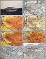
 Karte Kyffhäuser.jpg 748 × 1,009; 571 KB
-
 20 Hypsometric Tints 2000m.png 223 × 1,830; 17 KB
-
 20 Hypsometric Tints 2000m.svg 223 × 1,830; 33 KB
-
 20 Hypsometric Tints 4000m.png 200 × 2,000; 17 KB
-
 20 Hypsometric Tints 4000m.svg 223 × 1,830; 33 KB
-
 20 Hypsometric Tints 8000m.png 200 × 2,000; 17 KB
-
 20 Hypsometric Tints 8000m.svg 223 × 1,830; 33 KB
-
 80 Hypsometric Tints 2000m.png 223 × 6,630; 63 KB
-
 80 Hypsometric Tints 2000m.svg 223 × 6,630; 122 KB
-
 80 Hypsometric Tints 4000m.png 223 × 6,630; 66 KB
-
 80 Hypsometric Tints 4000m.svg 223 × 6,630; 122 KB
-
 80 Hypsometric Tints 8000m.png 223 × 6,630; 67 KB
-
 80 Hypsometric Tints 8000m.svg 223 × 6,630; 122 KB
-
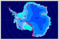 Antarctica interglacial hg.png 1,117 × 764; 402 KB
-
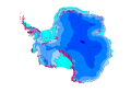 Antarctica interglacial hg.svg 512 × 512; 273 KB
-
 Borneo Topography.png 1,725 × 1,824; 2.52 MB
-
 Corpo Truppe Volontarie 36.jpg 4,836 × 3,549; 12.57 MB
-
 Corpo Truppe Volontarie 39.jpg 4,964 × 3,629; 5.13 MB
-
 Corpo Truppe Volontarie 41.jpg 9,701 × 3,464; 16.66 MB
-
 Corpo Truppe Volontarie 42.jpg 10,172 × 3,622; 17.56 MB
-
 Corpo Truppe Volontarie 43.jpg 9,692 × 3,598; 20.29 MB
-
 Corpo Truppe Volontarie 44.jpg 10,108 × 3,470; 14.62 MB
-
 Corpo Truppe Volontarie 45.jpg 9,924 × 3,478; 17.89 MB
-
 Corpo Truppe Volontarie 61.jpg 4,732 × 3,621; 13.02 MB
-
 Deister.jpg 496 × 417; 146 KB
-
 Drawehn.png 775 × 909; 76 KB
-
 Farbskala.svg 1,269 × 628; 129 KB
-
 Freiburg in Brockhaus 1937.jpg 1,579 × 2,672; 2.44 MB
-
 GEBCO-OpenSeaMap-Water-depth-Gibraltar.jpg 1,024 × 513; 69 KB
-
 Hypsocontours.png 1,224 × 792; 1.12 MB
-
 Hypsometric Visualization of the Moon (8137140463).png 4,000 × 4,000; 24.12 MB
-
 HypsoTintedContours.pdf 2,550 × 1,650; 674 KB
-
 Höhenprofil Pinneberg.jpg 413 × 556; 51 KB
-
 Isobates-simple example.svg 263 × 380; 5 KB
-
 IsraelCVFRtopography.jpg 1,233 × 1,656; 191 KB
-
 Lange diercke sachsen gebiet des windbergs farbige höhenschichten.jpg 1,170 × 774; 562 KB
-
 Lange diercke sachsen gebiet des windbergs.jpg 2,470 × 3,147; 6.86 MB
-
 Ldz-powierzchnia.tif 939 × 826; 2.22 MB
-
 Lodz Hypsometric tints.svg 744 × 744; 226 KB
-
 Maps-for-free Sierra Nevada.png 497 × 399; 377 KB
-
 Moon worldwind (cropped).jpg 936 × 935; 217 KB
-
 Moon worldwind.jpg 1,280 × 948; 220 KB
-
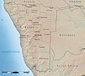 Namibia Natural Earth 1.jpg 1,015 × 914; 279 KB
-
 Rear map.jpg 2,201 × 1,617; 1.61 MB
-
 Sandbox with interactive projection at 31c3.jpg 2,688 × 4,053; 3.11 MB
-
 Scales mapping.PNG 1,269 × 628; 41 KB
-
 SRTM1 Example Nevada.png 1,600 × 1,812; 4.96 MB
-
 Sulawesi Topography.png 2,153 × 1,990; 1.71 MB
-
 Tanzania-Mount Meru NASA-PIA03356.jpg 540 × 432; 86 KB
-
 Vesuvius SRTM3.png 942 × 794; 922 KB
-
 Vesuvius SRTM3.xcf 942 × 794; 2.33 MB


.png)


.jpg)


