Category:Ilkeston
Zur Navigation springen
Zur Suche springen
Kleinstadt im Vereinigten Königreich  | |||||
| Medium hochladen | |||||
| Ist ein(e) | |||||
|---|---|---|---|---|---|
| Ort | Erewash, Derbyshire, East Midlands, England | ||||
 | |||||
Ilkeston is a Market town in Derbyshire.
Unterkategorien
Es werden 12 von insgesamt 12 Unterkategorien in dieser Kategorie angezeigt:
In Klammern die Anzahl der enthaltenen Kategorien (K), Seiten (S), Dateien (D)
Medien in der Kategorie „Ilkeston“
Folgende 129 Dateien sind in dieser Kategorie, von 129 insgesamt.
-
 2006 - geograph.org.uk - 98418.jpg 640 × 480; 35 KB
-
 Bailey Brook Road, Ilkeston - geograph.org.uk - 2075691.jpg 640 × 480; 65 KB
-
 Bailey's Factory, Ilkeston.jpg 640 × 427; 89 KB
-
 Baltex, Ilkeston - geograph.org.uk - 5485577.jpg 1.280 × 960; 423 KB
-

-
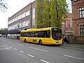 Bus on Wharncliffe Road, Ilkeston (1) - geograph.org.uk - 3035463.jpg 1.024 × 768; 183 KB
-
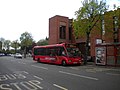
 Bus on Wharncliffe Road, Ilkeston (2) - geograph.org.uk - 3035480.jpg 1.024 × 768; 151 KB
-
 Bus on Wharncliffe Road, Ilkeston (3) - geograph.org.uk - 3035492.jpg 1.024 × 768; 166 KB
-
 Bus on Wharncliffe Road, Ilkeston (Crop).jpg 521 × 275; 109 KB
-
 Care home off Awsworth Road, Ilkeston - geograph.org.uk - 5039066.jpg 1.200 × 799; 333 KB
-
 Cast iron planter - geograph.org.uk - 5485582.jpg 960 × 1.280; 497 KB
-
 Day Nursery, Stanton Road - geograph.org.uk - 4272112.jpg 4.912 × 2.760; 6,81 MB
-
 Detail of The Ritz - geograph.org.uk - 1125260.jpg 425 × 640; 107 KB
-

-
 Eden Surgery in Ilkeston - geograph.org.uk - 3803148.jpg 3.928 × 2.900; 2,52 MB
-
En-Ilkeston.ogg 2,6 s; 40 KB
-
 Erewash flood meadow at Ilkeston - geograph.org.uk - 1772275.jpg 640 × 480; 82 KB
-
 Erewash Valley - geograph.org.uk - 1409641.jpg 640 × 479; 194 KB
-
 Erewash1847.png 794 × 1.524; 93 KB
-
 Erewash1862.png 794 × 1.524; 115 KB
-
 Factory Building, Ilkeston - geograph.org.uk - 1009961.jpg 640 × 480; 101 KB
-
 Factory of Ball and Son.jpg 1.280 × 960; 372 KB
-
 Finn McCoul's - geograph.org.uk - 1458494.jpg 640 × 480; 74 KB
-
 Fire Training House - geograph.org.uk - 1249949.jpg 640 × 416; 112 KB
-
 Gallows Inn Area, Ilkeston, Derbys. - geograph.org.uk - 3331351.jpg 3.420 × 2.546; 1,51 MB
-
 Gallows Inn Area, Ilkeston, Derbys. - geograph.org.uk - 3331360.jpg 3.592 × 2.819; 1,74 MB
-
 Gallows Inn Bridge, Ilkeston, Derbys. - geograph.org.uk - 3331309.jpg 3.835 × 2.877; 2,31 MB
-
 Goodbye to the Melting Shop - geograph.org.uk - 1548891.jpg 640 × 426; 72 KB
-
 Hallam Fields Road, Ilkeston - geograph.org.uk - 371183.jpg 640 × 428; 88 KB
-
 Hallam Fields, Ilkeston DE7 - geograph.org.uk - 3331479.jpg 3.592 × 2.697; 1,62 MB
-
 Heanor Road former railway bridge - geograph.org.uk - 5482886.jpg 1.280 × 960; 296 KB
-
 Heanor Road in Ilkeston - geograph.org.uk - 4858509.jpg 800 × 512; 133 KB
-
 Heanor Road, Ilkeston - geograph.org.uk - 876526.jpg 640 × 480; 114 KB
-
 Houseboats on the Erewash Canal - geograph.org.uk - 1009925.jpg 480 × 640; 107 KB
-
 IKEA customer service in Ilkeston.jpeg 3.264 × 2.448; 2,03 MB
-
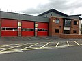
 Ikeston Community Fire Station - geograph.org.uk - 1249937.jpg 640 × 479; 115 KB
-
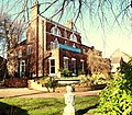
 Ilkeston - Cromwell Buildings - geograph.org.uk - 3382888.jpg 1.600 × 1.236; 561 KB
-
 Ilkeston - houses on east side of Lord Haddon Road - geograph.org.uk - 3382898.jpg 1.600 × 1.429; 799 KB
-
 Ilkeston art by Craig Hazell.jpg 494 × 576; 119 KB
-
 Ilkeston Community Fire Station - geograph.org.uk - 1452034.jpg 640 × 480; 69 KB
-
 Ilkeston Community Hospital - geograph.org.uk - 3863150.jpg 1.280 × 851; 284 KB
-
 Ilkeston DE7, Derbys - geograph.org.uk - 3315345.jpg 3.318 × 2.898; 4,54 MB
-
 Ilkeston DE7, Derbys - geograph.org.uk - 3315365.jpg 3.656 × 2.525; 1,79 MB
-
 Ilkeston Fair Derbyshire.jpg 440 × 600; 100 KB
-
 Ilkeston Fire Station - geograph.org.uk - 72517.jpg 640 × 427; 176 KB
-
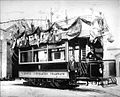 Ilkeston tram.jpg 271 × 219; 15 KB
-
 Ilkeston unparished area UK locator map.svg 1.372 × 1.305; 326 KB
-
 Ilkeston Warm Baths.jpg 744 × 402; 115 KB
-
 Ilkeston, DE7 - geograph.org.uk - 3301781.jpg 3.756 × 2.108; 1,58 MB
-
 Ilkeston, DE7 - geograph.org.uk - 3301836.jpg 2.968 × 2.289; 1,64 MB
-
 Ilkeston, DE7 - geograph.org.uk - 3301854.jpg 2.812 × 3.803; 2,2 MB
-
 Ilkeston, DE7 - geograph.org.uk - 3301863.jpg 3.468 × 2.522; 2,12 MB
-
 Ilkeston, DE7 - geograph.org.uk - 3313769.jpg 3.912 × 2.529; 1,82 MB
-
 Ilkeston, Derbys. DE7 - geograph.org.uk - 3302631.jpg 3.511 × 2.089; 1,32 MB
-
 Ilkeston, Derbys. DE7 - geograph.org.uk - 3302680.jpg 2.541 × 3.641; 1,62 MB
-
 Ilkeston, Derbys. DE7 - geograph.org.uk - 3302709.jpg 4.032 × 2.483; 2,3 MB
-
 Ilkeston, UK - panoramio.jpg 1.536 × 2.048; 1,16 MB
-
 Ilkeston-banner01.jpg 2.197 × 315; 111 KB
-
 Ilkeston-Nottingham Railway Lines - geograph.org.uk - 3302084.jpg 4.032 × 2.141; 1,97 MB
-
 Ilkeston-sl02.jpg 2.511 × 315; 125 KB
-
 Illkeston, DE7 - Derbys - geograph.org.uk - 3314460.jpg 3.720 × 2.738; 2,04 MB
-

-
 Industrial building, Ilkeston - geograph.org.uk - 3608386.jpg 800 × 525; 82 KB
-

-
 Large factory at Ilkeston Junction - geograph.org.uk - 1198329.jpg 640 × 427; 83 KB
-
 Large factory on Digby Street - geograph.org.uk - 1772209.jpg 640 × 480; 82 KB
-
 Longfield Lane - geograph.org.uk - 1660006.jpg 640 × 426; 75 KB
-
 Manner Floods - geograph.org.uk - 1268369.jpg 640 × 428; 140 KB
-
 Merlin Way - geograph.org.uk - 775086.jpg 640 × 427; 73 KB
-

-
 Mouth and Foot, Ilkeston - geograph.org.uk - 4272153.jpg 4.912 × 2.760; 5,34 MB
-
 Narrowboat on Erewash canal - geograph.org.uk - 355924.jpg 640 × 480; 135 KB
-

-

-
 Nottingham Road in Ilkeston - geograph.org.uk - 4858641.jpg 800 × 600; 136 KB
-
 Nottingham Road in Ilkeston - geograph.org.uk - 4858649.jpg 800 × 567; 118 KB
-
 Old brick kiln - geograph.org.uk - 1881528.jpg 1.280 × 853; 755 KB
-
 Old concrete bridge - geograph.org.uk - 775242.jpg 640 × 427; 151 KB
-
 Old footbridge over the Nut Brook - geograph.org.uk - 775157.jpg 640 × 427; 159 KB
-
 Old stone bench - geograph.org.uk - 1660432.jpg 640 × 480; 83 KB
-
 On the Nutbrook Trail at Ikeston - geograph.org.uk - 1305596.jpg 640 × 480; 224 KB
-
 Path and Benches at Straw's Bridge - geograph.org.uk - 2233159.jpg 640 × 427; 62 KB
-

-
 Path towards Mapperley - geograph.org.uk - 1268491.jpg 640 × 428; 131 KB
-
 Pewit Golf Course (1) - geograph.org.uk - 875834.jpg 640 × 480; 60 KB
-
 Pewit Golf Course (2) - geograph.org.uk - 875837.jpg 640 × 480; 71 KB
-
 Pewit Golf Course (3) - geograph.org.uk - 875838.jpg 640 × 480; 79 KB
-
 Pewit Golf Course - geograph.org.uk - 1269753.jpg 640 × 429; 91 KB
-
 Queens Drive, Ilkeston - geograph.org.uk - 1249960.jpg 640 × 480; 113 KB
-
 Ratcliffe on Soar Power Station from Ilkeston, Derbyshire.jpg 2.376 × 1.368; 223 KB
-
 Road bridge over the Nutbrook Trail - geograph.org.uk - 775210.jpg 640 × 427; 110 KB
-
 Rockin' Robin - geograph.org.uk - 1021248.jpg 640 × 480; 67 KB
-
 Spiral footbridge, Ilkeston - geograph.org.uk - 5497548.jpg 1.016 × 1.280; 392 KB
-
 Stanton Road Cemetery, Ilkeston - geograph.org.uk - 5497519.jpg 1.280 × 933; 476 KB
-
 StantonWireRH.jpg 2.576 × 1.932; 904 KB
-
 StantonWorks.jpg 2.576 × 1.932; 1,12 MB
-
 Station Road, Ilkeston - geograph.org.uk - 876496.jpg 640 × 480; 126 KB
-

-
 Steps down - geograph.org.uk - 5485586.jpg 1.280 × 872; 426 KB
-
 Stile to Pewit Golf Course - geograph.org.uk - 1305604.jpg 640 × 480; 198 KB
-

-
 Sunrise across the Erewash Valley - geograph.org.uk - 1094037.jpg 640 × 428; 71 KB
-
 The 'Stute - geograph.org.uk - 17054.jpg 640 × 423; 44 KB
-
 The Brewery Tap, Ilkeston - geograph.org.uk - 3862964.jpg 1.277 × 960; 278 KB
-
 The Durham Ox, Ilkeston - geograph.org.uk - 4761264.jpg 1.280 × 851; 289 KB
-

-

-

-

-

-
 The Nutbrook trail - geograph.org.uk - 1302046.jpg 640 × 480; 183 KB
-
 The Ritz - geograph.org.uk - 1125199.jpg 640 × 426; 81 KB
-
 Tree, Ilkeston - geograph.org.uk - 1005855.jpg 640 × 480; 92 KB
-
 View of Ilkeston from Shipley Hill - panoramio.jpg 1.600 × 1.200; 363 KB
-

-
 West End Drive, Ilkeston - geograph.org.uk - 1005907.jpg 640 × 480; 82 KB
-
 Western Edge of Ilkeston - geograph.org.uk - 1005858.jpg 640 × 480; 74 KB
-
 Western Edge of Ilkeston - geograph.org.uk - 1005862.jpg 640 × 480; 94 KB
-
 Back Gardens - geograph.org.uk - 98546.jpg 640 × 480; 103 KB
-
 Chaucer Old Park, Ilkeston - geograph.org.uk - 14817.jpg 640 × 423; 131 KB
-
 Fissh 'n' Chipps^ - geograph.org.uk - 135855.jpg 640 × 480; 138 KB
-
 Manners Industrial Estate, Ilkeston - geograph.org.uk - 17623.jpg 640 × 480; 59 KB
-
 Saint Mary Court - geograph.org.uk - 469468.jpg 640 × 480; 49 KB
-
 Saturday at the Fair - geograph.org.uk - 133778.jpg 640 × 480; 113 KB
-
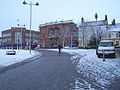 Snow Covered Town Centre - geograph.org.uk - 98532.jpg 640 × 480; 69 KB
-
 Straw's Bridge - geograph.org.uk - 518569.jpg 640 × 428; 103 KB
-
 Straw's Bridge - geograph.org.uk - 518586.jpg 428 × 640; 95 KB
-
 Straw's Bridge - geograph.org.uk - 518598.jpg 640 × 428; 98 KB
-
 The Stute, Ilkeston - geograph.org.uk - 371151.jpg 640 × 428; 83 KB


_-_geograph.org.uk_-_3035463.jpg)
_-_geograph.org.uk_-_3035480.jpg)
_-_geograph.org.uk_-_3035492.jpg)
.jpg)


_-_geograph.org.uk_-_875834.jpg)
_-_geograph.org.uk_-_875837.jpg)
_-_geograph.org.uk_-_875838.jpg)


