Category:Information boards in Hesse
Jump to navigation
Jump to search
Federal states of Germany:
Deutsch: Informationstafeln in Hessen
Subcategories
This category has the following 11 subcategories, out of 11 total.
Media in category "Information boards in Hesse"
The following 189 files are in this category, out of 189 total.
-
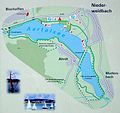 Aartalsperre-Lageplan.jpg 773 × 730; 141 KB
-
 Adolfsturm-01-Tafel.jpg 4,320 × 3,240; 5.73 MB
-
 Alte Schule Dodenhausen.jpg 4,237 × 3,178; 5.24 MB
-
 Alteburg lorsbach 071.JPG 3,264 × 2,448; 1.55 MB
-
 Altenberg (Hohenahr)-Tafel.jpg 4,320 × 3,240; 5.38 MB
-
 Amönau Schild.jpg 1,643 × 2,464; 2.45 MB
-
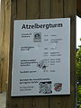 Atzelbergturm Tafel.JPG 3,240 × 4,320; 5.33 MB
-
 Aussichtskanzel Vogelnest Infotafel.JPG 3,240 × 4,320; 5.78 MB
-
 Aussichtspunkt Via Regia (Informationstafel).jpg 3,000 × 4,000; 2.32 MB
-
 Aussichtsturm Dillblick-03-Tafel.jpg 4,320 × 3,240; 5.45 MB
-
 Aussichtsturm Hohes Gras-03-Tafel.jpg 3,240 × 4,320; 4.71 MB
-
 Aussichtsturm Homberg-02-Tafel.jpg 3,240 × 4,320; 4.67 MB
-
 Aussichtsturm Kostheim Infotafel.JPG 3,240 × 4,320; 5.5 MB
-
 Backhaus Niedereisenhausen Schild.jpg 2,942 × 2,362; 1.85 MB
-
 Bad Soden Jüd. Friedhof 003.jpg 1,358 × 1,127; 306 KB
-
 Bahnradweg Rotkäppchenland-Infotafel.jpg 4,320 × 3,240; 5.35 MB
-
 Bellinger Warte-02-Tafel.jpg 4,320 × 3,240; 5.79 MB
-
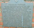
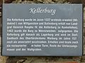 Bergfried Kellerburg-03-Tafel.jpg 4,320 × 3,240; 5.52 MB
-
 Biosphärenreservat Rhön nahe Frankenheim (18).jpg 2,140 × 2,572; 4.01 MB
-
 Biosphärenreservat Rhön nahe Frankenheim (19).jpg 2,592 × 3,888; 2.01 MB
-
 Blauer Kran-02-Tafel.jpg 4,320 × 3,240; 5.41 MB
-
 Bodenerlebnisstation Sulbach Taunus (3).jpg 3,648 × 2,736; 5.33 MB
-
 Bonifatius-Schotten.jpg 4,320 × 3,240; 5.61 MB
-
 Borkener See Vandalismus.jpg 2,048 × 1,536; 687 KB
-
 Braunauer Warte-03-Tafel.jpg 3,240 × 4,320; 4.71 MB
-
 Schild Alter Friedhof III Breidenbach.jpg 2,500 × 2,500; 4.18 MB
-
 Buchenwald am Ebersberg.jpg 3,888 × 2,592; 5.63 MB
-
 Burg Breuberg-Lageplan.jpg 4,320 × 3,240; 5.44 MB
-
 Burg Eisenberg-02-Tafel.jpg 4,320 × 3,240; 5.72 MB
-
 Burg Gleiberg-Infotafel.JPG 3,584 × 2,688; 5.18 MB
-
 Burg Greifenstein (Hessen) Jubiläum.jpg 1,673 × 2,252; 2.32 MB
-
 Burg Greifenstein (Hessen) Welcome.jpg 3,264 × 2,448; 2.9 MB
-
 Burg Heiligenberg-Schild.jpg 3,240 × 4,320; 5.79 MB
-
 Burg Idstein-Infotafel.jpg 4,320 × 3,240; 5.76 MB
-
 Burg Jesberg-03-Tafel.jpg 4,320 × 3,240; 5.46 MB
-
 Burg Lißberg-02-Tafel.jpg 4,320 × 3,240; 5.68 MB
-
 Burg Reifenberg-01-Lageplan.jpg 4,320 × 3,240; 5.92 MB
-
 Burg Ulrichstein-04-Infotafel.jpg 4,320 × 3,240; 5.73 MB
-
 Burg Vetzberg-Infotafel.JPG 4,430 × 3,322; 4.76 MB
-
 Burgkirche Dreieichenhain-04-Infotafel.jpg 4,320 × 3,240; 5.81 MB
-
 Burgruine Löwensten-07-Infotafel.jpg 4,320 × 3,240; 5.5 MB
-
 Burgruine Wallenstein-06-Infotafel.jpg 4,320 × 3,240; 5.19 MB
-
 Burgturm Hohenburg-03-Tafel.jpg 4,320 × 3,240; 5.32 MB
-
 Büdingen-Lorbach, Infotafel Herrnhaag-01.jpg 3,932 × 2,949; 6.4 MB
-
 Da-Eberstadt, Ernst-Ludwig-Saal-03-Infotafel.jpg 3,240 × 4,320; 6.88 MB
-
 Darmstadt, Südbahnhof-03-Infotafel.jpg 4,320 × 3,240; 7.15 MB
-
 Dodenhausen-Wanderschild.jpg 3,240 × 4,320; 4.91 MB
-
 Driedorf - Katholische Kirche Driedorf erbaut 1952-53 (3 07.2015).jpg 1,648 × 2,472; 4.42 MB
-
 Druselturm-03-Tafeln.jpg 3,240 × 4,320; 4.96 MB
-
 Duenzebacher Torturm Infotafel.jpg 2,150 × 1,377; 632 KB
-
 Ederradweg-landkarte.jpg 4,020 × 3,016; 2.97 MB
-
 Ehemalige Lessingschule (Darmstadt)-05-Tafel.jpg 4,320 × 3,240; 6.39 MB
-
 Eisenbaum Tafel 1.JPG 3,240 × 4,320; 5.55 MB
-
 Eisenbaum Tafel 2.JPG 3,240 × 4,320; 5.33 MB
-
 Eisenberg (Korbach)-02-Infoboard.jpg 4,320 × 3,240; 5.49 MB
-
 Ellerhöhturm-04-Infotafel.jpg 4,320 × 3,240; 4.96 MB
-
 Extratour Zweiburgentour - Wanderportal am Freibad Großenaltenstädten.jpg 4,032 × 2,268; 2.71 MB
-
 Felsburg (Hessen)-04-Schild.jpg 3,240 × 4,320; 5.12 MB
-
 Evangelische Kirche Fronhausen 11.jpg 4,655 × 3,491; 9.2 MB
-
 Gedenktafel des verschönerungvereins.JPG 4,000 × 3,000; 2.71 MB
-
 Geostation Kellerburg-Infotafel.jpg 4,320 × 3,240; 5.52 MB
-
 Gleichenhäuschen Infotafel.jpg 4,032 × 2,268; 3.04 MB
-
 Goetheturm 02.JPG 4,320 × 3,240; 5.19 MB
-
 Handelsstraße Hamburg — Leipzig, Steinau an der Straße, Schild.JPG 1,632 × 1,224; 550 KB
-
 Hardtbergturm-04-Infotafel.jpg 3,240 × 4,320; 6.79 MB
-
 Harmes'sches Handelshaus, Wanfried, Deutschland IMGL0142 edit.jpg 3,650 × 5,576; 13.14 MB
-
 Offenbach Hauptbahnhof - Tafel.jpg 4,000 × 3,000; 2.84 MB
-
 Hausbergturm-03-Tafel.jpg 4,320 × 3,240; 5.77 MB
-
 Hausbergturm-04-Tafel.jpg 3,240 × 4,320; 4.75 MB
-
 Hohenburg (Homberg)-Historie.jpg 4,320 × 3,240; 5.48 MB
-
 Holzturm Typ.jpg 2,737 × 2,121; 946 KB
-
 Hunburgturm-02-Infotafel.JPG 4,320 × 3,240; 5.53 MB
-
 Hutturm (Walsdorf)-05-Infotafel.jpg 4,320 × 3,240; 5.7 MB
-
 Informatioinstafel „Das schmeckt“.jpg 2,448 × 3,264; 2.28 MB
-
 Information board, reaction ferry Oedelsheim-Wesertal, river Weser.jpg 3,312 × 2,484; 1.26 MB
-
 Informationstafel "offenes Buch entland des Kegelspiel-Radweges".JPG 2,736 × 3,648; 4.73 MB
-
 Informationstafel am ehemaligem Bahnhof Leibolz (Eiterfeld).JPG 3,648 × 2,736; 5.44 MB
-
 Informationstafel am Erdwerk Calden bei Kassel (Gallerigräber) DSCF3623.JPG 3,488 × 2,616; 4.43 MB
-
 Informationstafel Die Zuckerrübe.jpg 3,240 × 4,320; 4.78 MB
-
 Informationstafel Hügelgräber.jpg 3,240 × 4,320; 2.73 MB
-
 Informationstafel Steinbruch am Carlsplatz Bad Karlshafen.jpg 4,320 × 3,240; 4.38 MB
-
 Informationstafel Stoffkreislauf.jpg 3,240 × 4,320; 4.98 MB
-
 Informationstafel Wölfersheim-Wohnbach.JPG 2,230 × 1,944; 1.75 MB
-
 Informationstafel Wüstung Reinersen.jpg 4,320 × 3,240; 4.78 MB
-
 Informationstafel „Hutestein von 1748“.jpg 4,320 × 3,240; 4.81 MB
-
 Informationstafel „Pflanze sucht Schutz“.jpg 2,448 × 3,264; 2.52 MB
-
 Infotafel "Wanderwege Ober-Mörlen" DSCF0754.jpg 1,944 × 2,592; 2.27 MB
-
 Infotafel "Wanderwege Ziegenberg".jpg 1,944 × 2,592; 2.33 MB
-
 Infotafel Am Galgenberg.jpg 4,032 × 2,268; 3.74 MB
-
 Infotafel Artenreicher Laubmischwald.jpg 4,032 × 2,268; 3.44 MB
-
 Infotafel Bergbau um Dillenburg.jpg 4,032 × 2,268; 3.38 MB
-
 Infotafel Beschertes Glück.jpg 4,032 × 2,268; 3.94 MB
-
 Infotafel Blick ins Nonnbachtal.jpg 4,032 × 2,268; 4.56 MB
-
 Infotafel Burg Hohensolms.jpg 4,032 × 2,268; 3.73 MB
-
 Infotafel Das Vogelschutzgebiet.jpg 4,032 × 2,268; 4.25 MB
-
 Infotafel Der Altenberg.jpg 4,032 × 2,268; 2.91 MB
-
 Infotafel Der Schelderwald.jpg 4,032 × 2,268; 4.51 MB
-
 Infotafel Dernbacher Fehde.jpg 2,268 × 4,032; 3.31 MB
-
 Infotafel Diabasabbau am Hessel.jpg 4,032 × 2,268; 4.21 MB
-
 Infotafel Die Landheege.jpg 4,032 × 2,268; 4.09 MB
-
 Infotafel Die Wüstung Minzhausen.jpg 4,032 × 2,268; 4.45 MB
-
 Infotafel Extratour Hohe Straße am Naturerlebnisbad Siegbach.jpg 4,032 × 2,268; 4.18 MB
-
 Infotafel Forschungs- und Lehrwald der Universität Marburg.jpg 4,032 × 2,268; 4.87 MB
-
 Infotafel Grube Neue Konstanze.jpg 4,032 × 2,268; 3.32 MB
-
 Infotafel Heimische Wildbienenarten.jpg 4,032 × 2,268; 3.23 MB
-
 Infotafel Hohensolms.jpg 4,032 × 2,268; 4.06 MB
-
 Infotafel Höhensiedlung Ställchen.jpg 4,032 × 2,268; 3.41 MB
-
 Infotafel Insektennisthilfen.jpg 4,032 × 2,268; 5.06 MB
-
 Infotafel Lebensraum Steinbruch.jpg 4,032 × 2,268; 3.79 MB
-
 Infotafel Naturschutzgebiet Kanzelstein bei Eibach.jpg 2,268 × 4,032; 4.61 MB
-
 Infotafel Nesselhof.jpg 4,032 × 2,268; 3.99 MB
-
 Infotafel Rennigishausen.JPG 2,273 × 2,478; 1.94 MB
-
 Infotafel Salzböderadweg Gemeinde Lohra.jpg 4,032 × 2,268; 3.05 MB
-
 Infotafel Salzböderadweg in Bad Endbach.jpg 4,032 × 2,268; 4 MB
-
 Infotafel Viermarkwald Altenvers (1).jpg 2,268 × 4,032; 4.02 MB
-
 Infotafel Viermarkwald Altenvers (2).jpg 2,268 × 4,032; 3.93 MB
-
 Infotafel Wacholderheide.jpg 4,032 × 2,268; 4.73 MB
-
 Infotafel Wanderparadies Gladenbach.jpg 4,032 × 2,268; 4.13 MB
-
 Johannisberg (Bad Nauheim), Infotafel Geschichte-1.jpg 4,320 × 3,240; 5.56 MB
-
 Johannisberg (Bad Nauheim), Infotafel Geschichte-2.jpg 4,320 × 3,240; 6.16 MB
-
 Jubiläums-Aussichtsturm-04-Tafel.jpg 3,240 × 4,320; 4.68 MB
-
 Kanzleitor (Idstein)-03-Tafeln.jpg 3,240 × 4,320; 6.07 MB
-
 Kirchhain Annapark Plan.jpg 4,726 × 3,264; 9.15 MB
-
 Kläranlage Cappel (Marburg) Schild.jpg 4,592 × 3,380; 7.16 MB
-
 Klein-Rohrheim und der Schinderhannes-Infotafel.jpg 3,024 × 4,032; 6.29 MB
-
 Kleinheubach, Evangelischer Friedhof (1) Infotafel.jpg 4,000 × 3,000; 2.52 MB
-
 Kneipp-Barfuß-Erlebnispfad.jpg 4,032 × 2,268; 4.07 MB
-
 Knoten - Gipfelschild.JPG 3,240 × 4,320; 5.65 MB
-
 Kohlenlore in Mariendorf.jpg 3,264 × 2,448; 2.48 MB
-
 Landau 20180626 13.jpg 3,237 × 2,158; 1.99 MB
-
 Landau 20180626 19.jpg 2,021 × 2,367; 1.02 MB
-
 Mainzlar - Bahnhof (1).jpg 3,456 × 5,184; 6.57 MB
-
 Mathematikum Gießen Schild.jpg 2,464 × 3,696; 3.56 MB
-
 Meisterturm Informationstafel.JPG 3,240 × 4,320; 5.56 MB
-
 Neu-Isenburg FFH-Gebiet Erlenbachaue-Infotafel.jpg 1,344 × 1,810; 1.22 MB
-
 Neustaedter Kirche Eschwege Infotafel.jpg 1,347 × 767; 242 KB
-
 Niedermittlau Laurentiuskirche (04).jpg 2,896 × 1,936; 1.05 MB
-
 NSG Breiter Berg (14).jpg 2,130 × 3,366; 3.92 MB
-
 Odenwaldlimes Steinturm Typ.jpg 2,373 × 2,299; 1.01 MB
-
 Ofenberg-Turm-03-Tafel.jpg 3,240 × 4,320; 4.86 MB
-
 Osthafenplan-schild-ffm001a.jpg 2,724 × 1,612; 1.51 MB
-
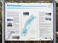 Perfstausee Infotafel.jpg 3,600 × 2,700; 3.99 MB
-
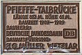 Pfieffetal Bridge Plaque.jpg 1,200 × 800; 334 KB
-
 Rachelshausen - Steinbruch-Endeschnabel (029) - Infotafel Kanzelblick.jpg 4,032 × 2,268; 3.23 MB
-
 Rastplatz an der Infotafel Hohensolms.jpg 4,032 × 2,268; 5.06 MB
-
 Rathaus Eberstadt-04-Infotafel.jpg 2,440 × 3,254; 3.99 MB
-
 Rosenhöhe Eingang Ludwig-Engel-Weg-Tafeln.jpg 3,240 × 4,320; 6.37 MB
-
 Rotes Moor Hinweistafel Torfabbau.jpg 2,023 × 1,479; 2.47 MB
-
 Rotes Moor Hinweistafel Vogelperspektive.jpg 1,838 × 1,478; 2.53 MB
-
 Rotes Moor Moornutzung.jpg 2,048 × 1,536; 719 KB
-
 Rundwanderwege Parkplatz Mühlenplatz.jpg 4,320 × 3,240; 2.82 MB
-
 Römerturm (Gaulskopf)-04-Tafel.jpg 4,320 × 3,240; 5.24 MB
-
 Römische Villa Haselburg, Jupitergigantensäule (4) Schild.jpg 4,000 × 3,000; 2.28 MB
-
 Römischer Signalturm (Johannisberg)-Infotafel.jpg 4,320 × 3,240; 5.22 MB
-
 RüdesheimNiederwaldEremitageSchutzhütteBis2011Schrifttafel.JPG 2,304 × 2,561; 1.4 MB
-
 RüdesheimNiederwaldInfotafel.JPG 3,072 × 2,304; 1.66 MB
-
 Schild 01.jpg 1,921 × 1,280; 2.06 MB
-
 Schild 02.jpg 1,920 × 1,280; 1.93 MB
-
 Schild Hinterturm in Schlitz (Vogelsbergkreis) (2).jpg 1,789 × 1,567; 1.04 MB
-
 Schillerturm (Oberursel)-02-Infotafel.jpg 3,240 × 4,320; 4.25 MB
-
 Schloss Hischhorn-Infotafel.jpg 3,240 × 4,320; 4.88 MB
-
 Schnullerbaum bei Gönnern Infotafel.jpg 2,268 × 4,032; 4.48 MB
-
 Schottenklein.jpg 432 × 324; 115 KB
-
 Seidenröther Warte-03-Schild.jpg 4,320 × 3,240; 5.55 MB
-
 Siechenkirche (Trendelburg)-Infotafel.jpg 4,320 × 3,240; 4.35 MB
-
 Sign in Wölfersheim.JPG 2,328 × 1,362; 1.87 MB
-
 Soisbergturm-02-Infotafel.jpg 3,240 × 4,320; 4.74 MB
-
 Somborn Kirche (12).jpg 2,896 × 1,936; 1.13 MB
-
 Stadtkirche Darmstadt-06-Infoblatt.jpg 3,240 × 4,320; 4.75 MB
-
 Stadtmauer Walsdorf-Schilder.jpg 3,240 × 4,320; 4.76 MB
-
 Staustufe Eddersheim 0201.JPG 2,304 × 3,072; 1.5 MB
-
 Sühnekreuze (Dreiech)-04-Infotafel.jpg 3,158 × 4,210; 5.52 MB
-
 Tafel Reinborn.JPG 3,072 × 2,304; 1.82 MB
-
 Tafel zur Grube Boxbach.JPG 3,456 × 5,184; 5.41 MB
-
 Tourist information Stellerskuppe Mar 2020.jpg 3,286 × 2,064; 1.83 MB
-
 Trail Info table height Klaus Marbach Viadukt.JPG 3,648 × 2,736; 4.54 MB
-
 Volkssternwarte Wetterau-Infotafel Aussichtsturm.jpg 4,320 × 3,240; 5.51 MB
-
 Wanderportal Extratour Hörlepanoramaweg in Oberhörlen.jpg 4,896 × 2,752; 5.69 MB
-
 Wartturm (Bad Orb)-04-Tafel.jpg 3,240 × 4,320; 4.83 MB
-
 Wasserburg Friedewald-05-Lageplan Kernburg.jpg 3,240 × 4,320; 4.71 MB
-
 Wegeportal Schauinsland-Tour.jpg 4,032 × 2,268; 3.34 MB
-
 Wegweiser Urwaldsteig.jpg 2,816 × 2,112; 2.56 MB
-
 Weilbacher Kiesgruben Lageplan.JPG 3,240 × 4,320; 5.75 MB
-
 Weißer Turm (Bad Homburg)-03-Tafeln.jpg 4,320 × 3,240; 5.49 MB
-
 Wintersteinturm Tafel.JPG 4,320 × 3,240; 5.51 MB
-
 Wolfhagen (Hesse)--180516-173040.jpg 1,445 × 1,445; 726 KB
-
 Wommelshausen - alte Ev. Kirche (Hinweistafel).jpg 2,739 × 4,180; 5.7 MB
-
 Wüstegarten-Infotafel.jpg 4,320 × 3,240; 4.23 MB
-
 Zwester Ohm (01).JPG 5,184 × 3,456; 7.42 MB


-Tafel.jpg)


.jpg)


.jpg)
.jpg)

.jpg)


_Jubil%C3%A4um.jpg)
_Welcome.jpg)


.jpg)


-05-Tafel.jpg)


-02-Infoboard.jpg)


-04-Schild.jpg)


-Historie.jpg)


-05-Infotafel.jpg)


.JPG)
_DSCF3623.JPG)


.jpg)
.jpg)


,_Infotafel_Geschichte-1.jpg)
,_Infotafel_Geschichte-2.jpg)

-03-Tafeln.jpg)

_Schild.jpg)

_Infotafel.jpg)


.jpg)


.jpg)
.jpg)


_-_Infotafel_Kanzelblick.jpg)


-04-Tafel.jpg)
_Schild.jpg)
-Infotafel.jpg)


_(2).jpg)
-02-Infotafel.jpg)


-Infotafel.jpg)


.jpg)


-04-Infotafel.jpg)


-04-Tafel.jpg)


-03-Tafeln.jpg)

--180516-173040.jpg)
.jpg)

.JPG)