Category:Ivybridge
Jump to navigation
Jump to search
| Object location | | View all coordinates using: OpenStreetMap |
|---|
town in Devon, SW England  | |||||
| Upload media | |||||
| Instance of | |||||
|---|---|---|---|---|---|
| Location | South Hams, Devon, South West England, England | ||||
| Said to be the same as | Ivybridge (Wikimedia duplicated page, civil parish) | ||||
| official website | |||||
 | |||||
This is a category containing images of Ivybridge — a small town in Devon, England.
Subcategories
This category has the following 6 subcategories, out of 6 total.
I
- Ivybridge Community College (1 F)
- Ivybridge in art (3 F)
- Ivybridge Town Hall (2 F)
P
R
V
- Ivybridge Viaduct (9 F)
Media in category "Ivybridge"
The following 200 files are in this category, out of 259 total.
(previous page) (next page)-
 A class 125 passes under Stowford Bridge - geograph.org.uk - 1419044.jpg 640 × 480; 103 KB
-
 A green slope - geograph.org.uk - 4819594.jpg 640 × 426; 46 KB
-
 A large grassy field - geograph.org.uk - 5138936.jpg 640 × 426; 37 KB
-
 A pair of horses - geograph.org.uk - 5872837.jpg 1,024 × 681; 99 KB
-
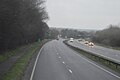 A38 approaching Ivybridge - geograph.org.uk - 5807666.jpg 1,024 × 681; 91 KB
-
 A38 Dual Carriageway - geograph.org.uk - 1424841.jpg 640 × 428; 75 KB
-

-
 A38 seen from the westbound slip road - geograph.org.uk - 2828378.jpg 800 × 600; 333 KB
-
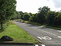 A38 slip road, Ivybridge - geograph.org.uk - 1411218.jpg 640 × 480; 95 KB
-
 B3213 (Western Rd), Ivybridge - geograph.org.uk - 5807671.jpg 919 × 1,024; 179 KB
-
 Bendy lane - geograph.org.uk - 233319.jpg 640 × 480; 95 KB
-
 Blachford Rd - geograph.org.uk - 4491756.jpg 640 × 426; 37 KB
-
 Cars parked by the main line - geograph.org.uk - 5797362.jpg 640 × 406; 97 KB
-
 Chapel Place.jpg 640 × 430; 73 KB
-
 Chimney above Ivybridge - geograph.org.uk - 5752924.jpg 640 × 426; 53 KB
-
 Chimney in Ivybridge - geograph.org.uk - 4947277.jpg 640 × 426; 58 KB
-
 Chimney in Ivybridge - geograph.org.uk - 5037834.jpg 640 × 426; 34 KB
-
 Chimney in Ivybridge - geograph.org.uk - 5797370.jpg 640 × 425; 39 KB
-
 Chimney, Ivybridge - geograph.org.uk - 5976203.jpg 1,024 × 681; 154 KB
-
 Cinema, Ivybridge - geograph.org.uk - 5807676.jpg 1,024 × 681; 113 KB
-
 Cleeve Drive, Ivybridge - geograph.org.uk - 232576.jpg 640 × 480; 90 KB
-
 Co-operative store and Post Office - geograph.org.uk - 3654000.jpg 640 × 428; 76 KB
-
 Constitutional Club, Ivybridge.jpg 640 × 430; 89 KB
-
 Cornward Road - geograph.org.uk - 3653973.jpg 640 × 428; 71 KB
-
 Cornwood Road, Langham - geograph.org.uk - 3168818.jpg 640 × 425; 197 KB
-
 Corrugated shed by the railway line - geograph.org.uk - 4491762.jpg 640 × 426; 33 KB
-
 Countryside near Ivybridge - geograph.org.uk - 4491754.jpg 640 × 426; 40 KB
-

-
 Crossing the footbridge - geograph.org.uk - 1759997.jpg 640 × 480; 284 KB
-
 Crossinhand Cross - geograph.org.uk - 3662477.jpg 640 × 428; 106 KB
-
 D Day Memorial Ivybridge - geograph.org.uk - 2779580.jpg 427 × 640; 537 KB
-
 Devon field - geograph.org.uk - 5717507.jpg 640 × 426; 55 KB
-
 Devon Hillside - geograph.org.uk - 5458501.jpg 640 × 426; 43 KB
-
 Devon pasture - geograph.org.uk - 5420517.jpg 640 × 426; 28 KB
-
 Dinnaton Golf Club - geograph.org.uk - 5458497.jpg 640 × 426; 52 KB
-
 Dinnaton Golf Course - geograph.org.uk - 4819593.jpg 640 × 426; 69 KB
-
 Dinnaton Golf Course - geograph.org.uk - 5270029.jpg 640 × 426; 74 KB
-
 Dinnaton Golf Course - geograph.org.uk - 5420488.jpg 640 × 426; 74 KB
-
 Dinnaton Golf Course - geograph.org.uk - 5872833.jpg 1,024 × 703; 148 KB
-
 Dual use path, Ivybridge - geograph.org.uk - 1411059.jpg 480 × 640; 93 KB
-
 Earthbank - geograph.org.uk - 5270041.jpg 640 × 426; 43 KB
-
 Eastbound on the A38 near Ivybridge - geograph.org.uk - 3163197.jpg 1,024 × 768; 86 KB
-
 Edge of Dartmoor National Park - geograph.org.uk - 5458511.jpg 640 × 426; 54 KB
-
 Electricity Pylon - geograph.org.uk - 3659421.jpg 640 × 428; 35 KB
-
 Entering Ivybridge - geograph.org.uk - 3483131.jpg 800 × 600; 154 KB
-

-
 Erme below Ivybridge - geograph.org.uk - 5402744.jpg 2,866 × 1,786; 1.13 MB
-
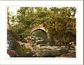
 Erme Bridge Works, Ivybridge - geograph.org.uk - 1410870.jpg 480 × 640; 105 KB
-
 Erme Primary School.jpg 640 × 430; 92 KB
-
 Erme Wood - geograph.org.uk - 4819621.jpg 640 × 426; 95 KB
-
 Erme-Plym Trail at A38 - geograph.org.uk - 5403806.jpg 3,072 × 2,048; 1.41 MB
-
 Erme-Plym Trail at Ivybridge Fire Station - geograph.org.uk - 5403786.jpg 1,681 × 2,372; 875 KB
-
 ErmeIvybridge.jpg 2,048 × 1,536; 1.42 MB
-
 Ivybridge Evangelical Church.jpg 640 × 427; 179 KB
-
 Exeter Road at Cole Lane, Ivybridge - geograph.org.uk - 3487120.jpg 800 × 600; 118 KB
-
 Exeter Road, Ivybridge - geograph.org.uk - 1273543.jpg 640 × 480; 104 KB
-
 Exeter Road, Ivybridge - geograph.org.uk - 3487126.jpg 800 × 600; 140 KB
-
 Exeter Road, Ivybridge - geograph.org.uk - 3487129.jpg 800 × 600; 165 KB
-
 Factory by the railway line - geograph.org.uk - 4491768.jpg 640 × 517; 52 KB
-
 Factory Chimney - geograph.org.uk - 5752925.jpg 640 × 426; 51 KB
-
 Factory Chimney - geograph.org.uk - 5834135.jpg 1,024 × 681; 74 KB
-
 Factory Chimney, Ivybridge - geograph.org.uk - 5514258.jpg 640 × 426; 66 KB
-
 Factory Chimney, Ivybridge - geograph.org.uk - 5514261.jpg 640 × 426; 98 KB
-
 Field and view, Ivybridge (2) - geograph.org.uk - 1411647.jpg 640 × 480; 112 KB
-
 Field and view, Ivybridge - geograph.org.uk - 1411645.jpg 640 × 480; 109 KB
-
 Field boundary - geograph.org.uk - 4819637.jpg 640 × 426; 52 KB
-
 Field boundary - geograph.org.uk - 4819640.jpg 640 × 426; 52 KB
-
 Field near Ivybridge - geograph.org.uk - 4039723.jpg 1,920 × 1,307; 641 KB
-
 Field near Ivybridge - geograph.org.uk - 4263321.jpg 1,920 × 1,260; 917 KB
-
 Field on the edge of Dartmoor - geograph.org.uk - 5420520.jpg 640 × 426; 48 KB
-
 Field on the edge of Ivybridge - geograph.org.uk - 4813810.jpg 640 × 420; 46 KB
-
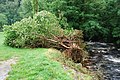 Flood damage - geograph.org.uk - 3096684.jpg 3,872 × 2,592; 4.84 MB
-
 Footbridge by the Erme - geograph.org.uk - 3620183.jpg 640 × 428; 128 KB
-
 Footbridge over the River Erme - geograph.org.uk - 906448.jpg 640 × 428; 136 KB
-
 Footpath damage - geograph.org.uk - 3096698.jpg 3,872 × 2,592; 4.54 MB
-

-
 Fore Street at Ivybridge.jpg 540 × 447; 69 KB
-
 Fore Street, Ivybridge - geograph.org.uk - 1410954.jpg 640 × 442; 65 KB
-
 Fore Street, Ivybridge - geograph.org.uk - 1410972.jpg 640 × 480; 72 KB
-
 Fore Street, Ivybridge - geograph.org.uk - 1760003.jpg 640 × 480; 209 KB
-
 Fore Street, Ivybridge - geograph.org.uk - 3483159.jpg 800 × 600; 139 KB
-
 Fore Street, Ivybridge 2 - geograph.org.uk - 1760008.jpg 640 × 480; 215 KB
-
 Glanville's Mill, Ivybridge (2) - geograph.org.uk - 1411023.jpg 640 × 480; 84 KB
-
 Glanville's Mill, Ivybridge (3) - geograph.org.uk - 1411031.jpg 480 × 640; 69 KB
-
 Glanville's Mill, Ivybridge - geograph.org.uk - 1411015.jpg 480 × 640; 94 KB
-
 Grassy slope - geograph.org.uk - 5872834.jpg 1,024 × 681; 93 KB
-
 Grazing land - geograph.org.uk - 5204202.jpg 640 × 426; 55 KB
-
 Grazing, Langham - geograph.org.uk - 4332899.jpg 800 × 560; 97 KB
-
 Harvested field - geograph.org.uk - 6036619.jpg 1,024 × 681; 166 KB
-
 Hedgeline - geograph.org.uk - 5458527.jpg 640 × 426; 54 KB
-

-
 Highland Street, Ivybridge - geograph.org.uk - 1410943.jpg 640 × 480; 81 KB
-
 Horse grazing - geograph.org.uk - 5458502.jpg 640 × 426; 43 KB
-
 Horses grazing - geograph.org.uk - 5270031.jpg 640 × 426; 47 KB
-
 Horses grazing - geograph.org.uk - 5420518.jpg 640 × 426; 35 KB
-

-

-
 Houses, Cole Lane - geograph.org.uk - 4947284.jpg 640 × 426; 54 KB
-
 Housing estates in the east of Ivybridge - geograph.org.uk - 3894447.jpg 1,536 × 1,152; 991 KB
-

-
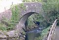 The Ivy Bridge.jpg 640 × 438; 122 KB
-
 Ivybridge , Car Park - geograph.org.uk - 5387185.jpg 6,000 × 4,000; 5.87 MB
-
 Ivybridge , Fore Street - geograph.org.uk - 5387182.jpg 5,312 × 2,988; 4.82 MB
-
 Ivybridge , Fore Street - geograph.org.uk - 5387183.jpg 5,312 × 2,988; 3.03 MB
-
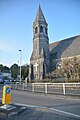 Ivybridge , Ivybridge Methodist Church - geograph.org.uk - 5387192.jpg 3,976 × 5,964; 6.64 MB
-
 Ivybridge , Pavement - geograph.org.uk - 5387180.jpg 5,312 × 2,988; 3.82 MB
-
 Ivybridge , Roundabout - geograph.org.uk - 5387189.jpg 6,000 × 4,000; 5.96 MB
-
 Ivybridge , St John's Road - geograph.org.uk - 5387193.jpg 6,000 × 4,000; 7.45 MB
-
 Ivybridge , The River Erme - geograph.org.uk - 5387179.jpg 5,312 × 2,988; 6.49 MB
-
 Ivybridge - geograph.org.uk - 4947274.jpg 640 × 387; 53 KB
-
 Ivybridge - geograph.org.uk - 5037835.jpg 640 × 426; 44 KB
-
 Ivybridge - geograph.org.uk - 5403587.jpg 640 × 426; 68 KB
-
 Ivybridge - geograph.org.uk - 5403591.jpg 640 × 426; 67 KB
-
 Ivybridge - geograph.org.uk - 5403765.jpg 640 × 426; 34 KB
-
 Ivybridge - geograph.org.uk - 5403767.jpg 640 × 426; 54 KB
-
 Ivybridge - geograph.org.uk - 5513942.jpg 640 × 426; 74 KB
-
 Ivybridge - geograph.org.uk - 5924097.jpg 1,024 × 681; 121 KB
-
 Ivybridge - geograph.org.uk - 5972495.jpg 1,024 × 681; 144 KB
-
 Ivybridge - water turbine - geograph.org.uk - 3834004.jpg 640 × 480; 138 KB
-
 Ivybridge Community College - geograph.org.uk - 2126737.jpg 640 × 432; 73 KB
-
 Ivybridge Community College A-Level Results.png 914 × 514; 63 KB
-
 Ivybridge cornishman geograph-2387874-by-Ben-Brooksbank.jpg 1,102 × 722; 392 KB
-
 Ivybridge Fire Station - geograph.org.uk - 1374134.jpg 640 × 428; 83 KB
-
 Ivybridge Fire Station.jpg 640 × 405; 227 KB
-
 Ivybridge Fore Street.jpg 4,032 × 3,024; 4.05 MB
-
 Ivybridge general view Plymouth England.jpg 1,068 × 829; 170 KB
-
 Ivybridge in Devon, England and Intel Ivy Bridge.jpg 3,264 × 2,448; 1.86 MB
-
 Ivybridge Leisure Centre - geograph.org.uk - 1411038.jpg 640 × 480; 84 KB
-
 Ivybridge Old Fire Station - geograph.org.uk - 88306.jpg 640 × 427; 232 KB
-
 Ivybridge railway station - geograph.org.uk - 3599178.jpg 1,024 × 768; 126 KB
-
 Ivybridge Recycling Centre - geograph.org.uk - 1374120.jpg 640 × 428; 67 KB
-
 Ivybridge snow panorama.jpg 11,834 × 1,994; 12.85 MB
-
 Ivybridge Tennis Club - geograph.org.uk - 1342819.jpg 640 × 428; 83 KB
-
 Ivybridge the bridge Plymouth England.jpg 1,065 × 829; 255 KB
-
 Ivybridge Watermark.jpg 640 × 480; 156 KB
-
 St. Austin's Priory, Ivybridge - geograph.org.uk - 232670.jpg 640 × 480; 76 KB
-
 Ivybridge, general view, Plymouth, England-LCCN2002708051.jpg 3,670 × 2,716; 3.25 MB
-
 Ivybridge, general view, Plymouth, England-LCCN2002708051.tif 3,670 × 2,716; 28.52 MB
-
 Ivybridge, the bridge, Plymouth, England-LCCN2002708050.jpg 3,659 × 2,716; 4.37 MB
-
 Ivybridge, the bridge, Plymouth, England-LCCN2002708050.tif 3,659 × 2,716; 28.44 MB
-

-
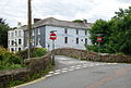
 Langham Bridge - geograph.org.uk - 233303.jpg 480 × 640; 129 KB
-
 Langham Bridge on Langham Levels - geograph.org.uk - 880414.jpg 640 × 430; 107 KB
-
 Langham Levels - geograph.org.uk - 5204204.jpg 640 × 426; 73 KB
-

-
 Luscombe Close, Ivybridge - geograph.org.uk - 4771883.jpg 1,600 × 1,068; 178 KB
-
 Mail train near Ivybridge - geograph.org.uk - 1140446.jpg 640 × 479; 121 KB
-
 Many colours in the Erme - geograph.org.uk - 2706826.jpg 800 × 800; 568 KB
-

-

-
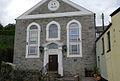
 Ivybridge Methodist Church.jpg 640 × 430; 55 KB
-
 Mini Roundabout, Langham Levels - geograph.org.uk - 5513945.jpg 640 × 426; 76 KB
-
 Mini-roundabout, B3213 - geograph.org.uk - 5807680.jpg 1,024 × 524; 117 KB
-
 Modern Housing in Ivybridge - geograph.org.uk - 49841.jpg 640 × 458; 93 KB
-
 Old housing in Ivybridge - geograph.org.uk - 49859.jpg 556 × 640; 101 KB
-
 Old Leat - geograph.org.uk - 3620190.jpg 640 × 428; 127 KB
-

-
 Old Smithy, Ivybridge - geograph.org.uk - 1411008.jpg 640 × 501; 70 KB
-
 Paper Mill, Ivybridge.jpg 430 × 640; 62 KB
-
 Parallel road and railway - geograph.org.uk - 1419058.jpg 640 × 480; 105 KB
-
 Park, Ivybridge - geograph.org.uk - 1410917.jpg 640 × 480; 111 KB
-
 Parkland on Blachford Road - geograph.org.uk - 3662501.jpg 640 × 428; 108 KB
-
 Pasture Land - geograph.org.uk - 3654011.jpg 640 × 428; 107 KB
-
 Pasture on the edge of Dartmoor - geograph.org.uk - 5420524.jpg 640 × 426; 44 KB
-
 Performance area, Ivybridge - geograph.org.uk - 1411043.jpg 640 × 427; 101 KB
-
 Playing fields at Ivybridge.jpg 640 × 480; 78 KB
-
 Ploughed field - geograph.org.uk - 5594672.jpg 640 × 426; 60 KB
-
 Population change in Ivybridge (1911-2011).png 1,018 × 502; 12 KB
-
 Population change in Ivybridge.png 1,491 × 772; 102 KB
-
 Prominent tree - geograph.org.uk - 5037806.jpg 640 × 426; 53 KB
-
-
 River Erme - geograph.org.uk - 3620186.jpg 640 × 428; 120 KB
-
 River Erme - geograph.org.uk - 4877444.jpg 1,600 × 1,067; 902 KB
-
 River Erme above Ivybridge 1.jpg 3,912 × 2,848; 4.15 MB
-
 River Erme at Ivybridge in summer.jpg 640 × 430; 130 KB
-
 River Erme at Ivybridge sewage works - geograph.org.uk - 5402771.jpg 2,048 × 3,072; 1.51 MB
-

-
 River Erme in Ivybridge.jpg 3,912 × 2,592; 5.7 MB
-
 River Erme leaving Ivybridge - geograph.org.uk - 5402663.jpg 2,825 × 1,894; 1.32 MB
-
-
 River Erme, Ivybridge - geograph.org.uk - 1410893.jpg 640 × 447; 85 KB
-
 River Erme, Ivybridge - geograph.org.uk - 1759992.jpg 640 × 480; 254 KB
-
 Road Bridge - geograph.org.uk - 3659419.jpg 640 × 428; 92 KB
-

-

-

-

-
 Road to Cornwood - geograph.org.uk - 1848565.jpg 640 × 370; 53 KB
-
 Roofscape of Ivybridge - geograph.org.uk - 4813822.jpg 640 × 351; 38 KB
-
 Roofscape, Ivybridge - geograph.org.uk - 4491777.jpg 640 × 426; 47 KB
-
 Rooftops, Ivybridge - geograph.org.uk - 4947259.jpg 640 × 387; 42 KB
-
 Rooftops, Ivybridge - geograph.org.uk - 5037830.jpg 640 × 426; 53 KB
-
 Rough grasses - geograph.org.uk - 5513940.jpg 640 × 426; 77 KB
-

-
 School for Handicapped Children - geograph.org.uk - 880706.jpg 640 × 430; 87 KB
-
 Shed by the railway, Ivybridge - geograph.org.uk - 4813804.jpg 640 × 426; 39 KB
-
 Sheep grazing - geograph.org.uk - 5138940.jpg 640 × 426; 55 KB
-
 Shops on Fore Street, Ivybridge - geograph.org.uk - 1410998.jpg 640 × 448; 60 KB
-
 Slip road - geograph.org.uk - 3639219.jpg 640 × 428; 78 KB
-
 Sloping field - geograph.org.uk - 5270030.jpg 640 × 426; 53 KB


,_Ivybridge_-_geograph.org.uk_-_5807671.jpg)


_-_geograph.org.uk_-_1411647.jpg)


_-_geograph.org.uk_-_1411023.jpg)
_-_geograph.org.uk_-_1411031.jpg)


.jpg)


.png)


