Category:Katholische Kirche von Gurmels
Jump to navigation
Jump to search
| Object location | | View all coordinates using: OpenStreetMap |
|---|
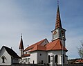
church building in Gurmels in the canton of Fribourg, Switzerland  .jpg) | |||||
| Upload media | |||||
| Instance of | |||||
|---|---|---|---|---|---|
| Part of | |||||
| Location | Gurmels, See District, Canton of Fribourg, Switzerland | ||||
| Street address |
| ||||
| Heritage designation | |||||
 | |||||
Subcategories
This category has only the following subcategory.
I
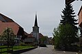
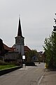
Media in category "Katholische Kirche von Gurmels"
The following 9 files are in this category, out of 9 total.
-
 Catholic churh of gurmels 299.JPG 1,920 × 2,560; 1.46 MB
-
 Kirche Gurmels 01.jpg 2,796 × 2,202; 2.25 MB
-
 Kirche Gurmels 02.jpg 2,592 × 3,872; 2.71 MB
-
 Kirche Gurmels 03.jpg 2,592 × 3,872; 2.48 MB
-
 Kirche Gurmels 04.jpg 2,592 × 3,872; 2.43 MB
-
 Kirche Gurmels 05.jpg 3,872 × 2,592; 3.22 MB
-
 Kirche Gurmels 06.jpg 2,592 × 3,872; 2.61 MB
-
 Kirche Gurmels 07.jpg 2,592 × 3,872; 1.99 MB
-
 Madelaine de armas PICT0275.JPG 2,560 × 1,920; 1.14 MB


