Category:Kenn, Somerset
Jump to navigation
Jump to search
English: Kenn is a small village and civil parish in county of Somerset, England. It falls within the area of the North Somerset Unitary Authority. It lies on the B3133 road near Clevedon in the North Somerset Levels and near the edge of the Mendip Hills Area of Outstanding Natural Beauty. The parish has a population of 332.
Main Wikipedia article: Kenn, Somerset.

a village and civil parish in North Somerset, UK  | |||||
| Upload media | |||||
| Instance of | |||||
|---|---|---|---|---|---|
| Location | North Somerset, Somerset, South West England, England | ||||
 | |||||
Subcategories
This category has the following 2 subcategories, out of 2 total.
J
R
- Rush (pond) (1 F)
Media in category "Kenn, Somerset"
The following 118 files are in this category, out of 118 total.
-
 "Cat's cradle", Kennmoor Rd, Kenn - geograph.org.uk - 2138604.jpg 4,000 × 3,000; 2.51 MB
-
 1 mile to junction 20 - geograph.org.uk - 4739451.jpg 640 × 444; 48 KB
-
 Access bridge over the Blind Yeo - geograph.org.uk - 3451201.jpg 1,024 × 768; 174 KB
-
 B3133 at Kenn village boundary - geograph.org.uk - 5813434.jpg 1,024 × 767; 176 KB
-
 B3133 bridge over M5 - geograph.org.uk - 2686435.jpg 800 × 600; 314 KB
-
 B3133 Kenn Road - geograph.org.uk - 5813439.jpg 1,024 × 770; 235 KB
-
 B3133 through Kenn - geograph.org.uk - 3502945.jpg 640 × 416; 52 KB
-

-
 Barns Ground, Kenn near Clevedon - geograph.org.uk - 4002169.jpg 800 × 600; 175 KB
-
 Blind Yeo - Clevedon - geograph.org.uk - 3533443.jpg 1,920 × 1,272; 284 KB
-
 Blind Yeo - Clevedon - geograph.org.uk - 3533446.jpg 1,920 × 1,272; 294 KB
-
 Blind Yeo east of the B3133, Clevedon - geograph.org.uk - 4147422.jpg 800 × 476; 106 KB
-
 Blind Yeo footbridge, Clevedon - geograph.org.uk - 4147416.jpg 800 × 566; 128 KB
-
 Chapel House, Kenn - geograph.org.uk - 3995185.jpg 800 × 592; 134 KB
-
 Church Path Cottage, Kenn - geograph.org.uk - 3996175.jpg 800 × 583; 131 KB
-
 Church Path, Kenn - geograph.org.uk - 3622206.jpg 3,648 × 2,736; 2.92 MB
-
 Clevedon Boundary Rhyne - geograph.org.uk - 3451175.jpg 1,024 × 787; 141 KB
-
 Colehouse Lane near Clevedon - geograph.org.uk - 4002186.jpg 800 × 550; 147 KB
-
 Cottage, on Kennmoor Road - geograph.org.uk - 3451232.jpg 1,024 × 780; 204 KB
-
 Davis Lane bridge over M5 - geograph.org.uk - 2686439.jpg 800 × 600; 316 KB
-
 Davis Lane bridge over M5 - geograph.org.uk - 4739952.jpg 640 × 394; 127 KB
-
 Davis Lane crossing the M5 - geograph.org.uk - 3032685.jpg 1,024 × 775; 117 KB
-
 Davis Lane near Clevedon - geograph.org.uk - 4002195.jpg 800 × 584; 206 KB
-
 Davis Lane passing an equestrian centre - geograph.org.uk - 3032644.jpg 1,024 × 715; 75 KB
-
 Duck Lane, Kenn - geograph.org.uk - 3960992.jpg 800 × 629; 159 KB
-
 East along Mawkins Rhyne near Kenn - geograph.org.uk - 4146455.jpg 623 × 800; 215 KB
-

-
 Eastern start of the 30 zone in Kenn - geograph.org.uk - 3960966.jpg 799 × 800; 187 KB
-
 Entrance to The Hand Stadium - geograph.org.uk - 3451249.jpg 1,024 × 757; 181 KB
-
 Farmland at Kenn - geograph.org.uk - 4100841.jpg 3,264 × 2,448; 3.2 MB
-
 Field at Kenn - geograph.org.uk - 3503070.jpg 640 × 404; 55 KB
-
 Fields at the edge of Clevedon - geograph.org.uk - 3737038.jpg 3,264 × 2,448; 4 MB
-
 Fishing lake at Warrens Holiday Village - geograph.org.uk - 4090700.jpg 3,264 × 2,448; 3.23 MB
-
 Footbridge across the Blind Yeo - geograph.org.uk - 3478244.jpg 640 × 424; 92 KB
-
 House behind trees, Kenn - geograph.org.uk - 4002148.jpg 637 × 640; 126 KB
-

-

-

-

-

-

-
 Junction on Kennmoor Rd, Kenn - geograph.org.uk - 2138591.jpg 4,000 × 3,000; 3.01 MB
-
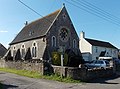
 Kenn church.jpg 640 × 426; 159 KB
-
 Kenn pier - geograph.org.uk - 3533448.jpg 1,920 × 1,272; 274 KB
-
 Kenn public toilets - geograph.org.uk - 3996072.jpg 800 × 621; 133 KB
-
 Kenn Road approaches Clevedon - geograph.org.uk - 4002173.jpg 800 × 800; 155 KB
-
 Kenn Road bridge over the M5, Kenn - geograph.org.uk - 4002149.jpg 800 × 643; 131 KB
-
 Kenn Road, Clevedon - geograph.org.uk - 3451259.jpg 1,024 × 768; 252 KB
-
 Kenn Street towards Kenn - geograph.org.uk - 3960919.jpg 800 × 647; 156 KB
-
 Kenn Village Hall - geograph.org.uk - 3995125.jpg 800 × 477; 115 KB
-

-
 Kennmoor Road roadworks near Kenn - geograph.org.uk - 4146473.jpg 799 × 800; 282 KB
-
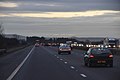
 M5 heading south - geograph.org.uk - 1325983.jpg 640 × 480; 155 KB
-
 M5 motorway towards Bristol from Kenn - geograph.org.uk - 4002150.jpg 800 × 449; 110 KB
-
 M5 near Kenn - geograph.org.uk - 2296804.jpg 2,464 × 1,632; 2.86 MB
-

-
 M5 south of Clevedon - geograph.org.uk - 3638190.jpg 2,703 × 1,617; 2.03 MB
-
 M5 southbound, 64 miles to Exeter - geograph.org.uk - 3638197.jpg 2,559 × 1,575; 2.09 MB
-
 Moorgate House, Kenn - geograph.org.uk - 3961024.jpg 800 × 736; 197 KB
-
 North Somerset , Countryside Scenery - geograph.org.uk - 3722841.jpg 4,200 × 2,710; 6.26 MB
-
 North Somerset , M5 Motorway - geograph.org.uk - 5951228.jpg 6,000 × 4,000; 6.26 MB
-
 North Somerset , M5 Motorway - geograph.org.uk - 5951229.jpg 6,000 × 4,000; 7.35 MB
-
 North Somerset , M5 Motorway Northbound - geograph.org.uk - 2793919.jpg 4,288 × 2,848; 4.04 MB
-
 North Somerset , M5 Motorway Northbound - geograph.org.uk - 3722840.jpg 4,288 × 2,848; 5.06 MB
-
 North Somerset , M5 Motorway Southbound - geograph.org.uk - 2795466.jpg 4,288 × 2,848; 4.71 MB
-
 North Somerset , M5 Motorway Southbound - geograph.org.uk - 2795467.jpg 4,288 × 2,848; 4.43 MB
-
 North Somerset , M5 Motorway Southbound - geograph.org.uk - 2795468.jpg 4,288 × 2,848; 4.47 MB
-

-

-
 Northbound M5 Motorway - geograph.org.uk - 3806796.jpg 640 × 427; 232 KB
-
 Northbound M5, Kenn Road Bridge - geograph.org.uk - 3802431.jpg 640 × 480; 215 KB
-
 Oaklands Garage near Clevedon - geograph.org.uk - 4002166.jpg 800 × 490; 108 KB
-
 Old Direction Sign - Signpost Kennmoor Road, Kenn parish - geograph.org.uk - 6048494.jpg 1,184 × 1,795; 407 KB
-
 Overland Garage, Kenn - geograph.org.uk - 3996265.jpg 800 × 512; 110 KB
-
 Poppy display at Kenn - geograph.org.uk - 4100834.jpg 3,264 × 2,448; 3.78 MB
-
 Power lines over Mawkins Rhyne near Kenn - geograph.org.uk - 4146458.jpg 800 × 600; 153 KB
-

-
 Pylon and a roadworks sign SE of Kenn - geograph.org.uk - 4146453.jpg 800 × 657; 150 KB
-

-
 Rhyne, looking east from Mawkin's Bridge, Kennmoor Rd, Kenn - geograph.org.uk - 2138631.jpg 4,000 × 3,000; 3.61 MB
-
 Rhyne, looking west from Mawkin's Bridge, Kennmoor Rd, Kenn - geograph.org.uk - 2138613.jpg 4,000 × 3,000; 3.61 MB
-
 Roadside buildings, Manor Farm near Kenn - geograph.org.uk - 4146464.jpg 800 × 593; 179 KB
-
 Roadside farm buildings, Kenn Moor - geograph.org.uk - 4146451.jpg 800 × 556; 108 KB
-

-
 Sign for Junction 20 on northbound M5 - geograph.org.uk - 2686434.jpg 800 × 600; 312 KB
-
 Southern boundary of Clevedon - geograph.org.uk - 4147405.jpg 800 × 627; 233 KB
-
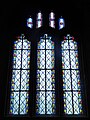
 St John the Evangelist, Kenn, altar - geograph.org.uk - 5448992.jpg 640 × 480; 67 KB
-

-

-

-

-

-

-

-
 St John the Evangelist, Kenn, organ - geograph.org.uk - 5448990.jpg 480 × 640; 56 KB
-
 St John the Evangelist, Kenn, pulpit - geograph.org.uk - 5448988.jpg 640 × 480; 78 KB
-
-

-

-

-

-

-
 The Blind Yeo at sunset - geograph.org.uk - 951126.jpg 640 × 480; 50 KB
-
 The Drum and Monkey, Kenn - geograph.org.uk - 3996339.jpg 800 × 579; 131 KB
-
 The end of Duck Lane - geograph.org.uk - 4100839.jpg 3,264 × 2,448; 2.53 MB
-
 The end of the disused railway line - geograph.org.uk - 4100828.jpg 3,264 × 2,448; 3.59 MB
-

-

-
 The old Kenn Road - geograph.org.uk - 4100846.jpg 3,264 × 2,448; 2.68 MB
-
 The Old School House, Kenn - geograph.org.uk - 3995208.jpg 800 × 617; 104 KB
-

-
 Two shades of red in Kenn - geograph.org.uk - 4002147.jpg 800 × 548; 136 KB
-
 Victorian postbox, Kenn - geograph.org.uk - 3961029.jpg 382 × 800; 90 KB
-
 Viper Valets, Kenn - geograph.org.uk - 3996279.jpg 640 × 446; 80 KB
-
 Wires junction above a Kenn bus shelter - geograph.org.uk - 3996220.jpg 800 × 688; 144 KB
-
-

-
 Yew Tree Farm entrance, Kenn - geograph.org.uk - 3995148.jpg 800 × 578; 197 KB


_off_the_B3133,_Clevedon_-_geograph.org.uk_-_3504317.jpg)


_-_geograph.org.uk_-_5448981.jpg)
_-_geograph.org.uk_-_5448982.jpg)
_-_geograph.org.uk_-_5448986.jpg)
_-_geograph.org.uk_-_5448983.jpg)
_-_geograph.org.uk_-_5448984.jpg)
_-_geograph.org.uk_-_5448985.jpg)


_-_geograph.org.uk_-_5448968.jpg)
_-_geograph.org.uk_-_5448970.jpg)
_-_geograph.org.uk_-_5448969.jpg)
_-_geograph.org.uk_-_5448767.jpg)
_-_geograph.org.uk_-_5448966.jpg)
_-_geograph.org.uk_-_5448978.jpg)
_-_geograph.org.uk_-_5448980.jpg)


_-_geograph.org.uk_-_5448996.jpg)
_-_geograph.org.uk_-_5448997.jpg)
_-_geograph.org.uk_-_5448998.jpg)


