Category:Kennington, Oxfordshire
Jump to navigation
Jump to search
village and civil parish in Vale of White Horse, Oxfordshire, England, UK  | |||||
| Upload media | |||||
| Instance of | |||||
|---|---|---|---|---|---|
| Location | Vale of White Horse, Oxfordshire, South East England, England | ||||
| Located in or next to body of water | |||||
| official website | |||||
 | |||||
English: Kennington is a village and civil parish in the Vale of White Horse district of the English county of Oxfordshire, just to the south of Oxford. It sits in a narrow stretch of land between the River Thames and the A34 dual carriageway, and is home to around 4,000 people. In 1974 it was transferred from Berkshire.
Subcategories
This category has the following 9 subcategories, out of 9 total.
F
I
- Isis Bridge (8 F)
K
- Kennington Railway Bridge (21 F)
S
- Sandford Hydro (6 F)
- Sandford Lasher (8 F)
Media in category "Kennington, Oxfordshire"
The following 200 files are in this category, out of 294 total.
(previous page) (next page)-
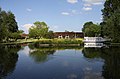 A former college barge by the Four Pillars Hotel - geograph.org.uk - 3292404.jpg 1,500 × 989; 156 KB
-
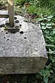
 A millstone on the site of Iffley Mill - geograph.org.uk - 1253481.jpg 640 × 427; 120 KB
-
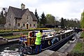 A narrowboat in Iffley Lock - geograph.org.uk - 1253460.jpg 640 × 427; 83 KB
-
 A party boat on the Thames - geograph.org.uk - 1932950.jpg 1,500 × 1,000; 197 KB
-
 A Quiet Kennington Road - geograph.org.uk - 3205679.jpg 1,600 × 1,274; 455 KB
-
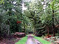 A ride in Bagley Wood - geograph.org.uk - 4873084.jpg 1,500 × 1,125; 359 KB
-
 A Suburban Cul de Sac - geograph.org.uk - 3204307.jpg 2,406 × 1,668; 1.26 MB
-
 A track in western Bagley Wood - geograph.org.uk - 1232438.jpg 640 × 427; 114 KB
-
 A woodland ride in Bagley Wood - geograph.org.uk - 4873088.jpg 1,125 × 1,500; 327 KB
-
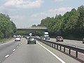
 A34 Bridge (Bagley Wood Road) - geograph.org.uk - 3295071.jpg 640 × 480; 397 KB
-
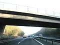
 A34 bridge carrying Bagley Wood Road - geograph.org.uk - 2534706.jpg 3,648 × 2,736; 1.69 MB
-
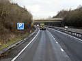
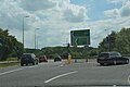
 A34 northbound - geograph.org.uk - 3342115.jpg 640 × 480; 49 KB
-
 A34 northbound - geograph.org.uk - 3342118.jpg 640 × 480; 54 KB
-
 A34 northbound - geograph.org.uk - 5637652.jpg 640 × 428; 76 KB
-
 A34 northbound - geograph.org.uk - 5637742.jpg 640 × 428; 84 KB
-
 A34 slip road to Hinksey Hill Interchange - geograph.org.uk - 2534722.jpg 3,648 × 2,736; 1.22 MB
-

-
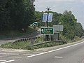
 A423 - geograph.org.uk - 5622147.jpg 640 × 426; 53 KB
-
 A423 - geograph.org.uk - 5622148.jpg 640 × 426; 58 KB
-
 A423 - geograph.org.uk - 5627119.jpg 640 × 426; 52 KB
-

-

-
 A423 bridge over River Thames - geograph.org.uk - 2772235.jpg 683 × 1,024; 179 KB
-
 A423 bridge parapet over Weirs Mill Stream - geograph.org.uk - 2644643.jpg 683 × 1,024; 226 KB
-

-
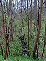
 Alder catkins by the River Thames - geograph.org.uk - 5698641.jpg 2,011 × 2,700; 478 KB
-
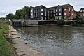 Apartment at Sandford Lock - geograph.org.uk - 2612014.jpg 1,024 × 680; 170 KB
-
 Apartment at Sandford Lock - geograph.org.uk - 2612015.jpg 1,024 × 680; 205 KB
-
 Approaching Sandford Lock - geograph.org.uk - 3401174.jpg 640 × 427; 195 KB
-
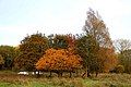 Autumn leaves by Kennington - geograph.org.uk - 1624796.jpg 640 × 427; 75 KB
-
 Autumn trees in Egrove Park - geograph.org.uk - 5613957.jpg 2,025 × 2,700; 687 KB
-
 Avicenna Pharmacy on Kennington Road - geograph.org.uk - 5698656.jpg 2,700 × 2,011; 385 KB
-
 Bagley Wood - geograph.org.uk - 2241809.jpg 640 × 480; 122 KB
-
 Bagley Wood - geograph.org.uk - 2241984.jpg 640 × 480; 126 KB
-
 Bagley Wood - geograph.org.uk - 6120945.jpg 2,025 × 2,700; 725 KB
-
 Bagley Wood - geograph.org.uk - 6120947.jpg 2,025 × 2,700; 686 KB
-
 Bagley Wood Saw Mill - geograph.org.uk - 1371223.jpg 640 × 427; 100 KB
-
 Bagley Wood Saw Mill - geograph.org.uk - 1371224.jpg 640 × 427; 105 KB
-
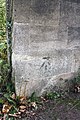
 Benchmark on A423 bridge over The Thames - geograph.org.uk - 2644864.jpg 683 × 1,024; 287 KB
-
 Benchmark on A423 bridge over Weirs Mill Stream - geograph.org.uk - 2644602.jpg 683 × 1,024; 264 KB
-
 Benchmark on abutment wall of railway bridge - geograph.org.uk - 3862094.jpg 683 × 1,024; 275 KB
-
 Benchmark on bridge taking A423 over railway - geograph.org.uk - 2643568.jpg 683 × 1,024; 302 KB
-
 Benchmark on ^115 Bagley Wood Road - geograph.org.uk - 3321338.jpg 683 × 1,024; 184 KB
-
 Benchmark on ^121 Bagley Wood Road - geograph.org.uk - 3314323.jpg 703 × 1,024; 249 KB
-
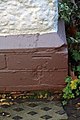
 Benchmark on ^64 Kennington Road - geograph.org.uk - 3861496.jpg 683 × 1,024; 207 KB
-
 Benchmark on ^93 Bagley Wood Road - geograph.org.uk - 3321381.jpg 683 × 1,024; 187 KB
-

-
 Best-one store on Kennington Road - geograph.org.uk - 5555186.jpg 1,500 × 1,125; 163 KB
-
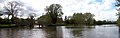
 Birds along the River Thames - geograph.org.uk - 4531410.jpg 1,024 × 636; 282 KB
-
 Black Bridge over the River Thames - geograph.org.uk - 5698640.jpg 2,700 × 2,025; 485 KB
-
 Black Bridge over the River Thames - geograph.org.uk - 5698645.jpg 2,700 × 2,025; 394 KB
-
 Boat near Sandford - geograph.org.uk - 3400735.jpg 470 × 640; 248 KB
-
 Bridge over River Thames for Cowley Works branch - geograph.org.uk - 3862130.jpg 1,024 × 683; 190 KB
-
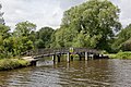
 Bridges of Kennington - geograph.org.uk - 3007885.jpg 1,500 × 1,125; 233 KB
-
 Bus stop on Hinksey Hill - geograph.org.uk - 1371228.jpg 640 × 427; 77 KB
-
 Cattle grazing at Kennington - geograph.org.uk - 1624809.jpg 640 × 453; 85 KB
-
 Cattle in the meadow at Kennington - geograph.org.uk - 1624805.jpg 640 × 427; 76 KB
-
 Chandlings Manor School - geograph.org.uk - 1371212.jpg 640 × 413; 79 KB
-
 Chilswell Lane - geograph.org.uk - 2165138.jpg 640 × 480; 92 KB
-
 Church of St Swithun - geograph.org.uk - 5622131.jpg 640 × 426; 52 KB
-
 Clearing in Bagley Wood - geograph.org.uk - 4658890.jpg 4,000 × 2,664; 4.68 MB
-
 Contrast at Rose Isle - geograph.org.uk - 3400727.jpg 640 × 427; 179 KB
-
 Cycle track by the A423 - geograph.org.uk - 6075163.jpg 2,700 × 2,025; 1.08 MB
-
 Cycle track under the Kennington Roundabout - geograph.org.uk - 6075160.jpg 2,700 × 1,972; 434 KB
-
 Cycle track under the Kennington Roundabout - geograph.org.uk - 6075161.jpg 2,700 × 2,009; 281 KB
-
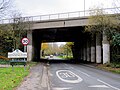
 Cycle track-A423 bridge over Kennington Road - geograph.org.uk - 2644184.jpg 1,024 × 683; 169 KB
-
 Electricity Pylon at Kennington - geograph.org.uk - 1222594.jpg 427 × 640; 61 KB
-
 Electricity Pylon at Kennington - geograph.org.uk - 1624822.jpg 640 × 427; 84 KB
-
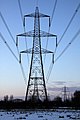
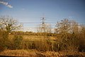
 Electricity Pylons at Kennington - geograph.org.uk - 1624813.jpg 427 × 640; 48 KB
-
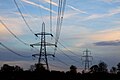 Electricity Pylons at Kennington - geograph.org.uk - 1624818.jpg 640 × 427; 42 KB
-
 Entrance to Bagley Wood Saw Mill - geograph.org.uk - 1371225.jpg 640 × 427; 107 KB
-
 Fallen tree along the River Thames - geograph.org.uk - 4531396.jpg 1,024 × 767; 328 KB
-
 Flooded cycleway near Kennington - geograph.org.uk - 3834581.jpg 1,500 × 999; 318 KB
-
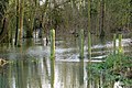 Flooded cycleway near Kennington - geograph.org.uk - 3834582.jpg 1,500 × 999; 262 KB
-
 Flooded cycleway near Kennington - geograph.org.uk - 3834583.jpg 1,500 × 999; 345 KB
-
-
 Flooded footpath to the River Thames - geograph.org.uk - 3834571.jpg 1,500 × 999; 335 KB
-
 Flooded meadow by the River Thames - geograph.org.uk - 3834564.jpg 1,500 × 993; 289 KB
-
 Flooded meadow by the River Thames - geograph.org.uk - 3834585.jpg 1,500 × 999; 253 KB
-
 Flooded Sandford Lane - geograph.org.uk - 3323340.jpg 1,024 × 683; 282 KB
-
 Footbridge across Hinksey Stream - geograph.org.uk - 4530497.jpg 1,024 × 686; 231 KB
-
 Footbridge along the Thames Path - geograph.org.uk - 4531003.jpg 1,024 × 653; 312 KB
-
 Footbridge along the Thames Path - geograph.org.uk - 4531389.jpg 1,024 × 714; 237 KB
-
 Footbridge over Hinksey Stream - geograph.org.uk - 3007853.jpg 1,500 × 1,125; 289 KB
-
 Footbridge over Hinksey Stream - geograph.org.uk - 5698642.jpg 2,700 × 2,025; 483 KB
-
 Footbridge over Hinksey Stream - geograph.org.uk - 871863.jpg 640 × 480; 126 KB
-
 Footbridge over Hinskey Stream - geograph.org.uk - 2497369.jpg 640 × 427; 160 KB
-
 Footbridge over the backwater - geograph.org.uk - 3292437.jpg 1,500 × 1,000; 278 KB
-
 Footbridge over the Hinksey stream - geograph.org.uk - 5666647.jpg 5,202 × 3,465; 5.2 MB
-
 Footbridge over the railway - geograph.org.uk - 5698654.jpg 4,500 × 3,375; 951 KB
-
 Footbridge over the railway - geograph.org.uk - 5698655.jpg 2,700 × 2,025; 414 KB
-

-
-
 Footbridge to Fiddler's Elbow - geograph.org.uk - 3292397.jpg 1,500 × 1,000; 175 KB
-
 Footbridge to Fiddler's Elbow - geograph.org.uk - 3292410.jpg 1,500 × 1,000; 259 KB
-
 Footbridge to Kennington - geograph.org.uk - 3400719.jpg 640 × 468; 226 KB
-
 Footpath across the meadow - geograph.org.uk - 5698633.jpg 4,500 × 3,375; 859 KB
-

-
 Forest Side Playing Field - geograph.org.uk - 4658436.jpg 1,600 × 1,098; 479 KB
-
 Four Pillars Hotel - geograph.org.uk - 3401181.jpg 640 × 432; 262 KB
-
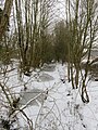 Frozen drain in Kennington - geograph.org.uk - 5698647.jpg 2,025 × 2,700; 735 KB
-
 Frozen rose bushes on Christmas Day - geograph.org.uk - 2207736.jpg 1,500 × 1,000; 350 KB
-
 Fungi in Bagley Wood - geograph.org.uk - 4873091.jpg 1,500 × 1,093; 219 KB
-
 Garden on Christmas Day - geograph.org.uk - 2207741.jpg 1,500 × 979; 245 KB
-
 Gardens near Kennington Junction - geograph.org.uk - 5666626.jpg 5,202 × 3,465; 5.67 MB
-
 Graffiti on the bridge - geograph.org.uk - 5048864.jpg 1,500 × 1,125; 217 KB
-
 Graffiti under the bridge - geograph.org.uk - 5048866.jpg 1,500 × 1,125; 177 KB
-

-
 Greylag geese on the Thames Path - geograph.org.uk - 5698639.jpg 2,700 × 1,990; 426 KB
-
 Greylag goose on the Thames Path - geograph.org.uk - 5698638.jpg 2,700 × 2,025; 218 KB
-
 Henry Colyear Dawkins in Bagley Wood.jpg 2,448 × 3,264; 2.58 MB
-
 Hinksey Stream - geograph.org.uk - 3007864.jpg 1,500 × 1,125; 258 KB
-
 Hinksey Stream - geograph.org.uk - 5698643.jpg 2,700 × 2,025; 512 KB
-
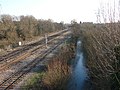 Hinksey Stream and Railway - geograph.org.uk - 332690.jpg 640 × 480; 267 KB
-
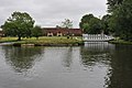 Hotel beside Thames - geograph.org.uk - 2612022.jpg 1,024 × 680; 151 KB
-
 House by the Thames on Rose Isle - geograph.org.uk - 6078424.jpg 2,700 × 2,025; 746 KB
-
 Houses on Kennington Road - geograph.org.uk - 332661.jpg 640 × 480; 70 KB
-
 Houses, Poplar Grove - geograph.org.uk - 3929354.jpg 640 × 302; 41 KB
-
 Icicles on Christmas Day - geograph.org.uk - 2207737.jpg 1,500 × 1,000; 125 KB
-
 Iffley Lock on the River Thames - geograph.org.uk - 6075164.jpg 2,700 × 2,025; 861 KB
-
 Isis Bridge crossing the River Thames - geograph.org.uk - 4530349.jpg 1,024 × 769; 288 KB
-
 Isis Bridge crossing the River Thames - geograph.org.uk - 4530411.jpg 1,024 × 768; 259 KB
-
 Junction of Upper Road and Kenville Road - geograph.org.uk - 3861527.jpg 1,024 × 683; 173 KB
-
 Junction on the Oxford Ring Road, Hinksey - geograph.org.uk - 6064932.jpg 1,920 × 1,280; 702 KB
-
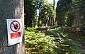 Keep Off The Logs - geograph.org.uk - 3632592.jpg 1,024 × 650; 319 KB
-
 Keepers Cottages, Oxford Road - geograph.org.uk - 3320671.jpg 1,024 × 683; 182 KB
-
 Sandford Lane - geograph.org.uk - 1085531.jpg 640 × 480; 116 KB
-

-
 Kennington Crossing - geograph.org.uk - 1345741.jpg 640 × 409; 99 KB
-
 Kennington Junction - geograph.org.uk - 1345738.jpg 640 × 421; 100 KB
-
 Kennington Methodist Church - geograph.org.uk - 5555190.jpg 1,500 × 1,060; 142 KB
-
 Kennington Playgroup and school, The Avenue - geograph.org.uk - 3321772.jpg 1,024 × 683; 206 KB
-
 Kennington railway bridge - geograph.org.uk - 5219858.jpg 5,184 × 3,456; 6.43 MB
-
 Kennington Rd - geograph.org.uk - 5622129.jpg 640 × 426; 68 KB
-
 Kennington Road - geograph.org.uk - 5628037.jpg 2,700 × 2,025; 469 KB
-
 Kennington Road and Egrove Park - geograph.org.uk - 332679.jpg 640 × 480; 216 KB
-
 Kennington Road runs under the Ring Road - geograph.org.uk - 5613964.jpg 2,700 × 2,025; 678 KB
-
 Kennington Road runs under the Ring Road - geograph.org.uk - 5613972.jpg 2,700 × 2,025; 537 KB
-
 Kennington Village Centre - geograph.org.uk - 4362254.jpg 640 × 480; 86 KB
-
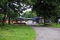
 Kennington Village Hall - geograph.org.uk - 1224764.jpg 640 × 427; 66 KB
-

-
 Kissing gate on the Thames Path by Black Bridge - geograph.org.uk - 5698646.jpg 2,700 × 2,025; 568 KB
-
 Kissing gate to the Kennington - geograph.org.uk - 5698631.jpg 2,700 × 2,025; 455 KB
-
 Kissing gate to the river meadow - geograph.org.uk - 5698630.jpg 4,500 × 3,375; 1.14 MB
-
 Logs in Bagley Wood - geograph.org.uk - 3632589.jpg 1,024 × 768; 438 KB
-
 Looking across Rose Isle - geograph.org.uk - 2497362.jpg 640 × 427; 124 KB
-
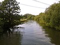
 Looking south along the River Thames - geograph.org.uk - 4531644.jpg 1,024 × 768; 276 KB
-
 Meadow View Road - geograph.org.uk - 3204317.jpg 1,600 × 1,184; 509 KB
-
 Memorial Field, Kennington - geograph.org.uk - 871583.jpg 640 × 480; 115 KB
-
 Merry Christmas from Rowles Close - geograph.org.uk - 2207735.jpg 1,500 × 1,000; 166 KB
-
 Narrowboat on the Thames - geograph.org.uk - 3400676.jpg 640 × 421; 210 KB
-
 National Cycle Route 5 in Kennington - geograph.org.uk - 5698626.jpg 2,025 × 2,700; 557 KB
-
 National Cycle Route 5 in Kennington - geograph.org.uk - 5698629.jpg 2,700 × 2,025; 316 KB
-
 National Cycle Route 5 in Kennington - geograph.org.uk - 5698648.jpg 2,700 × 2,025; 660 KB
-
 National Cycle Route 5 in Kennington - geograph.org.uk - 5698649.jpg 2,700 × 2,025; 503 KB
-
 National Cycle Route 5 in Kennington - geograph.org.uk - 5698650.jpg 2,700 × 2,025; 328 KB
-
 National Grid - geograph.org.uk - 1381261.jpg 640 × 480; 97 KB
-
 North of Sandford Lock - geograph.org.uk - 3401177.jpg 640 × 427; 215 KB
-
 Northbound A34 near Oxford - geograph.org.uk - 3295080.jpg 640 × 480; 436 KB
-
 Northbound A34, Bagley Wood - geograph.org.uk - 3295075.jpg 640 × 480; 400 KB
-
 Overpainted benchmark on ^8 Kennington Road - geograph.org.uk - 2644318.jpg 683 × 1,024; 247 KB
-
 Oxford Road closed for repairs - geograph.org.uk - 3314303.jpg 1,024 × 683; 180 KB
-
 Oxford Thames Four Pillars Hotel - geograph.org.uk - 4531420.jpg 1,024 × 690; 212 KB
-
-
 Pillar box at the edge of Bagley Wood - geograph.org.uk - 1498131.jpg 480 × 640; 162 KB
-
 Playfield Rd - geograph.org.uk - 5622136.jpg 640 × 426; 81 KB
-
 Playfield Road sports pitch - geograph.org.uk - 6033843.jpg 2,700 × 1,679; 336 KB
-
 Playfield Road sports pitch - geograph.org.uk - 6033844.jpg 2,700 × 1,758; 375 KB
-
 Playfield Road sports pitch - geograph.org.uk - 6033845.jpg 2,700 × 2,025; 405 KB
-
 Playfield Road sports pitch - geograph.org.uk - 6033846.jpg 2,700 × 1,804; 290 KB
-
 Ponds by the railway - geograph.org.uk - 3929367.jpg 640 × 430; 63 KB
-
 Poplar Grove - geograph.org.uk - 3204296.jpg 2,560 × 1,920; 877 KB
-
 Power lines from the railway - geograph.org.uk - 5666633.jpg 5,202 × 3,465; 4.77 MB
-
 Pylon by the Hinksey Stream - geograph.org.uk - 3937200.jpg 640 × 277; 49 KB
-
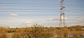
 Pylon in the Thames Valley - geograph.org.uk - 3937197.jpg 640 × 430; 51 KB
-
 Pylon in the Thames Valley - geograph.org.uk - 3937202.jpg 640 × 430; 63 KB
-
 Pylon in the Thames Valley - geograph.org.uk - 3937204.jpg 640 × 430; 72 KB
-
 Pylon in the Thames Valley - geograph.org.uk - 3937205.jpg 640 × 430; 54 KB
-
 Pylon in the Thames Valley - geograph.org.uk - 3937208.jpg 640 × 286; 34 KB
-
 Pylon in the Thames Valley - geograph.org.uk - 3937210.jpg 640 × 430; 49 KB
-
 Railway bridge over the River Thames - geograph.org.uk - 6078423.jpg 2,700 × 2,025; 766 KB
-
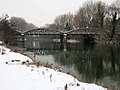
 Railway bridge over the Thames - geograph.org.uk - 2423716.jpg 1,500 × 1,000; 189 KB
-
 Railway Mileage Post at Kennington - geograph.org.uk - 1224823.jpg 640 × 456; 154 KB
-
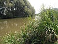 Reeds and river - geograph.org.uk - 3176606.jpg 640 × 480; 164 KB
-
 River and railway bridges - geograph.org.uk - 3400686.jpg 640 × 400; 216 KB
-
 River Thames at Sandford - geograph.org.uk - 2925233.jpg 5,766 × 1,812; 2.55 MB
-
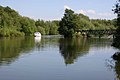
 River Thames near Kennington - geograph.org.uk - 2611627.jpg 1,024 × 680; 178 KB
-
 River Thames under the A423 - geograph.org.uk - 3400668.jpg 640 × 427; 232 KB
-
 River Thames, looking south from Kennington rail bridge - geograph.org.uk - 5666649.jpg 5,202 × 3,465; 4.01 MB
-

-

-
 Rose Isle by the River Thames - geograph.org.uk - 5698635.jpg 2,700 × 2,060; 545 KB
-
 Rowles Close in Kennington - geograph.org.uk - 5698620.jpg 2,700 × 2,005; 377 KB
-
 Sandford Lane - geograph.org.uk - 2612027.jpg 1,024 × 680; 316 KB
-
 Sandford Lock - geograph.org.uk - 5218541.jpg 5,184 × 3,456; 6.49 MB
-
 Scrubby woodland - geograph.org.uk - 3937192.jpg 640 × 430; 56 KB
-
 Signal OX12 to the main line - geograph.org.uk - 3040081.jpg 1,500 × 1,000; 285 KB
-

-
 Snow covered Rowles Close - geograph.org.uk - 2207734.jpg 1,500 × 970; 171 KB
-
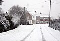 Snowy Rowles Close - geograph.org.uk - 1222592.jpg 640 × 445; 72 KB


_-_geograph.org.uk_-_3295071.jpg)


