Category:Kingston on Soar
Jump to navigation
Jump to search
English: Kingston on Soar is a village and civil parish in the Rushcliffe borough of Nottinghamshire, England. It has a population of 239, as of the 2001 census.
Français : Kingston on Soar est une paroisse civile du borough de Rushcliffe dans le Nottinghamshire dans la région des Midlands de l'Est, en Angleterre au Royaume Uni.
Main Wikipedia article: Kingston on Soar.

village and civil parish in the Rushcliffe borough of Nottinghamshire, England  | |||||
| Upload media | |||||
| Instance of | |||||
|---|---|---|---|---|---|
| Location | Rushcliffe, Nottinghamshire, East Midlands, England | ||||
 | |||||
Subcategories
This category has the following 7 subcategories, out of 7 total.
Media in category "Kingston on Soar"
The following 169 files are in this category, out of 169 total.
-
 1, 3, 5 and 7 The Green, Kingston on Soar.jpg 3,648 × 2,432; 4.43 MB
-
 21, 23, 25, and 27 The Green, Kingston on Soar.jpg 1,024 × 768; 306 KB
-
 9, 11, 15, 17 and 19 The Green, Kingston on Soar.jpg 3,648 × 2,432; 5.08 MB
-
 Bench mark alongside Gotham Road - geograph.org.uk - 3838626.jpg 1,280 × 927; 554 KB
-
 Bench mark, Gotham Road, Kingston - geograph.org.uk - 3838643.jpg 1,280 × 960; 498 KB
-
 Bench mark, Kingston Brook bridge - geograph.org.uk - 3838649.jpg 1,280 × 960; 466 KB
-
 Bridge Farm, Kegworth - geograph.org.uk - 6180807.jpg 1,673 × 1,255; 635 KB
-
 Bridge over the Kingston Brook - geograph.org.uk - 3838651.jpg 1,280 × 960; 281 KB
-
 Bridge under Midland Main Line railway - geograph.org.uk - 4442989.jpg 1,200 × 1,600; 503 KB
-
 Bridge under the Midland Main Line - geograph.org.uk - 6245192.jpg 800 × 450; 143 KB
-
 Bus shelter with a library - geograph.org.uk - 4661511.jpg 1,200 × 900; 410 KB
-
 Canal from Station Road bridge, Kegworth - geograph.org.uk - 3457285.jpg 2,048 × 1,536; 559 KB
-
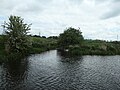 Confluence of Kingston Brook and the River Soar - geograph.org.uk - 6180816.jpg 1,703 × 1,277; 812 KB
-
 Corner pylon (1) - geograph.org.uk - 685868.jpg 480 × 640; 77 KB
-
 Cottages, Kingston on Soar (geograph 7469489).jpg 1,024 × 768; 276 KB
-
 Crop field New Kingston - geograph.org.uk - 4037299.jpg 640 × 480; 72 KB
-
 Curving hedge bordering the old tramway - geograph.org.uk - 4653839.jpg 1,200 × 900; 382 KB
-
 Drain flaps, east bank of the River Soar - geograph.org.uk - 6180814.jpg 1,600 × 1,201; 433 KB
-
 Entering Kegworth on Station Road - geograph.org.uk - 1921856.jpg 640 × 427; 98 KB
-
 Ephemeral monument - geograph.org.uk - 1170779.jpg 640 × 479; 133 KB
-
 Farmland and pylon - geograph.org.uk - 4755246.jpg 640 × 426; 56 KB
-
 Farmland and pylons - geograph.org.uk - 3606509.jpg 640 × 446; 41 KB
-

-
 Farmland and woodland - geograph.org.uk - 3606516.jpg 640 × 480; 85 KB
-
 Farmland by the main line - geograph.org.uk - 4766743.jpg 640 × 426; 47 KB
-
 Farmland in the Soar Valley - geograph.org.uk - 4766739.jpg 640 × 426; 39 KB
-
 Farmland off West Leake Lane - geograph.org.uk - 4037301.jpg 640 × 480; 59 KB
-
 Fields near Kingston - geograph.org.uk - 1170688.jpg 640 × 480; 213 KB
-
 Flood moorings at Kegworth Marine - geograph.org.uk - 1921998.jpg 640 × 427; 106 KB
-
 Footbridge across the River Soar north-east of Kegworth - geograph.org.uk - 5998038.jpg 1,440 × 1,080; 2.01 MB
-

-
 Footbridge across the River Soar north-east of Kegworth - geograph.org.uk - 5998053.jpg 1,440 × 1,080; 1.91 MB
-
 Footbridge over Kingston Brook - geograph.org.uk - 4946958.jpg 1,280 × 960; 645 KB
-
 Footbridge over the Kingston Brook - geograph.org.uk - 5798394.jpg 1,280 × 960; 554 KB
-
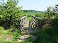
 Footbridge over the River Soar - geograph.org.uk - 715777.jpg 640 × 442; 96 KB
-
 Footpath alongside Kingston Brook - geograph.org.uk - 3356951.jpg 2,048 × 1,536; 678 KB
-
 Footpath alongside the Kingston Brook - geograph.org.uk - 5798395.jpg 1,280 × 960; 440 KB
-
 Gateway to Kingston Hall - geograph.org.uk - 4037303.jpg 640 × 480; 83 KB
-
 Gotham Road - geograph.org.uk - 3606517.jpg 640 × 480; 87 KB
-
 Gotham Road near Firs Farm - geograph.org.uk - 3937524.jpg 640 × 427; 302 KB
-
 Gotham Road near Firs Farm - geograph.org.uk - 3937526.jpg 640 × 427; 423 KB
-
 Gotham Road towards Gotham - geograph.org.uk - 2999770.jpg 640 × 478; 58 KB
-
 Gotham Road towards Kingston on Soar - geograph.org.uk - 2999771.jpg 640 × 466; 112 KB
-
 Gotham Road, near Kingston Hall Lodge - geograph.org.uk - 3838647.jpg 1,280 × 960; 318 KB
-
 Hedgerow near Scotland Farm - geograph.org.uk - 5798393.jpg 1,280 × 960; 356 KB
-
 Holiday homes off Kingston Lane - geograph.org.uk - 6180804.jpg 1,634 × 1,226; 646 KB
-
 In the Soar Valley - geograph.org.uk - 4755245.jpg 640 × 426; 62 KB
-
 Kegworth Bridge - geograph.org.uk - 5812450.jpg 1,280 × 894; 320 KB
-
 Kegworth Bridge - geograph.org.uk - 5812451.jpg 1,280 × 960; 311 KB
-
 Kegworth Bridge – detail - geograph.org.uk - 5812455.jpg 1,280 × 960; 514 KB
-
 Kegworth Flood Lock with top gates closed - geograph.org.uk - 4860849.jpg 1,280 × 960; 399 KB
-
 Kegworth Marine - geograph.org.uk - 1921995.jpg 640 × 427; 103 KB
-
 Kegworth Road Bridge (no 45), from the north - geograph.org.uk - 6180800.jpg 1,600 × 1,200; 570 KB
-
 Kegworth Road, Kingston - geograph.org.uk - 1170761.jpg 640 × 477; 207 KB
-
 Kegworth Road, Kingston on Soar - geograph.org.uk - 3606513.jpg 640 × 480; 86 KB
-
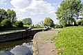
 Kegworth shallow flood lock - geograph.org.uk - 1910699.jpg 640 × 427; 90 KB
-
 Kegworth Shallow Flood Lock - geograph.org.uk - 3575.jpg 640 × 480; 64 KB
-
 Kegworth Shallow Flood Lock - geograph.org.uk - 3575454.jpg 640 × 480; 91 KB
-
 Kegworth Shallow Flood Lock - geograph.org.uk - 3976077.jpg 1,600 × 1,063; 620 KB
-
 Kegworth Shallow Flood Lock - geograph.org.uk - 5812418.jpg 1,280 × 960; 450 KB
-
 Kegworth Shallow Flood Lock - geograph.org.uk - 5812463.jpg 1,280 × 960; 413 KB
-
 Kegworth Shallow Flood Lock - geograph.org.uk - 5812465.jpg 960 × 1,280; 397 KB
-
 Kegworth Shallow Flood Lock - geograph.org.uk - 5836196.jpg 1,024 × 683; 236 KB
-
 Kegworth Shallow Lock 57 - geograph.org.uk - 2355934.jpg 640 × 480; 63 KB
-
 Kingston Brook - geograph.org.uk - 1170708.jpg 640 × 479; 239 KB
-
 Kingston Brook - geograph.org.uk - 3606510.jpg 640 × 480; 78 KB
-
 Kingston Hall - geograph.org.uk - 3356963.jpg 2,048 × 1,536; 467 KB
-
 Kingston Hall Lodge - geograph.org.uk - 3937510.jpg 640 × 427; 361 KB
-
 Kingston Hall lodge and gateway - geograph.org.uk - 3838638.jpg 1,280 × 995; 310 KB
-
 Kingston on Soar - geograph.org.uk - 1293151.jpg 640 × 480; 168 KB
-
 Kingston on Soar - geograph.org.uk - 4620105.jpg 1,165 × 783; 82 KB
-
 Kingston on Soar field and house - geograph.org.uk - 1293115.jpg 640 × 480; 212 KB
-
 Kingston on Soar field and houses - geograph.org.uk - 1293148.jpg 640 × 480; 197 KB
-

-
 Kingston on Soar Flattened - geograph.org.uk - 1293139.jpg 640 × 480; 191 KB
-

-

-

-
 Kingston on Soar house - geograph.org.uk - 1293169.jpg 640 × 480; 203 KB
-
 Kingston on Soar house - geograph.org.uk - 1293403.jpg 640 × 480; 230 KB
-
 Kingston on Soar houses - geograph.org.uk - 1293163.jpg 640 × 480; 179 KB
-
 Kingston on Soar houses - geograph.org.uk - 1293167.jpg 640 × 480; 185 KB
-
 Kingston on Soar houses - geograph.org.uk - 1293175.jpg 640 × 480; 190 KB
-
 Kingston on Soar path - geograph.org.uk - 1293173.jpg 640 × 480; 205 KB
-
 Kingston on Soar path under railway - geograph.org.uk - 1293126.jpg 640 × 480; 197 KB
-

-
 Kingston on Soar power - geograph.org.uk - 1293119.jpg 480 × 640; 198 KB
-
 Kingston on Soar Spring Brook.JPG 3,872 × 2,592; 1.6 MB
-

-

-
 Kingston Village - geograph.org.uk - 1170683.jpg 640 × 479; 160 KB
-
 Kingston village pump - geograph.org.uk - 1170762.jpg 470 × 640; 200 KB
-
 Leaving Kegworth shallow flood lock - geograph.org.uk - 5812467.jpg 1,280 × 960; 374 KB
-
 Looking towards Kingston - geograph.org.uk - 1170675.jpg 640 × 479; 169 KB
-
 Low stile By Station Road, Kegworth - geograph.org.uk - 1910727.jpg 640 × 427; 110 KB
-
 Lumbry Wood in May - geograph.org.uk - 4940386.jpg 1,280 × 960; 367 KB
-
 Moor Wood in May - geograph.org.uk - 4940374.jpg 1,280 × 960; 331 KB
-

-
 New Cut on the River Soar - geograph.org.uk - 1921956.jpg 640 × 427; 90 KB
-
 New Kingston - geograph.org.uk - 3353278.jpg 2,048 × 1,536; 605 KB
-
 Oak trees and rape - geograph.org.uk - 3937508.jpg 640 × 640; 550 KB
-
 Old Post Office, Kingston on Soar.jpg 3,648 × 2,432; 3.46 MB
-
 On Station Road Bridge - geograph.org.uk - 1921835.jpg 640 × 427; 82 KB
-
 On the country boundary (2) - geograph.org.uk - 1921972.jpg 640 × 427; 86 KB
-
 On the county boundary - geograph.org.uk - 1921965.jpg 640 × 427; 91 KB
-

-
 Power lines over Kingston Lane - geograph.org.uk - 3937482.jpg 640 × 640; 496 KB
-
 Pumphouse Kingston on Soar - Grade II Listed Building 01.jpg 4,752 × 3,168; 8.46 MB
-
 Pumphouse Kingston on Soar - Grade II Listed Building 02.jpg 4,752 × 3,168; 8.68 MB
-
 Pumphouse Kingston on Soar - Grade II Listed Building 03.jpg 3,168 × 4,752; 9.17 MB
-
 Pumphouse Kingston on Soar - Grade II Listed Building 04.jpg 4,752 × 3,168; 10.2 MB
-
 Pylon in the Soar Valley - geograph.org.uk - 4766691.jpg 458 × 640; 49 KB
-
 Pylon in the Soar Valley - geograph.org.uk - 4766693.jpg 387 × 640; 48 KB
-
 Pylon with insulator - geograph.org.uk - 1938205.jpg 683 × 1,024; 180 KB
-
 Pylons and cooling towers - geograph.org.uk - 3937489.jpg 640 × 640; 584 KB
-
 Pylons in the Soar Valley - geograph.org.uk - 4755247.jpg 640 × 426; 50 KB
-
 Pylons near Kingston - geograph.org.uk - 737266.jpg 480 × 640; 107 KB
-
 Railway bridge over Kegworth Road - geograph.org.uk - 3606511.jpg 640 × 480; 85 KB
-
 Railway bridge over Kingston Brook - geograph.org.uk - 4653833.jpg 1,200 × 900; 449 KB
-
 Railway bridge west of Kingston on Soar - geograph.org.uk - 3356994.jpg 2,048 × 1,536; 656 KB
-
 Railway heading north - geograph.org.uk - 3606518.jpg 640 × 480; 80 KB
-
 Rape field and chimney - geograph.org.uk - 3937507.jpg 640 × 640; 562 KB
-
 Rape field north of Kingston on Soar - geograph.org.uk - 3937506.jpg 640 × 427; 355 KB
-
 Ratcliffe near sunset - geograph.org.uk - 1929092.jpg 683 × 1,024; 110 KB
-
 Ratcliffe on Soar Power Station - geograph.org.uk - 3976072.jpg 1,600 × 1,063; 478 KB
-

-
 Repairing Kegworth Bridge - geograph.org.uk - 5812370.jpg 1,280 × 960; 360 KB
-
 River Soar at Kegworth Bridge - geograph.org.uk - 2240676.jpg 1,024 × 768; 213 KB
-

-
-

-
 Road towards industrial site - geograph.org.uk - 4037296.jpg 640 × 480; 56 KB
-
 Road towards industrial site - geograph.org.uk - 4037297.jpg 640 × 480; 58 KB
-
 Rushcliffe Map - Kingston on Soar Parish.png 654 × 590; 82 KB
-
 Signpost, Kingston-on-Soar - geograph.org.uk - 1170754.jpg 479 × 640; 216 KB
-
 Signs by the lock - geograph.org.uk - 1910684.jpg 640 × 427; 104 KB
-
 Sluice on Kingston Brook - geograph.org.uk - 3356956.jpg 2,048 × 1,536; 513 KB
-
 Solstice sunset - geograph.org.uk - 1929205.jpg 683 × 1,024; 97 KB
-
 The bridge at Kingston - geograph.org.uk - 1170703.jpg 640 × 479; 166 KB
-
 The edge of Kingston Spinney - geograph.org.uk - 3937528.jpg 640 × 427; 464 KB
-
 The former Station Hotel - geograph.org.uk - 4746064.jpg 1,280 × 960; 519 KB
-
 The Green, Kingston - geograph.org.uk - 1170769.jpg 640 × 479; 185 KB
-
 The Green, Kingston-on-Soar - geograph.org.uk - 1170713.jpg 640 × 479; 166 KB
-
 The road from Kingston on Soar to Gotham - geograph.org.uk - 3937493.jpg 640 × 640; 623 KB
-
 The route of the Kingston Mineral Railway - geograph.org.uk - 4940383.jpg 1,280 × 960; 707 KB
-
 The Station Hotel (for sale) - geograph.org.uk - 3606519.jpg 640 × 480; 79 KB
-
 Tunnel under Midland Mainline Railway - geograph.org.uk - 4927569.jpg 480 × 640; 109 KB
-
 Twas not always so peaceful (1) - geograph.org.uk - 737751.jpg 640 × 480; 169 KB
-
 Twas not always so peaceful (2) - geograph.org.uk - 737749.jpg 640 × 480; 259 KB
-

-
 View north east from Melton Lane - geograph.org.uk - 5798384.jpg 1,280 × 832; 417 KB
-
 Village Hall, Kingston on Soar - geograph.org.uk - 3606512.jpg 640 × 480; 76 KB
-
 Village pump, Kingston - geograph.org.uk - 1170763.jpg 640 × 479; 207 KB
-
 Village pump, Kingston - geograph.org.uk - 1170767.jpg 640 × 479; 280 KB
-
 West Leake Lane - geograph.org.uk - 4037302.jpg 640 × 480; 99 KB
-
 West Leake Lane, New Kingston - geograph.org.uk - 4037300.jpg 640 × 480; 54 KB
-
 Woodside Lodge - geograph.org.uk - 4680348.jpg 1,200 × 900; 434 KB
-
 Wossock Lane off West Leake Lane - geograph.org.uk - 3320350.jpg 2,256 × 1,504; 947 KB
-
 Bridge under the railway - geograph.org.uk - 737719.jpg 640 × 477; 179 KB
-
 Firs Farm, New Kingston - geograph.org.uk - 737754.jpg 640 × 480; 104 KB
-
 Houses at Kingston on Soar - geograph.org.uk - 9388.jpg 640 × 411; 150 KB
-
 Houses at New Kingston - geograph.org.uk - 14895.jpg 640 × 404; 128 KB
-
 Kegworth Marine - geograph.org.uk - 556547.jpg 640 × 406; 97 KB
-
 Kegworth Shallow Lock - geograph.org.uk - 556535.jpg 640 × 398; 107 KB
-
 Kingston Brook near Kingston - geograph.org.uk - 685864.jpg 640 × 480; 81 KB
-
 Kingston Hall Lodge, Kingston On Soar - geograph.org.uk - 14893.jpg 640 × 358; 115 KB
-
 Kingston Lane bridge - geograph.org.uk - 737265.jpg 640 × 446; 174 KB
-
 New Kingston Cross Roads - geograph.org.uk - 687386.jpg 480 × 640; 102 KB
-
 New Kingston Cross Roads - geograph.org.uk - 687388.jpg 640 × 480; 70 KB


_-_geograph.org.uk_-_685868.jpg)
.jpg)


,_from_the_north_-_geograph.org.uk_-_6180800.jpg)


_-_geograph.org.uk_-_1921972.jpg)


_-_geograph.org.uk_-_3606519.jpg)

_-_geograph.org.uk_-_737751.jpg)
_-_geograph.org.uk_-_737749.jpg)


