Category:Kirche Frauenkappelen
Jump to navigation
Jump to search
| Object location | | View all coordinates using: OpenStreetMap |
|---|
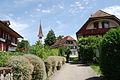
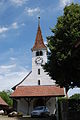
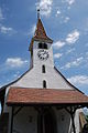
church buildings in Frauenkappeln in the canton of Bern, Switzerland  _023.JPG) | |||||
| Upload media | |||||
| Instance of | |||||
|---|---|---|---|---|---|
| Part of | |||||
| Location | Frauenkappelen, Bern-Mittelland administrative district, Bernese Mittelland administrative region, Bern, Switzerland | ||||
| Street address |
| ||||
| Heritage designation | |||||
| Inception |
| ||||
| Date of official closure |
| ||||
 | |||||
Media in category "Kirche Frauenkappelen"
The following 18 files are in this category, out of 18 total.
-
 2012-07-18-Regiono Arbergo (Foto Dietrich Michael Weidmann) 013.JPG 3,872 × 2,592; 4.58 MB
-
 2012-07-18-Regiono Arbergo (Foto Dietrich Michael Weidmann) 014.JPG 2,592 × 3,872; 4.22 MB
-
 2012-07-18-Regiono Arbergo (Foto Dietrich Michael Weidmann) 016.JPG 2,592 × 3,872; 4.17 MB
-
 2012-07-18-Regiono Arbergo (Foto Dietrich Michael Weidmann) 017.JPG 2,592 × 3,872; 4.18 MB
-
 2012-07-18-Regiono Arbergo (Foto Dietrich Michael Weidmann) 018.JPG 2,592 × 3,872; 3.83 MB
-
 2012-07-18-Regiono Arbergo (Foto Dietrich Michael Weidmann) 019.JPG 3,872 × 2,592; 3.81 MB
-
 2012-07-18-Regiono Arbergo (Foto Dietrich Michael Weidmann) 020.JPG 3,872 × 2,592; 3.03 MB
-
 2012-07-18-Regiono Arbergo (Foto Dietrich Michael Weidmann) 021.JPG 2,592 × 3,872; 3.54 MB
-
 2012-07-18-Regiono Arbergo (Foto Dietrich Michael Weidmann) 022.JPG 2,592 × 3,872; 3.66 MB
-
 2012-07-18-Regiono Arbergo (Foto Dietrich Michael Weidmann) 023.JPG 3,872 × 2,592; 3.95 MB
-
 2012-07-18-Regiono Arbergo (Foto Dietrich Michael Weidmann) 024.JPG 2,592 × 3,872; 3.98 MB
-
 2012-07-18-Regiono Arbergo (Foto Dietrich Michael Weidmann) 025.JPG 2,592 × 3,872; 4 MB
-
 2012-07-18-Regiono Arbergo (Foto Dietrich Michael Weidmann) 026.JPG 2,592 × 3,872; 3.18 MB
-
 2012-07-18-Regiono Arbergo (Foto Dietrich Michael Weidmann) 027.JPG 2,592 × 3,872; 3.69 MB
-
 2012-07-18-Regiono Arbergo (Foto Dietrich Michael Weidmann) 028.JPG 2,592 × 3,872; 3.51 MB
-
 2012-07-18-Regiono Arbergo (Foto Dietrich Michael Weidmann) 032.JPG 2,592 × 3,872; 3.74 MB
-
 CH-NB - Frauenkappelen - Collection Gugelmann - GS-GUGE-WEIBEL-D-36.tif 5,700 × 3,793, 2 pages; 36.56 MB
-
 Kirche und Pfarrhaus Frauenkappeln.JPG 3,648 × 2,736; 3.9 MB
_013.JPG)
_014.JPG)
_016.JPG)
_017.JPG)
_018.JPG)
_019.JPG)
_020.JPG)
_021.JPG)
_022.JPG)
_024.JPG)
_025.JPG)
_026.JPG)
_027.JPG)
_028.JPG)
_032.JPG)