Category:Kirchenpingarten
Zur Navigation springen
Zur Suche springen
Gemeinde im Landkreis Bayreuth in Bayern    | |||||
| Medium hochladen | |||||
| Ist ein(e) |
| ||||
|---|---|---|---|---|---|
| Ist Teil von |
| ||||
| Ort | Landkreis Bayreuth, Oberfranken, Bayern, Deutschland | ||||
| Leiter der Regierung oder Verwaltung |
| ||||
| Einwohnerzahl |
| ||||
| Fläche |
| ||||
| Höhe über dem Meeresspiegel |
| ||||
| offizielle Website | |||||
 | |||||
Unterkategorien
Es werden 4 von insgesamt 4 Unterkategorien in dieser Kategorie angezeigt:
In Klammern die Anzahl der enthaltenen Kategorien (K), Seiten (S), Dateien (D)
Medien in der Kategorie „Kirchenpingarten“
Folgende 39 Dateien sind in dieser Kategorie, von 39 insgesamt.
-
 DEU Kirchenpingarten COA.svg 512 × 559; 78 KB
-
 Wappen Kirchenpingarten.png 219 × 237; 14 KB
-
 Am Heinersbach - panoramio.jpg 1.600 × 1.200; 529 KB
-
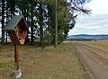
 Auf dem Kreuzstein - panoramio.jpg 1.600 × 1.200; 482 KB
-
 Aussichtsbank am Schieferberg - panoramio.jpg 4.108 × 3.076; 2,71 MB
-
 Bank beim Biotop (inzw. entf.) - panoramio.jpg 4.602 × 3.448; 4,33 MB
-
 Bernlohe - panoramio.jpg 4.592 × 3.436; 3,56 MB
-
 Biber-Biotop - panoramio.jpg 4.608 × 2.589; 2,12 MB
-
 Bildstock bei Lienlas - panoramio.jpg 2.048 × 1.536; 699 KB
-
 Biotop bei Kirchenpingarten - panoramio.jpg 1.600 × 1.200; 384 KB
-
 Bärenlöcher im März 1 - panoramio.jpg 4.608 × 3.456; 4,46 MB
-
 Bärenlöcher im März 2 - panoramio.jpg 4.606 × 3.454; 4,31 MB
-
 Gedenkkreuz Königskron - panoramio.jpg 1.600 × 1.200; 609 KB
-
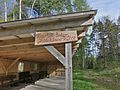
 Gänskopfhütte - panoramio (1).jpg 2.048 × 1.536; 571 KB
-
 Gänskopfhütte - panoramio.jpg 1.600 × 1.200; 302 KB
-
 Hahnengrün (HDR) - panoramio.jpg 4.608 × 2.588; 2,32 MB
-
 Heinersbachtal - panoramio.jpg 1.600 × 1.200; 311 KB
-
 Hier stand bis 2013 das Forsthaus Königskron - panoramio.jpg 4.608 × 3.456; 4,03 MB
-
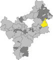 Kirchenpingarten im Landkreis Bayreuth.png 467 × 526; 49 KB
-
 Kirchenpingarten in BT.svg 734 × 785; 793 KB
-
 Kirchenpingarten P1130895.jpg 2.048 × 1.536; 1,42 MB
-
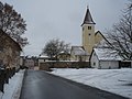 Kirchenpingarten P1130910.jpg 2.048 × 1.536; 1,32 MB
-
 Kleine Kapelle bei Lienlas - panoramio.jpg 2.048 × 1.536; 639 KB
-
 Kreuzsteinbank - panoramio.jpg 4.608 × 3.456; 4,28 MB
-
 Lienlas P1130918.jpg 2.048 × 1.536; 1,22 MB
-
 Marter bei Tressau - panoramio.jpg 2.048 × 1.536; 512 KB
-
 O.W. - panoramio.jpg 4.608 × 3.456; 3,52 MB
-
 Rastplatz am Flurbereinigungsdenkmal - panoramio.jpg 4.608 × 3.456; 5,47 MB
-
 Rastplatz bei Tressau - panoramio.jpg 2.048 × 1.536; 901 KB
-
 Steg über den Haidbach - panoramio.jpg 1.536 × 2.048; 653 KB
-
 Stüblas-Kapelle - panoramio.jpg 1.600 × 1.200; 314 KB
-
 Waldklimastation Kreuzstein - panoramio.jpg 4.608 × 3.456; 4,76 MB
-
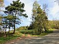 Wanderparkplatz Gänskopfhütte - panoramio.jpg 4.598 × 3.442; 3,97 MB
-
 Wanderparkplatz Heinersbachtal - panoramio.jpg 4.608 × 3.456; 4,35 MB
-
 Wegkreuz bei Kirmsees - panoramio.jpg 2.048 × 1.536; 772 KB
-
 Wegkreuz bei Lienlas - panoramio.jpg 2.048 × 1.536; 864 KB
-
 Wegkreuz bei Tressau - panoramio (1).jpg 2.048 × 1.536; 525 KB
-
 Wegkreuz bei Tressau - panoramio.jpg 4.500 × 3.308; 3,48 MB
-
 Wellnessliege auf dem Kreuzstein - panoramio.jpg 4.608 × 3.456; 4,03 MB


_-_panoramio.jpg)


.jpg)

_-_panoramio.jpg)


.jpg)

