Category:Kirkmichael, Dumfries and Galloway
Jump to navigation
Jump to search

Scottish parish in Dumfries and Galloway | |||||
| Upload media | |||||
| Instance of | |||||
|---|---|---|---|---|---|
| Part of |
| ||||
| Location |
| ||||
| Population |
| ||||
| Area |
| ||||
| Different from | |||||
 | |||||
Subcategories
This category has the following 5 subcategories, out of 5 total.
Media in category "Kirkmichael, Dumfries and Galloway"
The following 200 files are in this category, out of 479 total.
(previous page) (next page)-
 "View" towards Queensberry - geograph.org.uk - 4167022.jpg 800 × 450; 300 KB
-

-

-
 A sea of rashes on Tawnaze Hill south of Moffat - geograph.org.uk - 4057870.jpg 3,648 × 2,736; 4.84 MB
-
 A stationary view of the A701 - geograph.org.uk - 4385905.jpg 800 × 533; 143 KB
-
 A701 - geograph.org.uk - 4385935.jpg 800 × 450; 157 KB
-
 A701 - geograph.org.uk - 4387384.jpg 800 × 533; 216 KB
-
 A701 approaching Wester Parkgate - geograph.org.uk - 2949536.jpg 640 × 494; 90 KB
-
 A701 at Shawfoot - geograph.org.uk - 3507927.jpg 640 × 481; 77 KB
-
 A701 at Wester Parkgate - geograph.org.uk - 3507912.jpg 640 × 480; 50 KB
-
 A701 below Bog Hill - geograph.org.uk - 4388491.jpg 800 × 533; 319 KB
-
 A701 entering Parkgate - geograph.org.uk - 2949533.jpg 640 × 465; 73 KB
-
 A701 junction at Long Hill - geograph.org.uk - 3509153.jpg 640 × 480; 79 KB
-
 A701 near Blackacre - geograph.org.uk - 3507931.jpg 640 × 479; 117 KB
-
 A701 near Kirkland - geograph.org.uk - 3507920.jpg 640 × 481; 45 KB
-
-
 A701 straight south of Kirklands - geograph.org.uk - 2949553.jpg 640 × 501; 63 KB
-
 A701, Parkgate - geograph.org.uk - 4385875.jpg 800 × 533; 262 KB
-
 A701, Wester Parkgate - geograph.org.uk - 4385889.jpg 800 × 533; 208 KB
-
 Above White Naze, Forest of Ae - geograph.org.uk - 95811.jpg 640 × 449; 123 KB
-
 Ae village sign and road. - geograph.org.uk - 1503230.jpg 640 × 480; 106 KB
-
 An entrance into the Forest of Ae - geograph.org.uk - 3712941.jpg 4,506 × 3,316; 2.93 MB
-
 Annfield Moor - geograph.org.uk - 764841.jpg 640 × 480; 75 KB
-
 Auchenbue Burn - geograph.org.uk - 4650185.jpg 800 × 600; 448 KB
-
 Auchenskew Cottage and farmstead - geograph.org.uk - 1074099.jpg 640 × 480; 136 KB
-
 Auchenskew Cottage in ruins - geograph.org.uk - 1074091.jpg 640 × 480; 135 KB
-
 Auchenskew Cottage ruin - geograph.org.uk - 1074093.jpg 640 × 480; 139 KB
-
 Badly potholed road near Dalfibble - geograph.org.uk - 3715685.jpg 1,600 × 1,200; 442 KB
-
 Bags of trees - geograph.org.uk - 4381674.jpg 800 × 533; 298 KB
-
 Barley field at Parkgate - geograph.org.uk - 4629019.jpg 640 × 480; 431 KB
-
 Barley silage - geograph.org.uk - 4777728.jpg 800 × 533; 229 KB
-
 Barony College - geograph.org.uk - 5715062.jpg 1,024 × 682; 107 KB
-
 Beech Avenue, Parkgate - geograph.org.uk - 4385826.jpg 800 × 533; 151 KB
-
 Beech Hedge - geograph.org.uk - 289502.jpg 640 × 480; 194 KB
-
 Bench in Forest of Ae - geograph.org.uk - 2623577.jpg 2,212 × 1,502; 1,021 KB
-
 Benchmark on the Kirkmichael Hall, Parkgate - geograph.org.uk - 6745136.jpg 4,608 × 2,240; 3.9 MB
-
 Bend in forest track - geograph.org.uk - 1074022.jpg 640 × 480; 140 KB
-
 Big Knowe - geograph.org.uk - 4381814.jpg 800 × 533; 205 KB
-
 Blue Cairn - geograph.org.uk - 4162378.jpg 800 × 600; 420 KB
-
 Blue Cairn - geograph.org.uk - 4380266.jpg 800 × 533; 189 KB
-
 Bran Burn - geograph.org.uk - 380405.jpg 640 × 480; 118 KB
-
 Branrigg, Forest of Ae - geograph.org.uk - 102225.jpg 640 × 480; 123 KB
-
 Bridge over the Garroch Water - geograph.org.uk - 377383.jpg 640 × 480; 122 KB
-
 Bridge over the Water of Ae - geograph.org.uk - 377372.jpg 640 × 462; 126 KB
-
 Bridge, Water of Ae - geograph.org.uk - 4381828.jpg 640 × 426; 117 KB
-
 Bridges over Water of Ae - geograph.org.uk - 4381598.jpg 800 × 533; 280 KB
-

-
 Brownmoor - geograph.org.uk - 387923.jpg 640 × 480; 86 KB
-
 Burn course on Tawnaze Hill south of Moffat - geograph.org.uk - 4057469.jpg 3,648 × 2,736; 4.77 MB
-
 By Glenkill Burn - geograph.org.uk - 501291.jpg 640 × 480; 142 KB
-
 Byre, Burrancehill - geograph.org.uk - 4385952.jpg 640 × 360; 59 KB
-
 Capel Water - geograph.org.uk - 419961.jpg 640 × 480; 244 KB
-
 Capel Water - geograph.org.uk - 419966.jpg 480 × 640; 182 KB
-
 Cattle at Parkgate - geograph.org.uk - 4629102.jpg 640 × 480; 471 KB
-
 Cattle pens and silo at Cumrue Farm - geograph.org.uk - 4630318.jpg 640 × 480; 392 KB
-
 Cattle ramp at Cumrue Farm - geograph.org.uk - 4630056.jpg 640 × 480; 418 KB
-
 Cattle, Garrel - geograph.org.uk - 4777732.jpg 800 × 533; 164 KB
-
 Clachanbirnie Rig - geograph.org.uk - 4167072.jpg 800 × 450; 355 KB
-
 Clark Forest, Parkgate - geograph.org.uk - 4629040.jpg 640 × 481; 331 KB
-
 Clark Forest, Parkgate - geograph.org.uk - 5363019.jpg 1,024 × 768; 106 KB
-
 Clatterstanes - geograph.org.uk - 134606.jpg 640 × 480; 77 KB
-
 Clear fell above Ae - geograph.org.uk - 5933385.jpg 1,024 × 683; 309 KB
-
 Clear fell, Ae - geograph.org.uk - 4167020.jpg 800 × 450; 303 KB
-
 Clear felled slope, Ae - geograph.org.uk - 4650750.jpg 800 × 600; 513 KB
-
 Clearing, Forest of Ae - geograph.org.uk - 4168107.jpg 800 × 600; 410 KB
-

-
 Cleuch running through clearfell - geograph.org.uk - 1073968.jpg 640 × 480; 141 KB
-
 Cottages at Ae - geograph.org.uk - 3712932.jpg 4,508 × 3,320; 1.89 MB
-
 Country road heading for Lambholm - geograph.org.uk - 1805710.jpg 640 × 480; 68 KB
-

-
 Country road to Townhead, Kirkmichael - geograph.org.uk - 5715078.jpg 1,024 × 682; 208 KB
-
 Courancehill farm - geograph.org.uk - 609765.jpg 640 × 480; 71 KB
-
 Craigshields - geograph.org.uk - 4650767.jpg 800 × 600; 539 KB
-
 Craigshields Outdoor Centre, Ae Forest - geograph.org.uk - 2594641.jpg 3,264 × 2,448; 1.86 MB
-
 Craigshiels - geograph.org.uk - 4381860.jpg 800 × 533; 319 KB
-
 Craih Hill - geograph.org.uk - 380426.jpg 640 × 480; 102 KB
-
 Crossroads at Cumrue Cottages - geograph.org.uk - 3715628.jpg 1,600 × 1,200; 397 KB
-
 Crossroads at Ross Mill - geograph.org.uk - 3715641.jpg 1,600 × 1,200; 474 KB
-
 Crossroads near Shieldhill - geograph.org.uk - 3715653.jpg 1,600 × 1,200; 474 KB
-
 Crossroads near Shieldhill - geograph.org.uk - 5371241.jpg 1,066 × 800; 266 KB
-
 Cumleys - geograph.org.uk - 4168226.jpg 800 × 600; 390 KB
-
 Cumleys and Bridge over Garrel Water - geograph.org.uk - 5370710.jpg 926 × 694; 133 KB
-
 Cumrue - geograph.org.uk - 4168280.jpg 800 × 600; 394 KB
-
 Cumrue Cottages - geograph.org.uk - 287625.jpg 640 × 480; 189 KB
-
 Cumrue Cottages - geograph.org.uk - 3715627.jpg 1,600 × 1,200; 481 KB
-
 Cumrue Cottages - geograph.org.uk - 4630061.jpg 640 × 480; 435 KB
-
 Cumrue Cottages - geograph.org.uk - 5370695.jpg 1,066 × 800; 176 KB
-
 Cycle Bridge Over Capel Water - geograph.org.uk - 160312.jpg 480 × 640; 219 KB
-
 Dairy cattle at Cumrue (1) - geograph.org.uk - 5652223.jpg 640 × 480; 40 KB
-
 Dairy cattle at Cumrue (2) - geograph.org.uk - 5652217.jpg 640 × 480; 40 KB
-
 Dalfibble - geograph.org.uk - 4777721.jpg 800 × 533; 289 KB
-
 Dalfibble Cottages - geograph.org.uk - 5371238.jpg 1,066 × 800; 136 KB
-
 Dalfibble Farm - geograph.org.uk - 5370732.jpg 1,066 × 800; 146 KB
-
 Dalruscan - geograph.org.uk - 312720.jpg 640 × 293; 21 KB
-

-
 Deer Burn - geograph.org.uk - 4381601.jpg 800 × 533; 296 KB
-
 Deer Burn - geograph.org.uk - 4381644.jpg 800 × 533; 228 KB
-
 Deer Burn - geograph.org.uk - 501000.jpg 640 × 480; 155 KB
-
 Deer Burn, Ae Forest - geograph.org.uk - 2594709.jpg 2,448 × 3,264; 1.69 MB
-
 Derelict cottage at Gillriggfoot - geograph.org.uk - 3715631.jpg 1,600 × 1,200; 470 KB
-
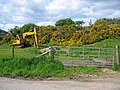 Digger and gorse - geograph.org.uk - 190099.jpg 640 × 480; 125 KB
-
 Display of Tractor Attachments - geograph.org.uk - 160293.jpg 640 × 480; 177 KB
-
 Disused quarry - geograph.org.uk - 1074033.jpg 640 × 480; 140 KB
-
 Disused quarry - geograph.org.uk - 1074040.jpg 640 × 480; 139 KB
-
 Ditch and gate near Milngate - geograph.org.uk - 4629376.jpg 640 × 480; 473 KB
-
 Donkens Cottage - geograph.org.uk - 1732237.jpg 640 × 480; 133 KB
-
 Drainage channel in young plantation - geograph.org.uk - 1074121.jpg 640 × 480; 138 KB
-
 Drainage Ditch Near Water Of Ae - geograph.org.uk - 1703916.jpg 480 × 640; 92 KB
-
 Driveway to Dalfibble - geograph.org.uk - 4629280.jpg 640 × 480; 421 KB
-
 Driveway to Kirkmichael Old Manse - geograph.org.uk - 4628968.jpg 480 × 640; 648 KB
-
 Driveway to Wood Farm - geograph.org.uk - 5363072.jpg 1,066 × 800; 308 KB
-
 Drystane dyke on Tawnaze Hill south of Moffat - geograph.org.uk - 4057867.jpg 3,648 × 2,736; 4.81 MB
-
 Dyke on forest edge on Tawnaze Hill south of Moffat - geograph.org.uk - 4057868.jpg 3,648 × 2,736; 4.9 MB
-
 Dyke, Forest of Ae - geograph.org.uk - 4381714.jpg 800 × 533; 264 KB
-
 Early Morning Mist Over Capel Water - geograph.org.uk - 600749.jpg 640 × 427; 49 KB
-
 Edge of the Forest of Ae - geograph.org.uk - 5715089.jpg 1,024 × 682; 150 KB
-
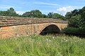 Elshieshiels Bridge - geograph.org.uk - 4768571.jpg 1,024 × 682; 396 KB
-
 Entrance to Meikleholm Farm - geograph.org.uk - 289433.jpg 640 × 480; 187 KB
-
 Entry into forest - geograph.org.uk - 1073904.jpg 640 × 480; 122 KB
-
 Fallen tree blocking forest road on Main Rig near Mollin - geograph.org.uk - 4058392.jpg 3,648 × 2,736; 4.84 MB
-
 Farm buildings, Cumrue Fawrm - geograph.org.uk - 4630320.jpg 640 × 480; 408 KB
-
 Farm buildings, Dalfibble Farm - geograph.org.uk - 4629297.jpg 640 × 480; 410 KB
-
 Farm road near Parkgate - geograph.org.uk - 4385894.jpg 800 × 533; 290 KB
-
 Farmland at Garrel Hill - geograph.org.uk - 3715643.jpg 1,600 × 1,200; 652 KB
-
 Farmland near Parkgate - geograph.org.uk - 1805693.jpg 640 × 480; 77 KB
-
 Fauld Sike - geograph.org.uk - 1074087.jpg 640 × 480; 134 KB
-
 Felled area, Forest of Ae - geograph.org.uk - 4380112.jpg 800 × 533; 223 KB
-
 Felled Section of Forest of Ae - geograph.org.uk - 832138.jpg 640 × 480; 169 KB
-
 Felled Section of Forest of Ae - geograph.org.uk - 832171.jpg 640 × 480; 178 KB
-
 Fence boundary of Rossmuir Plantation - geograph.org.uk - 3715634.jpg 1,600 × 1,200; 647 KB
-
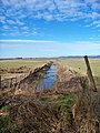
 Field and drainage ditch near Dalfibble - geograph.org.uk - 3715687.jpg 1,600 × 1,200; 439 KB
-
 Field and forest near Dalfibble - geograph.org.uk - 4629218.jpg 640 × 480; 447 KB
-
 Field and Trees - geograph.org.uk - 289440.jpg 640 × 480; 189 KB
-
 Field near Dalfibble - geograph.org.uk - 4629289.jpg 640 × 480; 461 KB
-
 Field near Gillrig - geograph.org.uk - 4651466.jpg 800 × 600; 483 KB
-
 Field near Third - geograph.org.uk - 4651462.jpg 800 × 600; 467 KB
-
 Field of Seagulls - geograph.org.uk - 289480.jpg 640 × 480; 190 KB
-
 Field, Ashbank - geograph.org.uk - 4385885.jpg 800 × 533; 186 KB
-
 Field, Garrel - geograph.org.uk - 4777727.jpg 800 × 533; 304 KB
-
 Field, Holehouse - geograph.org.uk - 4381689.jpg 800 × 533; 258 KB
-
 Field, Kirkland - geograph.org.uk - 4385910.jpg 800 × 533; 210 KB
-
 Fields Below Wood Hill - geograph.org.uk - 835934.jpg 640 × 480; 163 KB
-
 Fields near Kirkland - geograph.org.uk - 4385947.jpg 800 × 450; 170 KB
-
 Fields near Parkgate - geograph.org.uk - 3844681.jpg 2,592 × 1,936; 1.9 MB
-
 Fields on the way to Hazliebrae Farm - geograph.org.uk - 4629364.jpg 640 × 480; 516 KB
-
 Flat farmland, Annandale - geograph.org.uk - 4168284.jpg 640 × 480; 309 KB
-
 Flock of Black-headed Gulls tale Flight - geograph.org.uk - 5370678.jpg 1,066 × 800; 99 KB
-
 Flood defences, Water of Ae - geograph.org.uk - 4768574.jpg 1,024 × 682; 251 KB
-
 Flooding, Sheep and Hightown Hill - geograph.org.uk - 289477.jpg 640 × 480; 162 KB
-
 Footbridge over the Water of Ae - geograph.org.uk - 95757.jpg 640 × 459; 168 KB
-
 Footpath signs, Ae Forest - geograph.org.uk - 2594755.jpg 3,264 × 2,448; 1.86 MB
-
 Forest break near Deer Edge - geograph.org.uk - 6560258.jpg 640 × 480; 154 KB
-
 Forest clear area - geograph.org.uk - 1074073.jpg 640 × 480; 130 KB
-
 Forest clearing and Holehouse, Ae Forest - geograph.org.uk - 2594679.jpg 3,264 × 2,448; 1.88 MB
-

-
 Forest edge on Bog Shaw near Mollin - geograph.org.uk - 4058340.jpg 3,648 × 2,736; 4.7 MB
-
 Forest edge on Tawnaze Hill near Mollin south of Moffat - geograph.org.uk - 4057863.jpg 3,648 × 2,736; 4.75 MB
-
 Forest equipment dump on Main Rig south of Moffat - geograph.org.uk - 4057878.jpg 3,648 × 2,736; 4.81 MB
-
 Forest fence beside Glenkill Burn - geograph.org.uk - 6561403.jpg 640 × 480; 144 KB
-
 Forest of Ae - geograph.org.uk - 4162443.jpg 800 × 600; 389 KB
-
 Forest of Ae - geograph.org.uk - 4168113.jpg 800 × 877; 715 KB
-
 Forest of Ae - geograph.org.uk - 4381847.jpg 800 × 600; 283 KB
-
 Forest of Ae - geograph.org.uk - 4383326.jpg 640 × 426; 86 KB
-
 Forest of Ae - geograph.org.uk - 832127.jpg 640 × 480; 234 KB
-
 Forest of Ae - geograph.org.uk - 832146.jpg 640 × 480; 167 KB
-
 Forest of Ae - geograph.org.uk - 832159.jpg 480 × 640; 220 KB
-
 Forest of Ae - geograph.org.uk - 832160.jpg 640 × 480; 157 KB
-
 Forest of Ae - geograph.org.uk - 835880.jpg 640 × 480; 211 KB
-
 Forest of Ae - geograph.org.uk - 835951.jpg 640 × 480; 196 KB
-
 Forest of Ae from the air - geograph.org.uk - 5394930.jpg 640 × 480; 132 KB
-
 Forest of Ae from the air - geograph.org.uk - 5614797.jpg 640 × 480; 101 KB
-
 Forest of Ae from the air - geograph.org.uk - 5614800.jpg 640 × 480; 104 KB
-
 Forest of Ae windfarms, aerial 2016 - geograph.org.uk - 5088104.jpg 640 × 340; 43 KB
-
 Forest of Ae, signposts old and new - geograph.org.uk - 4162434.jpg 640 × 316; 216 KB
-

-
 Forest road on Tawnaze Hill south of Moffat - geograph.org.uk - 4057882.jpg 3,648 × 2,736; 4.75 MB
-
 Forest track - geograph.org.uk - 1074158.jpg 640 × 480; 128 KB
-
 Forest track - geograph.org.uk - 1074217.jpg 640 × 480; 127 KB
-
 Forest track and Blenoch Burn clearing - geograph.org.uk - 501284.jpg 640 × 480; 143 KB
-
 Forest track at Brown Knowe - geograph.org.uk - 6560255.jpg 640 × 480; 136 KB
-
 Forest track near Grey Mare - geograph.org.uk - 501283.jpg 640 × 480; 144 KB
-
 Forestry logpile and view over Annandale - geograph.org.uk - 1701806.jpg 3,872 × 2,592; 4.11 MB
-
 Gable end of ruined Auchenskew Cottage with tree inside - geograph.org.uk - 1701776.jpg 3,872 × 2,592; 4.59 MB
-
 Gamerigg Cemetery - geograph.org.uk - 699100.jpg 640 × 480; 85 KB
-
 Garrel Burn - geograph.org.uk - 289506.jpg 640 × 480; 182 KB
-
 Garrel Rig - geograph.org.uk - 4387362.jpg 800 × 533; 214 KB
-
 Garrel Water - geograph.org.uk - 289466.jpg 480 × 640; 206 KB
-
 Garrel Water - geograph.org.uk - 289493.jpg 640 × 480; 188 KB
-
 Garrel Water - geograph.org.uk - 4387382.jpg 800 × 533; 343 KB
-
 Garrel Water - geograph.org.uk - 4629381.jpg 640 × 480; 488 KB
-
 Garrel Water at Cumleys - geograph.org.uk - 289472.jpg 640 × 480; 159 KB
-
 Garrel Water at Cumleys - geograph.org.uk - 289474.jpg 640 × 480; 180 KB
-
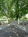
 Garvald Church and graveyard - geograph.org.uk - 1816480.jpg 2,448 × 3,264; 1.1 MB
-
 Garvald graveyard - geograph.org.uk - 1816478.jpg 3,264 × 2,448; 1.07 MB
-
 Garvald kirkyard - geograph.org.uk - 4385941.jpg 800 × 450; 201 KB
-
 Garvald Parish Church Ruin and Churchyard - geograph.org.uk - 765022.jpg 640 × 480; 117 KB
-
 Gate in Forest of Ae - geograph.org.uk - 835937.jpg 640 × 480; 169 KB
-
 Gate, Gamerigg - geograph.org.uk - 4777726.jpg 800 × 533; 271 KB
-
 Gated entrance to Gamerigg Farm - geograph.org.uk - 3715645.jpg 1,600 × 1,200; 642 KB
-
 Gated farm track at Dalfibble - geograph.org.uk - 3715659.jpg 1,600 × 1,200; 536 KB


_-_geograph.org.uk_-_5652223.jpg)
_-_geograph.org.uk_-_5652217.jpg)


