Category:Klimentovsky Lane
Jump to navigation
Jump to search
Русский: Климентовский переулок в Москве
| Object location | | View all coordinates using: OpenStreetMap |
|---|
street in Zamoskvorechye District, Russia  | |||||
| Upload media | |||||
| Instance of | |||||
|---|---|---|---|---|---|
| Location | Zamoskvorechye District, Central Administrative Okrug, Moscow, Russia | ||||
| Terminus | |||||
 | |||||
Subcategories
This category has the following 6 subcategories, out of 6 total.
Media in category "Klimentovsky Lane"
The following 37 files are in this category, out of 37 total.
-
 B Tatarskaya 18 Mar 2011 07.JPG 1,500 × 1,700; 1.3 MB
-
 B Tatarskaya 18 Mar 2011 08.JPG 1,800 × 1,200; 1.19 MB
-
 Moscow, Pyatnitskaya 29 Sep 2008 01.JPG 2,000 × 1,035; 772 KB
-
 Moscow, Malaya Ordynka 1-9 Apr 2009 01.JPG 1,040 × 1,600; 581 KB
-
 0909 - Moskau 2015 (26309230572).jpg 4,184 × 2,771; 2.63 MB
-
 Moscow at night (19344451133).jpg 5,520 × 3,680; 6.19 MB
-
 Moscow, Pyatnitskaya 26 June 2008 02.jpg 1,200 × 1,600; 715 KB
-
 Zamoskvorechye District, Moscow, Russia - panoramio (18).jpg 3,360 × 2,548; 4.77 MB
-
 Alfa-Bank na Tretyakovskoy.jpg 2,560 × 1,714; 717 KB
-
 Banner Moscow Zamoskvorechye 101 0722.jpg 7,210 × 1,030; 5.3 MB
-
 Kostiukov Leonid 2001.jpg 480 × 640; 70 KB
-
 Moscow ClementChurch 101 0722.jpg 6,057 × 3,949; 17 MB
-
 Moscow, B Tatarskaya 18 Mar 2011 04.jpg 2,455 × 3,296; 2.89 MB
-
 Moscow, B Tatarskaya 18 Mar 2011 07.jpg 2,400 × 3,200; 2.35 MB
-
 Moscow, B Tatarskaya 18 Mar 2011 08.jpg 3,200 × 2,400; 2.28 MB
-
 Moscow, Golikovsky Lane from Klimentovsky Lane (25776706880).jpg 3,264 × 2,178; 1.1 MB
-
 Moscow, Klimentovsky 10 Apr 2009 01.JPG 1,200 × 1,250; 549 KB
-
 Moscow, Klimentovsky 10C3 Jan 2009 01.JPG 1,600 × 1,200; 822 KB
-
 Moscow, Klimentovsky 14 June 2022 01.jpg 5,062 × 3,375; 4.34 MB
-
 Moscow, Klimentovsky 14 June 2022 02.jpg 5,184 × 3,456; 4.28 MB
-
 Moscow, Klimentovsky 3 Apr 2009 01.JPG 1,600 × 900; 613 KB
-
 Moscow, Klimentovsky 3,5 Sep 2008 01.JPG 1,200 × 1,600; 681 KB
-
 Moscow, Klimentovsky middle June 2008 02.jpg 2,000 × 1,000; 591 KB
-
 Moscow, New Year in Klimentovsky Lane 1.jpg 1,200 × 1,600; 434 KB
-
 Moscow, Pyatnitskaya 26.jpg 1,500 × 1,036; 341 KB
-
 Moscow, Pyatnitskaya 31c5 (Klimentovsky Lane) June 2022 01.jpg 5,184 × 3,456; 4.96 MB
-
 Moscow, Pyatnitskaya 31c5 (Klimentovsky Lane) June 2022 02.jpg 5,184 × 3,456; 4.55 MB
-
 Moscú, varios (2006) 09.jpg 921 × 667; 560 KB
-
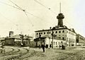
 Municipal Album 1.205 Pyatnitskaya Police.jpg 483 × 350; 48 KB
-
 Zamoskvorechye District Tretyakovskaya 2015-05 1432301238.jpg 9,728 × 4,864; 9.92 MB
-
 Zamoskvorechye District, Moscow, Russia - panoramio (61).jpg 5,376 × 2,688; 7.49 MB
-
 Zamoskvorechye District, Moscow, Russia - panoramio (62).jpg 5,376 × 2,688; 7.62 MB
-
 Замоскворечье. Климентовский переулок.JPG 2,592 × 1,944; 2.34 MB
-
 Климентовский переулок - panoramio.jpg 598 × 900; 212 KB
-
 Климентовский переулок.JPG 4,244 × 2,417; 3.9 MB
-
 Москва, строительство 'Русских Сезонов', октябрь 2023.jpg 2,400 × 1,394; 783 KB
-
 Пятницкий полицейский дом.jpg 974 × 693; 587 KB


.jpg)
.jpg)

.jpg)


.jpg)


_June_2022_01.jpg)
_June_2022_02.jpg)
_09.jpg)


.jpg)
.jpg)


