Category:Kornschütte Kreuzlingen (Seemuseum)
Jump to navigation
Jump to search
| Object location | | View all coordinates using: OpenStreetMap |
|---|
| Upload media | |||||
| Instance of | |||||
|---|---|---|---|---|---|
| Legal form | |||||
| Inception |
| ||||
 | |||||
|
This is a category about a cultural property of national significance in Switzerland with KGS number 9483
|
|
This is a category about a cultural property of regional significance in Switzerland with KGS number 16145
|
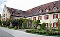
Deutsch: Ehemaliges Kornhaus und Trotte (Seeburgscheune) des Klosters Kreuzlingen in der Schweiz. Sanierung 1990-1993. Beherbergt seither das Seemuseum.
Media in category "Kornschütte Kreuzlingen (Seemuseum)"
The following 18 files are in this category, out of 18 total.
-
 KornschuetteKreuzlingen.JPG 4,224 × 2,319; 7.65 MB
-
 KornschuetteKreuzlingen2.JPG 3,985 × 2,376; 6.83 MB
-
 KornschuetteKreuzlingen3.JPG 4,224 × 2,376; 6.23 MB
-
 KornschuetteKreuzlSchilf.JPG 4,001 × 2,204; 6.68 MB
-
 Kornschütte (Seemuseum) in Kreuzlingen TG.jpg 4,000 × 2,500; 7.56 MB
-
 Kornschütte - Seemuseum in Kreuzlingen.jpg 4,200 × 2,800; 7.82 MB
-
 Kreuzlingen - Seemuseum (1) (9521588453).jpg 3,008 × 2,000; 4.41 MB
-
 Kreuzlingen - Seemuseum (2) (9521504665).jpg 2,000 × 3,008; 4.78 MB
-
 Kreuzlingen, Seemuseum Kornschütte v N, 4.jpeg 4,528 × 2,496; 3.52 MB
-
 Kreuzlingen-Seeburgscheune.jpg 1,817 × 1,200; 2.13 MB
-
 KreuzlingenKornschuette.jpg 4,810 × 2,908; 8.96 MB
-
 KreuzlingenKornschuette1.jpg 5,299 × 4,033; 14.71 MB
-
 KreuzlingenKornschuetteSued.jpg 6,096 × 2,598; 13.55 MB
-
 KreuzlingenKornschuetteWetterfahne.jpg 3,382 × 5,048; 12.36 MB
-
 Krezlingen - Seemuseum (3) (9521614771).jpg 3,008 × 2,000; 4.48 MB
-
 Schaufelrad eines Raddampfers.jpeg 1,552 × 1,152; 1.3 MB
-
 Seemuseum Kreuzlingen 20150514.jpg 2,310 × 1,540; 3.75 MB
-
 SeemuseumKreuzlingen.JPG 1,600 × 1,200; 796 KB


_in_Kreuzlingen_TG.jpg)

_(9521588453).jpg)
_(9521504665).jpg)


_(9521614771).jpg)


